Eglinton Street railway station

Last updated

Eglinton Street
Eglinton Street railway station (site), Glasgow (geograph 6191092).jpg
The site of the station in 2019
General information
Location Port Eglinton, Glasgow
Scotland
Coordinates 55°50′47″N4°15′39″W / 55.8465°N 4.2609°W / 55.8465; -4.2609 Coordinates: 55°50′47″N4°15′39″W / 55.8465°N 4.2609°W / 55.8465; -4.2609
Platforms6
Other information
StatusDisused
History
Original company Caledonian Railway
Pre-grouping Caledonian Railway
Post-grouping LMS
Key dates
1 July 1879Opened
(as per Glasgow Herald notice) [1]
28 February 1909Opened
(as documented by Butt) [2]
1 February 1965Closed [2]
Glasgow Central & St Enoch approaches
BSicon CONTg.svg
BSicon HUBc2.svg
BSicon HUB3.svg
BSicon KBHFa.svg
BSicon STR.svg
Glasgow Central
BSicon tCONTgq.svg
BSicon tdSTRq.svg
BSicon HUB1.svg
BSicon tBHFq.svg
BSicon HUBc4.svg
BSicon KRZt.svg
BSicon tSTRq.svg
BSicon STRc2.svg
BSicon tSTRq.svg
BSicon tSTRq.svg
BSicon STR3.svg
BSicon tCONTfq.svg
BSicon STR.svg
BSicon exKBHFaq.svg
BSicon ABZ1+fxr.svg
BSicon exSTR+r.svg
BSicon STRc4.svg
St Enoch Glasgow Subway.svg
BSicon WASSERq.svg
BSicon hKRZWae.svg
BSicon WASSERq.svg
BSicon hKRZWae.svg
BSicon WASSERq.svg
BSicon dSTR.svg
BSicon dENDEa.svg
BSicon STR.svg
parts of former station
reused as carriage sidings
BSicon evBHF.svg
BSicon v-STR.svg
Glasgow Bridge Street
BSicon vSHI2g+l-.svg
BSicon exldHST~F.svg
BSicon xv-SHI2gr.svg
Main Street
BSicon STR.svg
BSicon exldHST~G.svg
BSicon dSTR.svg
BSicon exdHST.svg
Gorbals
BSicon CONTgq.svg
BSicon STRq.svg
BSicon ABZgr.svg
BSicon cdSTRc2.svg
BSicon dSTR3.svg
BSicon exdSTR.svg
BSicon CONTgq.svg
BSicon STRq.svg
BSicon cSTRq.svg
BSicon dKRZu.svg
BSicon exldHST.svg
BSicon cSTRq.svg
BSicon cdSTRr+1.svg
BSicon dSTRc4.svg
BSicon exdSTR.svg
Cumberland
Street
BSicon v-SHI2gr.svg
BSicon exlvBHF@G-.svg
BSicon exvSTR.svg
Southside
BSicon evHST.svg
BSicon exv-SHI2g+r.svg
Eglinton Street
BSicon STR~L.svg
BSicon tSTR2a.svg
BSicon STR~R.svg
BSicon tSTRc3.svg
BSicon exSTR.svg
BSicon cdSTRc2.svg
BSicon dSTR3.svg
BSicon tdSTRc1.svg
BSicon tSTR2+4e.svg
BSicon xSTR+c3.svg
BSicon dSTR+1.svg
BSicon cSTRc4.svg
BSicon STRc1.svg
BSicon xKRZ2+4o.svg
BSicon STRc3.svg
BSicon CONTgq.svg
BSicon tSTRaq.svg
BSicon KRZt.svg
BSicon tSTRq.svg
BSicon PORTALr.svg
BSicon STRq.svg
BSicon STRc12.svg
BSicon xKRZo.svg
BSicon ABZq+34.svg
BSicon CONTfq.svg
BSicon CONTgq.svg
BSicon kSTR2+r.svg
BSicon kSTRc3.svg
BSicon ABZg2.svg
BSicon STRc3.svg
BSicon STRc2.svg
BSicon ABZ3+1xg.svg
BSicon STRc4.svg
BSicon STRc1.svg
BSicon kABZg+4.svg
BSicon lvHST@G-.svg
BSicon STR2u+4.svg
BSicon STR3+1.svg
BSicon STRc4.svg
Pollokshields East
BSicon STRc2.svg
BSicon STRc2.svg
BSicon ABZg3.svg
BSicon STR3+1.svg
BSicon STRl+4u.svg
BSicon STRq.svg
BSicon CONTfq.svg
BSicon HST+1.svg
BSicon STRc4.svg
BSicon ABZg+1.svg
BSicon STRc4.svg
Pollokshields West
BSicon STR.svg
BSicon eHST.svg
Strathbungo
BSicon STR.svg
BSicon CONTf.svg
BSicon CONTf.svg

Eglinton Street railway station was a railway station approximately one mile (1.5 kilometres) south of Glasgow Central, in the Port Eglinton district of Glasgow.

Contents

History

Sources published in the late 20th century claim that this station opened on Sunday 28 February 1909, [2] which would have been highly unlikely given Scotland's sabbatarian culture at the time. Contemporary sources, such as railway notices, timetables, maps and Post Office Directories, show that the station existed nearly 30 years before that date.

When the station opened, on 1 July 1879, it allowed Caledonian Railway trains from Edinburgh and Lanarkshire, which had previously terminated at Southside to reach Bridge Street to connect with trains for Greenock and Wemyss Bay, with through carriages being provided from Edinburgh to stations on the Glasgow, Paisley and Greenock Railway and Greenock and Wemyss Bay Railway. [1] These continued to terminate at Bridge Street even after Central Station had opened on 1 August 1879. [3]

On 19 March 1883, there was a collision between two trains at Eglinton Street station in which four people died and many more were injured. [4] The crash involved the 6:15pm train from Central Station to East Kilbride and the 5pm train from Edinburgh to Glasgow Central, which had stopped at Eglinton Street Station. The driver of the Edinburgh train failed to heed the signal against the train leaving the station. The East Kilbride train had left Central on time and had a clear signal to proceed. It was slowing down when it collided with the Edinburgh train which was getting up steam. The drivers and firemen of both trains survived the crash, having been violently thrown from their engines. [5]

Opened by the Caledonian Railway on the former routes of the Cathcart District Railway and Polloc and Govan Railway on the southern approached to Glasgow Central, Eglinton Street station became part of the London Midland and Scottish Railway during the Grouping of 1923. The station was located in the routes to the:

The station was closed in 1965. [2]

The site today

Some parts of Eglinton Street station remain intact today, including sections of the platforms and access towers from the station platforms.

Route

Preceding station Historical railways Following station
Glasgow Central
Line and station open
  Caledonian Railway
Polloc and Govan Railway
  Rutherglen
Line and station open
  Caledonian Railway
Cathcart District Railway
  Pollokshields East
Line and station open
  Caledonian Railway
Cathcart District Railway
  Pollokshields West
Line and station open
  CR & G&SWR
Glasgow, Barrhead and Kilmarnock Joint Railway
  Strathbungo
Line open; station closed

Related Research Articles

<span class="mw-page-title-main">Glasgow Central station</span> Railway station in Glasgow, Scotland

Glasgow Central is one of two principal mainline rail terminals in Glasgow, Scotland. The railway station was opened by the Caledonian Railway on 1 August 1879 and is one of 20 managed by Network Rail. It is the northern terminus of the West Coast Main Line. As well as being Glasgow's principal inter-city terminus for services to England, Central also serves the southern suburbs of the Greater Glasgow conurbation, as well as the Ayrshire and Clyde coasts. The other main station in Glasgow is Glasgow Queen Street.

<span class="mw-page-title-main">Mount Florida railway station</span> Railway station in Glasgow, Scotland

Mount Florida railway station is a staffed island platform station on the Cathcart Circle. It serves the Mount Florida and Battlefield areas of Glasgow, Scotland. Services are provided by ScotRail on behalf of Strathclyde Partnership for Transport.

<span class="mw-page-title-main">Cathcart railway station</span> Railway station in Glasgow, Scotland

Cathcart railway station is a railway station serving the Cathcart area of Glasgow, Scotland. It is located on the Cathcart Circle Line, 3.7 miles (6 km) south of Glasgow Central. Services are provided by ScotRail on behalf of Strathclyde Partnership for Transport.

<span class="mw-page-title-main">Crosshill railway station</span> Railway station in Glasgow, Scotland

Crosshill railway station is a railway station serving the Crosshill and Govanhill areas of Glasgow, Scotland. It is located on the Cathcart Circle Line but also has trains going to and from Neilston and Newton. Services are provided by ScotRail on behalf of Strathclyde Partnership for Transport.

<span class="mw-page-title-main">Port Glasgow railway station</span> Railway station in Inverclyde, Scotland

Port Glasgow railway station is on the Inverclyde Line, serving the town of Port Glasgow, Scotland. It is located in the town centre with the main entrance at the junction of Princes Street and John Wood Street.

<span class="mw-page-title-main">Paisley Gilmour Street railway station</span> Railway station in Renfrewshire, Scotland

Paisley Gilmour Street railway station is the largest of the four stations serving the town of Paisley, Renfrewshire, Scotland, and acts as the town's principal railway station. The station is managed by ScotRail and serves the Ayrshire Coast Line and Inverclyde Line, 7+14 miles (11.7 km) west of Glasgow Central. The station is protected as a category B listed building.

<span class="mw-page-title-main">Bellshill railway station</span> Railway station in North Lanarkshire, Scotland

Bellshill railway station is a railway station in the town of Bellshill, North Lanarkshire, Scotland. The station is managed by ScotRail and served by Argyle Line and Shotts Line services. The station is adjacent to Bellshill Main Street, on Hamilton Road, and was opened by the Caledonian Railway as part of the Cleland and Midcalder Line on 1 May 1879. West of the station, the Glasgow, Bothwell, Hamilton and Coatbridge Railway crossed with a second station in the town to the north west - this ceased to carry passengers back in 1951.

<span class="mw-page-title-main">Burnside railway station</span> Railway station in South Lanarkshire, Scotland

Burnside railway station serves the Burnside and Blairbeth areas of the Royal Burgh of Rutherglen, South Lanarkshire, Greater Glasgow, Scotland. The station is managed by ScotRail and is located on the Newton branch of the Cathcart Circle Lines, which has been electrified since 1962 by British Railways. This is the busiest railway station on the Newton branch.

<span class="mw-page-title-main">Dumbarton East railway station</span> Railway station in West Dunbartonshire, Scotland

Dumbarton East railway station serves the town of Dumbarton in the West Dunbartonshire region of Scotland. The station is managed by ScotRail and is served by trains on the North Clyde Line, 15 miles (24 km) west of Glasgow Queen Street.

<span class="mw-page-title-main">Pollokshields East railway station</span> Railway station in Glasgow, Scotland

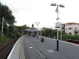
Pollokshields East railway station is one of three railway stations serving Pollokshields in Glasgow, Scotland. The station is managed by ScotRail and lies on the Cathcart Circle Line.

<span class="mw-page-title-main">Muirend railway station</span> Railway station in Glasgow City, Scotland, UK

Muirend railway station is an island platform suburban railway station in the Muirend area of Glasgow, Scotland. The station, which opened in 1903, is managed by ScotRail and lies on the Neilston branch of the Cathcart Circle Lines.

<span class="mw-page-title-main">Pollokshaws West railway station</span> Railway station in Glasgow, Scotland

Pollokshaws West railway station is a railway station in Glasgow, Scotland. The station is managed by ScotRail and is served by trains on the Glasgow South Western Line.

<span class="mw-page-title-main">Pollokshaws East railway station</span> Railway station in Glasgow, Scotland

Pollokshaws East railway station is a railway station in Glasgow, Scotland, serving parts of the Pollokshaws, Auldhouse, Newlands and Shawlands neighbourhoods of the city. The station is managed by ScotRail and is located on the Cathcart Circle Line.

<span class="mw-page-title-main">Maxwell Park railway station</span> Railway station in Glasgow, Scotland

Maxwell Park railway station is a railway station in Pollokshields area of Glasgow, Scotland, adjacent to the park of the same name. The station is managed by ScotRail and is located on the Cathcart Circle Line, which has been electrified since 1962 by British Railways.

<span class="mw-page-title-main">Clarkston railway station</span> Railway station in East Renfrewshire, Scotland

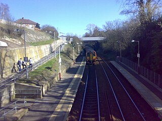
Clarkston railway station is a suburban side platform railway station in the town of Clarkston, East Renfrewshire, Scotland. The station is managed by ScotRail and is on the East Kilbride branch of the Glasgow South Western Line. It was opened in 1866 by the Busby Railway.

<span class="mw-page-title-main">Busby railway station</span> Railway station in East Renfrewshire, Scotland

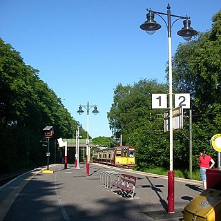
Busby railway station is a railway station in the village of Busby, East Renfrewshire, Greater Glasgow, Scotland. The station is managed by ScotRail and is on the Glasgow South Western Line 7+14 miles (11.7 km) south of Glasgow Central towards East Kilbride.

The Glasgow and Paisley Joint Railway was the section of railway line between Glasgow Bridge Street railway station and Paisley, in the west of Scotland. It was constructed and operated jointly by two competing railway companies as the stem of their lines to Greenock and Ayr respectively, and it opened in 1840. The Joint Committee, which controlled the line, built a branch to Govan and later to Cessnock Dock, and then Prince's Dock.

The Greenock and Wemyss Bay Railway was a railway owned by the Caledonian Railway, providing services between Greenock and Wemyss Bay.

<span class="mw-page-title-main">Upper Greenock railway station</span> Former railway station in Scotland

Upper Greenock railway station was a railway station serving the town of Greenock, Inverclyde, Scotland, originally as part of the Greenock and Wemyss Bay Railway and later owned by the Caledonian Railway.

The Clydesdale Junction Railway company was formed to build a railway connecting Motherwell and Hamilton with Glasgow, in Scotland.

References

Notes

  1. 1 2 Caledonian Railway.| Opening Of New Stations at Bridge Street and Eglinton Street, Glasgow., The Glasgow Herald, 1 July 1879
  2. 1 2 3 4 Butt (1990), page 90
  3. Caledonian Railway.| Opening Of Central Station, Glasgow., The Glasgow Herald, 1 August 1879
  4. The People's History of Glasgow, 1899, page 38
  5. A disastrous railway collision, The Glasgow Herald, 20 March 1883

Sources