St Enoch subway station

Last updated

St Enoch
Scottish Gaelic: Ceàrnag Èanaig [1] Glasgow Subway.svg
St Enoch subway station entrance September 2022.jpg
North entrance from Argyle Street
General information
Location10 St Enoch Square
Glasgow, G1 4DB [2]
Scotland
Coordinates 55°51′25″N4°15′21″W / 55.85694°N 4.25583°W / 55.85694; -4.25583
Operated by SPT
Platforms2 (side platforms)
Tracks2
Connections National Rail logo.svg Glasgow Central
National Rail logo.svg Argyle Street
Construction
Structure typeUnderground
ParkingNo [2]
Bicycle facilitiesYes (bike hire) [3]
AccessibleYes (step-free access) [4]
History
Opened14 December 1896
Rebuilt16 April 1980;43 years ago (1980-04-16)
Passengers
2018Increase2.svg 1.991 million [5]
Preceding station Glasgow Subway.svg SPT Following station
Buchanan Street
anticlockwise / inner circle
Glasgow Subway Bridge Street
clockwise / outer circle
Location St Enoch subway station Notes
Passenger statistics provided are gate entries only. Information on gate exits for patronage is incomplete, and thus not included. [8]

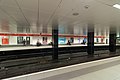
St Enoch subway station is a station on the Glasgow Subway in Scotland. It is located north of the River Clyde in Glasgow city centre. Although it does not have direct interchange with the main line railway, it is located approximately halfway between Glasgow Central railway station and Argyle Street railway station, within a few minutes' walk to both. The subway station is accessible via St Enoch Square.

Contents

Usage of the entire subway in 2007/08 was 14.45 million passengers, increased from 13.14 million in 2005/06. [9]

Original building

Flemish Renaissance style original building Travel Centre, Glasgow - geograph.org.uk - 250472.jpg
Flemish Renaissance style original building
The former station building, now converted into a cafe, with the St Enoch Centre in the background. Former Glasgow Subway St Enoch station building.jpg
The former station building, now converted into a café, with the St Enoch Centre in the background.

Above ground, the original station building housed both a booking office and the headquarters of the original Glasgow District Subway Railway Company. This was (and is) the subway's most distinctive building – an ornate, Flemish Renaissance, late-Victorian red sandstone structure; designed by James Miller in 1896.

Reconstruction

St Enoch is one of two stations on the Subway that was completely rebuilt from scratch (the other being Partick) during the late 1970s modernisation. Although the original surface building was retained, it would not form part of the new facility, but due to its listed status meant it could not be demolished. To facilitate its preservation, the original foundations were removed to allow the construction of a concrete box to house the expanded station and new subterranean ticket hall. To facilitate this, the old building was relocated onto a precast platform supported on the new station's concrete pillars. Memorable images exist from the late 1970s showing the building seemingly perilously sitting on its new foundations with the empty void of the old station underneath.

Following the modernisation, the old building became a travel information centre for SPT. The building became disused with the travel centre facilities being moved to the underground ticket hall in 2008. In December 2009, a Caffè Nero coffee shop was established in the building. It is now protected as a category A listed building. [10]

Accessibility

St Enoch is the only station on the system which requires two escalator rides to reach the platforms owing to its deep location. Along with Govan subway station, it is one of two Glasgow Subway stations that is wheelchair accessible. [11] [12]

Refurbishment (2010s)

As part of the wider refurbishment of the city's subway, St Enoch station received new glass canopies for each entrance, and an overhaul of the ticket hall.

Past passenger numbers

Related Research Articles

<span class="mw-page-title-main">Glasgow Subway</span> Underground rapid transit line in Glasgow, Scotland

The Glasgow Subway is an underground light metro system in Glasgow, Scotland. Opened on 14 December 1896, it is the third-oldest underground rail transit system in Europe after the London Underground and the Budapest Metro. It is also one of the very few railways in the world with a track running gauge of 4 ft wide. Originally a cable railway, the subway was later electrified, but the double-track circular line was never expanded. The line was originally known as the Glasgow District Subway, and was thus the first mass transit system to be known as a "subway"; it was later renamed Glasgow Subway Railway. In 1936 it was renamed the Glasgow Underground. Despite this rebranding, many Glaswegians continued to refer to the network as "the Subway". In 2003, the name "Subway" was officially readopted by its operator, the Strathclyde Partnership for Transport (SPT).

<span class="mw-page-title-main">Strathclyde Partnership for Transport</span> Regional transport partnership for the Strathclyde area of western Scotland

Strathclyde Partnership for Transport (SPT) is a regional transport partnership for the Strathclyde area of western Scotland. It is responsible for planning and coordinating regional transport, especially the public transport system in the area, including responsibility for operating the Glasgow Subway, the third-oldest in the world.

<span class="mw-page-title-main">Kelvinhall subway station</span> Glasgow subway station

Kelvinhall is an underground station on the Glasgow Subway, renamed after the nearby Kelvin Hall. It is located in the West End of Glasgow, Scotland, near to many of the city's best known tourist destinations including:

<span class="mw-page-title-main">Transport in Glasgow</span> Overview of transport in Glasgow

The city of Glasgow, Scotland, has a transport system encompassing air, rail, road and an underground light metro line. Prior to 1962, the city was also served by trams. Commuters travelling into Glasgow from the neighbouring local authorities of North and South Lanarkshire, Renfrewshire, East Renfrewshire, and East and West Dunbartonshire have a major influence on travel patterns, with tens of thousands of residents commuting into the city each day. The most popular mode of transport in the city is the car, used by two-thirds of people for journeys around the city.

<span class="mw-page-title-main">Partick station</span> Glasgow subway and railway station

Partick is combined National Rail and Glasgow Subway station in the Partick area of Glasgow, Scotland. Along with the adjacent bus station, it forms one of the main transport hubs in Glasgow. As of 2022, it was the fifth-busiest station in Scotland, but was overtaken in 2023. The station is served by Glasgow Subway and ScotRail services and was one of the first to receive bilingual English and Gaelic signs, due to the significant Gaelic-speaking population in the surrounding Partick area.

<span class="mw-page-title-main">Jordanhill railway station</span> Railway station in Glasgow, Scotland

Jordanhill railway station is a side-platformed suburban railway station in the Jordanhill area in the West End of Glasgow, Scotland. The station, which is governed by Transport Scotland and managed by ScotRail, lies on the Argyle Line and the North Clyde Line. In operation since 1887, the station stemmed losses for an area that was in decline.

<span class="mw-page-title-main">Transport Scotland</span> National transport agency of Scotland

Transport Scotland is the national transport agency of Scotland. It was established by the Transport (Scotland) Act 2005, and began operating on 1 January 2006 as an executive agency of the Scottish Government.

<span class="mw-page-title-main">Buchanan Street subway station</span> Glasgow subway station

Buchanan Street subway station is a station on the Glasgow Subway in Scotland. It serves the major shopping thoroughfare of Buchanan Street, and is one of two stations on the Subway that directly serve the city centre. Close to Buchanan Bus Station and providing interchange with Glasgow Queen Street railway station via a travelator, it is the busiest station on the Subway, with 2.54 million passengers in the 12 months ending 31 March 2005.

<span class="mw-page-title-main">Cowcaddens subway station</span> Glasgow subway station

Cowcaddens subway station is a station on the Glasgow Subway and serves the Cowcaddens, Garnethill and Dundasvale areas of Glasgow, Scotland. It is located on the north side of the city centre. Glasgow School of Art, Tenement House, the National Piping Centre, and to some extent Glasgow Caledonian University are local institutions and attractions served by the station.

<span class="mw-page-title-main">St George's Cross subway station</span> Glasgow Subway station

St George's Cross subway station is a Glasgow Subway station in Glasgow, Scotland which serves the areas of Woodside and Woodlands of the city. It is located at St George's Cross, previously an important road junction but realigned due to the construction of the M8 motorway and less heavily used by traffic since then. Today the station serves mainly the eastern extremity of Great Western Road and the northern reaches of the neighbouring Charing Cross district.

<span class="mw-page-title-main">Kelvinbridge subway station</span> Glasgow subway station

Kelvinbridge subway station is a Glasgow Subway station serving the Woodlands, Woodside and Hillhead areas of Glasgow, Scotland. It is named after the bridge crossing the River Kelvin, next to the station. This station is one of the two serving Kelvingrove Park, the other being Kelvinhall.

<span class="mw-page-title-main">Hillhead subway station</span> Glasgow subway station

Hillhead subway station is a station on the Glasgow Subway, serving the Hillhead area of Glasgow, Scotland, and is the principal station that serves the city's West End. The entrance is located on Byres Road.

<span class="mw-page-title-main">Govan subway station</span> Glasgow subway station

Govan subway station is a station serving the area of Govan in Glasgow, Scotland. It is located on the south side of the River Clyde. Just to the south of the station is the main depot and test track for the Glasgow Subway. The station is located near the historic Govan Old Parish Church.

<span class="mw-page-title-main">Ibrox subway station</span> Glasgow subway station

Ibrox subway station is a station serving the Ibrox area of Glasgow, Scotland. The station was known as Copland Road until 1977. The station's surface buildings were replaced during the Subway's modernisation programme, with the main entrance still located on Copland Road. The station now has a side platform arrangement for boarding the trains.

<span class="mw-page-title-main">Cessnock subway station</span> Glasgow subway station

Cessnock subway station is a station on the Glasgow Subway that serves the eastern part of Ibrox and the Cessnock area of the city. It is also the nearest station to Festival Park. Along with Kelvinhall, it is one of only two stations to retain its pre-modernisation surface buildings and entryway. It is also the only station to retain its pre-modernisation livery and signage. The entrance is at the east end of Walmer Crescent and leads under the residential housing.

<span class="mw-page-title-main">Kinning Park subway station</span> Glasgow subway station

Kinning Park subway station serves the Kinning Park area of Glasgow, Scotland. However, to reach Kinning Park, a footbridge is provided across the M8.

<span class="mw-page-title-main">Shields Road subway station</span> Glasgow subway station

Shields Road subway station is a station of Glasgow Subway, serving the Pollokshields and Kingston areas of Glasgow, Scotland. Nearby is Charles Rennie Mackintosh's Scotland Street School Museum. This was one of four stations which has Park and Ride facilities.

<span class="mw-page-title-main">West Street subway station</span> Glasgow subway station

West Street subway station on the Glasgow Subway network serves the Tradeston and Kingston areas of Glasgow, Scotland.

<span class="mw-page-title-main">Bridge Street subway station</span> Glasgow subway station

Bridge Street subway station serves Tradeston, Laurieston and the western fringe of the Gorbals in Glasgow, Scotland. It is the main interchange between the Glasgow Subway and buses travelling to and from the south side. It is the nearest subway station for the Citizens Theatre, O2 Academy Glasgow, Glasgow Sheriff Court Glasgow Central Mosque, as well as the Buchanan Wharf office and residential complex.

<span class="mw-page-title-main">Glasgow Subway rolling stock</span>

The Glasgow Subway rolling stock serves the Glasgow Subway, the third-oldest underground metro system in the world. The Subway is currently on the second generation of rolling stock, with a third-generation which entered service on 11 December 2023. Unlike other Metro systems in the United Kingdom, the Subway has a running gauge of 1,220 mm.

References

  1. King, Jake (12 July 2020). "Glasgow's Gaelic Underground". Ainmean-Àite na h-Alba . Archived from the original on 4 October 2022. Retrieved 17 February 2023.
  2. 1 2 "Maps & stations". spt.co.uk. Strathclyde Partnership for Transport. Archived from the original on 15 January 2023. Retrieved 16 February 2023.
  3. "Bike parking facilities". spt.co.uk. Strathclyde Partnership for Transport. Archived from the original on 7 November 2022. Retrieved 16 February 2023.
  4. "Accessibility & mobility". spt.co.uk. Strathclyde Partnership for Transport. Archived from the original on 7 November 2022. Retrieved 16 February 2023.
  5. "Request for some usage statistics". Strathclyde Partnership for Transport. 11 January 2019. Archived from the original on 1 March 2019. Retrieved 28 February 2019 via WhatDoTheyKnow.
  6. 1 2 3 "Station usage statistics" (PDF). Strathclyde Partnership for Transport. 20 July 2022. Archived (PDF) from the original on 16 February 2023. Retrieved 16 February 2023 via WhatDoTheyKnow.
  7. "Request for annual Subway station patronage 2022". 22 February 2023. Archived (PDF) from the original on 22 February 2023. Retrieved 22 February 2023.
  8. "Freedom of Information Request: Subway Station Usage Statistics" (PDF). Strathclyde Partnership for Transport. 3 August 2022. Archived (PDF) from the original on 17 February 2023. Retrieved 17 February 2023 via WhatDoTheyKnow.
  9. "SPT Annual Report 2007/08" (PDF). Archived (PDF) from the original on 1 December 2010. Retrieved 7 November 2010.
  10. "St Enoch Square Travel Centre, Formerly St Enoch Underground Station". Historic Scotland. Archived from the original on 23 October 2017. Retrieved 18 March 2019.
  11. "Subway: Maps & Stations". Strathclyde Partnership for Transport . Retrieved 23 June 2021.
  12. "Glasgow's Subway needs to be more accessible, say campaigners". Glasgow Standard. Retrieved 23 June 2021.
  13. "Freedom of Information request: Subway station patronage - 1 April 2011 to 31 March 2012". Strathclyde Partnership for Transport. 18 December 2012. Archived from the original on 9 February 2019. Retrieved 9 February 2019 via WhatDoTheyKnow.