
Helensburgh Central railway station serves the town of Helensburgh on the north shore of the Firth of Clyde, near Glasgow, Scotland. The station is a terminus on the North Clyde Line, sited 24 miles 31 chains (39.2 km) from Glasgow Queen Street, measured via Singer and Maryhill. Passenger services are operated by ScotRail on behalf of Strathclyde Partnership for Transport.

Paisley St James railway station is on the Inverclyde Line, serving one of the residential districts of the town, just west of the town centre. For passengers travelling to the commercial district, Paisley Gilmour Street is the main railway station of Paisley and is located in the heart of Paisley town centre. There is an ongoing campaign to rename the station "Paisley St Mirren" due to the station's proximity to St Mirren's new stadium.
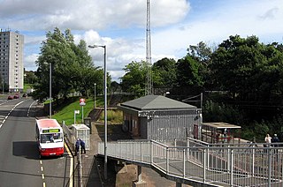
Branchton railway station is a railway station in Scotland opened in 1967 under British Rail located in the south-west of the town of Greenock, beside the area called Branchton. The station is on the Inverclyde Line, 24+3⁄4 mi (40 km) west of Glasgow Central. The station is managed by ScotRail.

Addiewell railway station is a railway station serving Addiewell in West Lothian, Scotland. It is located on the Shotts Line from Glasgow Central to Edinburgh Waverley via Shotts.

Baillieston railway station is located in Caledonia Road on the southern boundary of the Baillieston area of Glasgow, Scotland, with the Broomhouse area on the other side of the tracks. It is on the Whifflet Line, 8 miles (13 km) east of Glasgow Central railway station. Train services are provided by ScotRail.

Cardross railway station is a railway station serving the village of Cardross, Scotland. The station is 19 miles 50 chains (31.6 km) from Glasgow Queen Street, measured via Singer and Maryhill. It is on the North Clyde Line between Dalreoch and Craigendoran, positioned on the banks of the north side of the River Clyde. The station is managed by ScotRail, who operate all services.

Barnhill railway station is in Glasgow, Scotland, 3 miles (5 km) north of Glasgow Queen Street railway station on the Springburn branch of the North Clyde Line. The station is managed by ScotRail.

Alexandra Parade railway station is a railway station in Glasgow, Scotland. The station is 1+3⁄4 miles (2.8 km) east of Glasgow Queen Street on the Springburn branch of the North Clyde Line. The station is managed by ScotRail.

Johnstone railway station serves the town of Johnstone, Renfrewshire, Scotland. The station is managed by ScotRail and is on the Ayrshire Coast Line 10+3⁄4 miles (17.3 km) south west of Glasgow Central. Johnstone has no ticket gates but ticket checks take place occasionally.
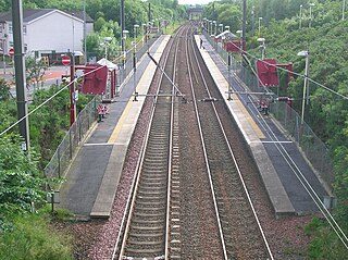
Howwood railway station is a railway station serving the village of Howwood, Renfrewshire, Scotland. The station is managed by ScotRail and is on the Ayrshire Coast Line, 13 miles (21 km) south west of Glasgow Central.
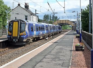
Glengarnock railway station is a railway station in the village of Glengarnock, North Ayrshire, Scotland, serving the towns of Beith and Kilbirnie. The station is managed by ScotRail and is on the Ayrshire Coast Line.

Corkerhill railway station serves the Corkerhill and Mosspark neighbourhoods of Glasgow, Scotland. The station is managed by ScotRail and lies on the Paisley Canal Line, 3¼ miles (5 km) west of Glasgow Central.
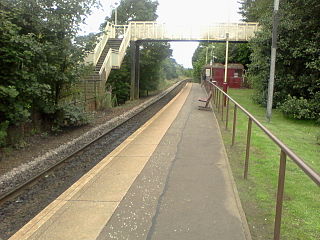
Mosspark railway station serves the Pollok and Cardonald areas of Glasgow, Scotland. The station is on the Paisley Canal Line, 3¾ miles (6 km) west of Glasgow Central and is managed by ScotRail.

Crookston railway station is a railway station in Crookston, a district of Glasgow, Scotland. The station is managed by ScotRail and lies on the Paisley Canal Line which was reopened by British Rail, 41⁄2 miles (7 km) west of Glasgow Central.
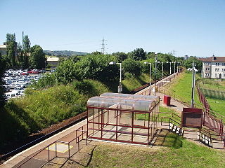
Hawkhead railway station is a railway station in the Seedhill area of Paisley, Renfrewshire, Scotland. The station is managed by ScotRail and lies on the Paisley Canal Line, 6½ miles (10 km) west of Glasgow Central.
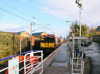
Paisley Canal railway station is a railway station in Paisley, Renfrewshire, Scotland. The station is managed by ScotRail and lies on the Paisley Canal Line.

Thornliebank railway station is a railway station in the village of Thornliebank, East Renfrewshire, Greater Glasgow, Scotland. The station is managed by ScotRail and is on the Glasgow South Western Line.
Pollokshields railway station was a railway station in Pollokshields, a district of Glasgow, Scotland. The station was originally part of the Glasgow and Paisley Joint Railway. It was opened in 1840 and amalgamated into the neighbouring Shields Road station in 1925.

Bellahouston railway station was a railway station serving the Bellahouston area of Glasgow, Scotland. The station was originally part of the G&SWR Paisley Canal Branch.
Shields railway station was a railway station in Pollokshields, Glasgow, Scotland.


