
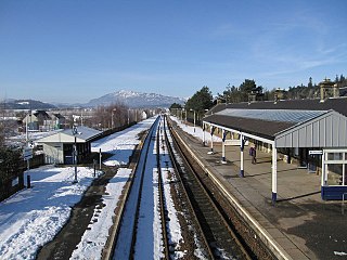
Aviemore railway station serves the town and tourist resort of Aviemore in the Highlands of Scotland. The station,which is owned by Network Rail (NR) and managed by ScotRail,is on the Highland Main Line,83 miles 31 chains from Perth,between Kingussie and Carrbridge,and is also the southern terminus of the Strathspey preserved railway.

Helensburgh Central railway station serves the town of Helensburgh on the north shore of the Firth of Clyde,near Glasgow,Scotland. The station is a terminus on the North Clyde Line,sited 24 miles 31 chains (39.2 km) from Glasgow Queen Street,measured via Singer and Maryhill. Passenger services are operated by ScotRail on behalf of Strathclyde Partnership for Transport.
Helensburgh Upper railway station serves the town of Helensburgh,Scotland,on the north shore of the Firth of Clyde to the west of Glasgow. It is located in a residential area uphill from the town centre and is by far the smaller of the town's two stations. It is on the West Highland Line,2 miles 8 chains (3.4 km) from Craigendoran Junction,near Helensburgh,the first station on the line before Garelochhead. ScotRail manage the station and operate most services,with others provided by Caledonian Sleeper.

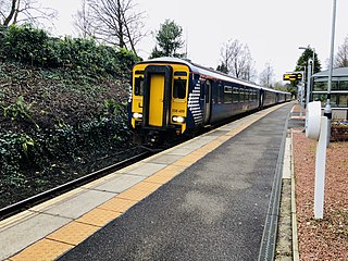
Westerton railway station is a railway station that serves the Westerton district in the town of Bearsden,Scotland. The station is managed and served by ScotRail as part of the Strathclyde Partnership for Transport network. It is located on the Argyle and North Clyde lines,between Drumchapel to the west,Bearsden to the north,and Anniesland and Maryhill to the south-east. It is 6 miles 10 chains (9.9 km) west of Glasgow Queen Street,measured via Maryhill.
Arisaig railway station serves the village of Arisaig on the west coast of the Highland region of Scotland. This station is on the West Highland Line,measured 32 miles 2 chains (51.5 km) from the former Banavie Junction,near Fort William,between Beasdale and Morar on the way to Mallaig. The westernmost station on the Network Rail network,it is the only one of the four cardinal points of the national network that is not a terminus. ScotRail,who manage the station,operate all services.

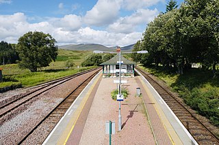
Falls of Cruachan railway station is a railway station located at the foot of Ben Cruachan in Scotland. This station is on the Oban branch of the West Highland Line,originally part of the Callander and Oban Railway. It is sited between Taynuilt and Loch Awe,sited 52 miles 69 chains (85.1 km) from Callander via Glen Ogle. ScotRail manage the station and operate all services.
Rannoch railway station,on the West Highland Line,serves the area of Rannoch in Perth and Kinross,Scotland. In 2017,Simon Jenkins reported it to be one of the best 10 stations in Britain. It is situated between Corrour and Bridge of Orchy,64 miles 36 chains (103.7 km) from Craigendoran Junction,near Helensburgh. ScotRail manage the station and operate most services,along with Caledonian Sleeper.
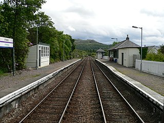
Tulloch railway station is a rural railway station in the remote Tulloch area of the Highland region of Scotland. This station is on the West Highland Line,between Corrour and Roy Bridge,sited 81 miles 59 chains (131.5 km) from Craigendoran Junction,near Helensburgh.

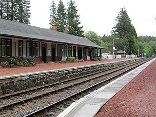
Spean Bridge railway station is a railway station serving the village of Spean Bridge in the Highland region of Scotland. This station is on the West Highland Line,between Roy Bridge and Fort William,sited 90 miles 56 chains (146 km) from Craigendoran Junction,near Helensburgh. ScotRail manage the station and operate most services,along with Caledonian Sleeper.

Loch Eil Outward Bound railway station is a railway station on the northern bank of Loch Eil in the Highland region of Scotland. This station is on the West Highland Line,between Corpach and Locheilside,sited 4 miles 20 chains (6.8 km) from Banavie Junction,near Fort William. ScotRail,who manage the station,operate all services.

Mallaig railway station is a railway station serving the ferry port of Mallaig,Lochaber,in the Highland region of Scotland. This station is a terminus on the West Highland Line,41 miles (66 km) by rail from Fort William and 164 miles (264 km) from Glasgow Queen Street. The station building is Category C listed. ScotRail,who manage the station,operate most of the services.

Drumry railway station serves the Drumry and Linnvale area of Clydebank,West Dunbartonshire,Scotland. The railway station is managed by ScotRail and is served by trains on the Argyle Line and North Clyde Line. It is situated between Singer to the west and Drumchapel to the east,8 miles 10 chains (13.1 km) from Glasgow Queen Street,measured via Maryhill.
Hillfoot railway station is a railway station in Bearsden,East Dunbartonshire near Glasgow,Scotland. The station is managed by ScotRail and is served by their trains on the Argyle and North Clyde Lines. It is sited between Milngavie and Bearsden,7 miles 66 chains (12.6 km) from Glasgow Queen Street,measured via Maryhill.

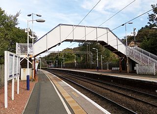
Bearsden railway station serves Bearsden,East Dunbartonshire near Glasgow,Scotland. The railway station is managed by ScotRail and lies on the Argyle Line and North Clyde Lines. It is located between Westerton and Hillfoot on the line to Milngavie,and is 7 miles 21 chains (11.7 km) from Glasgow Queen Street,measured via Maryhill.

Craigendoran railway station is a railway station serving Craigendoran,east of Helensburgh,Scotland. The station is managed by ScotRail,which operates all services at the station. It is located on the North Clyde Line between Helensburgh Central and Cardross,23 miles 18 chains (37.4 km) west of Glasgow Queen Street,measured via Singer and Maryhill. West Highland Line trains used to call here but no longer do following the closure of the upper platforms.

Elgin railway station is a railway station serving the town of Elgin,Moray in Scotland. The station is managed and served by ScotRail and is on the Aberdeen to Inverness Line,between Keith and Forres,measured 12 miles 18 chains (19.7 km) from Forres.

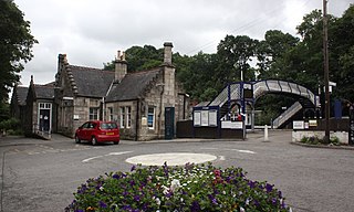
Dunkeld &Birnam railway station serves the town of Dunkeld and village of Birnam in Perth and Kinross,Scotland. It is located on the Highland Main Line,15 miles 31 chains (24.8 km) north of Perth and is the first stop on the line north of there,before Pitlochry. Most services are operated by ScotRail,who also manage the station. LNER and Caledonian Sleeper also call some services here.
Pitlochry railway station is a railway station serving the town of Pitlochry in Perth and Kinross,Scotland. It is managed by ScotRail and is located on the Highland main line,28 miles 21 chains (45.5 km) from Perth,between Dunkeld &Birnham and Blair Atholl.
Kingussie railway station serves the town of Kingussie,Inverness-shire in the Highland Council Area of Scotland. The station is managed by ScotRail and is on the Highland Main Line,71 miles 43 chains (115.1 km) from Perth,between Newtonmore and Aviemore.
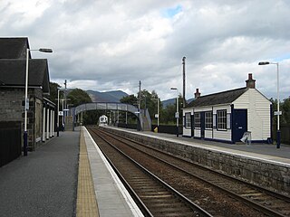
Blair Atholl railway station is a railway station serving the town of Blair Atholl,Perth and Kinross,Scotland. The station is managed by ScotRail and is on the Highland Main Line,35 miles 9 chains (56.5 km) from Perth,between Pitlochry and Dalwhinnie. There is a crossover at the north end of the station to allow trains to turn back if the line south to Pitlochry is closed.

