Duke Street railway station

Last updated

Duke Street

Scottish Gaelic: Sràid an Diùic [1]
National Rail logo.svg
Duke Street station looking north - 2012-04-25.jpg
General information
Location Dennistoun, Glasgow
Scotland
Coordinates 55°51′32″N4°12′44″W / 55.8590°N 4.2122°W / 55.8590; -4.2122
Grid reference NS616650
Managed by ScotRail
Platforms2
Other information
Station codeDST
History
Original company City of Glasgow Union Railway
Key dates
1 January 1881Opened
Passengers
2018/19Decrease2.svg 0.181 million
Railways in the Parkhead area
BSicon CONTg.svg
BSicon exCONTg.svg
Alexandra Parade
BSicon dHST.svg
BSicon exdDST.svg
Kennyhill Goods
Haghill Goods
BSicon edDST.svg
BSicon exdSTR.svg
Duke Street
BSicon STRc2.svg
BSicon STR3.svg
BSicon lvHST@F-.svg
BSicon exSTRl.svg
BSicon exKRZo.svg
BSicon exSTR2+r.svg
BSicon exSTRc3.svg
Haghill Junction
(CB NBR) Camlachie Goods
Coatbridge Branch (NBR) Arrow Blue Left 001.svg 
BSicon dCONTgq.svg
BSicon ABZq1.svg
BSicon STRq.svg
BSicon cSTRc4.svg
BSicon edDSTq.svg
BSicon eKRZq2u.svg
BSicon exSTRc13.svg
BSicon eHSTq.svg
BSicon eABZq+4.svg
BSicon dCONTfq.svg
BSicon tdCONTgq.svg
BSicon lBHFc2.svg
BSicon tSTR2+r.svg
BSicon lBHFc3.svg
BSicon exSTRc1.svg
BSicon exSTRc2.svg
BSicon exSTR+4.svg
BSicon exENDE3.svg
Parkhead Forge Siding (SB CR)
(GCR)
Bridgeton
BSicon lBHFc1.svg
BSicon lBHFc4.svg
BSicon tABZ4+fxl.svg
BSicon extSTR2+r.svg
BSicon extSTRc3.svg
BSicon exABZg+1.svg
BSicon exSTRc4.svg
Parkhead Forge Junction
BSicon tSTR.svg
BSicon exd-KDST2.svg
BSicon exSTRc3.svg
BSicon exKRZ2+4t.svg
BSicon extSTRc3.svg
London Road Goods
BSicon tSTR.svg
BSicon exSTRc12.svg
BSicon extSTRc1.svg
BSicon exABZ3+4g.svg
BSicon extSTR+4.svg
London Road Junction
(GCR)
Dalmarnock
BSicon tSTRe.svg
BSicon exSTRc2.svg
BSicon lHST.svg
BSicon exHST3+1.svg
BSicon exSTRc4.svg
BSicon extSTR.svg
Dalmarnock
Strathclyde Junction
BSicon eABZg+1.svg
BSicon exSTRc4.svg
BSicon extSTR.svg
(GCR)
Bridgeton Goods
BSicon eABZg+l.svg
BSicon excSTRq.svg
BSicon exdKDSTeq.svg
BSicon extHST2.svg
BSicon extdSTRc3.svg
Parkhead Stadium
(GCR)
BSicon hbKRZWae.svg
BSicon extdSTRc1.svg
BSicon extCONT4.svg
BSicon CONTf.svg
Railways
CB NBR
Coatbridge Branch (NBR)
CoGUR
City of Glasgow Union Railway (Joint G&SWR and NBR)
GCR
Glasgow Central Railway (CR)
SB CR
The Switchback (CR)

Duke Street Railway Station is a railway station in Glasgow, Scotland. The station is managed by ScotRail and is served by trains on the North Clyde Line, 1½ miles (2 km) north east of Glasgow Queen Street.

It was built as part of the City of Glasgow Union Railway which provided a link across the Clyde (between the Glasgow and Paisley Joint Railway at Shields Junction and the Edinburgh and Glasgow Railway at Sighthill Junction). Though goods traffic began using the line in 1875, the station was not opened until 1881 with trains initially running as far as Alexandra Park (as it was then known). An extension to Barnhill followed two years later, but it was not until 1887 that they finally reached Springburn.

Electric operation at the station began in 1960 (using the 25 kV A.C overhead system), when the branch from Bellgrove was incorporated into the North Clyde line electrification scheme. Through running to Cumbernauld began in May 2014 - prior to this a change at Springburn was required.

Services

Monday to Saturday there is a half-hourly service northbound to Springburn and southbound to Glasgow Queen Street and beyond (usually to Dumbarton Central).

The proposed timetable changes in 2022 would create a half hourly service in each direction at Duke Street, going eastbound to Springburn and westbound to Milngavie

On Sundays, an hourly service between Partick and Springburn call in each direction between 10am and 6pm [2]

Related Research Articles

<span class="mw-page-title-main">North Clyde Line</span> Railway line in Glasgow City, Scotland, UK

The North Clyde Line is a suburban railway in West Central Scotland. The route is operated by ScotRail. As a result of the incorporation of the Airdrie–Bathgate rail link and the Edinburgh–Bathgate line, this route has become the fourth rail link between Glasgow and Edinburgh.

<span class="mw-page-title-main">Clydebank railway station</span> Railway station in West Dunbartonshire, Scotland

Clydebank railway station is a railway station serving the town of Clydebank in West Dunbartonshire, Scotland. It is located on the Argyle Line and the North Clyde Line. Passenger services are operated by ScotRail.

<span class="mw-page-title-main">Yoker railway station</span> Railway station in West Dunbartonshire, Scotland

Yoker railway station serves the district of Yoker, Scotland.

<span class="mw-page-title-main">Maryhill railway station</span> Railway station in Glasgow, Scotland

Maryhill railway station is a railway station serving the Maryhill area of Glasgow, Scotland. It is located on the Maryhill Line, 4+34 miles (7.6 km) northwest of Glasgow Queen Street, a short distance east of Maryhill Viaduct and Maryhill Park Junction. It has two side platforms. Services are provided by ScotRail on behalf of Strathclyde Partnership for Transport.

<span class="mw-page-title-main">Kelvindale railway station</span> Railway station in Glasgow, Scotland

Kelvindale railway station is a railway station that serves the Kelvindale suburb of Glasgow, Scotland. It was opened on 26 September 2005 by Bill Butler, the then Member of Parliament in the Scottish Parliament and Councillor Alistair Watson. A bronze plaque records the event. The station is 5+12 miles (8.9 km) north of Glasgow Queen Street on the Maryhill Line.

<span class="mw-page-title-main">Bishopbriggs railway station</span> Railway station in East Dunbartonshire, Scotland

Bishopbriggs railway station is a railway station serving Bishopbriggs in East Dunbartonshire, Scotland. It is located on the Glasgow to Edinburgh via Falkirk Line, 3+14 miles (5.2 km) north of Glasgow Queen Street, but is currently only served by services on the Croy Line.
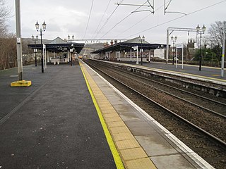
<span class="mw-page-title-main">Dumbarton Central railway station</span> Railway station in West Dunbartonshire, Scotland

Dumbarton Central railway station serves the town of Dumbarton in West Dunbartonshire, Scotland. This station is on the West Highland Line and the North Clyde Line, 15+34 miles (25.3 km) northwest of Glasgow Queen Street.

<span class="mw-page-title-main">Hyndland railway station</span> Railway station in Glasgow, Scotland

Hyndland railway station serves Hyndland in Glasgow, Scotland. The station is 3+14 miles (5.2 km) west of Glasgow Central and 2+34 miles (4.4 km) west of Glasgow Queen Street on the Argyle and North Clyde Lines. It is managed by ScotRail.

<span class="mw-page-title-main">Garscadden railway station</span> Railway station in Glasgow, Scotland

Garscadden railway station serves Garscadden in Glasgow, Scotland. The station is managed by ScotRail and lies on the Argyle Line.
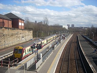
<span class="mw-page-title-main">Springburn railway station</span> Railway station in Glasgow, Scotland

Springburn railway station serves the Springburn district of Glasgow, Scotland. The station is 1+14 miles (2.0 km) north of Glasgow Queen Street station on the Cumbernauld Line and is a terminus of the Springburn branch, a spur from Bellgrove station, on the North Clyde Line.

<span class="mw-page-title-main">Bowling railway station</span> Railway station in West Dunbartonshire, Scotland

Bowling railway station serves the village of Bowling in the West Dunbartonshire region of Scotland. This station is on the North Clyde Line, 12¼ miles (20 km) west of Glasgow Queen Street.
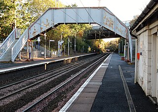
<span class="mw-page-title-main">Kilpatrick railway station</span> Railway station in West Dunbartonshire, Scotland

Kilpatrick railway station serves the village of Old Kilpatrick in the West Dunbartonshire region of Scotland. The station is managed by ScotRail and is on the North Clyde Line, 1112 miles (18 km) west of Glasgow and the Argyle Line on Sundays.

<span class="mw-page-title-main">Barnhill railway station</span> Railway station in Glasgow, Scotland

Barnhill railway station is in Glasgow, Scotland, 3 miles (5 km) north of Glasgow Queen Street railway station on the Springburn branch of the North Clyde Line. The station is managed by ScotRail.

<span class="mw-page-title-main">Alexandra Parade railway station</span> Railway station in Glasgow, Scotland

Alexandra Parade railway station is a railway station in Glasgow, Scotland. The station is 1+34 miles (2.8 km) east of Glasgow Queen Street on the Springburn branch of the North Clyde Line. The station is managed by ScotRail.

<span class="mw-page-title-main">Bellgrove railway station</span> Railway station in Glasgow

Bellgrove Railway Station is in the East End of Glasgow, Scotland, serving the city's Calton, Gallowgate and south Dennistoun neighbourhoods. The station is approximately 1 mile (1.6 km) to the east of Glasgow Queen Street, and is managed by ScotRail.

<span class="mw-page-title-main">High Street (Glasgow) railway station</span> Railway station in Glasgow, Scotland

High Street railway station serves High Street in Glasgow, Scotland and the surrounding area, which includes Townhead, the Merchant City, as well the western fringes of Dennistoun and Calton. The station is managed by ScotRail and is served by trains on the North Clyde Line. It is located in the eastern part of the city centre, with Strathclyde University, Glasgow Cathedral and Glasgow Royal Infirmary being major institutions located nearby.

<span class="mw-page-title-main">Greenfaulds railway station</span> Railway station in North Lanarkshire, Scotland

Greenfaulds railway station serves the Greenfaulds area of Cumbernauld, North Lanarkshire, Scotland. It is also within walking distance of the Lenziemill industrial estate, the Luggie Water and the Blairlinn industrial estate. The station is managed by ScotRail and is located 13+14 miles (21.3 km) north east of Glasgow Queen Street on the Cumbernauld Line and is 11 miles (18 km) north of Motherwell railway station on the Motherwell to Cumbernauld Line.

<span class="mw-page-title-main">Cumbernauld railway station</span> Railway station in North Lanarkshire, Scotland

Cumbernauld railway station serves the town of Cumbernauld, Scotland. The station is managed by ScotRail and is located on the Cumbernauld Line, 14 miles (23 km) north east of Glasgow Queen Street station and the Motherwell to Cumbernauld Line, 11+34 miles (18.9 km) north of Motherwell. Trains serving the station are operated by ScotRail.
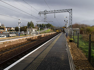
<span class="mw-page-title-main">Stepps railway station</span> Railway station in North Lanarkshire, Scotland

Stepps railway station serves the town of Stepps, North Lanarkshire, Scotland. The railway station is located on the Cumbernauld Line, 5¼ miles (8 km) north east of Glasgow Queen Street and is managed by ScotRail.

<span class="mw-page-title-main">Gartcosh railway station</span> Railway station in North Lanarkshire, Scotland

Gartcosh railway station serves the village of Gartcosh, North Lanarkshire, Scotland. The railway station is managed by ScotRail and is located on the Cumbernauld Line, 7+34 mi (12 km) northeast of Glasgow Queen Street station.

References

  1. Brailsford, Martyn, ed. (December 2017) [1987]. "Gaelic/English Station Index". Railway Track Diagrams 1: Scotland & Isle of Man (6th ed.). Frome: Trackmaps. ISBN   978-0-9549866-9-8.
  2. Table 226 National Rail timetable, December 2018
Preceding station National Rail logo.svg National Rail Following station
Alexandra Parade   ScotRail
North Clyde Line
  Bellgrove
  Historical railways  
Alexandra Parade   City of Glasgow Union Railway
G&SWR and NBR
  Bellgrove