Glasgow Central, usually referred to in Scotland as just Central or Central Station, is one of two principal mainline rail terminals in Glasgow, Scotland. The railway station was opened by the Caledonian Railway on 1 August 1879 and is one of 20 managed by Network Rail. It is the northern terminus of the West Coast Main Line. As well as being Glasgow's principal inter-city terminus for services to England, Central also serves the southern suburbs of the Greater Glasgow conurbation, as well as the Ayrshire and Clyde coasts. The other main station in Glasgow is Glasgow Queen Street.

The North Clyde Line is a suburban railway in West Central Scotland. The route is operated by ScotRail. As a result of the incorporation of the Airdrie–Bathgate rail link and the Edinburgh–Bathgate line, this route has become the fourth rail link between Glasgow and Edinburgh.

The Cathcart Circle Lines form a mostly suburban railway route linking Glasgow (Central) to Cathcart via a circular line, with branches to Newton and Neilston, on the south bank of the River Clyde. They are part of the Strathclyde Partnership for Transport network.

Anderston railway station serves Glasgow's financial district of Anderston and, across the M8 motorway, the housing schemes of both Anderston West and the Blythswood Court estate of the Anderston Centre. It is also close to both the Hilton and Marriott hotels. It is a staffed station with an island platform and most of it is underground.

Mount Florida railway station is a staffed island platform station on the Cathcart Circle. It serves the Mount Florida and Battlefield areas of Glasgow, Scotland and can get busy on match days as it is nearby to Hampden Park football stadium. Services are provided by ScotRail on behalf of Strathclyde Partnership for Transport.

Cathcart railway station is a railway station serving the Cathcart area of Glasgow, Scotland. It is located on the Cathcart Circle Line, 3.7 miles (6 km) south of Glasgow Central. Services are provided by ScotRail on behalf of Strathclyde Partnership for Transport.

Hamilton West railway station serves the Hamilton West area of Hamilton, South Lanarkshire, in Scotland, lying on the Argyle Line.

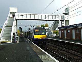
Newton railway station is a railway station located between the neighbourhoods of Drumsagard, Halfway, Newton and Westburn in the town of Cambuslang, Scotland. The station is managed by ScotRail on the Argyle and Cathcart Circle Lines.

Airbles railway station serves the Airbles area of Motherwell, North Lanarkshire in Scotland. It is located around 1⁄2 mile (1 km) away from Fir Park stadium, home of Motherwell F.C.

Bellshill railway station is a railway station in the town of Bellshill, North Lanarkshire, Scotland. The station is managed by ScotRail and served by Argyle Line and Shotts Line services. The station is adjacent to Bellshill Main Street, on Hamilton Road, and was opened by the Caledonian Railway as part of the Cleland and Midcalder Line on 1 May 1879. West of the station, the Glasgow, Bothwell, Hamilton and Coatbridge Railway crossed with a second station in the town to the north west - this ceased to carry passengers back in 1951.

Wishaw railway station is a railway station in Wishaw, North Lanarkshire, Scotland. The station is managed by ScotRail and lies on the Wishaw Deviation Line just south of the single track link line which connects to the West Coast Main Line at Shieldmuir.

Carluke railway station is a railway station on the West Coast Main Line (WCML) that serves the town of Carluke, South Lanarkshire, Scotland. The station is managed by ScotRail and is predominantly served by Argyle Line commuter trains running between Lanark and Glasgow Central. The station lies at the western edge of the town, and enjoys panoramic views of the Clyde Valley and beyond to the hills of Lanarkshire and Ayrshire.

King's Park is a district in the city of Glasgow, Scotland. It is situated south of the River Clyde and borders the Glasgow areas of Croftfoot, Cathcart, Simshill, Mount Florida and Toryglen and the neighbourhood of Bankhead in the adjoining town of Rutherglen.

Kirkhill railway station is a railway station serving the Kirkhill area of the town of Cambuslang, South Lanarkshire, Greater Glasgow, Scotland. The station is managed by ScotRail and is located on the Cathcart Circle Lines. This is the least used station on the Newton Branch.

Burnside railway station serves the Burnside and Blairbeth areas of the Royal Burgh of Rutherglen, South Lanarkshire, Greater Glasgow, Scotland. The station is managed by ScotRail and is located on the Newton branch of the Cathcart Circle Lines, which has been electrified since 1962 by British Railways. This is the busiest railway station on the Newton branch.

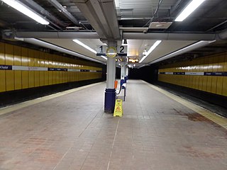
Charing Cross (Glasgow) is a railway station close to the centre of Glasgow, Scotland, serving the district of the same name. It is managed by ScotRail and is served by trains on the North Clyde Line.

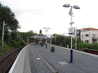
Muirend railway station is an island platform suburban railway station in the Muirend area of Glasgow, Scotland. The station, which opened in 1903, is managed by ScotRail and lies on the Neilston branch of the Cathcart Circle Lines.

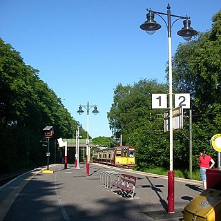
Maxwell Park railway station is a railway station in Pollokshields area of Glasgow, Scotland, adjacent to the park of the same name. The station is managed by ScotRail and is located on the Cathcart Circle Line, which has been electrified since 1962 by British Railways.

Greenfaulds railway station serves the Greenfaulds area of Cumbernauld, North Lanarkshire, Scotland. It is also within walking distance of the Lenziemill industrial estate, the Luggie Water and the Blairlinn industrial estate. The station is managed by ScotRail and is located 13+1⁄4 miles (21.3 km) north east of Glasgow Queen Street on the Cumbernauld Line and is 11 miles (18 km) north of Motherwell railway station on the Motherwell to Cumbernauld Line.

Cumbernauld railway station serves the town of Cumbernauld, Scotland. The station is managed by ScotRail and is located on the Cumbernauld Line, 14 miles (23 km) north east of Glasgow Queen Street station and the Motherwell to Cumbernauld Line, 11+3⁄4 miles (18.9 km) north of Motherwell. Trains serving the station are operated by ScotRail.


