Paisley St James railway station

Last updated

Paisley Saint James

Scottish Gaelic: Eaglais Sheumais Phàislig [1]
National Rail logo.svg
Paisley St James station TN.jpg
St James' Church can be seen in the distance under the footbridge.
General information
Location Paisley, Renfrewshire
Scotland
Coordinates 55°51′07″N4°26′31″W / 55.8519°N 4.4419°W / 55.8519; -4.4419
Grid reference NS472648
Managed by ScotRail
Platforms2
Other information
Station codePYJ
Key dates
29 March 1841Opened
Passengers
2018/19Increase2.svg 73,330
Railway stations in Paisley
BSicon CONTg.svg
BSicon CONTg@Gq.svg
BSicon eABZq+r.svg
BSicon STR2+r.svg
BSicon UWu3.svg
BSicon exSTR3+l.svg
BSicon eABZgr+r.svg
Walkinshaw N & S Junctions
Ferguslie
BSicon exSTRc2.svg
BSicon exSTR.svg
BSicon exlvBST@F-.svg
BSicon exSTR3+1u.svg
BSicon STR+4.svg
BSicon HST.svg
Paisley St James
BSicon exSTRc2.svg
BSicon exKRZ3+1o.svg
BSicon exSTRc4.svg
BSicon BHF-L.svg
BSicon BHF-R.svg
Paisley Gilmour Street
BSicon exSTR+1.svg
BSicon exSTRc4.svg
BSicon exSTR2.svg
BSicon exSTRc3.svg
BSicon STR+c2.svg
BSicon STR3.svg
BSicon exCONTg.svg
Wallneuk Junction
BSicon exSTR.svg
BSicon exSTRc1.svg
BSicon exSTR+4.svg
BSicon ABZg+1.svg
BSicon STRc4.svg
BSicon exKHSTaq.svg
BSicon exABZgr.svg
Paisley
Hamilton Street
Greenlaw
Goods
BSicon exSTR.svg
BSicon exSTR.svg
BSicon STR.svg
BSicon exKDST2.svg
BSicon exSTRc3.svg
BSicon exHST.svg
Paisley Abercorn
Stanely
BSicon exBST.svg
BSicon exSTR+l.svg
BSicon exABZgr+r.svg
BSicon eABZgl.svg
BSicon exSTRc1.svg
BSicon exSTRq.svg
BSicon exABZg+r.svg
BSicon exSTR+4.svg
Glenfield
BSicon exBST.svg
BSicon exSTR.svg
BSicon exSTR.svg
BSicon xABZgl+xl.svg
BSicon kSTR2+r.svg
BSicon kSTRc3.svg
BSicon exSTR.svg
Arkleston Junction
(PCL)
Paisley West
BSicon exSTR.svg
BSicon exSTR.svg
BSicon exHST.svg
BSicon exBST.svg
BSicon xkABZg+4.svg
Paisley East
(PCL)
Paisley Canal
BSicon exSTR.svg
BSicon exSTR.svg
BSicon exUWu2.svg
BSicon KHST2xa.svg
BSicon exSTR3.svg
BSicon CONTf.svg
Potterhill
BSicon exSTR.svg
BSicon exHST.svg
BSicon exSTR+1.svg
BSicon lv-HST@F.svg
BSicon eSTR2+4u.svg
BSicon STRc3.svg
Hawkhead
(PCL)
Dykebar
BSicon exSTR2.svg
BSicon exUWu2.svg
BSicon exUWu3.svg
BSicon exABZ23.svg
BSicon exBST3@g.svg
BSicon STRc1.svg
BSicon STRl+4.svg
BSicon lCONTf@Gq.svg
Gleniffer Goods Depot
BSicon exUWu1.svg
BSicon exKDST1.svg
BSicon exABZ+14.svg
BSicon exUWu4.svg
BSicon exSTR2+4.svg
BSicon exSTRc3.svg
Blackbyres
West Junction
(P&BDR)
BSicon exCONTf@F.svg
BSicon exSTRc1.svg
BSicon exSTRl+4.svg
BSicon exlCONTf@Gq.svg

Relocation

On 13 October 2016, Glasgow Airport Rail Link plans were revived with a PRT option proposed. If this plan goes ahead, then Paisley St James would be relocated to a site next to Junction 29 of the M8. A PRT to the airport is also proposed from this station. [5] [6]

Related Research Articles

<span class="mw-page-title-main">Clydebank railway station</span> Railway station in West Dunbartonshire, Scotland

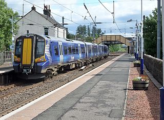
Clydebank railway station is a railway station serving the town of Clydebank in West Dunbartonshire, Scotland. It is located on the Argyle Line and the North Clyde Line. Passenger services are operated by ScotRail.

<span class="mw-page-title-main">Port Glasgow railway station</span> Railway station in Inverclyde, Scotland

Port Glasgow railway station is on the Inverclyde Line, serving the town of Port Glasgow, Scotland. It is located in the town centre with the main entrance at the junction of Princes Street and John Wood Street.

<span class="mw-page-title-main">Paisley Gilmour Street railway station</span> Railway station in Renfrewshire, Scotland

Paisley Gilmour Street railway station is the largest of the four stations serving the town of Paisley, Renfrewshire, Scotland, and acts as the town's principal railway station. The station is managed by ScotRail and serves the Ayrshire Coast Line and Inverclyde Line, 7+14 miles (11.7 km) west of Glasgow Central. The station is protected as a category B listed building.

<span class="mw-page-title-main">Croy railway station</span> Railway station in North Lanarkshire, Scotland

Croy railway station serves the village of Croy – as well as the nearby town of Kilsyth and parts of Cumbernauld – in North Lanarkshire, Scotland. Located on the Glasgow to Edinburgh via Falkirk Line, 11+12 miles (18.5 km) northeast of Glasgow Queen Street. It is served by services on the Glasgow–Edinburgh mainline and services between Glasgow Queen Street and Stirling. Train services are provided by ScotRail.

<span class="mw-page-title-main">Lenzie railway station</span> Railway station in East Dunbartonshire, Scotland

Lenzie railway station is a railway station serving Lenzie and Kirkintilloch in East Dunbartonshire, Scotland. It is located on the Croy Line, 6+14 miles (10.1 km) northeast of Glasgow Queen Street. Trains on the Glasgow to Edinburgh via Falkirk Line pass Lenzie by. The station is served by ScotRail.

<span class="mw-page-title-main">Barnhill railway station</span> Railway station in Glasgow, Scotland

Barnhill railway station is in Glasgow, Scotland, 3 miles (5 km) north of Glasgow Queen Street railway station on the Springburn branch of the North Clyde Line. The station is managed by ScotRail.

<span class="mw-page-title-main">Alexandra Parade railway station</span> Railway station in Glasgow, Scotland

Alexandra Parade railway station is a railway station in Glasgow, Scotland. The station is 1+34 miles (2.8 km) east of Glasgow Queen Street on the Springburn branch of the North Clyde Line. The station is managed by ScotRail.

<span class="mw-page-title-main">High Street (Glasgow) railway station</span> Railway station in Glasgow, Scotland

High Street railway station serves High Street in Glasgow, Scotland and the surrounding area, which includes Townhead, the Merchant City, as well the western fringes of Dennistoun and Calton. The station is managed by ScotRail and is served by trains on the North Clyde Line. It is located in the eastern part of the city centre, with Strathclyde University, Glasgow Cathedral and Glasgow Royal Infirmary being major institutions located nearby.

<span class="mw-page-title-main">Shettleston railway station</span> Railway station in Glasgow, Scotland

Shettleston railway station serves the Shettleston area of Glasgow, Scotland and is 3½ miles (5 km) east of Glasgow Queen Street railway station on the North Clyde Line. The station is managed by ScotRail.

<span class="mw-page-title-main">Easterhouse railway station</span> Railway station in Glasgow, Scotland

Easterhouse railway station serves the Easterhouse area of Glasgow, Scotland. It was built by the North British Railway as part of their Coatbridge Branch and opened when the branch opened on 1 February 1871. The station is 5¾ miles (9 km) east of Glasgow Queen Street railway station on the North Clyde Line and is managed by ScotRail.

<span class="mw-page-title-main">Airdrie railway station</span> Railway station in North Lanarkshire, Scotland

Airdrie railway station is a railway station serving the town of Airdrie, North Lanarkshire, Scotland. The station is managed by ScotRail and is served by trains on the North Clyde Line, 11 miles (18 km) east of Glasgow Queen Street.

<span class="mw-page-title-main">Dumbreck railway station</span> Railway station in Glasgow, Scotland

Dumbreck railway station is a railway station in Dumbreck, a district of Glasgow, Scotland. The station is managed by ScotRail and lies on the Paisley Canal Line, 1¾ miles (3 km) west of Glasgow Central, close to the M77 motorway. It is accessed from the Nithsdale Road at the bridge over the railway. Dumbreck railway station is also the closest station for the Bellahouston Park.

<span class="mw-page-title-main">Johnstone railway station</span> Railway station in Renfrewshire, Scotland

Johnstone railway station serves the town of Johnstone, Renfrewshire, Scotland. The station is managed by ScotRail and is on the Ayrshire Coast Line 10+34 miles (17.3 km) south west of Glasgow Central. Johnstone has no ticket gates but ticket checks take place occasionally.

<span class="mw-page-title-main">Milliken Park railway station</span> Railway station in Renfrewshire, Scotland

Milliken Park railway station serves the west end of Johnstone and the south west of the village of Kilbarchan in Renfrewshire, Scotland. The station is managed by ScotRail and is on the Ayrshire Coast Line.

<span class="mw-page-title-main">Glengarnock railway station</span> Railway station in North Ayrshire, Scotland

Glengarnock railway station is a railway station in the village of Glengarnock, North Ayrshire, Scotland, serving the towns of Beith and Kilbirnie. The station is managed by ScotRail and is on the Ayrshire Coast Line.

<span class="mw-page-title-main">Corkerhill railway station</span> Railway station in Glasgow, Scotland

Corkerhill railway station serves the Corkerhill and Mosspark neighbourhoods of Glasgow, Scotland. The station is managed by ScotRail and lies on the Paisley Canal Line, 3¼ miles (5 km) west of Glasgow Central.

<span class="mw-page-title-main">Mosspark railway station</span> Railway station in Glasgow, Scotland

Mosspark railway station serves the Pollok and Cardonald areas of Glasgow, Scotland. The station is on the Paisley Canal Line, 3¾ miles (6 km) west of Glasgow Central and is managed by ScotRail.

<span class="mw-page-title-main">Crookston railway station</span> Railway station in Glasgow, Scotland

Crookston railway station is a railway station in Crookston, a district of Glasgow, Scotland. The station is managed by ScotRail and lies on the Paisley Canal Line which was reopened by British Rail, 412 miles (7 km) west of Glasgow Central.

<span class="mw-page-title-main">Hawkhead railway station</span> Railway station in Renfrewshire, Scotland

Hawkhead railway station is a railway station in the Seedhill area of Paisley, Renfrewshire, Scotland. The station is managed by ScotRail and lies on the Paisley Canal Line, 6½ miles (10 km) west of Glasgow Central.

<span class="mw-page-title-main">Paisley Canal railway station</span> Railway station in Renfrewshire, Scotland

Paisley Canal railway station is a railway station in Paisley, Renfrewshire, Scotland. The station is managed by ScotRail and lies on the Paisley Canal Line.

References

Notes

  1. Brailsford 2017, Gaelic/English Station Index.
  2. "Railway station named after St Mirren fans - Daily Record". Archived from the original on 26 December 2018. Retrieved 26 December 2018.
  3. Butt 1995, p. 180.
  4. Table 219 National Rail timetable, May 2016
  5. "£80million rail link could take travellers from new station to Glasgow Airport (From Evening Times)". Archived from the original on 28 October 2016. Retrieved 28 October 2016.
  6. "New option could see Glasgow Airport rail link run from relocated Paisley St James station | Renfrewshire News". Archived from the original on 28 October 2016. Retrieved 28 October 2016.

Sources

Commons-logo.svg Media related to Paisley St James railway station at Wikimedia Commons