Elouera Beach

Last updated

Elouera Beach
Beach
Elouera Beach 1.JPG
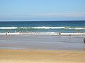
View of Eloura looking north
Coordinates: 34°02′47″S151°09′34″E / 34.04639°S 151.15944°E / -34.04639; 151.15944
Location Cronulla, Sydney, New South Wales, Australia
Dimensions
  Length350 m
Patrolled by Elouera Surf Life Saving Club
Hazard rating6/10 (moderately hazardous)
Wanda  

Elouera Beach or Elouera is a patrolled beach on Bate Bay, in Cronulla, Sydney, New South Wales, Australia. [1] The Wall is the local name given to the area between North Cronulla Beach and Elouera.

Contents

History

Elouera is an Aboriginal word meaning a pleasant place. [2]

Elouera Surf Lifesaving Club

The Elouera Surf Lifesaving Club [3] was established in 1966. On the official opening of the clubhouse on 8 June 1967, the club's first surf boat Charlotte Breen, donated by local businessman Tom Breen, was christened and launched. The Elouera "Sharks" had 375 members in the initial season.

See also

Related Research Articles

<span class="mw-page-title-main">Surf lifesaving</span> Beach surf lifesaving volunteers

Surf lifesaving is a multifaceted social movement that comprises key aspects of voluntary lifeguard services and competitive surf sport. Originating in early 20th century Australia, the movement has expanded globally to other countries, including New Zealand, Ireland, South Africa, and the United Kingdom. Surf lifesavers in Australia are colloquially known as "Clubbies".

<span class="mw-page-title-main">Bondi Beach</span> Suburb of Sydney, New South Wales, Australia

Bondi Beach is a popular beach and the name of the surrounding suburb in Sydney, New South Wales, Australia. Bondi Beach is located 7 kilometres east of the Sydney central business district, in the local government area of Waverley Council, in the Eastern Suburbs. It has a population of 11,656 residents. Its postcode is 2026. Bondi, North Bondi and Bondi Junction are neighbouring suburbs. Bondi Beach is one of the most visited tourist sites in Australia sparking two hit TV series Bondi Rescue and Bondi Vet.

<span class="mw-page-title-main">Palm Beach, New South Wales</span> Suburb of Sydney, New South Wales, Australia

Palm Beach is a suburb in the Northern Beaches region of Greater Sydney, in the state of New South Wales, Australia. Palm Beach is located 41 kilometres (25 mi) north of the Sydney central business district, in the local government area of Northern Beaches Council. Palm Beach sits on a peninsula at the end of Barrenjoey Road near Pittwater and is the northernmost beach in the Greater Sydney Metropolitan area. The population of Palm Beach was 1,593 as at the 2016 census.

<span class="mw-page-title-main">Bronte, New South Wales</span> Suburb of Sydney, New South Wales, Australia

Bronte is a beachside Eastern Suburb of Sydney, in the state of New South Wales, Australia. Bronte Beach is located 7 kilometres east of the Sydney central business district, in the Waverley Council local government area of the Eastern Suburbs.

<span class="mw-page-title-main">Sutherland Shire</span> Local government area in New South Wales, Australia

Sutherland Shire is a local government area in the southern region of Sydney, in the state of New South Wales, Australia. The Sutherland Shire is located just south of the Sydney CBD, and comprises an area of 370 square kilometres (140 sq mi) and as at the 2016 census and has an estimated population of 218,464. The Sutherland Shire is colloquially known as "The Shire" which has been featured in several reality television series.

<span class="mw-page-title-main">Cronulla, New South Wales</span> Suburb of Sydney, New South Wales, Australia

Cronulla is a suburb of Sydney, in the state of New South Wales, Australia. Boasting numerous surf beaches and swimming spots, the suburb attracts both tourists and Greater Sydney residents. Cronulla is 26 kilometres south of the Sydney central business district, in the local government area of the Sutherland Shire.

Sawtell is a suburb of the City of Coffs Harbour in northern New South Wales, Australia. It borders Toormina to the West.

<span class="mw-page-title-main">Yamba, New South Wales</span> Town in New South Wales, Australia

Yamba is a town in the Northern Rivers region of New South Wales, Australia located at the mouth of the Clarence River.

<span class="mw-page-title-main">Mollymook</span> Town in New South Wales, Australia

Mollymook is a town located on the South Coast of New South Wales, Australia approximately three hours' drive south of Sydney within the City of Shoalhaven local government area. At the 2016 census, Mollymook had a population of 1,083 while the adjacent locality of Mollymook Beach was home to a further 2,447 people. Geographically, Mollymook is considered part of the Milton-Ulladulla district, a coastal corridor of urban development stretching from Burrill Lake, south of Ulladulla to Mollymook's northern neighbour, Narrawallee and the historic town of Milton a few kilometres inland.

<span class="mw-page-title-main">Nippers</span>

Nippers are young surf lifesavers, usually aged between 5 and 14 years old, in clubs across Australia, New Zealand and South Africa. Unlike senior surf lifesavers, the majority of them do not patrol the beaches. The focus for Nippers tends to be on fun, and surf awareness.

<span class="mw-page-title-main">Cronulla Beach</span>

Cronulla Beach, is a patrolled beach on Bate Bay in the Sydney suburb of Cronulla, New South Wales, Australia. The Cronulla Pavilion and the Cronulla Lifesaving Club are two prominent buildings located close to the sand. Cronulla Park sits behind the beach. The Cronulla Rock Pools are between Cronulla Beach and North Cronulla beach. The Alley is the local name given to the area between Cronulla Beach and North Cronulla Beach. Shark Island is a dangerous reef break, located off Cronulla Beach.

<span class="mw-page-title-main">Forster, New South Wales</span> Town in New South Wales, Australia

Forster is a coastal town in the Mid North Coast region of New South Wales, Australia, in the Mid-Coast Council LGA, about 308 km north-north-east of Sydney. It is immediately adjacent to its twin, Tuncurry, which is the smaller of the two towns. Forster is known for its stunning waters and Manning Valley beauty.

<span class="mw-page-title-main">Wanda Beach</span>

Wanda Beach or Wanda is the northernmost patrolled beach at Bate Bay in Cronulla, Sydney, New South Wales, Australia. Green Hills or Green Hills Ridge is the name given to the Cronulla sand dunes, just north of Wanda.

<span class="mw-page-title-main">North Cronulla Beach</span> Beach in New South Wales, Australia

North Cronulla Beach or North Cronulla is a patrolled beach on Bate Bay, in Cronulla, Sydney New South Wales, Australia. The Wall is the local name given to the area between North Cronulla Beach and Elouera. The Alley is the local name given to the permanent rip current located at the southern end of North Cronulla Beach.

The club was founded in 1903 and the movement has since spread to other parts of New South Wales and the rest of the country. The club rests on indigenous land and whilst there is no clear evidence for the name or names of the Eora people who lived in what is now the Waverley area, most sources agree on the Cadigal, but some sources name the Biddigal and Birrabirragal bands as well.

<span class="mw-page-title-main">Narrawallee</span> Town in New South Wales, Australia

Narrawallee is a coastal village in the South Coast region of New South Wales, Australia. At the 2016 census, it had a population of 1,241. The village, along with its southern neighbours Mollymook and Mollymook Beach are generally considered part of the Milton-Ulladulla district within the City of Shoalhaven local government area. Narrawallee is predominantly a residential suburb, bordered by a tidal inlet to the north and Matron Porter Drive. The name "Narrawallee" is taken from the creek which flows eastwards from Milton and its estuary on the Tasman Sea and is itself a corruption of the Aboriginal words Nurrawerree or Narra Warra.

<span class="mw-page-title-main">Cronulla Surf Life Saving Club</span>

The Cronulla Surf Life Saving Club, was one of the first surf clubs established in Australia in 1907. The club is located in the southern Sydney suburb of Cronulla, which had very humble beginnings in a tram carriage and today the clubhouse is housed in a magnificent art deco building on the beachfront, that was built in 1940.

<span class="mw-page-title-main">Greenhills Beach</span>

Greenhills Beach is an unpatrolled beach on Bate Bay, located in Greenhills Beach, Sydney, New South Wales, Australia. The beach is located roughly 18 kilometres from the Sydney central business district, in the local government area of the Sutherland Shire. Recognised as one of Sydney's longest beaches, Greenhills beach is roughly 3 kilometres in length and forms part of a chain of beaches residing on Bate Bay. It is the northernmost section of the Greenhills-North Cronulla beach complex and is the only section of the beach not to be patrolled by a Surf Club or by volunteer lifesavers.

The Elouera Surf Lifesaving Club is an Australian surf lifesaving club in Cronulla, New South Wales.

References

  1. "Elouera Beach". Geographical Names Register (GNR) of NSW. Geographical Names Board of New South Wales . Retrieved 5 August 2013. OOjs UI icon edit-ltr-progressive.svg
  2. "Sutherland Shire Place Names Fact Sheet" (PDF). Archived from the original (PDF) on 3 September 2007. Retrieved 23 June 2007.
  3. "Elouera Surf Lifesaving Club" . Retrieved 25 June 2007.