Currawinya is a national park near Hungerford in South West Queensland, Australia, 828 km west of Brisbane. Part of the mulga lands bioregion this is an area of dry sandy plain with small trees and shrubs. The Paroo River passes through the park.

Gwydir River, a major inland perennial river of the Barwon catchment within the Murray–Darling basin, is located in the Northern Tablelands, North West Slopes, and Orana districts of New South Wales, Australia.

The Macquarie Marshes Nature Reserve is a protected natural wetland reserve that is located within the Macquarie Marshes, in the region along the lower Macquarie River in northwestern New South Wales, Australia. The 19,824-hectare (48,990-acre) reserve is situated approximately 600 kilometres (370 mi) northwest of Sydney and 100 kilometres (62 mi) north of Warren.
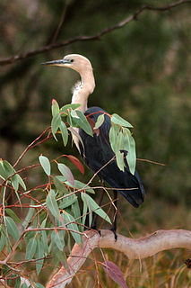
The Macquarie Marshes comprise the wetlands associated with the floodplains of the Macquarie River and its tributaries, in northern New South Wales, Australia. The Macquarie River and the marshes eventually drain into the Darling River. The marshes are important as a breeding site for waterbirds, especially in the aftermath of major floods.

Lake Argyle is Western Australia's largest and Australia's second largest freshwater man-made reservoir by volume. The reservoir is part of the Ord River Irrigation Scheme and is located near the East Kimberley town of Kununurra. The lake flooded large parts of the Shire of Wyndham-East Kimberley on the Kimberley Plateau about 80 kilometres (50 mi) inland from the Joseph Bonaparte Gulf, close to the border with the Northern Territory.
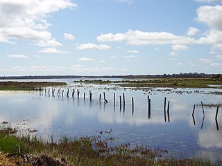
The Vasse-Wonnerup Estuary is an estuary in the South West region of Western Australia close to the town of Busselton. The estuary is listed with DIWA. It was also recognised as a wetland of international importance under the Ramsar Convention on 7 June 1990 when an area of 1,115 ha was designated Ramsar Site 484 as an important dry-season habitat for waterbirds. It is also the main part of the 2,038 ha (5,040-acre) Busselton Wetlands Important Bird Area.

The Yanga National Park is a newly formed national park, located near the township of Balranald in south- western New South Wales. It covers an area of 66,734 hectares which includes 1,932 hectares of Yanga Nature Reserve, and has a frontage of 170 kilometres (110 mi) on the Murrumbidgee River. It is largely located in the Lower Murrumbidgee Floodplain, which is included on A Directory of Important Wetlands in Australia because of its importance as a breeding site for waterbirds when flooded.

Reedy Lake, historically also known as Lake Reedy, is a shallow 5.5-square-kilometre (2.1 sq mi) intermittent freshwater lake or swamp on the lower reaches of the Barwon River, on the Bellarine Peninsula southeast of Geelong in the Australian state of Victoria.

Mandora Marsh, also known as Mandora Salt Marsh, is a complex and diverse wetland system in Western Australia close to Eighty Mile Beach, and included in the Eighty Mile Beach Ramsar Site. It lies at the western edge of the Great Sandy Desert bioregion and within the Mandora Station pastoral lease. The marsh is part of the 3337 km2 Mandora Marsh and Anna Plains Important Bird Area, identified as such by BirdLife International because of its importance for supporting large numbers of waders and waterbirds.
Fivebough and Tuckerbil Wetlands are two wetland sites within the Riverina and Murrumbidgee Irrigation Area (MIA), near Leeton in New South Wales, Australia. Both Fivebough and Tuckerbil sites form Crown reserve number 1030008 managed by NSW Department of Industry, for ecological conservation and public recreation. The reserve was recognised as being a Wetland of International Importance through designation under the Ramsar Convention on 21 October 2002 as Ramsar Site 1224

The Goyder Lagoon is a large ephemeral swamp in the Australian state of South Australia in the state's Far North region. The lake is part of the Diamantina River floodplain, lying beside the Birdsville Track close to the state border with Queensland.

Lake Woods is an ephemeral freshwater lake in the Northern Territory of Australia. It lies on Newcastle Creek close to the small town of Elliott on the Stuart Highway, about halfway between Darwin and Alice Springs. It is important as a breeding site for waterbirds.
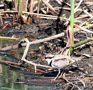
The Narran Wetlands, also known as the Narran Lakes, contained within the Narran Lake Nature Reserve, comprise a series of protected ephemeral lakes and swamps fed by the Narran River in the north-west of New South Wales, Australia. The 26,480-hectare (65,400-acre) reserve is located approximately 50 kilometres (31 mi) east of Brewarrina.
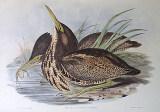
The North Victorian Wetlands, also known as the Kerang Wetlands, comprise an extensive series of over 100 freshwater, brackish and saline lakes and swamps on the floodplain of the Loddon River where it enters the Murray valley, in the vicinity of the town of Kerang, in northern Victoria, south-eastern Australia. They are important for a variety, and sometimes large numbers, of waterbirds.
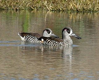
The Paroo Floodplain and Currawinya Important Bird Area is a 7,874 km2 (3,040 sq mi) site comprising the floodplain and the associated wetlands of the Paroo River in north-western New South Wales and south-western Queensland, Australia. It includes extensive areas of the Paroo-Darling and Currawinya National Parks, both of which are listed under the Ramsar Convention as wetland sites of international importance, as well as of the Nocoleche Nature Reserve.

The Swan Bay and Port Phillip Bay Islands Important Bird Area comprises a cluster of disparate sites centred at the eastern end of the Bellarine Peninsula, and the southern end of Port Phillip, in Victoria, south-eastern Australia. As well as providing core wintering habitat for orange-bellied parrots, it is important for waders, or shorebirds, and seabirds.

The Tarrabool Lake – Eva Downs Swamp System is an ephemeral wetland complex lying on the west of the Barkly Tableland region in the Northern Territory of Australia. It is listed on the DIWA wetland directory.
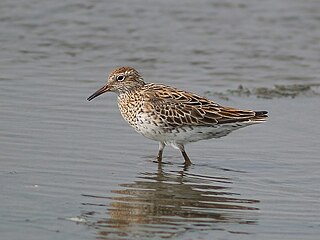
The Watervalley Wetlands is a nationally important wetland system located in the Australian state of South Australia which consists of a series of contiguous wetlands, lying on 56.6 square kilometres (21.9 sq mi) of private land between the Coorong National Park and Gum Lagoon Conservation Park, in the state's south-east.
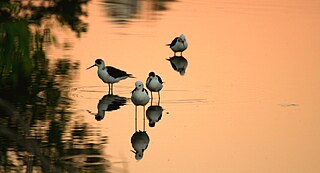
The Cooper Floodplain below Windorah comprises a 1741 km2 tract of floodplain of the Cooper Creek river system, below the town of Windorah, in the Channel Country of western Queensland, Australia. When inundated it is an important breeding site for large numbers of waterbirds.

Bertha's Beach Important Bird Area comprises 3300 ha of coastal wetlands at the entrance to Choiseul Sound, on the east coast of East Falkland, in the Falkland Islands. It lies about 8 km south-east of Mount Pleasant Airport and 40 km south-west of Stanley. It has been identified by BirdLife International as an Important Bird Area (IBA) because of its significancer for a variety of migratory waders and other waterbirds. Overlapping it is the 4000 ha Bertha's Beach Ramsar site, recognising it as a wetland of international importance.


