
The Hattah-Kulkyne National Park is a national park in the Mallee district of Victoria, Australia. The 48,000-hectare (120,000-acre) national park is situated adjacent to the Murray River, approximately 417 kilometres (259 mi) northwest of Melbourne with the nearest regional centre being Mildura. The Hattah Lakes National Park was proclaimed on 7 June 1960, later being greatly expanded in 1980 and becoming the Hattah-Kulkyne National Park. It is a popular destination for bushwalkers and school camping trips.

The Wyperfeld National Park is the third largest national park in Victoria, Australia, located in the Mallee district, approximately 450 kilometres (280 mi) northwest of Melbourne, The national park was declared in 1921 and expanded significantly to protect 357,017 hectares of mallee, woodland, and heathland. For management purposes, the Wyperfeld National Park is managed with the Hattah-Kulkyne National Park, Murray-Sunset National Park, Lake Albacutya Park and Murray-Kulkyne Park as part of the Victorian Mallee Parks.

Dimboola is a town in the Shire of Hindmarsh in the Wimmera region of western Victoria, Australia, 334 kilometres north-west of Melbourne.

The Avoca River, an inland intermittent river of the north–central catchment, part of the Murray-Darling basin, is located in the lower Riverina bioregion and Central Highlands and Wimmera regions of the Australian state of Victoria. The headwaters of the Avoca River rise on the northern slopes of the Pyrenees Range and descend to flow into the ephemeral Kerang Lakes.

Lake Alexandrina is a coastal freshwater lake located between the Fleurieu and Kangaroo Island and Murray and Mallee regions of South Australia, about 100 kilometres (62 mi) south-east of Adelaide. The lake adjoins the smaller Lake Albert and a coastal lagoon called The Coorong to its southeast, before draining into the Great Australian Bight via a short, narrow opening known as Murray Mouth.

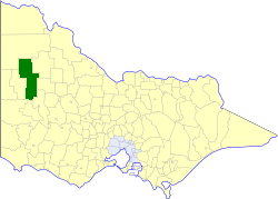
The Victorian government's Wimmera Southern Mallee subregion is part of the Grampians region in western Victoria. It includes most of what is considered the Wimmera, and part of the southern Mallee region. The subregion is based on the social catchment of Horsham, its main settlement.
Lake Corangamite, a hypersaline endorheic lake, is located near Colac in the Lakes and Craters region of the Victorian Volcanic Plains of south-west Victoria, Australia. The lake's salinity levels have increased dramatically as the lake level has dropped in recent decades. It is Australia's largest permanent saline lake, covering approximately 230 square kilometres (89 sq mi) with a circumference of 150 kilometres (93 mi). It forms part of the Ramsar-listed Western District Lakes wetland site. The Aboriginal name of the lake is recorded as Kronimite.

"Victoria (Australia)" is an invalid category parameter for Template:Coord missing.
The problem is usually caused either by a spelling mistake or by an-over-precise category.
For a full list of categories, see Category:Unclassified articles missing geocoordinate data and its subcategories.

The Wimmera River, an inland intermittent river of the Wimmera catchment, is located in the Grampians and Wimmera regions of the Australian state of Victoria. Rising in the Pyrenees, on the northern slopes of the Great Dividing Range, the Wimmera River flows generally north by west and drains into Lake Hindmarsh and Lake Albacutya, a series of ephemeral lakes that, whilst they do not directly empty into a defined watercourse, form part of the Murray River catchment of the Murray-Darling basin.

Lake Connewarre, a shallow estuarine 880-hectare (2,200-acre) lake on the Barwon River, is located on the Bellarine Peninsula southeast of Geelong in the Australian state of Victoria.
Ebenezer Mission, also known as Wimmera mission, Hindmarsh mission and Dimboola mission, was a mission station for Aboriginal people established near Lake Hindmarsh in Victoria, Australia in 1859 by the Moravian Church on the land of the Wotjobaluk. The first missionaries were two Germans, Reverend Friedrich Hagenauer and Reverend F.W. Spieseke. In 1861 the Victorian Colonial Government gazetted 1,897 acres (7.68 km2) as a reserve for the Ebenezer Mission Station. The mission was established a few years after the failure of the Moravian Lake Boga mission in Wemba-Wemba territory.
The Shire of Dimboola was a local government area in the Wimmera region of western Victoria, Australia. The shire covered an area of 4,856 square kilometres (1,874.9 sq mi), and existed from 1885 until 1995.

The Barmah National Park, formerly Barmah State Park, is a national park located in the Hume region of the Australian state of Victoria. The park is located adjacent to the Murray River near the town of Barmah, approximately 225 kilometres (140 mi) north of Melbourne. The park consists of river red gum floodplain forest, interspersed with treeless freshwater marshes. The area is subject to seasonal flooding from natural and irrigation water flows.

Reedy Lake, historically also known as Lake Reedy, is a shallow 5.5-square-kilometre (2.1 sq mi) intermittent freshwater lake or swamp on the lower reaches of the Barwon River, on the Bellarine Peninsula southeast of Geelong in the Australian state of Victoria.
Lake Hindmarsh, an ephemeral lake located in the Wimmera region of western Victoria, Australia, is the state's largest natural freshwater lake. The nearest towns are Jeparit to the south and Rainbow to the north. After more than a decade of drought, in early 2011 the lake filled as a result of flooding in the region. The Wemba Wemba name of the lake is recorded as Gour or Koor.
The Wergaia or Werrigia people are an Aboriginal Australian group in the Mallee and Wimmera regions of north-Western Victoria, made up of a number of clans. The people were also known as the Maligundidj which means the people belonging to the mali (mallee) eucalypt bushland which covers much of their territory.

The Richardson River, an inland intermittent river of the Wimmera catchment, located in the Grampians and Wimmera regions of the Australian state of Victoria. Rising on the northern slopes of the Great Dividing Range, the Richardson River flows generally north and drains into Lake Buloke, one of a series of ephemeral lakes that, whilst they do not directly empty into a defined watercourse, form part of the Murray River catchment of the Murray-Darling basin.
Lake Coorong is an eutrophic lake located in the Wimmera region of western Victoria, Australia. The lake is located adjacent to the township of Hopetoun. After more than a decade of drought, in early 2011 the lake filled as a result of flooding in the region.
The Wotjobaluk are an Aboriginal Australian people of the state of Victoria. They are closely related to the Wergaia people.

The Barengi Gadjin Land Council was formed in 2005 to represent the Wotjobaluk, Jardwadjali, Wergaia and Jupagalk peoples. The Council manages native title rights across Western Victoria in an area "roughly described as the Wimmera River from the head of the Yarriambiack Creek through to Outlet Creek at the northern end of Lake Albacutya". The Council is governed by a board of directors representing various family groups and has offices in Wail and Horsham. The current chairperson is Dylan Clark.
