
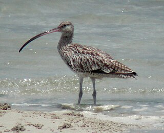
Yala (යාල) National Park is the most visited and second largest national park in Sri Lanka, bordering the Indian Ocean. The park consists of five blocks, two of which are now open to the public, and also adjoining parks. The blocks have individual names such as, Ruhuna National Park, and Kumana National Park or 'Yala East' for the adjoining area. It is situated in the southeast region of the country, and lies in Southern Province and Uva Province. The park covers 979 square kilometres (378 sq mi) and is located about 300 kilometres (190 mi) from Colombo. Yala was designated as a wildlife sanctuary in 1900, and, along with Wilpattu was one of the first two national parks in Sri Lanka, having been designated in 1938. The park is best known for its variety of wild animals. It is important for the conservation of Sri Lankan elephants, Sri Lankan leopards and aquatic birds.
A Ramsar site is a wetland site designated to be of international importance under the Ramsar Convention. The Convention on Wetlands, known as the Ramsar Convention, is an intergovernmental environmental treaty established in 1971 by UNESCO, which came into force in 1975. It provides for national action and international cooperation regarding the conservation of wetlands, and wise sustainable use of their resources. Ramsar identifies wetlands of international importance, especially those providing waterfowl habitat.

Lake Argyle is Western Australia's largest and Australia's second largest freshwater man-made reservoir by volume. The reservoir is part of the Ord River Irrigation Scheme and is located near the East Kimberley town of Kununurra. The lake flooded large parts of the Shire of Wyndham-East Kimberley on the Kimberley Plateau about 80 kilometres (50 mi) inland from the Joseph Bonaparte Gulf, close to the border with the Northern Territory.

The Ord River is a 650-kilometre (400 mi) long river in the Kimberley region of Western Australia. The river's catchment covers 55,100 square kilometres (21,274 sq mi).

Roebuck Bay is a bay on the coast of the Kimberley region of Western Australia. Its entrance is bounded in the north by the town of Broome, and in the south by Bush Point and Sandy Point. It is named after HMS Roebuck, the ship captained by William Dampier when he explored the coast of north-western Australia in 1699. The Broome Bird Observatory lies on the northern coast of the bay.

The Zambezian flooded grasslands is an ecoregion of southern and eastern Africa that is rich in wildlife.

The Barotse Floodplain also known as the Bulozi Plain, Lyondo or the Zambezi Floodplain is one of Africa's great wetlands, on the Zambezi River in the Western Province of Zambia. It is a designated Ramsar site, regarded as being of high conservation value.

Tanbi Wetland Complex is a wetland reserve in the Gambia outside of Banjul which was etsbalished in 2001.

The Yanga National Park is a newly formed national park, located near the township of Balranald in south- western New South Wales. It covers an area of 66,734 hectares which includes 1,932 hectares of Yanga Nature Reserve, and has a frontage of 170 kilometres (110 mi) on the Murrumbidgee River. It is largely located in the Lower Murrumbidgee Floodplain, which is included on A Directory of Important Wetlands in Australia because of its importance as a breeding site for waterbirds when flooded.
The Port Phillip Bay and Bellarine Peninsula Ramsar Site is one of the Australian sites listed under the Ramsar Convention as a wetland of international importance. It was designated on 15 December 1982, and is listed as Ramsar Site No.266. Much of the site is also part of either the Swan Bay and Port Phillip Bay Islands Important Bird Area or the Werribee and Avalon Important Bird Area, identified as such by BirdLife International because of their importance for wetland and waterbirds as well as for orange-bellied parrots. It comprises some six disjunct, largely coastal, areas of land, totalling 229 km2, along the western shore of Port Phillip and on the Bellarine Peninsula, in the state of Victoria. Wetland types protected include shallow marine waters, estuaries, freshwater lakes, seasonal swamps, intertidal mudflats and seagrass beds.

The Kimberley tropical savanna is a tropical and subtropical grasslands, savannas, and shrublands ecoregion in northwestern Australia, covering portions of Western Australia and the Northern Territory south of the Timor Sea.

Lake Kununurra is a freshwater man-made reservoir located in the Ord River valley. The lake was formed in 1963 by the construction of the Ord Diversion Dam in Kununurra, northern Western Australia, which was built to supply water to the Ord River Irrigation Area. Prior to the diversion dam construction a natural permanent waterhole held back by the Bandicoot Bar was known as "Carlton Reach", which was reputed to be the largest waterhole in the Kimberley.
The Lakes Argyle and Kununurra Ramsar Site comprises an extensive system of artificial freshwater reservoirs, with their associated permanent wetlands, formed by damming the Ord River in the eastern part of the Kimberley Region of northern Western Australia. The reservoirs include Lake Argyle and Lake Kununurra. There are numerous endemic plants and a rich fauna. The 1,500 km2 (580 sq mi) site was designated a wetland of international importance under the Ramsar Convention on 7 June 1990, making it Ramsar Site 478.

Banrock Station Wetland Complex is a wetland complex located in South Australia which has been recognised as being of international importance by designation under the Ramsar Convention. It was listed on 21 October 2002 as Ramsar site 1221. It lies in the Riverland region of south-eastern South Australia and is adjacent to the Murray River. It is a floodplain wetland subject to an ongoing environmental restoration program by a commercial organisation which manages the wetlands and promotes ecologically sustainable land use practices. In 2002 Banrock Station Wines received the Ramsar Wetland Conservation Award in recognition of its conservation efforts.
Buckingham Bay is a large, rectangular bay on the northern coast of Arnhem Land, in the Northern Territory of Australia. It lies 520 km east of Darwin and 120 km west of Nhulunbuy.
The Songor Lagoon is located at 05°45'N 000°30'E on the eastern coast of Ghana, West Africa. The site covers an area of 28,740 hectares, and it is located just outside the major town of Ada and to the west of the Volta River estuary. It was designated as Ramsar wetland site of international importance number 566 on June 22, 1988. In 2011, UNESCO approved the Songor Biosphere Reserve as part of the World Network of Biosphere Reserves. Among several other important functions, it acts as habitat and/or breeding ground for several notable species.

Moulting Lagoon Important Bird Area is a composite wetland site in eastern Tasmania, Australia. It comprises two adjacent and hydrologically continuous wetlands – Moulting Lagoon and the Apsley Marshes – at the head of Great Oyster Bay, near the base of the Freycinet Peninsula, between the towns of Swansea and Bicheno. Both components of the site are listed separately under the Ramsar Convention as wetlands of international significance. Moulting Lagoon is so named because it is a traditional moulting place for black swans. It is an important site for waterbirds.
The Paroo Floodplain and Currawinya Important Bird Area is a 7,874 km2 (3,040 sq mi) site comprising the floodplain and the associated wetlands of the Paroo River in north-western New South Wales and south-western Queensland, Australia. It includes extensive areas of the Paroo-Darling and Currawinya National Parks, both of which are listed under the Ramsar Convention as wetland sites of international importance, as well as of the Nocoleche Nature Reserve.

The Flood Plain Lower Ringarooma River wetlands is a wetland site comprises the floodplain of the lower Ringarooma River in north-eastern Tasmania, Australia. In 1982 it was designated a wetland of international importance under the Ramsar Convention.

The Gulf of Panama mangroves (NT1414) is an ecoregion along the Pacific coast of Panama, Colombia. The mangroves experience seasonal flooding with high levels of sediment, and occasional extreme storms or very low rainfall due to El Niño effects. They are important as a breeding or nursery area for marine species. Areas of the mangroves have been recognized as Important Bird Areas and Ramsar wetlands. The ecoregion has been severely degraded by clearance of mangroves for agriculture, pasturage and shrimp farming, by urban pressure around Panama City, and by pollution related to the Panama Canal.


