Lake Muir

Last updated

Lake Muir
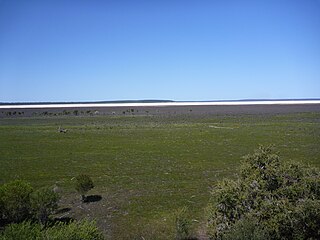
Lakemuir.JPG
Lake Muir in October 2010
Australia Western Australia relief location map.png
Red pog.svg
Lake Muir
Location in Western Australia
Location South West, Western Australia
Coordinates 34°26′49″S116°44′54″E / 34.44694°S 116.74833°E / -34.44694; 116.74833 Coordinates: 34°26′49″S116°44′54″E / 34.44694°S 116.74833°E / -34.44694; 116.74833
Primary outflows Deep River
Catchment area 384 km2 (148 sq mi)
Basin  countriesAustralia
DesignationMuir-Byenup System Ramsar Site
Max. length11 km (6.8 mi)
Max. width5 km (3.1 mi)
Surface area46 km2 (18 sq mi)
Surface elevation170 m (560 ft)
References [1] [2]

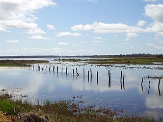
Lake Muir is a freshwater lake, with a larger surrounding wetlands area, that is located in the South West region of Western Australia. The lake lies near Muirs Highway, north of Walpole and southeast of Manjimup.

Contents

Description

The lake has a surface area of 46 square kilometres (18 sq mi). Lake Muir and its surrounding wetland lies within the Lake Muir-Byenup System, a 694 km2 (268 sq mi) area of internal drainage containing a complex of wetland systems. Lake Muir may, in flood, overflow southwest into the Deep River catchment (and possibly also southeast into the Frankland River via Poorginup Gully). [3]

Lake Muir is usually brackish (1000–3000 mg/L TDS) at the end of winter, saline by summer and dry throughout autumn. [3]

Lake Muir is protected within Lake Muir Nature Reserve, which was designated in 2001. [4]

Flora and fauna

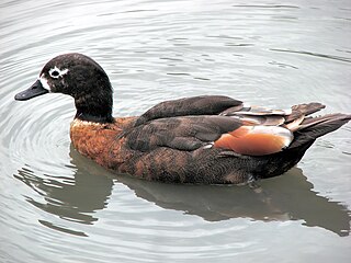
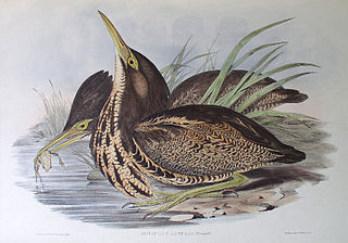
A 14-square-kilometre (5.4 sq mi) section of wetland around Lake Muir has been identified by BirdLife International as an Important Bird Area (IBA) because it provides habitat for 10 or more pairs of endangered Australasian bitterns. The wetlands within the IBA are shallow with extensive beds of dense sedgeland and fringing stands of shrubland and woodland. Lake Muir has been excluded from the IBA as it is unsuitable for bitterns but it has supported large numbers of Australian Shelduck and may prove to be globally significant for that species. [5]

History

Lake Muir was named after brothers Thomas and John Muir, the first European settlers in the Warren district, who settled at Deeside, 25 kilometres (16 mi) west of the lake, in 1852 and built a rush hut there in 1856. [6]

Historically the area was a Game Reserve, with a duck shooting season. The Department of Environment and Conservation (CALM) started monitoring the wetlands system in 1980 in order to manage the duck shooting.

On 5 January 2001, a 106-square-kilometre (41 sq mi) area was designated, under the Ramsar Convention as Ramsar site 1050, a wetland of international importance, acknowledging its rich ecological diversity. Lake Muir Nature Reserve was designated in the same year by the Government of Western Australia. [4]

A magnitude 5.7 earthquake was centred at the lake on 16 September 2018 [7] and was followed by a magnitude 4.7 quake on 13 October [8] and a 5.4 quake on 9 November. [9]

See also

Related Research Articles

Muirs Highway Highway in Western Australia

Muirs Highway is a Western Australian highway linking Manjimup and Mount Barker on the Albany Highway. It is signed as State Route 102 and is 161 kilometres (100 mi) long. It provides a shorter distance between Manjimup and Albany. It is a lonely highway surrounded with karri and jarrah forests with no settlements in between except the small farming settlement of Rocky Gully.

Lake Argyle Lake in Australia

Lake Argyle is Western Australia's largest and Australia's second largest freshwater man-made reservoir by volume. The reservoir is part of the Ord River Irrigation Scheme and is located near the East Kimberley town of Kununurra. The lake flooded large parts of the Shire of Wyndham-East Kimberley on the Kimberley Plateau about 80 kilometres (50 mi) inland from the Joseph Bonaparte Gulf, close to the border with the Northern Territory.
Bird reserve

A bird reserve is a wildlife refuge designed to protect bird species. Like other wildlife refuges, the main goal of a reserve is to prevent species from becoming endangered or extinct. Typically, bird species in a reserve are protected from hunting and habitat destruction. Because of the protection they provide from such threats, bird reserves also serve as excellent locations for bird watching. Normally, wildlife refuges are under the care of non-profit organizations and governmental institutions.

Quill Lakes

The Quill Lakes is a wetland complex in Saskatchewan, Canada that encompasses the endorheic basin of three distinct lake wetlands: Big Quill Lake, Middle Quill Lake and Little Quill Lake. On May 27, 1987, it was designated a wetland of international importance via the Ramsar Convention. It was the first Canadian site in the North American Waterfowl Management Plan, is a site in the International Biological Programme and Saskatchewan Heritage Marsh Program, and was designated a Western Hemisphere Shorebird Reserve Network site of International significance in May, 1994. The site is an important staging and breeding area for spring and fall migration of shorebirds. The site qualifies as an Important Bird Area for its globally and nationally significant migratory and breeding populations of more than a dozen species of birds.

Lake Warden is a salt lake in the Goldfields-Esperance region of Western Australia. It and its associated wetlands are protected in a nature reserve; they were recognised as being of international importance under the Ramsar Convention through designation of the Lake Warden System on 7 June 1990 as Ramsar Site 485. The lake is also a DIWA-listed wetland.

Lake Gore is a seasonal and semi-permanent freshwater lake in the Goldfields-Esperance region of Western Australia located approximately 24 km (15 mi) west of Esperance. It is an important site for waterbirds.
Vasse-Wonnerup Estuary

The Vasse-Wonnerup Estuary is an estuary in the South West region of Western Australia close to the town of Busselton. The estuary is listed with DIWA. It was also recognised as a wetland of international importance under the Ramsar Convention on 7 June 1990 when an area of 1,115 ha was designated Ramsar Site 484 as an important dry-season habitat for waterbirds. It is also the main part of the 2,038 ha (5,040-acre) Busselton Wetlands Important Bird Area.

Earthquakes have occurred in Western Australia (WA) on a regular basis throughout its geological history.

The South West Seismic Zone is a major intraplate earthquake province located in the south west of Western Australia. It was known earlier as the Yandanooka – Cape Riche Lineament, corresponds to the physiographic boundary known as the Meckering Line, and also the junction between Swanland and Salinaland.

The zone exists within an Archaean Shield structure called the Yilgarn Block. The identified geological subdivisions within this Precambrian structure do not show an obvious relation to the seismicity.

Reedy Lake Lake or swamp in Victoria, Australia

Reedy Lake, historically also known as Lake Reedy, is a shallow 5.5-square-kilometre (2.1 sq mi) intermittent freshwater lake or swamp on the lower reaches of the Barwon River, on the Bellarine Peninsula southeast of Geelong in the Australian state of Victoria.

Edithvale-Seaford Wetlands

The Edithvale-Seaford Wetlands is a collection of principally freshwater swamps and marshlands totalling 261 hectares in southeastern Melbourne, Victoria, Australia, about 30 km (19 mi) southeast of Melbourne CBD. It is the largest natural wetland of its type in the Port Phillip and Western Port basins, and is all that remains of the historic Carrum Carrum Swamp, which once covered more than 4,000 hectares from present-day Mordialloc in the north to Frankston in the south.

Toolibin Lake is a seasonal fresh to brackish water perched lake or wooded swamp, in south-western Australia. The lake is contained with a 493-hectare (1,218-acre) nature reserve and it is located about 200 kilometres (124 mi) south-east of Perth, in the Shire of Narrogin, and 40 kilometres (25 mi) east of the town of Narrogin, in the Wheatbelt region of Western Australia. The lake is listed by the Australian Government as a threatened ecological community under the Environment Protection and Biodiversity Conservation Act 1999.

Thomsons Lake Lake within Thomsons Lake Nature Reserve in the south of Perth, Western Australia

Thomsons Lake Nature Reserve is a lake nature reserve around Thomsons Lake in the City of Cockburn, Western Australia, approximately 25 kilometres (16 mi) south of the central business district of Perth, the state capital, and on the southern fringes of the Perth metropolitan area. It is in the suburb of Beeliar, 7 kilometres (4.3 mi) south-west of Jandakot Airport. It is a still largely natural wetland, with adjoining native vegetation, surrounded by land developed for housing and agriculture, that regularly supports large numbers of shorebirds and other waterbirds.

Discovery Bay Coastal Park Protected area in Victoria, Australia

The Discovery Bay Coastal Park is a linear protected area of coastal land in western Victoria, south-eastern Australia. The 10,460-hectare (25,800-acre) park extends along the coast of Discovery Bay from Cape Nelson north-westwards for 50 kilometres (31 mi) to the border with South Australia. The park was listed on Australia's now-defunct Register of the National Estate, and lies within the traditional lands of the Gunditjmara people.
Coongie Lakes

The Coongie Lakes is a freshwater wetland system located in the Far North region of South Australia. The 21,790-square-kilometre (8,410 sq mi) lakes system is located approximately 1,046 kilometres north of the Adelaide city centre. The wetlands includes lakes, channels, billabongs, shallow floodplains, deltas, and interdune swamps. It lies on the floodplain of Cooper Creek, an ephemeral river flowing through a desert landscape in the Lake Eyre Basin which rarely, after occasional large floods, empties into Lake Eyre. The wetland system has been recognised both as being of international importance by designation under the Ramsar Convention with a listing on 15 June 1987 and being nationally important within Australia with a listing in A Directory of Important Wetlands in Australia (DIWA). Its extent includes the regional town of Innamincka, the Malkumba-Coongie Lakes National Park, the Innamincka Regional Reserve, the Strzelecki Regional Reserve and the Coongie Lakes Important Bird Area.

Hunter Estuary Wetlands Australian wetlands

The Hunter Estuary Wetlands comprise a group of associated wetlands at and near the mouth of the Hunter River in the city of Newcastle, New South Wales, Australia. Some 30 km2 of the wetlands has been recognised as being of international importance by designation under the Ramsar Convention. It was listed on 21 February 1984 as Ramsar site 287. A larger area of the wetlands has been identified by BirdLife International as an Important Bird Area (IBA). The wetlands are recognised as the most important area in New South Wales for waders, or shorebirds.

Western District Lakes Wetlands in south-eastern Australia

The Western District Lakes of Victoria, in the Western District of Victoria, south-eastern Australia, were recognised on 15 December 1982 as wetlands of international importance by listing under the Ramsar Convention, as Ramsar site no.268.
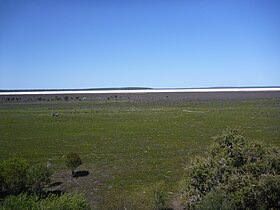
Lake Muir National Park is a national park in Western Australia, located 290 kilometres (180 mi) south east of Perth to the south of Muirs Highway in the Shire of Manjimup.

Lake Muir Nature Reserve is a protected area in Western Australia. It encompasses Lake Muir and several smaller lakes and wetlands. It is an important refuge for water birds, and home to several rare plants and plant communities.
References

  1. "Bonzle Digital Atlas – Map of Lake Muir". 2009. Retrieved 2 March 2009.
  2. "Information Sheet on Ramsar Wetlands - Muir – Byenup System, Western Australia". 2003. Archived from the original on 31 July 2008. Retrieved 2 March 2009.
  3. 1 2 Smith, Robin (April 2003). Hydrogeology of the Muir–Unicup catchments (pdf). East Perth, WA: Water and Rivers Commission. pp. 3–5. ISBN   1-920849-12-2 . Retrieved 21 January 2017.
  4. 1 2 UNEP-WCMC (2022). Protected Area Profile for Lake Muir from the World Database of Protected Areas. Accessed 3 May 2022.
  5. "Muir-Unicup Wetlands". BirdLife International. Retrieved 21 January 2017.
  6. Shire of Manjimup (1 January 2017). "Deeside Homestead Group". inHerit. Perth, WA: Heritage Council of Western Australia. Retrieved 22 January 2017.
  7. "Magnitude-5.7 earthquake rocks southern WA". Australian Broadcasting Corporation. 17 September 2018. Retrieved 9 November 2018.
  8. "Magnitude-4.7 earthquake rocks area surrounding Lake Muir in WA's Great Southern". Australian Broadcasting Corporation. 13 October 2018. Retrieved 9 November 2018.
  9. Ben Anserson (9 November 2018). "Earthquake at Lake Muir shakes Perth and WA's South West". News Corporation . Retrieved 9 November 2018.