
Carlton is a village in the Metropolitan Borough of Barnsley in South Yorkshire, England. It is situated between the villages of Athersley and Royston. The village is split in two with one half in the Monk Bretton ward and the rest in the Royston ward of the Barnsley MBC. It was built up on coking and coal mining industries and now has one of the largest industrial estates within the surrounding area. In the industrial estate lies a glass recycling plant, called Rexam. To its east stands the Mr Kipling cake factory, owned by Premier Foods. Until 1974 it was in the West Riding of Yorkshire.

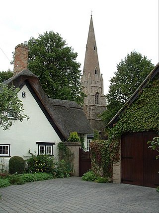
Barmpton is a small village and civil parish in the borough of Darlington and the ceremonial county of County Durham, England. The population taken at the 2011 Census was less than 100. Details are maintained in the parish of Great Burdon. It is situated a short distance to the north-east of Darlington, on the River Skerne, a tributary of the Tees.
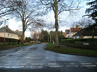
Blackwell is a suburb in the borough of Darlington and the ceremonial county of Durham, England. It is situated towards the edge of the West End of Darlington, beside the River Tees. Blackwell consists of large 1930s style semi-detached and detached houses, and private, newly built homes. Blackwell Grange is an 18th-century country house converted into a hotel.

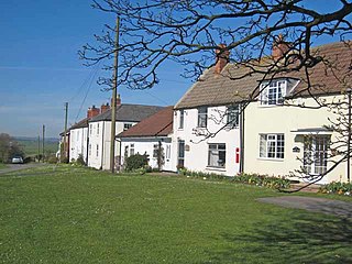
Piercebridge is a village and civil parish in the borough of Darlington and the ceremonial county of Durham, England. The population of the civil parish as of the 2011 census was 113. It is situated a few miles west of the town of Darlington. It is on the site of a Roman fort of AD 260–270, which was built at the point where Dere Street crossed the River Tees. Part of the fort is under the village green. The village is sited where the York-Newstead Roman road known as Dere Street crosses the River Tees.

Cockerton is an area in the north-west of Darlington in the borough of Darlington, County Durham, England. The Cocker Beck flows through the area and empties into the River Skerne via The Denes, an area and string of valleyed parks donated for the town in the early 20th century. It is also near Mowden, Branksome, West Park and Faverdale.
Mainsforth is a small village and former civil parish, now in the parish of Bishop Middleham, in the County Durham district, in the ceremonial county of Durham, England. It is to the east of Ferryhill. The earliest settlement in Mainsforth may have been on Marble. It has been suggested, without great historical foundation, that this was a Danish settlement. In 1961 the parish had a population of 229.
Mordon is a village and civil parish in County Durham, England. It is situated a few miles to the north-east of Newton Aycliffe. The population recorded by the 2011 census for the parish was 260.
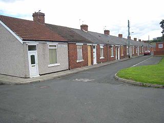
Coundon Grange is a village in the civil parish of Dene Valley, in County Durham, England. It is situated to the east of Bishop Auckland. In the 2001 census Coundon Grange had a population of 235.
Middlestone is a village and former civil parish in the County Durham district, in the ceremonial county of Durham, England. It is situated to the south of Spennymoor, near Kirk Merrington. In the 2001 census Middlestone had a population of 67.
Houghton is a village and former civil parish, now in the parish of Houghton and Wyton, in Cambridgeshire, England, approximately 3 miles (5 km) east of Huntingdon on the A1123 road, and south of RAF Wyton. It lies on the north bank of the River Great Ouse, by Houghton Mill.

Denton is a small village in the civil parish of Newhaven, in the Lewes district, in the county of East Sussex, England. It adjoins the villages of South Heighton and Mount Pleasant and backs onto the South Downs.

Martyr Worthy is a small village and former civil parish, now in the parish of Itchen Valley, in the Winchester non-metropolitan district of Hampshire, England. It is part of the Worthys cluster of small villages. In 1931 the parish had a population of 350. On 1 April 1932 the parish was abolished to form Itchen Valley.

The River Skerne is a tributary of the River Tees. It flows through County Durham in England.

Wansford is a village and former civil parish, now in the parish of Skerne and Wansford, in the East Riding of Yorkshire, England. It is situated on the B1249 road and just to the north of the River Hull and the Driffield Canal. It is approximately 2.5 miles (4 km) south-east of Driffield and 3 miles (4.8 km) north-west of North Frodingham.

Flaxley is a small settlement and former civil parish, now in the parish of Blaisdon, in the Forest of Dean, Gloucestershire, England. It is located in between the larger villages of Westbury-on-Severn and Mitcheldean. In 1931 the parish had a population of 87.

Skerne is a village and former civil parish, now in the parish of Skerne and Wansford, in the East Riding of Yorkshire, England. The village is situated 1 mile (1.6 km) to the south of the River Hull and the Driffield Canal. It is approximately 2 miles (3 km) south-east from Driffield and 2 miles north-east from Hutton Cranswick.
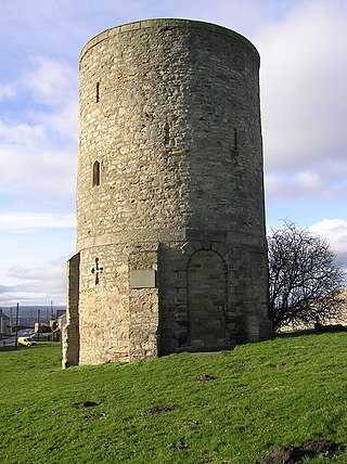
Westerton is a village and former civil parish in the County Durham district, in the ceremonial county of Durham, England. In the 2001 census Westerton had a population of 44. It is situated between Bishop Auckland and Spennymoor. It sits on top of a hill which is one of the highest points in County Durham, and is the location of an observatory built for Thomas Wright, who was the first person to suggest that the Milky Way consisted of a flattened disk of stars. The observatory is known today as "Wright's Folly".

Froxfield Green is a village in the civil parish of Froxfield and Privett, in the East Hampshire district of Hampshire, England. It is 3 miles (5 km) north-west of Petersfield, and lies just north of the A272 road.

Harton is a suburban area of South Shields, South Tyneside, Tyne and Wear, England. It was historically a village, however as the urban area grew it merged with its adjacent villages to become part of the town. Some of the original village buildings are still intact today, such as St Peter's Church. Until 1974 it was in County Durham.

Morton Palms is a civil parish in the Darlington district, in the ceremonial county of Durham, England. In 2001 the parish had a population of 32. The parish borders Barmpton, Great Burdon, Hurworth, Middleton St. George, Neasham and Sadberge.

