
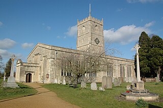
Avebury is a village and civil parish in Wiltshire, England. The village is about 5.5 miles (9 km) west of Marlborough and 8 miles (13 km) northeast of Devizes. Much of the village is encircled by the prehistoric monument complex also known as Avebury. The parish also includes the small villages of Avebury Trusloe and Beckhampton, and the hamlet of West Kennett.

Milton Abbas is a village and civil parish in Dorset, England, lying around 5 miles southwest of Blandford Forum. In the 2011 Census the civil parish had a population of 755.

Winterborne Houghton is a village and civil parish in north Dorset, England. It is situated in a winterbourne valley on the Dorset Downs, 5 miles (8 km) southwest of Blandford Forum. In the 2011 census the parish had 82 households and a population of 183. In 2001 the population was 195.
Shrivenham is a village and civil parish in the Vale of White Horse, Oxfordshire, England, about 5 miles (8 km) south-west of Faringdon. The village is close to the county boundary with Wiltshire and about 7 miles (11 km) east-northeast of Swindon. The 2011 Census recorded the parish population as 2,347. The parish is within the historic boundaries of Berkshire; the 1974 boundary changes transferred the Vale of White Horse to Oxfordshire for administrative purposes.

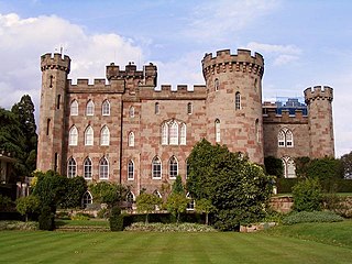
Raby Castle is a medieval castle located near Staindrop in County Durham, England, among 200 acres (810,000 m2) of deer park. It was built by John Neville, 3rd Baron Neville de Raby, between approximately 1367 and 1390. Cecily Neville, the mother of the Kings Edward IV and Richard III, was born here. After Charles Neville, 6th Earl of Westmorland, led the failed Rising of the North in favour of Mary, Queen of Scots in 1569 Raby Castle was taken into royal custody. Sir Henry Vane the Elder purchased Raby Castle in 1626 and neighbouring Barnard Castle from the Crown, and the Earls of Darlington and Dukes of Cleveland added a Gothic-style entrance hall and octagonal drawing room. From 1833 to 1891 they were the Dukes of Cleveland and they retain the title of Lord Barnard. Extensive alterations were carried out in the 17th and 18th centuries. It is famed for both its size and its art, including works by old masters and portraits. After 1733 it was frequented from his young age of eleven by the poet Christopher Smart, who eloped briefly at the age of thirteen with Anne Vane, daughter of Henry Vane, who succeeded to the Barnard title. It is a Grade I listed building and open to the public on a seasonal basis.
Archdeacon Newton is a hamlet and rural parish of several farms in the borough of Darlington and the ceremonial county of County Durham, in England. The population taken at the 2011 Census was less than 100. Details are maintained in the parish of Walworth. It is associated with an abandoned village site under pasture and farm buildings, and situated a short distance to the north-west of Darlington. The lost settlement was in existence by the early 15th century, and remained inhabited at least until the 1890s. There was a moated manor house at the southern end, part of which remains as the Old Hall, now a barn. At the north end of the site was the chapel, and in the middle were tofts and enclosures, with a ridge and furrow field and a trackway leading to the south-east. The site of the abandoned village is now a scheduled monument and the Old Hall is a listed building.

Aycliffe Village is a village in County Durham, in England. It is situated immediately to the south of the town of Newton Aycliffe.

Walworth is a central small village with outlying farmsteads, which together constitute a scattered village in the borough of Darlington and the ceremonial county of County Durham, England. It is a civil parish which does not have a church. It is situated 2.5 miles (4.0 km) to the north-west of Darlington. The nucleus of the central village is the 16th-century Walworth Castle, which is now a hotel. On the north side of the village, around North Farm, are earthworks signifying a lost settlement, grouped around a barn which was once a chapel.

Holmes Chapel is a village and civil parish in Cheshire, England, 8 miles (13 km) north of Crewe and 21 miles (34 km) south of Manchester; Swettenham Meadows Nature Reserve lies 2.5 miles (4.0 km) east of the village and Goostrey lies to the north.
Euxton is a village and civil parish of the Borough of Chorley, in Lancashire, England. The population of the civil parish as taken at the 2011 census was 9,993, however, the population is now estimated to be around 14,000 due to the increase in housing developments in the village, including the Buckshaw development. The village is situated just to the west of Chorley, and to the south of Clayton-le-Woods.

Hethersett is a large village and electoral ward in the county of Norfolk, England, about 6 miles (10 km) south-west of Norwich. It covers an area of 4.22 sq mi (10.9 km2) and had a population of 5,441 in 2,321 households at the 2001 census, increasing to 5,691 at the 2011 census. In 2013 Hethersett became the first village or town in the United Kingdom to receive a Prime Minister's Big Society Award for its outstanding contribution to the Olympic legacy and sport and fitness in general.

Appleby Magna is a village and civil parish in the North West Leicestershire district, in the county of Leicestershire, England. It includes the small hamlets of Appleby Parva and Little Wigston.

Baumber is a village and civil parish in the East Lindsey district of Lincolnshire, England. It is situated approximately 4 miles (6 km) north-west from Horncastle, and at the junction of the B1225 and the A158 roads.

Chitterne is a village and civil parish in the county of Wiltshire, in the south west of England. The village lies in the middle of Salisbury Plain, about 7 miles (11 km) east of the town of Warminster.

Redhill is a compact village at the foot of a 173 m (AOD) hill of the same name to its east and north-east. Its lower level local authority is the civil parish of Wrington which is in North Somerset, England. It straddles the A38 Bridgwater-Bristol Road. It is about 8 miles (12.9 km) SSW of Bristol and close to Bristol Airport.

Kington St Michael is a village and civil parish about 3 miles (4.8 km) north of Chippenham in Wiltshire, England.
Cholmondeley is a civil parish in Cheshire, England, north east of Malpas and west of Nantwich. It includes the small settlements of Croxton Green and Dowse Green, with a total population of a little over a hundred, increasing to 157 at the 2011 Census. Nearby villages include Bickerton to the north east, Bulkeley to the north, No Man's Heath to the south west, and Bickley Moss to the south.

Chapel Lawn is a small village in southwest Shropshire, England, located within the Redlake Valley, some three miles south of the small town of Clun.

The Church of St Peter, Croft-on-Tees is a 12th century grade I listed parish church in the village of Croft-on-Tees in North Yorkshire, England. Artefacts and carvings inside the church are believed to have given rise to many of the characters created by Lewis Carroll, who as a child, attended St Peter's in the 1840s when his father was rector of the church.

 Horses training in 1990
 Denton Village 1990
 Denton Village 1990
 Foggy day in Denton 1990
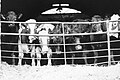 Livestock
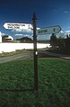 Sign post in Houghton-Le-Side
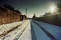 Church Lane, Denton
 Rolled field, Denton


