Washington is a town in the City of Sunderland district of Tyne and Wear, England. Historically part of County Durham, it is the ancestral settlement of the local Washington family, from which the first President of the United States George Washington descended.

Chester-le-Street is a market town in the County Durham district, in the ceremonial county of Durham, England. It is located around 6 miles north of Durham and is also close to Newcastle upon Tyne. The town holds markets on Tuesdays, Fridays and Saturdays. In 2011, it had a population of 24,227.

County Durham, officially simply Durham (/ˈdʌrəm/), is a ceremonial county in North East England. The county borders Northumberland and Tyne and Wear to the north, the North Sea to the east, North Yorkshire to the south, and Cumbria to the west. The largest settlement is Darlington.

Stanley is a former colliery town and civil parish in County Durham, England. Centred on a hilltop between Chester-le-Street and Consett, the town lies south west of Gateshead.

The Metropolitan Borough of Gateshead is a metropolitan borough in the metropolitan county of Tyne and Wear, England. It includes Gateshead, Rowlands Gill, Whickham, Blaydon, Ryton, Felling, Birtley, Pelaw, Dunston and Low Fell. The borough forms part of the Tyneside conurbation, centred on Newcastle upon Tyne. At the 2021 census, the borough had a population of 196,154.

Chester-le-Street was a local government district in County Durham, England. Its council was based in Chester-le-Street. Other places in the district included Great Lumley and Sacriston.
Bill Quay is a residential area in Gateshead, located around 4 miles (6.4 km) from Newcastle upon Tyne, 12 miles (19 km) from Sunderland, and 17 miles (27 km) from Durham. In 2011, Census data for the Gateshead Metropolitan Borough Council ward of Heworth and Pelaw recorded a total population of 9,100.

Ouston is a village in County Durham, about 8 miles south-west of Newcastle upon Tyne in the north-east of England. The main village of Ouston is adjoined by the 1970s built housing estate known as Urpeth Grange but both are referred to colloquially as Ouston by locals. The population of the parish, according to the 2011 census, was 2,821.

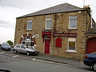
Newfield is a village in County Durham, England. It lies west of the town of Chester-le-Street, and falls partly within the civil parish of Pelton. In 2021 it had a population of 1529.

Whitburn is a village in South Tyneside, in the metropolitan county of Tyne and Wear on the coast of North East England. It is located 3 miles (4.8 km) north of the city of Sunderland and 4 miles (6.4 km) south of the town of South Shields. Historically, Whitburn is part of County Durham. Other nearby population centres include Seaburn, Cleadon and Marsden. The village lies on a south-facing slope, part of Durham's Magnesian Limestone plateau, which overlooks Sunderland. The population for the combined Whitburn and Marsden Ward in the 2011 UK Census was 7,448. For much of its history, Whitburn was a fishing and agricultural community. The village contains three schools, three churches, a cricket club, recreational grounds, a pub and a variety of shops.

Crawcrook is a village in the Metropolitan Borough of Gateshead in Tyne and Wear, England. The population taken at the 2021 Census of the Gateshead ward was 9,058, increasing from 8,841 in 2011. The village was historically part of County Durham until 1974.

Birtley is a town in the Metropolitan Borough of Gateshead, in Tyne and Wear, England. It is situated to the south of Gateshead and is conjoined to Chester-le-Street across the county boundary in County Durham.

Whickham is a village in Tyne and Wear, North East England, within the Metropolitan Borough of Gateshead. The village is on high ground overlooking the River Tyne and 5 miles (8 km) south-west of Newcastle upon Tyne.

Brickhill is a civil parish and electoral ward within northern Bedford in Bedfordshire, England.

Byker is a district in the east of the city and metropolitan borough of Newcastle upon Tyne, in the county of Tyne and Wear, England. Home to the Byker Wall estate, made famous by TV series Byker Grove, Byker's population was recorded at 12,206 in the 2011 census. Byker is bordered by Heaton to the north and by Shieldfield to the north east. Until 1974 it was in Northumberland.
Sunniside is a village in the Metropolitan Borough of Gateshead, which is located around 5.5 miles (9 km) from Newcastle upon Tyne. Prior to the creation of the county of Tyne and Wear in 1974, it was part of Whickham Urban District, which in turn formed a part of County Durham.
Heworth is a residential area in Gateshead, located around 3 miles (4.8 km) from Newcastle upon Tyne, 11 miles (18 km) from Sunderland, and 17 miles (27 km) from Durham. In 2011, Census data for the Gateshead Metropolitan Borough Council ward of Heworth and Pelaw recorded a total population of 9,100.


