Lindisfarne, also known as Holy Island, is a tidal island off the northeast coast of England, which constitutes the civil parish of Holy Island in Northumberland. Holy Island has a recorded history from the 6th century AD; it was an important centre of Celtic Christianity under Saints Aidan, Cuthbert, Eadfrith, and Eadberht of Lindisfarne. The island was originally home to a monastery, which was destroyed during the Viking invasions but re-established as a priory following the Norman Conquest of England. Other notable sites built on the island are St Mary the Virgin parish church, Lindisfarne Castle, several lighthouses and other navigational markers, and a complex network of lime kilns. In the present day, the island is an Area of Outstanding Natural Beauty and a hotspot for historical tourism and bird watching. As of February 2020, the island had three pubs, a hotel and a post office as well as a museum.

Cuthbert of Lindisfarne was a saint of the early Northumbrian church in the Celtic tradition. He was a monk, bishop and hermit, associated with the monasteries of Melrose and Lindisfarne in the Kingdom of Northumbria, today in northern England and southern Scotland. Both during his life and after his death, he became a popular medieval saint of Northern England, with a cult centred on his tomb at Durham Cathedral. Cuthbert is regarded as the patron saint of Northumbria. His feast days are 20 March and 4 September.

Deerhurst is a village and civil parish in Gloucestershire, England, about 2 miles (3 km) southwest of Tewkesbury. The village is on the east bank of the River Severn. The parish includes the village of Apperley and the hamlet of Deerhurst Walton. The 2011 Census recorded the parish's population as 906, the majority of whom live in Apperley.

Swithun was an Anglo-Saxon bishop of Winchester and subsequently patron saint of Winchester Cathedral. His historical importance as bishop is overshadowed by his reputation for posthumous miracle-working. According to tradition, if it rains on Saint Swithun's bridge (Winchester) on his feast day it will continue for forty days.

Bishop Auckland is a market town and civil parish at the confluence of the River Wear and the River Gaunless in County Durham, England. It is 12 miles (19 km) northwest of Darlington and 12 miles (19 km) southwest of Durham.

Brill is a village and civil parish in west Buckinghamshire, England, close to the border with Oxfordshire. It is about 4 miles (6 km) north-west of Long Crendon and 7 miles (11 km) south-east of Bicester. At the 2011 Census, the population of the civil parish was 1,141. Brill has a royal charter to hold a weekly market, but has not done so for many years.

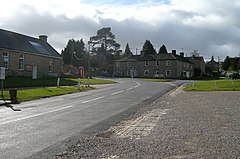
Water Stratford is a village and civil parish on the River Great Ouse in Buckinghamshire, England. It is about 3 miles (5 km) west of Buckingham, near the boundary with Oxfordshire.
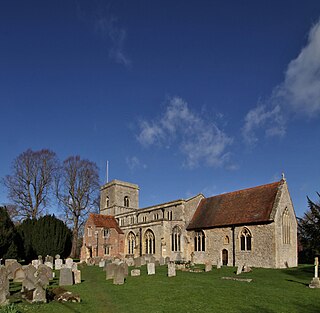
Sutton Courtenay is a village and civil parish in the Vale of White Horse district of Oxfordshire, England. It is situated on the south bank of the River Thames 2 miles (3 km) south of Abingdon-on-Thames and 3 miles (5 km) northwest of Didcot. The 2021 census recorded the parish's population as 3,055, a rise from 2,421 in 2011.

Staindrop is a village and civil parish in County Durham, England. It is situated approximately 6 miles (9.7 km) north east of Barnard Castle, on the A688 road. According to the 2011 UK census the population was 1,310, this includes the hamlets of Cleatlam and Killerby.

Kelloe is a village and civil parish in County Durham, England. The population of the civil parish as taken at the 2011 Census was 1,502. It is situated to the south-east of Durham.

High Coniscliffe is a parish and village in the borough of Darlington and ceremonial county of County Durham, England. The parish includes Carlbury and Low Coniscliffe. It is part of Heighington and Coniscliffe ward, and is situated approximately 4 miles (6.4 km) west of Darlington. At the 2011 Census the population of this civil parish was 242.

Eggleston is a village in County Durham, in England. The population of the civil parish taken at the 2011 Census was 448. It is in the Teesdale, a few miles north-west of Barnard Castle.
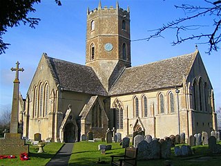
Uffington is a village and civil parish in Oxfordshire, about 4 miles (6.4 km) south of Faringdon and 6 miles (10 km) west of Wantage. The 2011 Census recorded the parish's population as 783. Lying within the historic county boundaries of Berkshire, in 1974 it was transferred for local government purposes to Oxfordshire under the Local Government Act 1972. Uffington is most commonly known for the Uffington White Horse hill figure on the Berkshire Downs in the south of the parish.

The Harrying of the North was a series of military campaigns waged by William the Conqueror in the winter of 1069–1070 to subjugate Northern England, where the presence of the last Wessex claimant, Edgar Ætheling, had encouraged Anglo-Saxon Northumbrian, Anglo-Scandinavian and Danish rebellions. William paid the Danes to go home, but the remaining rebels refused to meet him in battle, and he decided to starve them out by laying waste to the Northern shires using scorched earth tactics, especially in the historic county of Yorkshire and the city of York, before relieving the English aristocracy of their positions, and installing Norman aristocrats throughout the region.

Strixton is a small village in eastern Northamptonshire that borders the main A509 road between Wellingborough and Milton Keynes. The population of the village remained less than 100 at the 2011 Census and is included in the civil Parish of Wollaston.

Crayke is a village and civil parish in North Yorkshire, England, about 2 miles (3.2 km) east of Easingwold.

The County Palatine of Durham was a jurisdiction in the North of England, within which the bishop of Durham had rights usually exclusive to the monarch. It developed from the Liberty of Durham, which emerged in the Anglo-Saxon period. The gradual acquisition of powers by the bishops led to Durham being recognised as a palatinate by the late thirteenth century, one of several such counties in England during the Middle Ages. The county palatine had its own government and institutions, which broadly mirrored those of the monarch and included several judicial courts. From the sixteenth century the palatine rights of the bishops were gradually reduced, and were finally abolished in 1836. The last palatine institution to survive was the court of chancery, which was abolished in 1972.

The bishop of Durham is responsible for the diocese of Durham in the province of York. The diocese is one of the oldest in England and its bishop is a member of the House of Lords. Paul Butler was the most recent bishop of Durham until his retirement in February 2024.

The Priory Church of St Mary and St Hardulph is the Church of England parish church of Breedon on the Hill, Leicestershire, England. The church has also been known as Breedon Priory.

The Abbey Church of Saint Peter and Saint Paul, Monkwearmouth–Jarrow, known simply as Monkwearmouth–Jarrow Abbey, was a Benedictine double monastery in the Kingdom of Northumbria, England.