
Tamworth is a large market town and borough in Staffordshire, England, 14 miles (23 km) north-east of Birmingham and on the West Coast Main Line. The town adjoins Warwickshire to the south and east, Lichfield to the north and west and local junctions of the M6 Toll motorway. It takes its name from the River Tame, which flows through it. Its resident population (mid-2019 est.) was 76,696.

The A38, parts of which are known as Devon Expressway, Bristol Road and Gloucester Road, is a major A-class trunk road in England.

Aldridge is a town and former civil parish in the Walsall borough, West Midlands, England. Historically a village that was part of Staffordshire until 1974.

Rugeley is an industrial and market town in Cannock Chase District in Staffordshire, England.
Whitefield is a town in the Metropolitan Borough of Bury, Greater Manchester, England. It lies on undulating ground above the Irwell Valley, along the south bank of the River Irwell, 3 miles (4.8 km) south-southeast of Bury, and 4.9 miles (7.9 km) to the north-northwest of the city of Manchester. Prestwich and the M60 motorway lie just to the south.

Little Aston is an affluent area of the district of Lichfield, within the settlement of The Royal Town of Sutton Coldfield. At the last UK census there were 935 homes in the village, well over 10% of which were multimillion-pound properties, and is known for its footballers and successful businessmen and businesswomen.

The Lichfield Canal, as it is now known, was historically a part of the Wyrley and Essington Canal, being the section of that canal from Ogley Junction at Brownhills on the northern Birmingham Canal Navigations to Huddlesford Junction, east of Lichfield, on the Coventry Canal, a length of 7 miles (11.3 km). The branch was abandoned in 1955, along with several other branches of the Wyrley and Essington, and much of it was filled in.
Archdeacon Newton is a hamlet and rural parish of several farms in the borough of Darlington and the ceremonial county of County Durham, in England. The population taken at the 2011 Census was less than 100. Details are maintained in the parish of Walworth. It is associated with an abandoned village site under pasture and farm buildings, and situated a short distance to the north-west of Darlington. The lost settlement was in existence by the early 15th century, and remained inhabited at least until the 1890s. There was a moated manor house at the southern end, part of which remains as the Old Hall, now a barn. At the north end of the site was the chapel, and in the middle were tofts and enclosures, with a ridge and furrow field and a trackway leading to the south-east. The site of the abandoned village is now a scheduled monument and the Old Hall is a listed building.

Cranebrook is a suburb of Greater Western Sydney, in the state of New South Wales, Australia, and is located 50 km radially WNW of the Sydney central business district, in the local government area of the City of Penrith. Cranebrook is part of the Greater Western Sydney region.

Stonnall is a large village in Staffordshire, England, close to Shenstone, Brownhills, Walsall Wood and Aldridge. It is divided into Upper Stonnall, Stonnall and Lower Stonnall — Upper Stonnall partly lies in the Metropolitan Borough of Walsall; the remainder of the village is in the district of Lichfield.

Westwick Row is a place in Hertfordshire, in England. It is situated on the edge of Hemel Hempstead.

Brewood is an ancient market town and civil parish in South Staffordshire, England. Located around grid reference SJ883088, Brewood lies near the River Penk, eight miles north of Wolverhampton city centre and eleven miles south of the county town of Stafford. Some three miles to the west of Brewood is the border with the county of Shropshire.

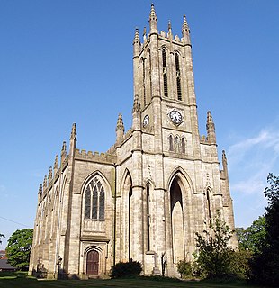
Wall is a small village and civil parish in Staffordshire, England, just south of Lichfield. It lies on the site of the Roman settlement of Letocetum.

Buerton is a village at SJ685435 and civil parish in the unitary authority of Cheshire East and the ceremonial county of Cheshire, England, about 7 miles south of the town of Nantwich and 1½ miles east of the village of Audlem, on the border with Shropshire. The parish also includes the small settlements of Hankins Heys, Moblake, Pinder's End and Three Wells, as well as parts of Chapel End, College Fields, Kinsey Heath, Longhill, Raven's Bank, Sandyford and Woolfall. In 2001, the total population was a little under 500, which had increased marginally to 503 at the 2011 Census. Nearby villages include Adderley, Audlem, Bridgemere, Hankelow, Hatherton, Hunsterson and Woore.
The A516 road is a road in Derbyshire that is used mostly for traffic flowing from the A50 to the A38. It finishes in Derby.

Rushall is a large, formerly mining English village in the West Midlands. It is centred on the main road between Walsall and Lichfield, and was mostly developed after 1920. It was served by Rushall railway station for about 100 years until the 1960s, although the Walsall–Lichfield railway remained open for freight until 1983.

Public transport in Christchurch, New Zealand, consists of bus services operated by two bus companies supported by a ferry, all jointly marketed as Metro.

Poole is a civil parish in the unitary authority of Cheshire East and the ceremonial county of Cheshire, England, which lies to the north west of Nantwich and to the west of Crewe. The Shropshire Union Canal runs through the parish. Nearby villages include Acton, Aston juxta Mondrum, Barbridge, Stoke Bank, Rease Heath and Worleston.

Wabash Avenue is a six-lane boulevard in northwest Baltimore, Maryland, that runs from Patterson Avenue to Hilton Street, mostly through the Arlington community, crossing over Northern Parkway and Cold Spring Lane along the way. The road starts near the Reisterstown Plaza Metro Subway Station and continues to just past the West Coldspring Metro Subway Station, where it narrows and becomes a one-way pair with Dorithan Road, which ends several blocks later at Hilton Street.
The Birmingham and Aston Tramways Company operated a steam-powered tramway service in Birmingham and Aston between 1882 and 1902.
