Hinton Charterhouse Pit

Last updated
Hinton Charterhouse Pit
Site of Special Scientific Interest
Somerset UK location map.svg
Red pog.svg
Location within Somerset
Area of Search Avon
Grid reference ST772573
Coordinates 51°18′52″N2°19′43″W / 51.31435°N 2.32852°W / 51.31435; -2.32852 Coordinates: 51°18′52″N2°19′43″W / 51.31435°N 2.32852°W / 51.31435; -2.32852
Interest Geological
Area 0.4 hectares (0.0040 km2; 0.0015 sq mi)
Notification 1971 (1971)
Natural England website

Hinton Charterhouse Pit (grid reference ST772573 ) is a 0.4 hectare geological Site of Special Scientific Interest near the village of Hinton Charterhouse, Bath and North East Somerset, notified in 1971.

Ordnance Survey National Grid System of geographic grid references used in Great Britain

The Ordnance Survey National Grid reference system is a system of geographic grid references used in Great Britain, distinct from latitude and longitude. It is often called British National Grid (BNG).

The hectare is an SI accepted metric system unit of area equal to a square with 100-metre sides, or 10,000 m2, and is primarily used in the measurement of land. There are 100 hectares in one square kilometre. An acre is about 0.405 hectare and one hectare contains about 2.47 acres.

Hinton Charterhouse

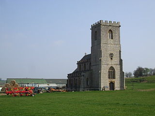
Hinton Charterhouse is a small village and civil parish in the Bath and North East Somerset unitary authority, Somerset, England. The parish, which includes the village of Midford, has a population of 515.

The Hinton Sands, where a sparse bivalve fauna has been found, is an unusual sandy facies developed in the middle of the Forest Marble Jurassic Formation. This rock unit has strong associations with William Smith, who used the name Hinton Sands for the facies early in the 19th century. [1]

The Jurassic was a geologic period and system that spanned 56 million years from the end of the Triassic Period 201.3 million years ago (Mya) to the beginning of the Cretaceous Period 145 Mya. The Jurassic constitutes the middle period of the Mesozoic Era, also known as the Age of Reptiles. The start of the period was marked by the major Triassic–Jurassic extinction event. Two other extinction events occurred during the period: the Pliensbachian-Toarcian extinction in the Early Jurassic, and the Tithonian event at the end; however, neither event ranks among the "Big Five" mass extinctions.

William Smith (geologist) geologist credited with the first nationwide map

William 'Strata' Smith was an English geologist, credited with creating the first nationwide geological map. At the time his map was first published he was overlooked by the scientific community; his relatively humble education and family connections prevented him from mixing easily in learned society. Financially ruined, Smith spent time in debtors' prison. It was only late in his life that Smith received recognition for his accomplishments, and became known as the "Father of English Geology".

Related Research Articles

Carthusians religious order

The Carthusian Order, also called the Order of Saint Bruno, is a Catholic religious order of enclosed monastics. The order was founded by Bruno of Cologne in 1084 and includes both monks and nuns. The order has its own Rule, called the Statutes, rather than the Rule of Saint Benedict, and combines eremitical and cenobitic monasticism.

Charterhouse School English collegiate independent boarding school

Charterhouse is an independent day and boarding school in Godalming, Surrey. Originally founded by Thomas Sutton in 1611 on the site of the old Carthusian monastery in Charterhouse Square, Smithfield, London, it educates over 800 pupils, aged 13 to 18 years, and is one of the original Great Nine English public schools. Today pupils are still referred to as Carthusians, and ex-pupils as Old Carthusians.

London Charterhouse historic complex of buildings in Smithfield, London

The London Charterhouse is a historic complex of buildings in Smithfield, London, dating back to the 14th century. It occupies land to the north of Charterhouse Square, and lies within the London Borough of Islington.

Charterhouse may refer to:

Abu Rawash village in Giza Governorate, Egypt

Abu Rawash, 8 kilometres (5.0 mi) north of Giza, is the site of Egypt's most northerly pyramid, also known as the lost pyramid – the mostly ruined Pyramid of Djedefre, the son and successor of Khufu. Originally, it was thought that this pyramid had never been completed, but the current archaeological consensus is that not only was it completed, but that it was built about the same size as the Pyramid of Menkaure – the third largest of the Giza pyramids. One notable fact about the pyramid at Abu Rawash is that the upper most part of the pyramid has seemingly disappeared, revealing the internal passage that runs down into the bedrock. Explanations to why this pyramid is missing its top vary. The second point of interest that this pyramid provides is that it is built on top of a hillock. The builders faced the colossal task of not only hauling megalith stones up a pyramid but also up a hillock.

Limpley Stoke village in United Kingdom

Limpley Stoke is a village and civil parish in Wiltshire, England. It is in the Avon valley, between Bath and Freshford and is both above and below the A36 road.

Hinton Charterhouse Field

Hinton Charterhouse Field is a 0.32 hectare biological Site of Special Scientific Interest (SSSI) near the village of Hinton Charterhouse in Bath and North East Somerset, notified in 1991.

Low Ham village in United Kingdom

Low Ham is a village in the civil parish of High Ham in the English county of Somerset.

Friary, Somerset

The Friary is a small hamlet outside the English village of Freshford, about 6 miles (10 km) south of Bath, Somerset. Although closer to Freshford it lies within the parish of Hinton Charterhouse.

Hinton Priory Refectory to west of Chapter house

Hinton Priory was a Carthusian monastery in northeast Somerset, England, from 1232 until 1539.

Asserbo Charterhouse

Asserbo Charterhouse is a fortress and Carthusian monastery ruin in the small town of Asserbo north of Frederiksværk on North Zealand in Denmark.

The Zenne Group is a group of rock strata in the subsurface of central and northwest Belgium. The group consists of three formations, all from the Ypresian and Lutetian ages. These formation have their shallow marine facies in common.

The George Inn, Norton St Philip Grade I listed pub in Mendip, United Kingdom

The George Inn in Norton St Philip, Somerset, England, one of a number of establishments that claims to be Britain’s oldest tavern, is located in the centre of the village. It was built in the 14th or 15th century and has been designated as a Grade I listed building.

Church of St John the Baptist, Hinton Charterhouse church in Bath and North East Somerset, UK

The Church of St John the Baptist is an Anglican parish church in Hinton Charterhouse, Somerset, England. It was built in the 12th century and has been designated as a Grade II* listed building.

Abel Moysey, of Hinton Charterhouse, Somerset, was an English lawyer and politician who sat in the House of Commons from 1774 to 1790.

Bridport Sand Formation

The Bridport Sand Formation is a formation of Toarcian age found in the Worcester and Wessex Basins of central and southern England. It forms one of the reservoir units in the Wytch Farm oilfield in Dorset. The sandstone is very-fine grained to fine-grained and contains regular narrow bands that are calcite-cemented and more resistant to weathering, giving it a characteristic banded appearance at outcrop, such as in the cliffs between Bridport and Burton Bradstock in Dorset. It is named for Bridport and has previously been known as the Midford Sand(s), Cotteswold Sands, Yeovil Sands and Upper Lias Sand(s). It forms a locally important aquifer, particularly around Yeovil.

Hinton House, Hinton Charterhouse

Hinton House in Hinton Charterhouse, Somerset, England was built around 1700. It is a Grade II* listed building.

Geology of Sierra Leone

The geology of Sierra Leone is primarily very ancient Precambrian Archean and Proterozoic crystalline igneous and metamorphic basement rock, in many cases more than 2.5 billion years old. Throughout Earth history, Sierra Leone was impacted by major tectonic and climatic events, such as the Leonean, Liberian and Pan-African orogeny mountain building events, the Neoproterozoic Snowball Earth and millions of years of weathering, which has produced thick layers of regolith across much of the country's surface.

References