Related Research Articles
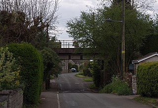
Tytherington is a village in South Gloucestershire, England, situated 2 miles (3.2 km) south east of Thornbury. The parish population taken at the 2011 census was 666.
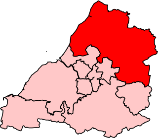
Northavon was, from 1983 until 2010, a constituency represented in the House of Commons of the Parliament of the United Kingdom. It elected one Member of Parliament (MP) by the first past the post system of election.

Hawkesbury is a hamlet consisting of a few cottages around a triangular green. It is also the name of a civil parish in the South Gloucestershire unitary authority in England in which Hawkesbury itself lies, it is located west of Hawkesbury Upton, off the A46 road.

Hillesley is a village in Gloucestershire, England. It was transferred from the county of Avon in 1991 and is now in Stroud District. The village forms part of the civil parish of Hillesley and Tresham. It is close to the Cotswold Edge, near the Cotswold Way and about 2+1⁄2 miles (4.0 km) south of the town of Wotton under Edge.
Wick is a village in South Gloucestershire, England. It is the main settlement in the civil parish of Wick and Abson. The population of this civil parish taken at the 2011 census was 1,989.

Thornbury and Yate is a constituency represented in the House of Commons of the UK Parliament since the 2015 election by Luke Hall, a member of the Conservative Party. Encompassing an area to the north-east of Bristol, it is one of three constituencies that make up the South Gloucestershire Unitary Authority Area, along with Filton and Bradley Stoke and Kingswood.

Uley Bury is the long, flat-topped hill just outside Uley, Gloucestershire, England. It is an impressive multi-vallate, scarp-edge Iron Age hill fort dating from around 300 B.C. Standing some 750 feet above sea level it has views over the Severn Vale.
Damery Road Section is a 0.5-hectare (1.2-acre) geological Site of Special Scientific Interest north of Tortworth, South Gloucestershire, notified in 1974.
Cullimore's Quarry is a 0.9 hectare geological Site of Special Scientific Interest near the village of Charfield, South Gloucestershire, notified in 1974.
Brinkmarsh Quarry is a 0.5 hectare geological Site of Special Scientific Interest near the town of Thornbury, South Gloucestershire, notified in 1974.
Bodkin Hazel Wood is a 10.62-hectare (26.2-acre) biological Site of Special Scientific Interest (SSSI), just south of the village of Hawkesbury Upton in South Gloucestershire, notified in 1974.
Hawkesbury Meadow is a 3.3 hectare biological Site of Special Scientific Interest (SSSI) in South Gloucestershire, notified in 1987.

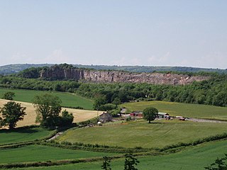
Slickstones Quarry, Cromhall is a 2.7 hectare geological Site of Special Scientific Interest near the village of Cromhall, South Gloucestershire, England notified in 1966.
Tytherington Quarry is a 0.9 hectare geological Site of Special Scientific Interest near the village of Tytherington, South Gloucestershire, notified in 1989.

Upton Coombe is a 7.4 hectare biological Site of Special Scientific Interest near the village of Hawkesbury Upton, South Gloucestershire, notified in 1989.
Dulcote Quarry is a disused limestone quarry at Dulcote, near Wells on the Mendip Hills, Somerset, England. The quarry measures around 600 metres (2,000 ft) from West to East and around 350 metres (1,150 ft) from North to South, with an area of 18 acres (7.3 ha), which is surrounded by 80 acres (32 ha) of woodland.

Petty France is a hamlet in the rural north of South Gloucestershire, near the Gloucestershire border, in Hawkesbury parish. It is on the A46, which runs from Bath, to Nailsworth and Stroud, just south of another, slightly smaller hamlet, Dunkirk.

Dunkirk is a hamlet in the rural north of South Gloucestershire, near the Gloucestershire border, in the parish of Hawkesbury. The hamlet is on an important T-junction where the A46 meets the A433.
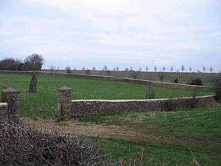
Swangrove is a Grade I listed country house in Hawkesbury, South Gloucestershire, England. The listing includes Swangrove House, its garden walls, four corner pavilions, and gate piers. It was built in 1703 by William Killigrew of Bath.

Coneyhurst Cutting is a 0.2-hectare (0.49-acre) geological Site of Special Scientific Interest south-east of Billingshurst in West Sussex. It is a Geological Conservation Review site.
References
- ↑ The story of geology and landscape in South Gloucestershire Archived 2008-09-08 at the Wayback Machine p.18
- English Nature citation sheet for the site (accessed 11 July 2006)
Coordinates: 51°35′03″N2°19′55″W / 51.58409°N 2.33191°W
| | This article about a Site of Special Scientific Interest in England is a stub. You can help Wikipedia by expanding it. |