
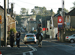
Midford is a village approximately 3 miles (5 km) south-south-east of Bath, Somerset, England. Although relatively small, it extends over 2 counties, is part of two unitary authorities and is part of five parishes. Although all five parishes extend very near to the village centre, most of the residents reside in the parish of Southstoke and are part of the Bath and North East Somerset unitary authority.
Peasedown St John is a village and civil parish in Somerset, England, standing on a hilltop roughly 5 miles (8 km) south-southwest of the city of Bath, and 2 miles (3 km) north-east of the town of Radstock at the foot of the Mendip Hills. Peasedown used to be a coal mining village, and after the last of the mines shut in the 1970s it became a dormitory village for Bath, Trowbridge and to a lesser extent Bristol. Its size was increased by substantial housing developments in the 1960s, 1970s and late 1990s, making it one of the largest villages in Somerset.

Wellow is a village and civil parish in Somerset, England, about 5 miles (8.0 km) south of Bath. The parish, which includes the hamlets of Twinhoe, White Ox Mead, Baggridge and part of Midford has a population of 529. The village itself falls within the southernmost boundary of the Cotswolds Area of Outstanding Natural Beauty and is recognised as having special architectural and historic interest, which led to it being designated as a Conservation Area in 1983.
The Radstock rail accident took place on the Somerset and Dorset Joint Railway in south west England, on 7 August 1876. Two trains collided on a single track section, resulting in fifteen passengers being killed.

Cleaves Wood is a 40.38 hectare biological Site of Special Scientific Interest (SSSI) near the village of Wellow in Bath and North East Somerset, notified in 1988.
Congrove Field and The Tumps is a is a 14.2 hectares biological Site of Special Scientific Interest (SSSI) on Lansdown Hill, north of Bath in Bath and North East Somerset, notified in 1991.
Hinton Charterhouse Field is a 0.32 hectare biological Site of Special Scientific Interest (SSSI) near the village of Hinton Charterhouse in Bath and North East Somerset, United Kingdom. It was SSSI notified in 1991.
Hinton Charterhouse Pit is a 0.4 hectare geological Site of Special Scientific Interest near the village of Hinton Charterhouse, Bath and North East Somerset, notified in 1971.
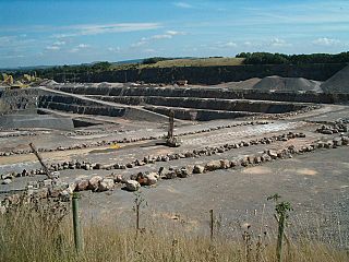
Huish Colliery Quarry is a 0.8 hectare geological Site of Special Scientific Interest near the town of Radstock, Bath and North East Somerset, notified in 1985.

Long Dole Wood and Meadows SSSI is a 9.8 hectares biological Site of Special Scientific Interest (SSSI) between the villages of Farrington Gurney and Hinton Blewitt in Bath and North East Somerset, notified in 1987.

The Stoney Littleton Long Barrow is a Neolithic chambered tomb with multiple burial chambers, located near the village of Wellow in the English county of Somerset. It is an example of the Cotswold-Severn Group and was scheduled as an ancient monument in 1882. It was one of the initial monuments included when the Ancient Monuments Protection Act 1882 became law.
The Cam brook is a small river in Somerset, England. It rises near Hinton Blewitt, flows through Cameley, Temple Cloud, Camerton, Dunkerton and Combe Hay. It then joins the Wellow Brook at Midford to form Midford Brook before joining the River Avon close to the Dundas Aqueduct.

Midford Brook is a small river in Somerset, England.

Hinton Charterhouse is a small village and civil parish in the Bath and North East Somerset unitary authority, Somerset, England. The parish, which includes the village of Midford, has a population of 515.
The Mendip Hills, (Mendips) in northern Somerset, are the most southerly Carboniferous Limestone uplands in Britain.

Shoscombe & Single Hill Halt was a small railway station on the Somerset and Dorset Joint Railway serving small villages between Wellow and Radstock, about seven miles south of Bath.

Cherry Hinton Pit is a 12.8-hectare (32-acre) biological Site of Special Scientific Interest (SSSI) on the south-eastern outskirts of Cambridge. The site consists of East Pit and most of the smaller West Pit. East Pit is part of the Limekiln Close and East Pit Local Nature Reserve, which is managed by the Wildlife Trust for Bedfordshire, Cambridgeshire and Northamptonshire under the name Cherry Hinton Chalk Pits. West Pit is a separate Local Nature Reserve (LNR).
Bathavon was a rural district in Somerset, England, from 1933 to 1974.

