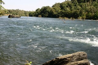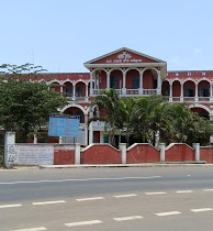
Bantwal is a taluk in Dakshina Kannada district, Karnataka, India. It is located 25 km (16 mi) East of Mangalore city center. BC Road-Kaikamba of Bantwal is one of the fastest developing areas in Dakshina Kannada district of Karnataka. Along with BC Road-Kaikamba, Panemangalore & Melkar regions are also urbanized. They are also developing as the eastern suburbs of Mangalore. Towards east of Mangalore, the stretch to BC Road-Kaikamba region forms a continuous Mangalore Urban Agglomeration area which is currently the second biggest in Karnataka after Bangalore. Bantwal is the fourth largest urban area in Dakshina Kannada district after Mangalore, Ullal & Puttur in terms of population.

Dandeli is a taluk in Uttara Kannada district of Karnataka, India, in the Western Ghats region.

Ramdurg is a town in Belgaum district in the Indian state of Karnataka. The name of the town derives from Rama, as it is believed that Lord Ram, lived here during his exile.

Bajpe is a locality in Mangalore city of Dakshina Kannada district in the state of Karnataka, India. It is around 18 km (11 mi) from the city centre of Mangalore. The Mangalore International Airport is located at Bajpe and was previously known as the Bajpe Aerodrome. City bus number 47 connects Bajpe to State Bank.There are a number of villages surrounding Bajpe, for which it serves as a hub. The nearby villages to which Bajpe serves as hub are Permude, Hosabettu, Kinnigoli, Kalamundkur and Kateel.Bajpe is derived from the Tulu word, Bija da Appe since it was famous for its agricultural market.

Chikkodi is a taluka and Town Municipal Council city in the Belgaum district of Karnataka, India. It is a Subdivision of the district. Chikodi, Athani, Hukkeri, Raybag, Nipani and Kagwad are the taluks that come under Chikodi Subdivision. It is 75 kilometers from the city of Belgaum, 65 kilometers from Kolhapur, 51 kilometers from Miraj, 160 kilometers from Hubballi, and 570 kilometers from the capital of Karnataka state, Bengaluru. Chikodi has many district level offices but it is not designated as a district by the Government of Karnataka. It is one of the major cities that lies in the border between Karnataka and Maharashtra states.official language is Kannada.
Sadalga is a municipal town in Chikodi Taluka in the Belagavi district of Karnataka, India.

Joida is a town located in the Uttar Kannada district in the Indian state of Karnataka. The town is the headquarters of the eponymous taluk.

Examba is a City and Municipal Council in the Belgaum district of the Indian state of karnataka.

Kabbur is a town in the southern state of Karnataka, India. It is located in the Chikodi taluk of Belgaum district in Karnataka.

Kunnur is a village in the southern state of Karnataka, India. It is located in the Chikodi taluk of Belgaum district in Karnataka.

Madabhavi is a large village located in Athani taaluk of Belagavi district, Karnataka state of India. The village is famous for production leather chappals which have main market in Kolhapur. The village name came from Madya means central and Bhavi means open well. Open well is near panchayat of village. This village Has two Oldest Ancients Temples one Kalbhairava and another one is Madhukeshwar temple.

Shamanewadi is a village in the southern state of Karnataka in Chikodi taluka, India. It is in the Chikodi taluk of Belgaum district in Karnataka.

Bijjargi is a village in the State of Karnataka, India. It is located in Vijayapur taluk of Vijayapur district, Karnataka.

Adi (Chikodi) is a village in the southern state of Karnataka, India. It is located in the Chikodi taluk of Belgaum district in Karnataka. Its population is nearly 5000. It is located near Bangalore-Pune highway. Famous for Shri Mallikarjun and Shri Dattatraya temple

Chamakeri is a village in the Belgaum district of Athani Taluk in the southern Indian state of Karnataka.

Shiradwad is a village in Belgaum district of Karnataka, situated on the bank of Dudhaganga River.The Village has population of around 3000 (Approx) with Kannada being the mainly spoken language followed by Marathi. Shiradwad is also known as Chand Shiradwad to differentiate it from another village with the same name in Maharashtra. The word Chand is derived from the famous shrine built on the bank of Dudhaganga river named, 'Chand Peer Dargah'. However the official name of the town remains as Shiradwad. The residents of Shiradwad mainly depend on agriculture, but the rise in literacy rate and industrial zones in the nearby area have also contributed to a large extent on the living and economic conditions of its residents. Prominent among people from different communities who reside in shiradwad are Jains, Lingayats, Muslims, Kurubas, Marathas, Scheduled Castes and Scheduled Tribes. Shiradwad was adopted by Mr. Prakash Babanna Hukkeri, the then MP of the territory under Sansad Adarsh Gram Yojana in 2014.

Hanamasagar (Halasagar) is a village in the southern state of Karnataka, India. It is located in Vijayapur taluk, of Vijayapur district, Karnataka and is nearly 40 km from the district headquarters Vijayapur. It is a small village and pilgrim, having the post office at Kambagi and Babaleshwar hobli.

Babalad or Muttyna Babalad is a village in the southern state of Karnataka, India. It is located in Bijapur taluk of Bijapur district, Karnataka. It is nearly 25 km from the district headquarters, Bijapur. It's one of several small villages near Bijapur.
Umalwad is a small village having population 5035 as on 2011 census survey of govt of India. It is situated 3 km from north side of Jaysingpur city. This village is famous for Guava. Every year on Mahashivratri Shree Danling Maharaj yatra or festival is celebrated. The history of the village dates back into the year 1600-1700 old. It is situated on the bank of Krishna River which flows from north to south, as it flows in Nrusinhwadi. This village is also famous for its all religions temples present in the village. In Umalwad there is Ramling Temple, Shree Danling temple, Shree Hanuman temple, Shree Vitthal-Rukmini Temple, Shree Basaveshwar temple, Shree Ganapati temple and a Christian church is also present.
Karoshi is a village panchayat in Belgaum district of Karnataka state of India. Fertile lands and greenery surround the settlement. The main profession of the people here is farming. It is also known for Urdu poetry.


