Ugar Khurd is a town municipal council in the district of Belagavi, in the state of Karnataka, in India. Khurd and Kalan Persian language word which means small and Big respectively when two villages have same name then it is distinguished as Kalan means Big and Khurd means Small with Village Name.

Gokak is a taluka headquarters in the Belgaum district of Karnataka state, India. It is located around 70 km from Belgaum at the confluence of two rivers, the Ghataprabha and the Markandeya. The population of the city is according to 2011 census is approximately 150,773. Gokak city has second highest GDP in the district of Belgaum after Belgaum city. The common language is Kannada.
Bailhongal is a Taluk in Belagavi District of Karnataka state in southern India. Bailhongal Taluk is located towards the north-east part of Belagavi. The taluk headquarters is about 44 km from the district headquarters. The total geographical area of the taluk is 1122.40 km2. There are 126 revenue villages and 14 hamlets with a total population of 356,400 people, according to the 2001 census.

Chikkodi is a taluka and Town Municipal Council city in the Belgaum district of Karnataka, India. It is a Subdivision of the district. Chikodi, Athani, Hukkeri, Raybag, Nipani and Kagwad are the taluks that come under Chikodi Subdivision. It is 75 kilometers from the city of Belgaum, 65 kilometers from Kolhapur, 51 kilometers from Miraj, 160 kilometers from Hubballi, and 570 kilometers from the capital of Karnataka state, Bengaluru. Chikodi has many district level offices but it is not designated as a district by the Government of Karnataka. It is one of the major cities that lies in the border between Karnataka and Maharashtra states.official language is Kannada.
Hukkeri is a Town Municipal Council and taluka in Belgaum district in the Indian state of Karnataka. Archeological studies reveal that the name Hukkeri is supposed to have been derived from the word Huvinakeri which means Street of Flowers. During Adil Shahi times, roses of good quality were grown here and were sent to Bijapur.
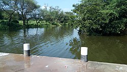
Ghataprabha is a village in the southern state of Karnataka, in north Karnataka India. It is located in the Gokak taluk of Belgaum district in Karnataka.
Inchal is a village in the southern state of Karnataka, India. It is located in the Saundatti taluk of Belgaum district in Karnataka.
Mamadapur is a village in the southern state of Karnataka, India. It is located in the Gokak taluk of Belagavi district in Karnataka. It is the birthplace of Wrangler D.C. Pavate
Murgod/Murugodu is a village in the southern state of Karnataka in India. It is located in the Savadatti taluk of Belagavi district in Karnataka, 491 km from the capital Bengaluru and 54 km from district headquarters Belagavi.
Shedbal is a town in the southern state of Karnataka, India. It is located in the Athni taluk of Belagavi district in Karnataka. Shedbal is very close to Sangli Miraj twin cities.
Shelawadi or Shelavadi is a panchayat town in the southern state of Karnataka, India. It is located in the Navalgund taluk of Dharwad district in Karnataka.

Akkiwat is a village in the southern state of Karnataka, India. It is located in the Hukeri taluk of Belgaum district in Karnataka. It is situated 23km away from sub-district headquarter Hukkeri and 58km apart from district headquarter Belgaum. As per 2009 stats, Kesthi is the gram panchayat of Akkiwat village.
Hulloli is a village which comes under Hukkeri Taluka in Belgaum district in the southern state of Karnataka, India.
Kolavi is a village in Gokak taluka and Belagavi district in Karnataka, India.It is located around 12 km from Gokak and 54 km from district headquarter Belagavi.The common language in use is Kannada. The main occupation of the people here is agriculture.

Midakanatti is a village in the Gokak Taluk and Belagavi District of Karnataka State in India. It is administered by the Midakanatti Panchayat. It is located 52 km east of the divisional headquarters in Belagavi, 25 km from the town of Gokak, and 507 km from the state capital, Bengaluru.
Shivanoor is a village in Belgaum district of Karnataka, India. According to Census 2011 information the location code or village code of Shivanoor village is 597265. Shivanoor village is located in Athni Tehsil of Belgaum district in Karnataka, India. It is situated 13km away from sub-district headquarter Athani and 167km away from district headquarter Belgaum. As per 2009 stats, Jambagi is the gram panchayat of Shivanoor village.
Gopankop is a village in Dharwad district of Karnataka, India. According to Census 2011 information the location code or village code of Gopankop village is 602377. Gopankop village is located in Hubli Tehsil of Dharwad district in Karnataka, India. It is situated 6km away from sub-district headquarter Hubli and 26km away from district headquarter Dharwad.
Yelimunnoli is a village in Belagavi district in the Indian state of Karnataka. It is a Zilla Panchayat constituency.
Hampasandra is a village in the southern state of Karnataka, India. It is located in the Gauribidanur taluk of Chikkaballapura district in Karnataka. It is situated 15 km away from sub-district headquarter Gauribidanur and 60 km away from district headquarter Chikkaballapura.
Markandeya is a river of southern India. It rises in the Bailur in Khanapur Taluk of Belgaum district, Karnataka state, enters Belagavi taluk on southern side and flows towards western side of the Belagavi city and flows 66 kilometres (41 mi) in Belgaum district forming beautiful Godchinamalaki Falls before reaching its confluence into the Ghataprabha River at Gokak about 60 kilometres (37 mi) from Belgaum