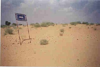
Thathawata is a village located in Churu District of Rajasthan state in India. At the 2001 census, the village had a total population of 2500.

A gramadevata is the tutelary deity of a given locality in Hinduism, primarily worshipped in the villages of India.
The tribes of Jharkhand consist of 32 scheduled tribes inhabiting the Jharkhand state in India. In 1872, only 18 tribes were counted among the schedule tribes from which Banjara, Bhatudi, Chik Baraik and Mahli were marked as semi-Hindu aboriginal and Kora as proletariat Hindu. In the 1931 census, including above four semi-Hindu aboriginal and Kora, a proletariat Hindu, the number was raised to 26 from 18 by adding four more in the annexure. They were Birajia, Godait, Karmali and Paharia, but Kisan was excluded from the list. In 1941 census, Baga, Bedia and Lohra included again taking Kisan in the annexure and number came to 30 which was prevailing till June 2003. Kanwar and Kol were added on 8 June 2003 in the annexure and the number of Schedule Tribes came to 32.
Vasna (Borsad INA) (sometimes spelled Wasna) is a town and an Industrial Notified Area of the Borsad municipality in Anand district in the Western Indian state of Gujarat.
Morsand is a village in Sitamarhi district, Bihar state, India. It is situated 18 km. to the southeast of the town of Sitamarhi on the banks of the river - Lakhandei, and is connected to the district headquarters via National Highway 77 Sitamarhi- Hajipur. The nearest railway stations are Sitamarhi and Muzaffarpur, and the nearest airport is in Patna. Now a new railway station is established in the village itself with the name "Runni Saidpur", which will be providing rail connectivity from this village to the rest of India.
Kari is a village in Jhunjhunu district of Rajasthan state in India. It is situated 17 km west of Nawalgarh and is connected to nearby cities such as Jhunjhunu and Gudha by roads. It is a 4000 -year-old village. Pareek's are said to be the first inhabitants of the village.
Sambalhera is an ancient village in Jansath Tehsil of Muzaffarnagar district, Uttar Pradesh, India, 6 km from Jansath town. Chhatraudi branch of Sadat Bahera settled here in the 11th century. Many ancient and medieval tombs of Barha generals are still there.
Kholua is a village located in the center of India. It is in the Mirzapur, Uttar Pradesh. Kholua has a population of around 2564, and is located on the bank of the Ganges. Kholua is the combined name of five different villages, the others being Semra, Daurhara, Majhalipatti, and Annirudhapur. The capital of the village is Mirzapur. It has been calculated that the clock tower in Mirzapur is nearly exactly on the reference longitude of Indian Standard Time at 82.5°
Nandikurali is a village in the southern state of Karnataka, India. It is located in the Raybag taluk of Belgaum district in Karnataka.
Chadchan is a taluq in the southern state of Karnataka, India. It is located in Vijayapura district in northern part of Karnataka.

Buttar Sivia is a village in the Amritsar district of Punjab, India. It is predominantly inhabited by people of the Buttar, Sivia and Randhawa Jat clans.
Sukhpur is a village in North Bihar. Sukhpur is endowed with fertile alluvial soil as it lie in the plain of koshi. Climate of village is mild and monsoon type. Summer is not so hot as compared to northern India mainly due to its proximity to the eastern Himalayas but temperature goes down to as cold as 8C during Winter. Rain is mainly concentrated from May to September. The village receives plenty of rain. Sukhpur is also flood prone due to shifting nature of River Koshi however till now the village has not yet taste the flood water except for its outskirt. Sukhpur is well organized in the sense that the region residing for living & agriculture is separated from each other.
Kadambankulam is a small village in the Radhapuram taluk of Tirunelveli District, Tamil Nadu in southern India. It is seven kilometers from the larger town of Valliyur. Kadambankulam, a hamlet in the extreme south of Vallioor, covers an area of 30 km2. As the major occupation of the villagers is agriculture, around 60% of the area is covered by agricultural land. Kadambankulam enjoys a tropical climate with an average temperature of 31˚C. It has an average annual rainfall of 150 cm, receiving rain both from the Southwest Monsoon and the Northeast Monsoon. Kadambankulam has a population of around 6,000, out of which 3,100 are men and 2,900 are women. Everyone in this village is a member of Ayyavazhi, a monistic belief system closely linked with Hinduism. Kadambankulam is the only known village where all the people belong to the same religion and live as a single community.
Malikwad is a village which is located in the Belgaum district of Karnataka state, India. It is located on the banks of the Doodhganga River. The river acts as the border between Karnataka and Maharashtra. Due to the border separation, the people in the area are bilingual; many can speak as well as write both Kannada and Marathi languages. Facilities in the village include schools, a library, and public toilets. Agriculture is a mainstream source of income of the village. It is regarded as one of the highest sugarcane producing villages. Along with sugarcane, farmers also grow different kinds of fruits and vegetables such as tomatoes and bananas. Almost one member of every family in the area is in the Indian army, so people have called this village “Sainik Malikwad,” the word “sainik” meaning “soldier.”
Shinal is a village in Belgaum district of Karnataka, India.
Chinawal is a village in the Jalgaon district of Maharashtra state, India. It is situated at the foothills of the Satpura range in a generally hot and dry climate. The densely populated village is surrounded by the flat land and nutrient-rich black soil.

Takchang (Takshang) is a village near Pakyong in Pakyong District, India. Takchang is 30.7 km from Gangtok and the population of the village is nearly 550-600. Ethnic Nepali and Lepcha are the main settler of this village. Etymologically the word "Taktsong" is derived from Lepcha (Rong) language. The word tak means "Tiger" and tshong means "House", translating to "House of a Tiger".
Kammanahalli is a small village located in Tumkur District, Turuvekere Taluk, Mayasandra Hobli and Vittalapura Post in India's Karnataka State. The village is about 12 km from Yadiyur which is famous for the Lord Siddalingeshwara Temple and is about 100 km from Bangalore.
Kotla Mehar Singh Wala is a village of Malwa region of Punjab state. It is situated about 30 km (19 mi) from Moga. The village has five patties : Babe ki patti, isawa patti, Vaddi Patti, Chhoti patti, Suhel patti etc. The people of the village belong to various religions, most of them are Sikhs of Brar clan. There are two water works in the village supplying pure water to the villagers. Streets of the village are made from concrete.
Kathikund is a community development block that forms one of the administrative units in the Dumka Sadar subdivision of the Dumka district, Jharkhand state, India.


