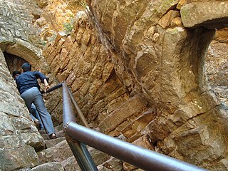
Parasgad Fort is a ruined hill fort in the Belgaum district of Karnataka state, India. magnificent fort of Parashghad, dating back to the 10th century and built by famous rulers of Ratta dynasty Parasgad Fort is located about two kilometres south of Saundatti village, and stands on the south-west edge of a range of hills immediately overlooking the black soil plain down below.

Saundatti also known as Savadatti is one of the oldest towns in Belgaum district in the Indian state of Karnataka. It is a celebrated pilgrimage centre located 78 kilometres from Belgaum and 37 kilometres from Dharwad. Savadatti is also the name of the taluk (sub-district), which was previously named Parasgad. There are several ancient temples in Saudatti.

Sogal is a place in Belgaum district, Karnataka, India. The name of the place is ascribed to a sage, Sugola Muni, who is believed to have lived in the area, but one inscription speaks of "Sovala." Located on a hillside, Sogal has many temples, including the Someshwara temple, and is of great antiquarian interest.

Hooli is a town in Belgaum District in Karnataka, India. It is about 9 km from Saundatti. One of the oldest villages in the Belgaum District, Hooli is the site of the Panchaligeswara temple and the Trikuteshwara Temple. The village is historically rich, boasting of a ruined fort atop a hill and numerous temples. Hooli has been under the rule of the Rattas of Saundatti, Patwardhans of Ramdurg and most of the temples feature Chalukya architecture and were initially Jain Bastis indicating a Chalukya rule. The name of the village is a corrupted form of PooValli meaning a flowery ear ornament. The village was also called MahishpatiNagar in ancient times.
Inchal is a village in the southern state of Karnataka, India. It is located in the Saundatti taluk of Belgaum district in Karnataka.
Karlakatti is a village in the southern state of Karnataka, India. It is located in the Saundatti taluk of Belgaum district in Karnataka.
Sattigeri is a village in the southern state of Karnataka, India. It is located in the Saundatti taluk of Belgaum district in Karnataka.
Soundatti is a village in the southern state of Karnataka, India. It is located in the Raybag taluk of Belgaum district in Karnataka.
Ugaragol is a village in the southern state of Karnataka, India. It is located in the Saundatti taluk of Belgaum district in Karnataka.
Yaragatti is a village in the southern state of Karnataka, India. It is located in the Saundatti taluk of Belgaum district in Karnataka.
Chachadi is an old village in the Belgaum district of the southern state of Karnataka, India. It is around 45 km from Belgaum and around 8 km from Nesargi town.
Hireulligeri is a village in Belgaum district in the southern state of Karnataka, India. It's in the main road between Saundatti and Dharwad. It is 9 km from Saundatti and 25 km from Dharwad. Sangolli family is very well known in this place. shree veerabhadreshwara and karemma devi temples are famous here.
Kalabhavi is a village in Belgaum district in Karnataka, India.

Midakanatti is a village in the Gokak Taluk and Belagavi District of Karnataka State in India. It is administered by the Midakanatti Panchayat. It is located 52 km east of the divisional headquarters in Belagavi, 25 km from the town of Gokak, and 507 km from the state capital, Bengaluru.
Yenagi ("ಏಣಗಿ"), is a village, named after renowned theatre personality Sri Yenagi Balappa, situated in Saundatti Taluk of Belagavi district in the southern state of Karnataka, India.
Shirasangi is a village in Belagavi District of Karnataka, India.Shirasangi is well known for the famous Shri Kalikadevi temple and the Shirsangi fort. Shirsangi Kalikadevi temple is considered the place where in ancient time, Shringa maharishi worshipped Shri Kalikadevi goddess and requested here to bless the place and hence there is a temple.
Hanchinala is a village in the Saundatti taluka of Belgaum district in Karnataka. In 2001, it had a population of 6232 with 3189 males and 3043 females.
Ratta dynasty was a minor Indian dynasty who ruled over the Belgaum region of modern Karnataka as a branch of Rashtrakutas. Savadatti (Saundatti), historically known as Sugandavarti was the capital of Ratta dynasty during 875-1250 CE period. Later their capital shifted to Belagavi (Belgaum) which is historically known as Venugrama. Belgaum was the capital of the Rattas during 1210 - 1250 AD. Rashtrika is a sanskritized form of Ratta. Hooli was also under the rule of Rattas of Saundatti.
Parasgad was a constituency of the Legislative Assembly in the Indian state of Karnataka. Election results of Parasgad assembly constituency seat is given below and also lists all MLAs from this seat. The constituency ceased to exist in 2008, following the redrawing of constituency boundaries. It was a part of largerBelagavi parliamentary constituency. It is succeeded by Saundatti Yellamma constituency.
Saundatti Yellamma Vidhan Sabha Seat, also spelt Savadatti, is one of 224 assembly constituencies in Karnataka state, in India. It is one of the 8 constituencies which make up Belagavi. The constituency came into existence when the assembly map was redrawn in 2008. Prior to that most of its area was under the now defunct Parasgad.

