
Spilsby is a market town and civil parish in the East Lindsey district of Lincolnshire, England. The town is adjacent to the main A16, 33 miles (53 km) east of Lincoln, 17 miles (27 km) north-east of Boston and 13 miles (21 km) north-west of Skegness. It lies at the southern edge of the Lincolnshire Wolds and north of the Fenlands.

Allington is a village and former civil parish in Dorset, England, 1 mile (1.6 km) north-west from the town of Bridport, with which it is physically contiguous; much of Allington lies within Bridport parish. In the 2011 census Allington civil parish had 371 dwellings, 339 households and a population of 766.

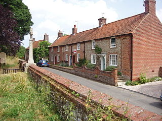
Moor Crichel is a village and former civil parish, now in the parish of Crichel, in East Dorset, England situated on Cranborne Chase five miles east of Blandford Forum. The civil parish includes the hamlet of Manswood notable for a terrace of twelve thatched cottages. Dorset County Council's 2013 estimate of the parish population is 140. In the 2001 census the parish had a population of 180. In the 2011 census the population of Moor Crichel parish combined with the neighbouring parish of Long Crichel was 246. The civil parish was abolished on 1 April 2015 and merged with Long Crichel to form Crichel.

Acton Turville is a parish in the Cotswold Edge ward within South Gloucestershire, England. It lies 17 miles (27 km) east-northeast of Bristol and 93 miles (150 km) due west of London, with the M4 south of the parish. Acton Turville consists of a cluster of households across 1,009 acres, with a total population of 370 people. Acton Turville is also listed as "Achetone" in the Domesday Book.

Binbrook is a village and civil parish in the East Lindsey district of Lincolnshire, England. It is situated on the B1203 road, and 8 miles (13 km) north-east from Market Rasen.

Little Paxton in Cambridgeshire, England is a village and civil parish that lies 5 miles (8.0 km) south of Huntingdon and 1.7 miles (2.7 km) north of St Neots. It is in the district and historic county of Huntingdonshire. Until the 1970s it was a minor village and the church was under threat of closure. The building of a housing estate and a junior school revived its fortunes and the establishment of the Paxton Pits Nature Reserve around part of the nearby gravel pits has brought visitors to the village.

Clowne is a village and civil parish in the Bolsover district of Derbyshire, England. The population was 7,590 at the 2011 Census. It lies 9 miles (14 km) north east of Chesterfield and 7 miles (11 km) south west of Worksop and is mentioned in the Domesday Book as Clune. The name is derived from the Celtic Clun for a river.

Askerswell is a small village and civil parish in the county of Dorset in southwest England. It is sited on the small River Asker. It lies 11 miles (18 km) west of the county town Dorchester. The parish has an area of 1,724 acres and in the northeast includes the western slopes of Eggardon Hill, including part of the Iron Age hill fort close to its summit. In the 2011 census the civil parish had a population of 154.

Broadwell is a village and civil parish in the English county of Gloucestershire. It is about 1.5 miles (2.4 km) north of Stow-on-the-Wold, In the 2001 United Kingdom census, the parish had a population of 384. decreasing to 355 at the 2011 census.

Sheriff Hutton is a village and civil parish in North Yorkshire, England. It lies about 10 miles (16 km) north by north-east of York.
Clutton is a village and civil parish on the eastern edge of the Chew Valley, close to the Cam Brook river, in the Bath and North East Somerset Council area, within the ceremonial county of Somerset, England. The village lies east of the A37 road between Bristol and Shepton Mallet, and west of the A39 between Bath and Wells. It is 9 miles (14 km) from Bristol and Bath, and 11 miles (18 km) from Wells. Close by are the villages of Temple Cloud and High Littleton. The town of Midsomer Norton is 5 miles (8 km) away. The parish, which includes the hamlets of Clutton Hill and Northend, had a population of 1,602 in 2011.

Roughton is a village and civil parish in the East Lindsey district of Lincolnshire, England. The parish population was 644 in 2011.
Great Snoring is a rural village in North Norfolk by the River Stiffkey, in the east of England. It is situated approximately 25 miles (40 km) north-west from the city and county town of Norwich, and 2 miles (3 km) north from the larger village of Little Snoring.

Cove is an ancient village turned suburb, forming the western part of Farnborough, in the Rushmoor district, in the county of Hampshire, England. The appropriate ward is called Cove and Southwood. It is located 33 mi (53 km) south west of London. Cove is adjacent to Hawley village and Southwood.

Mareham le Fen is a village and civil parish about 6 miles (10 km) south from the town of Horncastle, Lincolnshire, England. The hamlet of Mareham Gate lies about 0.5 miles (0.8 km) south from the village, and it is believed that the deserted medieval village (DMV) of Birkwood is situated nearby.

Handley is a village and civil parish in the unitary authority of Cheshire West and Chester and the ceremonial county of Cheshire, England. It is part of the local government ward of Tattenhall, a larger settlement approximately 2 miles (3.2 km) to the east. The hamlet of Milton Green is to the north west of the village. The A41 road, which previously passed through the village now bypasses it, having been re-routed further to the east.

Brinkhill is a village and civil parish in the East Lindsey district of Lincolnshire, England. It is situated approximately 5 miles (8 km) west from the market town of Alford and 7 miles (11 km) north-west from Spilsby, The village lies in the Lincolnshire Wolds, a designated Area of Outstanding Natural Beauty.

Friskney is a village and civil parish within the East Lindsey district of Lincolnshire, England.

Clopton is a village and civil parish in Suffolk. It is located between Ipswich and Debenham two kilometres north of Grundisburgh on the River Lark. The village is no larger than a series of houses either side of the B1078, surrounded by farm land. The village itself has no clear centre; houses and other buildings are concentrated around the four manors of Kingshall, Brendhall, Rousehall and Wascolies, all of which are mentioned in the Domesday Book of 1086.

Toynton St Peter is a village and civil parish in the East Lindsey district of Lincolnshire, England, approximately 2 miles (3 km) south from the town of Spilsby.

