Inglewood, Victoria

Last updated

Inglewood
Victoria
Brooke St Inglewood.JPG
Brooke Street, the town's main street
Australia Victoria Loddon Shire location map.svg
Red pog.svg
Inglewood
Coordinates 36°34′35″S143°52′08″E / 36.57639°S 143.86889°E / -36.57639; 143.86889
Population730 (2016 census) [1]
Established1859
Postcode(s) 3517
Location
LGA(s) Shire of Loddon
State electorate(s) Ripon, Western Victoria
Federal division(s) Mallee

Inglewood is a town in Victoria, Australia, located on the Calder Highway in the Shire of Loddon.

Contents

History

Inglewood, is known as the home of the 'Blue Mallee' Eucalyptus and is the home of Australia's largest Eucalyptus Oil Distillery, Bosisto's. The town was the largest producer of Eucalyptus Oil during the 1900s and is still home to two operating distilleries and the only Eucalyptus Distillery Museum in the country.

Heritage Listed Distillery and Museum Site Old Jones Distillery Inglewood.jpg
Heritage Listed Distillery and Museum Site

Inglewood was an important gold mining centre during the Victorian Gold Rush of the 1850s and 1860s.

Gold was first discovered in 1859 by Alexander, Joseph and Thomas Thompson and Joseph Hanny. On notification of the discovery some 16,000 diggers flocked to the area. By January 1860 a new field a few miles south of the original was opened up by Potter, Irvine and McKean and dubbed "New Inglewood". This is the site of the present township.

By mid-1860 the population on the field was estimated to be greater than 40,000, ranking among the biggest rushes in Victoria's history.

The population soon dwindled as the easily won alluvial deposits became exhausted but, as early as 1859, quartz reefs had been discovered which resulted in the permanent settlement of a few thousand miners and businessmen. [2]

The initial returns from the quartz reefs were significant. From the Columbian, 22 tons of stone crushed gave a return of over 2300 ounces of gold, one of the richest patches of gold recorded in the colony of Victoria. Numerous other reefs, including the Maxwell's, Jersey, March and Morning Star, gained renown for their rich yields. In November 1860 there were 4,500 men employed in quartz mining, more than any other field at that time. [2]

In 1861 the town was proclaimed a municipality and in 1863 the Borough of Inglewood was established. Self-government continued for 100 years until the borough was annexed to the Shire of Korong. [2]

In December 1862 one of the most destructive fires recorded in the colony to that time occurred in the town's main thoroughfare. A greater portion of the commercial precinct was burned to the ground, with damages estimated at over £100,000. The ultimate result of the fire was a transition from bark and canvass establishments to more substantial brick and iron structures, many of which remain today. [2]

Toward the end of the 19th century, gold production began to diminish, and a new form of employment was sought. The eucalyptus oil industry took hold when it was discovered that the leaves of the Blue Mallee, which is endemic to Inglewood and surrounds, produced the highest quality eucalyptus oil available. The most notable distilleries at the time were: The Valvoline Oil Company (of the United States), Bosisto's (still operating), The Taig's Distillery (still operating) and The Old Jones' Distillery which is now home to the Eucalyptus Distillery Museum and has attained an important heritage listing. The Inglewood district still produces the greater portion of Victoria's eucalyptus oil. [2]

Post offices opened at Inglewood on 12 March 1860 and at New Inglewood soon after on 15 May 1860. The Inglewood post office was renamed Old Inglewood around 1865 and closed in 1882. The New Inglewood post office was then renamed Inglewood around 1870. [3]

From 6 December 1861 until 1 February 1961, Inglewood was managed by a borough council.

At the 2011 census Inglewood had a population of 1058 (up from 834 in 2006).

Present

Inglewood is known as the "Blue Eucalyptus" town and is the largest town in the Loddon Shire, with 886 residents according to the 2021 census. It is the main service town for the Loddon Shire with a hospital, chemist, community bank, supermarket and hardware store providing services to its residents in Inglewood and the surrounding towns.

Inglewood's main tourist attraction is the Eucalyptus Distillery Museum which is located on the Calder Hwy on the site of the "Old Jones' Distillery". The site is heritage listed and houses a museum, retail store, coffee bar and model distillery. The eucalyptus oil industry is still a major employer in the region with two commercial distilleries located close by. There are many hectares of Eucalyptus polybractea plantations that the local distilleries use to harvest eucalyptus oil.

Inglewood is a notable example of a Victorian gold rush town, with its 19th-century architecture attracting many visitors. The main street, Brooke Street, is noted for its narrowness and concentration of double-story buildings. No less than seven hotel buildings (two still operating) and four bank buildings are found in Brooke Street. Several buildings were designed by prominent Bendigo architects Vahland and Getzmann, including the Charlie Napier Hotel. Inglewood is also notable for the collection of public and religious buildings located away from the main thoroughfare, unusual for a town of its size. The town hall features a tower and chiming clock.

The town is also gaining a reputation amongst treasure hunters, with at least half a dozen vintage and antique stores operating in Brooke Street.

Gold-seekers still converge on the surrounding bushland in search of gold. Since the million dollar "Hand of Faith" nugget was discovered 11 km west at Kingower in 1980, gold detectors have brought fresh discoveries left behind by the early prospectors. Inglewood forms part of the "Golden Triangle" which encompasses some of the richest alluvial goldfields in the world, including Kingower, Rheola, Dunolly, Tarnagulla and Moliagul, where the biggest gold nugget ever unearthed, the "Welcome Stranger", was discovered.

Quartz mining is also still present, with MG Gold operating the Maxwell's Mine to the north of the township.

Inglewood is the gateway to Kooyoora State Park. Located a short distance west of the town, the park is a popular camping and recreation location and home to Melville's Caves where the bushranger Captain Melville is rumoured to have based himself during the 1850s. Melville caves is a stunning location with a view of the entire region from the lookout.

The town is central to the Bridgewater On Loddon and Kingower wineries, producing quality red and white wines.

The town has an Australian Rules football team, the "Blues", competing in the Loddon Valley Football League. The Inglewood Football Club was formed around 1873 and was a foundation member of the Victorian Football Association (VFA) in 1877.

Golfers play at the course of the Inglewood Golf Club on the Calder Highway. [4]

Notable people

Related Research Articles

<span class="mw-page-title-main">Castlemaine, Victoria</span> City in Victoria, Australia

Castlemaine is a town in Victoria, Australia, in the Goldfields region about 120 kilometres northwest by road from Melbourne and about 40 kilometres from the major provincial centre of Bendigo. It is the administrative and economic centre of the Shire of Mount Alexander. The population at the 2021 Census was 7,506. Castlemaine was named by the chief goldfield commissioner, Captain W. Wright, in honour of his Irish uncle, Viscount Castlemaine.

<span class="mw-page-title-main">Shire of Loddon</span> Local government area in Victoria, Australia

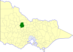
The Shire of Loddon is a local government area in Victoria, Australia, located in the northern part of the state. It covers an area of 6,696 square kilometres (2,585 sq mi) and in 2021 had a population of 7,759.

<span class="mw-page-title-main">Wedderburn, Victoria</span> Town in Victoria, Australia

Wedderburn is a rural town in Victoria, Australia on the Calder Highway, 217 kilometres (135 mi) north of Victoria's capital city, Melbourne. At the 2021 census, Wedderburn had a population of 951. It is mainly a farming community but its early residents were gold miners and prospectors.

<span class="mw-page-title-main">Hamilton, Victoria</span> City in Victoria, Australia

Hamilton is a city in south-western Victoria, Australia, at the intersection of the Glenelg Highway and the Henty Highway. The Hamilton Highway connects it to Geelong.

<span class="mw-page-title-main">Maldon, Victoria</span> Town in Victoria, Australia

Maldon is a town in Victoria, Australia, in the Shire of Mount Alexander local government area. It has been designated "Australia's first notable town" and is notable for its 19th-century appearance, maintained since gold-rush days. At the 2016 census, Maldon had a population of 1,513.

<span class="mw-page-title-main">Loddon River</span> River in Victoria, Australia

The Loddon River, an inland river of the north–central catchment, part of the Murray-Darling basin, is located in the lower Riverina bioregion and Central Highlands and Loddon Mallee regions of the Australian state of Victoria. The headwaters of the Loddon River rise on the northern slopes of the Great Dividing Range east of Daylesford and descend to flow north into the Little Murray River, near Swan Hill. The river is impounded by the Cairn Curran and Laanecoorie reservoirs.

<span class="mw-page-title-main">Kerang</span> Town in Victoria, Australia

Kerang is a town on the Loddon River in northern Victoria in Australia. It is the commercial centre to an irrigation district based on livestock, horticulture, lucerne and grain. It is located 279 kilometres (173 mi) north-west of Melbourne on the Murray Valley Highway a few kilometres north of its intersection with the Loddon Valley Highway, elevation 78 metres (256 ft). At the 2016 census, Kerang had a population of 3,893. Kerang is believed to be an Aboriginal word for Cockatoo. It is home to the largest solar and battery farm in the country which was opened in June 2019. The 50-megawatt battery system is located outside of Kerang and stores 100 per cent renewable energy. The 2,000 solar panels have become a tourist attraction and are drawing many businesses to the town.

<span class="mw-page-title-main">Thomas Hiscock</span>

Thomas Hiscock (1812–1855) was an English blacksmith and prospector who settled in Australia in the 1840s. He is best-remembered today for helping to spark the Victorian Gold Rush with his discovery of gold outside the town of Buninyong, near Ballarat.

<span class="mw-page-title-main">Eucalyptus oil</span> Distilled oil from the leaf of Eucalyptus

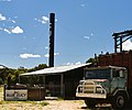
Eucalyptus oil is the generic name for distilled oil from the leaf of Eucalyptus, a genus of the plant family Myrtaceae native to Australia and cultivated worldwide. Eucalyptus oil has a history of wide application, as a pharmaceutical, antiseptic, repellent, flavouring, fragrance and industrial uses. The leaves of selected Eucalyptus species are steam distilled to extract eucalyptus oil.

<span class="mw-page-title-main">Macedon, Victoria</span> Town in Victoria, Australia

Macedon is a town at the foot of Mount Macedon in the Macedon Ranges, between Melbourne and Bendigo in central Victoria. It is administered by the Shire of Macedon Ranges. At the 2016 census Macedon had a population of 2,808. The combined population of Macedon and the nearby larger town of Gisborne was 21,071 at June 2016.

<span class="mw-page-title-main">Marong</span> Town in Victoria, Australia

Marong is a town in Victoria, Australia. At the 2016 census, Marong and the surrounding area had a population of 1,416. It is 17 kilometres (11 mi) to the west of Bendigo. Its local government area is the City of Greater Bendigo. The town is at the junction of the Calder Highway (A79) and the Calder Alternate Highway (A790).

<span class="mw-page-title-main">Bridgewater On Loddon, Victoria</span> Town in Victoria, Australia

Bridgewater On Loddon is a town in north central Victoria, Australia. The town is located on the Calder Highway, north-west of Bendigo, astride the Loddon River. At the 2021 census, Bridgewater On Loddon had a population of 341. The rural area which surrounds Bridgewater on Loddon is named simply "Bridgewater".

<span class="mw-page-title-main">Tarnagulla</span> Town in Victoria, Australia

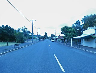
Tarnagulla is a town in central Victoria, Australia. The town is in the Shire of Loddon local government area, 183 kilometres (114 mi) north west of the state capital, Melbourne. At the 2011 census, Tarnagulla had a population of 304. By 2016, the population was 133.

<span class="mw-page-title-main">Shire of Korong</span> Local government area in Victoria, Australia

The Shire of Korong was a local government area about 75 kilometres (47 mi) west-northwest of Bendigo, in western Victoria, Australia. The shire covered an area of 238.5 square kilometres (92.1 sq mi), and existed from 1862 until 1995.

<span class="mw-page-title-main">Shire of Newstead</span> Local government area in Victoria, Australia

The Shire of Newstead was a local government area about 120 kilometres (75 mi) northwest of Melbourne, the state capital of Victoria, Australia. The shire covered an area of 409.22 square kilometres (158.0 sq mi), and existed from 1860 until 1995.

<span class="mw-page-title-main">Campbells Creek, Victoria</span> Town in Victoria, Australia

Campbells Creek is a town in Victoria, Australia.

Kingower is a locality in Victoria, Australia, located on Inglewood-Rheola Road, in the Shire of Loddon.

<span class="mw-page-title-main">Timor, Victoria</span> Town in Victoria, Australia

Timor (/ˈtaɪˈmɔː/), short-speak for the adjoining localities of Bowenvale and Timor, in the Central Goldfields Shire of Victoria, Australia. Their shared boundary is 8 kilometres (5 mi) north of Maryborough, Victoria and 178 kilometres (111 mi) northwest of Melbourne, the state capital.

<span class="mw-page-title-main">Mount Franklin (Victoria)</span> Mountain in Victoria, Australia

Mount Franklin is an extinct volcano about 10 km north of Daylesford and 4.6 km south east of Franklinford in Victoria, Australia. A road spirals round the outside slopes covered with pine trees, into a flat 50 acre caldera, now used as a camping ground, and onto the rim which hosts a fire lookout, parking area and picnic ground.

Rheola is a locality in central Victoria, Australia. At the 2011 census, Rheola and the surrounding area had a population of 316. Originally called the 'Berlin Rush' or 'Berlin field' after gold nuggets were found. It is part of Victoria's 'Golden Triangle,' which contains some of the world's richest gold fields. Some of the gold nuggets found in these fields include the Welcome Stranger, Hand of Faith, and the Blanche Barkly. The Viscount Canterbury, Viscountess Canterbury and Precious were all found in the gold field at Rheola.

References

  1. "2016 Census QuickStats: Inglewood (L) (Vic.)".
  2. 1 2 3 4 5 Inglewood 150 Years of Gold Celebrations 2009, David Rose
  3. Premier Postal History, Post Office List , retrieved 11 April 2008
  4. Golf Select, Inglewood , retrieved 11 May 2009
  5. "The late John Day.To the editor of the Sportsman". Sportsman. 2 November 1885.
  6. Blackburn Abeyasekere, Susan. Blackburn, Maurice McCrae (1880–1944). National Centre of Biography, Australian National University.{{cite book}}: |website= ignored (help)
  7. Thompson, Roger C. Tivey, Edwin (1866–1947). National Centre of Biography, Australian National University.{{cite book}}: |website= ignored (help)
  8. "Maj-General E. Tivey dies at 81". The Argus (Melbourne) . 28 May 1947. p. 7. Retrieved 12 September 2015.

Commons-logo.svg Media related to Inglewood, Victoria at Wikimedia Commons