Rheola, Victoria

Last updated

Rheola
Victoria
Australia Victoria Loddon Shire location map.svg
Red pog.svg
Rheola
Coordinates 36°39′06″S143°41′54″E / 36.65167°S 143.69833°E / -36.65167; 143.69833
Population56 (2016 census) [1]
Postcode(s) 3517
Elevation216 m (709 ft)
Location
LGA(s) Shire of Loddon
State electorate(s) Ripon
Federal division(s) Mallee

Rheola is a locality in central Victoria, Australia. At the 2011 census, Rheola and the surrounding area had a population of 316. [1] Originally called the 'Berlin Rush' or 'Berlin field' after gold nuggets were found. It is part of Victoria's 'Golden Triangle,' [2] which contains some of the world's richest gold fields. Some of the gold nuggets found in these fields include the Welcome Stranger, Hand of Faith, and the Blanche Barkly. The Viscount Canterbury, Viscountess Canterbury and Precious were all found in the gold field at Rheola. [3]

Contents

Nearby locations are the towns of Inglewood (birthplace of Sir Reginald Ansett), Moliagul (birthplace of The Flying Doctors, Reverend John Flynn) and Melville Caves located in the Kooyoora State Park.

The district is known for its annual Easter Monday Charity Carnival which began in 1871. [4]

Location

Rheola is within the Loddon Shire, located 60 kilometers west of Bendigo. Nearby districts include: Kingower, Arnold, Llanelly, Murphys Creek, Moliagul, Logan, Wehla and the Kooyoora State Park. Nearby towns include: Inglewood, Wedderburn, St Arnaud and Dunolly.

History

Rheola, like its neighbouring districts, was founded as gold mining village during the gold rush in the second half of the 19th century. Originally named 'Berlin' (earlier called Byr Lyn or Bervie) the mining village was based near Kangderaar Creek which runs through the area.

The Berlin Post Office was established on 15 February 1869 but was changed to the Rheola Post Office in November 1876 when the town changed its name to Rheola after the town in Wales. [5] The Post Office closed on 19 June 1974. [6]

The 'Berlin Rush' beginnings, August 1868 when Alexander Clelland sank a shallow shaft outside John Catto's Paddock and found a 60 oz nugget at the bottom. The Government rewarded him 100 pounds for the discovery of what he called "Bervie" Gold field. This name was spelled incorrectly and became Berlin in the official register. [7] The Rheola area became famous for its beds of large nuggets scattered through the gullies. [5]

Some of the gold nuggets found during the 19th century include: The Needful found in 1869, Rum Ton found in 1870, Viscount Canterbury found in 1871, Precious found in 1871, Viscountess Canterbury and the Crescent found in 1872. John Catto's Paddock was the location of both the Precious and the Viscount Canterbury. [3] The Precious was Victoria’ fourth largest nugget, weighted at 1,717 ounces. [8]

Easter Monday Charity Carnival

The Rheola Charity Carnival began in 1871. Events at the Charity Carnival include the wood chopping, vintage tractor pull, small stationary engines display, classic cars and ute display, sheep dog trials, clay target shooting, horse riding event, sheaf tossing, "Miss Rheola" Carnival Girl and the Rheola Gift footrace. Money raised during the event goes to local hospitals in Inglewood and Dunolly as well as helping to fund the maintenance of the Hall and grounds where the carnival is held. [9] The event has in recent years had the slogan "Real Country Entertainment since 1871" a prior slogan was "All roads lead to Rheola".

Related Research Articles

<span class="mw-page-title-main">Castlemaine, Victoria</span> City in Victoria, Australia

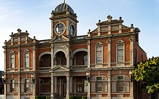
Castlemaine is a town in west central Victoria, Australia, in the Goldfields region about 120 kilometres northwest by road from Melbourne and about 40 kilometres from the major provincial centre of Bendigo. It is the administrative and economic centre of the Shire of Mount Alexander. The population at the 2021 Census was 7,506. Castlemaine was named by the chief goldfield commissioner, Captain W. Wright, in honour of his Irish uncle, Viscount Castlemaine.

<span class="mw-page-title-main">Victorian gold rush</span> Period in the history of Victoria, Australia

The Victorian gold rush was a period in the history of Victoria, Australia, approximately between 1851 and the late 1860s. It led to a period of extreme prosperity for the Australian colony, and an influx of population growth and financial capital for Melbourne, which was dubbed "Marvellous Melbourne" as a result of the procurement of wealth.

<span class="mw-page-title-main">Gold nugget</span> Piece of gold

A gold nugget is a naturally occurring piece of native gold. Watercourses often concentrate nuggets and finer gold in placers. Nuggets are recovered by placer mining, but they are also found in residual deposits where the gold-bearing veins or lodes are weathered. Nuggets are also found in the tailings piles of previous mining operations, especially those left by gold mining dredges.

<span class="mw-page-title-main">Wedderburn, Victoria</span> Town in Victoria, Australia

Wedderburn is a rural town in Victoria, Australia on the Calder Highway, 217 kilometres (135 mi) north of Victoria's capital city, Melbourne. At the 2021 census, Wedderburn had a population of 951. It is mainly a farming community but its early residents were gold miners and prospectors.

<span class="mw-page-title-main">Loddon River</span> River in Victoria, Australia

The Loddon River, an inland river of the north–central catchment, part of the Murray-Darling basin, is located in the lower Riverina bioregion and Central Highlands and Loddon Mallee regions of the Australian state of Victoria. The headwaters of the Loddon River rise on the northern slopes of the Great Dividing Range east of Daylesford and descend to flow north into the Little Murray River, near Swan Hill. The river is impounded by the Cairn Curran and Laanecoorie reservoirs.

<span class="mw-page-title-main">North Central Victoria</span> Region in Victoria, Australia

North Central Victoria is a rural region in the Australian state of Victoria. The region lies to the south of the Victorian/New South Wales border as defined by the Murray River, to the southwest of the Hume region, to the west of the Great Dividing Range contained within the Central Highlands and Victorian Alps, to the north of Greater Melbourne, to the northeast of the Wimmera, and to the east of the Mallee region.

<span class="mw-page-title-main">Kerang</span> Town in Victoria, Australia

Kerang is a town on the Loddon River in northern Victoria in Australia. It is the commercial centre to an irrigation district based on livestock, horticulture, lucerne and grain. It is located 279 kilometres (173 mi) north-west of Melbourne on the Murray Valley Highway a few kilometres north of its intersection with the Loddon Valley Highway, elevation 78 metres (256 ft). At the 2016 census, Kerang had a population of 3,893. Kerang is believed to be an Aboriginal word for Cockatoo. It is home to the largest solar and battery farm in the country which was opened in June 2019. The 50-megawatt battery system is located outside of Kerang and stores 100 per cent renewable energy. The 2,000 solar panels have become a tourist attraction and are drawing many businesses to the town.

<span class="mw-page-title-main">Welcome Stranger</span> Gold nugget found in Victoria, Australia

The Welcome Stranger is the biggest alluvial gold nugget ever discovered, and was unearthed by Cornish miners John Deason and Richard Oates on 5 February 1869, 9 miles north-west of Dunolly, Australia.

<span class="mw-page-title-main">Moliagul</span> Town in Victoria, Australia

Moliagul is a locality in Victoria, Australia, 202 kilometres (126 mi) northwest of Melbourne and 60 kilometres (37 mi) west of Bendigo. The town's name is believed to be a derivation of the aboriginal word "moliagulk", meaning "wooded hill". The area is notable for the discovery of a number of gold nuggets. These finds include the world's largest, the Welcome Stranger, which was discovered in 1869 by John Deason and Richard Oates.

<span class="mw-page-title-main">Dunolly, Victoria</span> Town in Victoria, Australia

Dunolly is a town in Victoria, Australia, located on the Dunolly - Maryborough Road, in the Shire of Central Goldfields. At the 2016 census, Dunolly had a population of 893, down from 969 in 2006.

<span class="mw-page-title-main">Inglewood, Victoria</span> Town in Victoria, Australia

Inglewood is a town in Victoria, Australia, located on the Calder Highway in the Shire of Loddon.

<span class="mw-page-title-main">Eaglehawk, Victoria</span> Town in Victoria, Australia

Eaglehawk is a suburb within the City of Greater Bendigo and a former gold-mining town in Victoria, Australia.

<span class="mw-page-title-main">Tarnagulla</span> Town in Victoria, Australia

Tarnagulla is a town in central Victoria, Australia. The town is in the Shire of Loddon local government area, 183 kilometres (114 mi) north west of the state capital, Melbourne. At the 2011 census, Tarnagulla had a population of 304. By 2016, the population was 133.

<span class="mw-page-title-main">Talbot, Victoria</span> Town in Victoria, Australia

Talbot is a town in Victoria, Australia. At the 2016 census, Talbot had a population of 442.

<span class="mw-page-title-main">Campbells Creek, Victoria</span> Town in Victoria, Australia

Campbells Creek is a town in Victoria, Australia.

Kingower is a locality in Victoria, Australia, located on Inglewood-Rheola Road, in the Shire of Loddon.

Inglewood Football Club is an Australian rules football club based in Inglewood, Victoria. The club is currently affiliated with the Loddon Valley Football League.

<span class="mw-page-title-main">Timor, Victoria</span> Town in Victoria, Australia

Timor (/ˈtaɪˈmɔː/), short-speak for the adjoining localities of Bowenvale and Timor, in the Central Goldfields Shire of Victoria, Australia. Their shared boundary is 8 kilometres (5 mi) north of Maryborough, Victoria and 178 kilometres (111 mi) northwest of Melbourne, the state capital.

<span class="mw-page-title-main">Australian gold rushes</span> Mass movement of Australian workers to places rumored to have gold (1851–1910s)

During the Australian gold rushes, starting in 1851, significant numbers of workers moved from elsewhere in Australia and overseas to where gold had been discovered. Gold had been found several times before, but the colonial government of New South Wales had suppressed the news out of the fear that it would reduce the workforce and destabilise the economy.

<span class="mw-page-title-main">Jim Crow goldfield</span> Nineteenth-century gold mine in Victoria, Australia

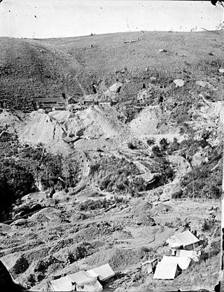
The Jim Crow goldfield was part of the Goldfields region of Victoria, Australia, where gold was mined from the mid- to the late-nineteenth century.

References

  1. 1 2 Australian Bureau of Statistics (31 October 2012). "Rheola (State Suburb)". 2011 Census QuickStats. Retrieved 7 December 2014. OOjs UI icon edit-ltr-progressive.svg
  2. Lodden Shire Council. "www.loddon.vic.gov.au" . Retrieved 13 August 2012.
  3. 1 2 National Library of Victoria. "Catalogue" . Retrieved 14 August 2012.
  4. Bendigo Tourism. "Whats On This Month" . Retrieved 13 August 2012.
  5. 1 2 Gold Fever Prospecting. "History & Methods".
  6. Premier Postal History. "Post Office List" . Retrieved 12 August 2012.
  7. Department of Planning and Community Development. "Kerong Region Sites" (PDF).
  8. Department of Planning and Community Development. "Korong Historical Notes" (PDF). Archived from the original (PDF) on 10 July 2012.
  9. 2012 Rheola Charity Carnival Poster