History
The Kingower goldfield was discovered in August 1853 by Captain John Mechosk and his party of 11 hired men. The discovery resulted in a rush of about 4000 diggers as the field became famous for unearthing monster nuggets.
In August 1857, Robert and James Ambrose and Samuel and Charles Napier discovered the Blanche Barkly nugget, at that time the world's largest gold nugget, weighing in at 1743 ounces. The Blanche Barkly remains the third largest gold nugget ever discovered to this day.
The discovery of the nearby Inglewood goldfield drained Kingower of most of its population in 1859. From then onward, only a small number of diggers continued "working the field," despite large nuggets still being unearthed from time to time.
In 1980, Kevin Hillier was fossicking in the forest behind the old Kingower school house when he came across the 875 ounce 'Hand of Faith' nugget. The nugget was sold to the Golden Nugget Casino in Las Vegas for over US$1 million and remains the largest nugget still in existence in the world today, and the largest ever found with a metal detector.

The Victorian gold rush was a period in the history of Victoria, Australia, approximately between 1851 and the late 1860s. It led to a period of extreme prosperity for the Australian colony and an influx of population growth and financial capital for Melbourne, which was dubbed "Marvellous Melbourne" as a result of the procurement of wealth.

A gold nugget is a naturally occurring piece of native gold. Watercourses often concentrate nuggets and finer gold in placers. Nuggets are recovered by placer mining, but they are also found in residual deposits where the gold-bearing veins or lodes are weathered. Nuggets are also found in the tailings piles of previous mining operations, especially those left by gold mining dredges.

The Welcome Stranger is an alluvial gold nugget which is the biggest ever discovered, and was unearthed by Cornish miners John Deason and Richard Oates on 5 February 1869, 9 miles north-west of Dunolly, Australia.

Dunolly is a town in Victoria, Australia, located on the Dunolly - Maryborough Road, in the Shire of Central Goldfields. At the 2016 census, Dunolly had a population of 893, down from 969 in 2006.

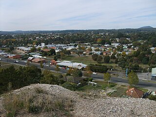
Inglewood is a town in Victoria, Australia, located on the Calder Highway in the Shire of Loddon.

Amherst is a locality situated within the Shire of Central Goldfields in Victoria, Australia. Much of the original township has been destroyed by fire, and little remains other than Amherst Cemetery at 235 Avoca Road, Talbot.
Adelaide Lead is a locality in Victoria, Australia, site of a former settlement, located on Old Avoca Road, south-west of Maryborough, west of the Paddy Ranges State Park, in the Shire of Central Goldfields. Located on the northern slopes of the Central Highlands, 225 metres above sea level, the area is naturally characterised by Box-Ironbark forest. Remnants of aboriginal settlement include rock wells beside the Possum Gully Road.

Talbot is a town in Victoria, Australia. At the 2016 census, Talbot had a population of 442.
Peak Hill is the name of a goldfield, locality and the site of a gold mining ghost town in the Murchison Region of Western Australia. The gold mine covers 2,162 hectares and consists of four open-cut mines, titled: Main, Jubilee, Fiveways and Harmony.

The Goldfields region of Victoria is a region commonly used but typically defined in both historical geography and tourism geography. The region is also known as the Victorian Golden Triangle.
Canadian is a residential suburb in Ballarat, Victoria, located 3km south-east of Ballarat Central. At the 2021 census, Canadian had a population of 4,098.

Blanche Cave, previously known as "The Big Cave", "The Old Cave" and "Mosquito Plains Cave", is one of 26 caves to be found in the Naracoorte Caves National Park, a World Heritage listed site. Blanche Cave was the first of the caves to be discovered in the Naracoorte area, having been found by European settlers in 1845, and can be accessed by the public through guided tours of the site. The cave contains a number of features, including, at one time, the mummified remains of an indigenous man – remains that were stolen twice in 1861 and never returned. The location has been the site for a number of events, such as, in the early days, annual New Years parties and, much more recently, it was featured as part of the Olympic torch relay for the 2000 Summer Olympics in Sydney. Blanche Cave, along with the nearby Victoria Fossil Cave, was added to the South Australian Heritage Register in 1984.

Gold mining in Western Australia is the third largest commodity sector in Western Australia (WA), behind iron ore and LNG, with a value of A$17 billion in 2021–22. The 6.9 million troy ounces sold during this time period was the highest amount in 20 years and accounted for almost 70 percent of all gold sold in Australia.

The Welcome Nugget was a large gold nugget, weighing 2,217 troy ounces 16 pennyweight. (68.98 kg), that was discovered by a group of twenty-two Cornish miners at the Red Hill Mining Company site at Bakery Hill in Ballarat, Victoria, Australia, on 9 June 1858. It was located in the roof of a tunnel 55 metres underground. Shaped roughly like a horse's head, it measured around 49 cm (19 in) long by 15 cm (5.9 in) wide and 15 cm (5.9 in) high, and had a roughly indented surface. It was assayed by William Birkmyre of the Port Phillip Gold Company and given its name by finder Richard Jeffery. Eclipsed by the discovery of the larger Welcome Stranger eleven years later in 1869, it remains the second largest gold nugget ever found.

Widgiemooltha is an abandoned town in Western Australia 631 kilometres (392 mi) east of Perth, Western Australia between Kambalda and Norseman in the Goldfields-Esperance region of Western Australia. It is found on the southern shoreline of Lake Lefroy.

During the Australian gold rushes, starting in 1851, significant numbers of workers moved from elsewhere in Australia and overseas to where gold had been discovered. Gold had been found several times before, but the colonial government of New South Wales had suppressed the news out of the fear that it would reduce the workforce and destabilise the economy.
Rheola is a locality in central Victoria, Australia. At the 2011 census, Rheola and the surrounding area had a population of 316. Originally called the 'Berlin Rush' or 'Berlin field' after gold nuggets were found. It is part of Victoria's 'Golden Triangle,' which contains some of the world's richest gold fields. Some of the gold nuggets found in these fields include the Welcome Stranger, Hand of Faith, and the Blanche Barkly. The Viscount Canterbury, Viscountess Canterbury and Precious were all found in the gold field at Rheola.

New South Wales experienced the first gold rush in Australia, a period generally accepted to lie between 1851 and 1880. This period in the history of New South Wales resulted in a rapid growth in the population and significant boost to the economy of the colony of New South Wales. The California Gold Rush three years prior signaled the impacts on society that gold fever would produce, both positive and negative. The New South Wales colonial government concealed the early discoveries, but various factors changed the policy.

Wenlock Goldfield is a heritage-listed mine in Archer River, Shire of Cook, Queensland, Australia. It was built from 1892 to 1950s. It is also known as Batavia Goldfield and Lower Camp (Wenlock). It was added to the Queensland Heritage Register on 3 March 2006.
The Blanche Barkly was a gold nugget found in Kingower, Victoria, named for the daughter of the governor of the colony at the time. Weighing 1743 oz (49.4 kg), it was discovered on August 27, 1857 at a depth of 13 feet by Samuel & Charles Napier and Robert & James Ambrose. It was, at the time, the largest gold nugget ever discovered and remains the third-largest discovered. The nugget measured 2'4" (71 cm) long, 10" (25 cm) wide and varied from 1" to 2" in thickness and was valued at between £8,000 and £10,000 at the time of its discovery. Sam Napier reported that it was taken to England and displayed at The Crystal Palace, that the British Museum made a replica, and that it was ultimately bought by the Bank of England for around £12,000 and melted down to make around 10000 sovereigns.

