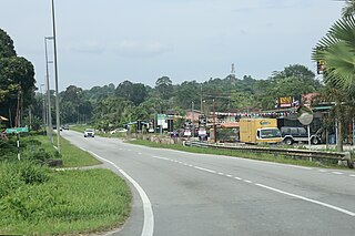
Kampong Belimbing

Last updated

Belimbing
Kampong Belimbing
Kampong Belimbing 03.jpg
Jalan Subok
Motto(s): 
Hidup berkampung, bermasyarakat, bernegara, pupuk muafakat membawa berkat, hidup sejahtera
Brunei location map.svg
Red pog.svg
Location in Brunei
Coordinates: 4°54′46″N114°59′00″E / 4.9129°N 114.9833°E / 4.9129; 114.9833
Country Brunei
District Brunei-Muara
Mukim Kota Batu
Population
 (2016) [1]
  Total2,721
Time zone UTC+8 (BNT)
Postcode
BD2917

Kampong Belimbing (Malay : Kampung Belimbing) or silly known as Belimbing, is a village in Brunei-Muara District, Brunei. It is also a neighbourhood in the capital Bandar Seri Begawan.[ citation needed ] The population was 2,721 in 2016. [1] It is one of the villages within Mukim Kota Batu. The postcode is BD2917. [2]

Contents

With the motto 'Hidup berkampung, bermasyarakat, bernegara, pupuk muafakat membawa berkat, hidup sejahtera' (Life as a village, a community, a nation, the fertilizer of consensus brings blessings, a prosperous life), the village continues to thrive with the vision of 'Keluarga riang, masyarakat cemerlang, kampung terbilang' (Joyful families, excellent communities, distinguished villages) and its mission 'Sentiasa bersiap siaga dalam mendepani berbagai cabaran ke arah kesempurnaan masyarakat' (Always be ready to face various challenges towards the perfection of society). Maju Kampungku, Kampung Belimbing is the village anthem. [3]

Name

Belimbing (Averrhoa bilimbi) is a large tree with a girth of about four pemalums, this fruit is light brown like a tampoi fruit and is similar in shape to a belimbing buluh and is twisted around it. The tree is very odd because it is scaly, where at one time in the past, in a village only one tree grew, making the villagers agree to name the village as 'Kampung Belimbing'. [3]

Geography

Kampong Belimbing is a village contained in Mukim Kota Batu. This village is included in the Bandar Seri Begawan area and is located 5.5 kilometers from the city. To visit this village, we can go through Jalan Subok and also Jalan Kebangsaan/Sungai Akar. This village is bordered by Kampong Sungai Akar in the North, Kampong Sungai Belukut, Kampong Serdang and Kampong Sungai Matan in the East, while Kampong Subok in the South. [3]

Economy

Kampong Belimbing hasn't had a distinct product under the One Village, One Product (1K1P) initiative. Awang Haji Gapor claims that Kampung Belimbing is persistent in its efforts to promote the goods made by the people and draw attention to them. The locals also develop handicrafts, weaving, top-making, kelulut honey, and other things. Products that garnered positive feedback from both locals and visitors were shown in expos organized by the District Department of the Ministry of Home Affairs in addition to being put in a number of specified places. [3]

Infrastructure

Tasik Sarubing Recreational Park Tasik Sarubing Recreational Park 2023 08.jpg
Tasik Sarubing Recreational Park

Kampong Belimbing, like other villages in the country, is not left behind in receiving basic facilities provided by the government such as mosques, roads, water and electricity supplies and telephones. [3]

Recreation

Bukit Markuching Recreational Park is located on Jalan Subok. Earliest settlers found that the quickest way to get to the Berakas or Bandar region was to cross the Bukit Markuching. The people would go up and bring food with them because the journey up and down the hill would take a while. Therefore, they often eat the snacks they brought with them when taking breaks. Several wild cats who resided in the hill were drawn by leftovers that are often thrown away. Kuching became Bukit Markuching as a result. [4]

Tasik Sarubing Recreational Park is a lake with wooden walkways, and shaded huts. The park also serves as an endpoint to a 2-hour hiking trail connected to Tasek Lama. [5] Tasik Sarubing was inaugurated by the Minister of Home Affairs, Pehin Udana Khatib Dato Paduka Seri Setia Ustaz Awang Haji Badaruddin on 14 January 2011. It is located in front of Kampung Belimbing Clinic, covering an area of 15 acres and having a jogging path of 450 meters. The jogging track between Bukit Markucing Recreation Park and Tasik Sarubing Recreation Park has been put together with a distance of four tenths of seven kilometers (round trip). This jogging track has also been penetrated from Taman Riadah Tasik Sarubing to Taman Tasek Lama with a distance of approximately eight to nine kilometers. [3]

Related Research Articles

<span class="mw-page-title-main">Bandar Baharu District</span> District of Malaysia in Kedah

The Bandar Baharu District is a town, district and state assembly constituency at the southernmost end of Kedah, Malaysia. Bandar Baharu is located along the Kedah-Penang–Perak border tripoint, 37 km (23 mi) southeast of George Town, Penang's capital city.

<span class="mw-page-title-main">Mukim Kilanas</span> Mukim of Brunei

Mukim Kilanas is a mukim in Brunei-Muara District, Brunei. The population was 22,492 in 2016.

<span class="mw-page-title-main">Mukim Kota Batu</span> Mukim of Brunei

Mukim Kota Batu is a mukim in Brunei-Muara District, Brunei. The population was 12,935 in 2016. The mukim is home to some of the country's museums and historical sites, in particular in Kota Batu.

<span class="mw-page-title-main">Mukim Tamoi</span> Mukim of Brunei

Mukim Tamoi is a mukim in Brunei-Muara District, Brunei. It is part of Kampong Ayer, the traditional stilt settlements on the Brunei River in the country's capital Bandar Seri Begawan. The population was 1,389 in 2016.

<span class="mw-page-title-main">Mukim Bangar</span> Mukim of Brunei

Mukim Bangar is a mukim in Temburong District, Brunei. It has a total area of 113 square kilometres (44 sq mi); the population was 2,112 in 2021. The mukim encompasses Bangar, the district's sole town and administrative centre.

<span class="mw-page-title-main">Kampong Keriam</span> Village in Brunei

Kampong Keriam is a village in Tutong District, Brunei, about 6 kilometres (3.7 mi) from the district town Pekan Tutong. The population was 2,195 in 2016. It is one of the villages within Mukim Keriam, a mukim in the district.

<span class="mw-page-title-main">Kampong Mentiri</span> Village in Brunei

Kampong Mentiri or simply known as Mentiri, is a village in the north-east of Brunei-Muara District, Brunei. It has an area of 322.29 hectares ; the population was 1,215 in 2016.

<span class="mw-page-title-main">Kampong Kapok</span> Village in Brunei

Kampong Kapok is a village in the north-east of Brunei-Muara District, Brunei and has an area of 1,241.01 hectares ; the population was 2,791 in 2016.

<span class="mw-page-title-main">Kampong Kiulap</span> Village in Brunei-Muara, Brunei

Kampong Kiulap or commonly known as Kiulap, is a village in Brunei-Muara District, Brunei, as well as a neighbourhood and commercial area in the capital Bandar Seri Begawan. It has an area of 176.53 hectares ; the population was 3,400 in 2016. It is one of the villages within Mukim Gadong 'B'. The postcode is BE1518.

<span class="mw-page-title-main">Kampong Kiarong</span> Village in Brunei

Kampong Kiarong or commonly known as Kiarong, is a village in Brunei-Muara District, Brunei, as well as a neighbourhood in the country's capital Bandar Seri Begawan. It has an area of 383.43 hectares ; the population was 4,530 in 2016.

<span class="mw-page-title-main">Kampong Sungai Akar</span> Village and neighbourhood in Brunei

Kampong Sungai Akar or commonly known as Sungai Akar, is a village in Brunei-Muara District, Brunei, as well as a neighbourhood in the capital Bandar Seri Begawan. The population was 5,467 in 2016.

<span class="mw-page-title-main">Kampong Menglait</span> Village in Brunei-Muara, Brunei

Kampong Menglait or simply known as Menglait, is a village in Brunei-Muara District, Brunei, as well as a neighbourhood and commercial area in the capital Bandar Seri Begawan. The population was 2,262 in 2016. It is one of the villages within Mukim Gadong 'B'. The postcode is BE3919.

<span class="mw-page-title-main">Kampong Pengiran Siraja Muda Delima Satu</span> Village in Brunei-Muara, Brunei

Kampong Pengiran Siraja Muda Delima Satu is a village in Brunei-Muara District, Brunei, and a neighbourhood in the capital Bandar Seri Begawan. The population was 2,354 in 2016. It is one of the villages within Mukim Berakas 'A'. The postcode is BB5113.

<span class="mw-page-title-main">Kampong Tasek Meradun</span> Village in Brunei

Kampong Tasek Meradun or simply known as Tasek Meradun, is a village in Brunei-Muara District, Brunei, as well as a neighbourhood in the capital Bandar Seri Begawan. The population was 400 in 2016. It is one of the villages within Mukim Kilanas. The postcode is BF1520.

<span class="mw-page-title-main">Kampong Limau Manis</span> Village in Brunei

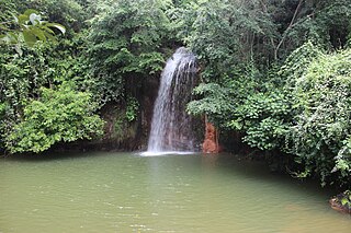
Kampong Limau Manis is a village in the south-west of Brunei-Muara District, Brunei. The population was 1,097 in 2016. It is one of the villages within Mukim Pengkalan Batu, a mukim in the district. It is home to an important archaeological site in the country, dating back to the 10th century AD. Their primary economic activities were agriculture and collecting forest products.

<span class="mw-page-title-main">Kampong Sungai Besar</span> Village in Brunei-Muara, Brunei

Kampong Sungai Besar or commonly known as Sungai Besar, is a village in the east of Brunei-Muara District, Brunei, near the mouth of the Brunei River with the Brunei Bay. The population was 2,039 in 2016.

<span class="mw-page-title-main">Kampong Sungai Matan</span> Village in Brunei

Kampong Sungai Matan or simply known as Sungai Matan, is a village in Brunei-Muara District, Brunei. It has an area of 0.36 square kilometres ; the population was 356 in 2016. It is one of the villages within Mukim Kota Batu. The postcode is BD1917. It is a cultural village in this country that is run by members of the Majlis Perundingan Kampung (MPK) with a focus on helping to advance programs and the villagers in matters of tourism and the economy.

<span class="mw-page-title-main">Kampong Bolkiah</span> Neighbourhood in Kampong Ayer, Brunei

Kampong Bolkiah is a village and housing estate in Kampong Ayer, the traditional riverine settlement in Bandar Seri Begawan, the capital of Brunei. The total population was 2,143 in 2016.

<span class="mw-page-title-main">Kampong Tasek Lama</span> Village in Brunei

Tasek Lama, also known as Kampong Tasek Lama is a neighbourhood in Brunei-Muara District, Brunei, as well as the capital Bandar Seri Begawan. The population was 827 in 2016. It is one of the villages within Mukim Kianggeh. The postcode is BA1611.

References

  1. 1 2 "Population and Housing Census Update Final Report 2016" (PDF). www.deps.gov.bn. Department of Statistics. December 2018. Retrieved 27 July 2021.
  2. "Buku Poskod Edisi Kedua (Kemaskini 26 Disember 2018)" (PDF). post.gov.bn (in Malay). Brunei Postal Services Department. 26 December 2018. Retrieved 27 July 2021.
  3. 1 2 3 4 5 6 KOMPILASI RENCANA KNK 2017 (PDF) (in Malay). Kenali Negera Kitani. 2017. pp. 3–9.
  4. "Animals in Brunei Place Names". Animals in Brunei Place Names. Retrieved 11 July 2023.
  5. activ8bn. "Tasek Sarubing". Brunei Tourism. Retrieved 11 July 2023.{{cite web}}: CS1 maint: numeric names: authors list (link)