Kokotungo, Queensland

Last updated

Kokotungo
Queensland
Australia Queensland location map.svg
Red pog.svg
Kokotungo
Coordinates 24°06′26″S149°57′00″E / 24.1072°S 149.95°E / -24.1072; 149.95 (Kokotungo (centre of locality))
Population89 (2021 census) [1]
 • Density0.1139/km2 (0.2950/sq mi)
Postcode(s) 4702
Area781.4 km2 (301.7 sq mi)
Time zone AEST (UTC+10:00)
LGA(s) Shire of Banana
State electorate(s) Callide
Federal division(s) Flynn
Suburbs around Kokotungo:
Barnard Gainsford Dumpy Creek
Alberta Kokotungo Goovigen
Baralaba Banana Woolein

Kokotungo is a rural locality in the Shire of Banana, Queensland, Australia. [2] In the 2021 census, Kokotungo had a population of 89 people. [1]

Contents

Geography

The Dawson Valley (Theodore) railway line passes through the locality from the east (Goovigen) and travels slightly south-west across the locality passing through the three railway stations: [3]

before exiting to the south-west (Baralaba). [3] The railway line has now closed and the stations are abandoned. [4]

History

Kokotungo is an Aboriginal name for a local hill. [2]

Kokotungo State School opened on 6 November 1939 and closed on 27 January 1969. [5]

Demographics

In the 2016 census Kokotungo had a population of 100 people. [6]

In the 2021 census, Kokotungo had a population of 89 people. [1]

Notable residents

Notable people born in or near Kokotungo include:

Related Research Articles

<span class="mw-page-title-main">Marlborough, Queensland</span> Town in Queensland, Australia

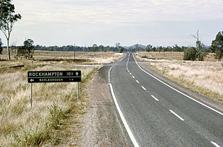
Marlborough is a rural town and coastal locality in the Livingstone Shire, Queensland, Australia. In the 2016 census, the locality of Marlborough had a population of 149 people.

<span class="mw-page-title-main">Banana, Queensland</span> Town in Queensland, Australia

Banana is a rural town and locality in the Shire of Banana, Queensland, Australia. In the 2016 census, the locality of Banana had a population of 356 people.

<span class="mw-page-title-main">Baralaba, Queensland</span> Town in Queensland, Australia

Baralaba is a rural town and locality in the Shire of Banana in central Queensland, Australia. In the 2016 census, Baralaba had a population of 314 people.

<span class="mw-page-title-main">Calen, Queensland</span> Town in Queensland, Australia

Calen is a rural town and coastal locality in the Mackay Region, Queensland, Australia. In the 2016 census, the locality of Calen had a population of 390 people.

<span class="mw-page-title-main">Dululu</span> Town in Queensland, Australia

Dululu is a rural town and locality in the Shire of Banana, Queensland, Australia. In the 2021 census, the locality of Dululu had a population of 97 people.

<span class="mw-page-title-main">Thangool</span> Town in Queensland, Australia

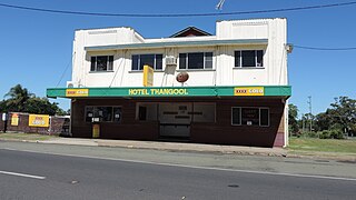
Thangool is a rural town and locality in the Shire of Banana, Queensland, Australia. In the 2016 census, the locality of Thangool had a population of 741 people.

<span class="mw-page-title-main">Goovigen</span> Town in Queensland, Australia

Goovigen is a rural town and locality in the Shire of Banana, Queensland, Australia. In the 2016 census, the locality of Goovigen had a population of 215 people.

<span class="mw-page-title-main">Wowan, Queensland</span> Town in Queensland, Australia

Wowan is a rural town and locality in the Shire of Banana, Queensland, Australia. In the 2016 census, the locality of Wowan had a population of 216 people.

<span class="mw-page-title-main">Jambin, Queensland</span> Town in Queensland, Australia

Jambin is a rural town and locality in the Shire of Banana, Queensland, Australia. In the 2021 census, the locality of Jambin had a population of 207 people.

<span class="mw-page-title-main">Macalister, Queensland</span> Town in Queensland, Australia

Macalister is a rural town and locality in the Western Downs Region, Queensland, Australia. In the 2016 census, the locality of Macalister had a population of 153.

<span class="mw-page-title-main">Mount Murchison, Queensland</span> Suburb of Shire of Banana, Queensland, Australia

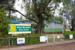
Mount Murchison is a rural locality in the Shire of Banana, Queensland, Australia.

Callide is a rural town and locality in the Shire of Banana, Queensland, Australia. In the 2016 census, the locality of Callide had a population of 86 people.

<span class="mw-page-title-main">Lawgi Dawes</span> Suburb of Shire of Banana, Queensland, Australia

Lawgi Dawes is a rural locality in the Shire of Banana, Queensland, Australia. It contains the neighbourhood of Lawgi, a former town.

Ulogie is a rural locality in the Shire of Banana, Queensland, Australia. In the 2021 census, Ulogie had a population of 31 people.

Dakenba is a rural locality in the Shire of Banana, Queensland, Australia. In the 2021 census, Dakenba had a population of 127 people.

Alberta is a rural locality in the Shire of Banana, Queensland, Australia. In the 2021 census, Alberta had a population of 36 people.

Orange Creek is a rural locality in the Shire of Banana, Queensland, Australia. In the 2021 census, Orange Creek had a population of 197 people.

<span class="mw-page-title-main">Kianga, Queensland</span> Suburb of Shire of Banana, Queensland, Australia

Kianga is a rural locality in the Shire of Banana, Queensland, Australia. In the 2021 census, Kianga had a population of 219 people.

Kinnoul is a rural locality in the Shire of Banana, Queensland, Australia. In the 2021 census, Kinnoul had a population of 80 people.

Kunwarara is a rural locality in the Livingstone Shire, Queensland, Australia. In the 2021 census, Kunwarara had a population of 69 people.

References

  1. 1 2 3 Australian Bureau of Statistics (28 June 2022). "Kokotungo (SAL)". 2021 Census QuickStats. Retrieved 28 February 2023. OOjs UI icon edit-ltr-progressive.svg
  2. 1 2 "Kokotungo – locality in Shire of Banana (entry 49562)". Queensland Place Names. Queensland Government . Retrieved 26 December 2020.
  3. 1 2 "Queensland Globe". State of Queensland . Retrieved 4 January 2021.
  4. 1 2 3 4 "Railway stations and sidings - Queensland". Queensland Open Data. Queensland Government. 2 October 2020. Archived from the original on 5 October 2020. Retrieved 5 October 2020.
  5. Queensland Family History Society (2010), Queensland schools past and present (Version 1.01 ed.), Queensland Family History Society, ISBN   978-1-921171-26-0
  6. Australian Bureau of Statistics (27 June 2017). "Kokotungo (SSC)". 2016 Census QuickStats. Retrieved 20 October 2018. OOjs UI icon edit-ltr-progressive.svg