
Westwood is a town in the Rockhampton Region and a locality split between the Rockhampton Region and the Shire of Banana in Queensland, Australia. It was the first town that was gazetted by the Queensland Government. In the 2016 census, Westwood had a population of 174 people.

Baralaba is a rural town and locality in the Shire of Banana in central Queensland, Australia. In the 2016 census, Baralaba had a population of 314 people.
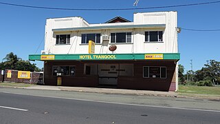
Thangool is a rural town and locality in the Shire of Banana, Queensland, Australia. In the 2016 census the locality of Thangool had a population of 741 people.
Goovigen is a town and a locality in the Shire of Banana, Queensland, Australia.
Wowan is a rural town and locality in the Shire of Banana, Queensland, Australia. The town of Deeford is also within the locality. In the 2016 census, the locality of Wowan had a population of 216 people.

Jambin is a rural town and locality in the Shire of Banana, Queensland, Australia.
Kokotungo is a rural locality in the Shire of Banana, Queensland, Australia. In the 2016 census Kokotungo had a population of 100 people.
Woolein is a rural locality in the Shire of Banana, Queensland, Australia. In the 2016 census, Woolein had a population of 7 people.

Lawgi Dawes is a rural locality in the Shire of Banana, Queensland, Australia. In the 2016 census Lawgi Dawes had a population of 144 people. It contains the neighbourhood of Lawgi, a former town.
Dumpy Creek is a rural locality in the Shire of Banana, Queensland, Australia. In the 2016 census Dumpy Creek had a population of 11 people.
Dakenba is a locality in the Shire of Banana, Queensland, Australia. In the 2016 census, Dakenba had a population of 116 people.
Alberta is a rural locality in the Shire of Banana, Queensland, Australia. In the 2016 census, Alberta had a population of 69 people.
Dumgree is a rural locality in the Shire of Banana, Queensland, Australia. In the 2016 census, Dumgree had a population of 55 people.
Kianga is a rural locality in the Shire of Banana, Queensland, Australia. In the 2016 census, Kianga had a population of 227 people.
Roundstone is a rural locality in the Shire of Banana, Queensland, Australia. In the 2016 census, Roundstone had a population of 43 people.
Coorada is a rural locality in the Shire of Banana, Queensland, Australia. In the 2016 census, Coorada had a population of 6 people.
Ghinghinda is a rural locality in the Shire of Banana, Queensland, Australia. In the 2016 census, Ghinghinda had a population of 36 people.
Gwambegwine is a rural locality in the Shire of Banana, Queensland, Australia. In the 2016 census, Gwambegwine had a population of 20 people.
Baroondah is a rural locality in the Shire of Banana, Queensland, Australia. In the 2016 census, Baroondah had a population of 4 people.
Tarramba is a rural locality in the Shire of Banana, Queensland, Australia. In the 2016 census, Tarramba had a population of 57 people.
