Lacey's Spring, Alabama | |
|---|---|
 Lacey's Spring  Lacey's Spring | |
| Coordinates: 34°32′03″N86°36′15″W / 34.53417°N 86.60417°W | |
| Country | United States |
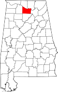
| State | Alabama |
| County | Morgan |
| Elevation | 709 ft (216 m) |
| Time zone | UTC-6 (Central (CST)) |
| • Summer (DST) | UTC-5 (CDT) |
| ZIP code | 35754 |
| Area code | 256 |
| GNIS feature ID | 151973 [1] |
Lacey's Spring is an unincorporated community in northeastern Morgan County, Alabama, United States at the base of Brindlee Mountain. It is included in the Decatur Metropolitan Area, as well as the Huntsville-Decatur Combined Statistical Area. It is located south of Huntsville's land within Morgan County. [2]
The community was established by three Virginia-born brothers, Hopkins, John, and Theophilus Lacy. The community took on their name and became the site for a U.S. post office in February 1831. "Lacy's Spring" became "Lacey's Spring" when the postal seal furnished by Washington officials mistakenly inserted an "e" into the name. [3]