The National Natural Landmarks (NNLs) in Illinois include 18 of the almost 600 such landmarks in the United States. They cover areas of geological, biological and historical importance, and include lakes, bogs, canyons and forests. Several of the sites provide habitat for rare or endangered plant and animal species. The landmarks are located in 13 of the state's 102 counties. Five counties each contain all or part of two or more NNLs, while one landmark is split between two counties. The first designation, Forest of the Wabash, was made in 1965, while the most recent designation, Markham Prairie, was made in 1987.[1] Natural Landmarks in Illinois range from 53 to 6,500 acres (21.4 to 2,630.5ha; 0.1 to 10.2sqmi) in size. Owners include private individuals or organizations, and several county, state and federal agencies.[2]
The National Natural Landmarks Program is administered by the National Park Service, a branch of the Department of the Interior. The National Park Service determines which properties meet NNL criteria and, after notifying the owners, makes nomination recommendations. The Secretary of the Interior reviews nominations and, based on a set of predetermined criteria, makes a decision on NNL designation or a determination of eligibility for designation. Both public and privately owned properties can be designated as NNLs. Owners may object to the nomination of the property as a NNL.[3] This designation provides indirect, partial protection of the historic integrity of the properties via tax incentives, grants, monitoring of threats, and other means.[4]
Contains a now-rare example of the ecosystems in Illinois stream valleys, with bottomland and upland forests in minimally disturbed condition. Part of Robert Allerton Park.
Part of the Shawnee National Forest, Bell Smith Springs contains excellent examples of sharply dissected sandstone substrates and their associated ecosystems. Stream erosion and mass wasting have created landform examples representative of the area.
Part of Beall Woods State Park, the site includes minimally disturbed bottom- and up-land forests along the Wabash River, including a major example of the region's remaining oak-hickory forest.
Transitional site between oak-hickory forest prevalent in the region and the western edge of the eastern mesophytic association. A now-rare example of the area's virgin forests.
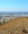
The site is a part of Illinois Beach State Park, and contains a wide range of savanna, prairie, wetland and beach ecosystems, as well as numerous endangered species.
Part of the Shawnee National Forest, the Ecological Area provides habitat for diverse vegetation, representing plants from throughout the state, including 40 rare species.
A large box canyon with vertical overhanging walls, containing a wide range of ecosystems, including sandstone, oak-hickory forest and prairie. The area is known for its wide range of snakes that hibernate in its seasonal habitats. Located in Shawnee National Forest.
The swamp is a remnant fragment of a once-extensive ecosystem, providing habitat for large trees, including three that hold the records for the largest of their respective species.
The largest high quality undisturbed prairie in the state and one of the largest in the area, Markham is a remaining fragment of a once-widespread ecosystem. Containing a mixture of sand prairie and tallgrass prairie, it also includes an undeveloped lakebed and beach ridges.
Contains cliffs, caves, and valleys illustrative of palisades topography, as well as extensive animal and plant habitat. Located in an eponymous state park.
The National Natural Landmarks (NNL) Program recognizes and encourages the conservation of outstanding examples of the natural history of the United States. It is the only national natural areas program that identifies and recognizes the best examples of biological and geological features in both public and private ownership. The program was established on May 18, 1962, by United States Secretary of the Interior Stewart Udall.
This is a list of properties and districts in Illinois that are on the National Register of Historic Places. There are over 1,900 in total. Of these, 85 are National Historic Landmarks. There are listings in all of the state's 102 counties. This National Park Service list is complete through NPS recent listings posted April 12, 2024.
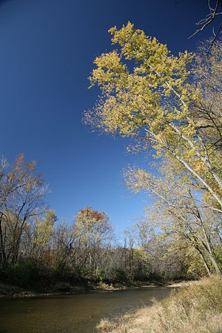
The Middle Fork of the Vermilion River is a tributary of the Vermilion River in Illinois. The Middle Fork rises in Ford County and flows southeast to join the Vermilion near Danville.
This is a list of the National Register of Historic Places listings in Morrison County, Minnesota. It is intended to be a complete list of the properties and districts on the National Register of Historic Places in Morrison County, Minnesota, United States. The locations of National Register properties and districts for which the latitude and longitude coordinates are included below, may be seen in an online map.
This is a list of the National Register of Historic Places listings in Cass County, Minnesota. It is intended to be a complete list of the properties and districts on the National Register of Historic Places in Cass County, Minnesota, United States. The locations of National Register properties and districts for which the latitude and longitude coordinates are included below, may be seen in an online map.
This is a list of the National Register of Historic Places listings in Gallatin County, Illinois.
This page is based on this Wikipedia article Text is available under the CC BY-SA 4.0 license; additional terms may apply. Images, videos and audio are available under their respective licenses.