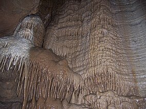
A cave or cavern is a natural void in the ground, specifically a space large enough for a human to enter. Caves often form by the weathering of rock and often extend deep underground. The word cave can refer to smaller openings such as sea caves, rock shelters, and grottos, that extend a relatively short distance into the rock and they are called exogene caves. Caves which extend further underground than the opening is wide are called endogene caves.

Mammoth Cave National Park is a national park in south-central Kentucky, encompassing portions of Mammoth Cave, the longest cave system known in the world. The park's 52,830 acres (21,380 ha) are located primarily in Edmonson County, with small areas extending eastward into Hart and Barren counties. The Green River runs through the park, with a tributary called the Nolin River feeding into the Green just inside the park.

The Natural Bridge Caverns are the largest commercial caverns in the US state of Texas. The name is derived from the 60-foot (18 m) natural limestone slab bridge that spans the amphitheater setting of the cavern's entrance. The span was left suspended when a sinkhole collapsed below it.

Maquoketa Caves State Park is a state park of Iowa, United States, located in Jackson County. It stands northwest of the city of Maquoketa. In 1991 111 acres (45 ha) on the east side of the park were listed as a historic district on the National Register of Historic Places.

Florida Caverns State Park is a state park of Florida in the United States, part of the Florida State Parks system. It is located in the Florida Panhandle near Marianna. It is the only Florida state park with air-filled caves accessible to the public.
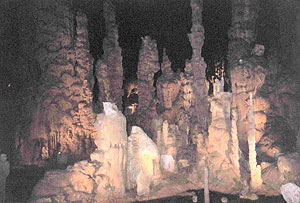
Cathedral Caverns State Park is a public recreation area and natural history preserve located in Kennamer Cove, Alabama, approximately 5 miles (8.0 km) northeast of Grant and 7 miles (11 km) southeast of Woodville in Marshall County. The park, first known as Bats Cave, was developed as a tourist attraction in the 1950s. Cathedral Caverns was declared a National Natural Landmark in 1972 and opened as a state park in 2000.
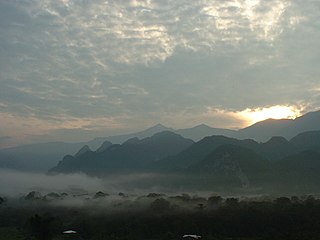
The Gunung Mulu National Park is a national park in Miri Division, Sarawak, Malaysia. It is a UNESCO World Heritage Site that encompasses caves and karst formations in a mountainous equatorial rainforest setting. The park is famous for its caves and the expeditions that have been mounted to explore them and their surrounding rainforest, most notably the Royal Geographical Society Expedition of 1977–1978, which saw over 100 scientists in the field for 15 months. This initiated a series of over 20 expeditions now named the Mulu Caves Project.

Bluespring Caverns is a cave system located in Lawrence County, Indiana, approximately 80 miles (128 km) south of Indianapolis. The cave system is a karst and river type cave formation and drains a 15 miles² (38.8 km²) sinkhole plain. The cave contains 21 miles (34 km) of surveyed passages and is most notable for having the longest known subterranean river in the United States with approximately 3 miles (4.8 km) of navigable river.
Buckner Cave is located in the karst topography of the Crawford Upland in Monroe County, Indiana, United States just outside Bloomington. The cave contains approximately 3 miles of known passage. It is managed by the Richard Blenz Nature Conservancy (RBNC) and resides in privately owned property. Over the years, the cave has been heavily vandalized with spray paint and trashed out from garbage including; food wrappers, broken bottles, empty beer cans, and spent calcium carbonate from carbide lamps. There is an ongoing effort to restore the cave to its natural state.

Black Chasm Cavern is a cave in the hamlet of Volcano in Amador County, California.
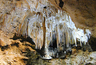
Carlsbad Caverns National Park is an American national park in the Guadalupe Mountains of southeastern New Mexico. The primary attraction of the park is the show cave Carlsbad Cavern. Visitors to the cave can hike in on their own via the natural entrance or take an elevator from the visitor center.

Onondaga Cave State Park is a Missouri state park located on the Meramec River approximately 5 miles (8.0 km) southeast of the village of Leasburg. The park was established in 1982. Park activities include cave tours, camping, fishing, hiking, picnicking, and swimming.

Germany Valley is a scenic upland valley high in the Allegheny Mountains of eastern West Virginia originally settled by German farmers in the mid-18th century. It is today a part of the Spruce Knob–Seneca Rocks National Recreation Area of the Monongahela National Forest, although much ownership of the Valley remains in private hands.
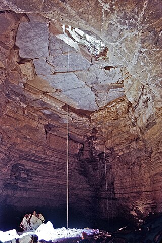
Hellhole is a large and deep pit cave in Germany Valley of eastern West Virginia. It is the seventh longest cave in the United States and is home to almost half of the world's population of Virginia big-eared bats. At 737 feet (225 m), Hellhole is the deepest of several caves in the Valley.
Gammarus acherondytes, the Illinois cave amphipod, is a species of crustacean in the family Gammaridae. The crustacean is endemic to the Illinois Sinkhole Plain of Monroe County and St. Clair County, in southwestern Illinois, including Illinois Caverns State Natural Area.
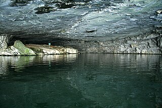
Nickajack Cave is a large, partially flooded cave in Marion County, Tennessee. It was partially flooded by the Tennessee Valley Authority's Nickajack Lake, created by the construction of Nickajack Dam in 1967. The entrance was originally 140 feet wide and 50 feet high. There is now about 25–30 feet of water at the entrance, so the portion of the entrance above water is 140 feet wide and 20–25 feet high. It houses a large colony of gray bats, an endangered species, and the water levels have posed a danger to the bat colony. The cave took its name from the Chickamauga Cherokee town of Nickajack, located between its mouth and the Tennessee River. The town was once attacked and destroyed in 1794 by the Nickajack Expedition.

Deer Cave, located near Miri, Sarawak, Malaysia, is a show cave attraction of Gunung Mulu National Park. It was surveyed in 1961 by G. E. Wilford of the British Borneo Geological Survey, who predicted that Mulu would yield many more caves in the future. The cave, which is also known as Gua Payau or Gua Rusa by the local Penan and Berawan people, is said to have received its name because of the deer that go there to lick salt-bearing rocks and shelter themselves.

Cascade Caverns is a historically, geologically, and biologically important limestone solutional cave 3 mi (4.8 km) south of Boerne, Texas, United States, on 226 Cascade Caverns Road, in Kendall County. It has been commercially operated as a show cave and open for public tours since 1932. Informal tours were run as far back as 1875, when Dr. Benjamin Hester owned the cave property. The cave was known by the native Lipan Apache people who lived in the area prior to 1800.

The Baradla Domica cave system is a large cave system in northern Hungary. As part of the Aggtelek Karst, it extends more than 25.5 km (25,500 m) and includes the 5.3 km (3.3 mi) Domica cave. A significant part of the cave has varied colors and shapes providing an unparalleled spectacle of decorative stalactites.

Guajataca State Forest is one of the 20 forests that make up the public forest system of Puerto Rico. The Guajataca Forest is located in the northwestern part of Puerto Rico, along the Northern Karst zone in the municipality of Isabela and municipality of Quebradillas, and is near Camuy and San Sebastián. The forest is renowned for its ecological diversity, the mogotes and karstic formations, and its numerous caves and canyons. It also has the largest trail system of any Puerto Rican state forest.
