Breese, Illinois

Last updated

Breese
The Breese watertower.jpg
Breese water tower along U.S. Route 50
Motto(s): 
"Proud of our past, planning for our future"
Clinton County Illinois Incorporated and Unincorporated areas Breese Highlighted.svg
Location of Breese in Clinton County, Illinois.
Illinois in United States (US48).svg
Location of Illinois in the United States
Coordinates: 38°36′50″N89°31′23″W / 38.61389°N 89.52306°W / 38.61389; -89.52306 [1]
CountryUnited States
StateIllinois
County Clinton
Named for Sidney Breese
Government
  MayorKevin Timmermann
Area
[2]
  Total2.70 sq mi (6.99 km2)
  Land2.67 sq mi (6.92 km2)
  Water0.03 sq mi (0.07 km2)
Elevation
[1]
453 ft (138 m)
Population
 (2020)
  Total4,641
  Density1,736.90/sq mi (670.50/km2)
Time zone UTC-6 (CST)
  Summer (DST) UTC-5 (CDT)
ZIP code
62230 [3]
Area code 618
FIPS code 17-07913
GNIS feature ID2393409 [1]
Public Transit South Central Transit
Wikimedia CommonsBreese, Illinois
Website Official Website

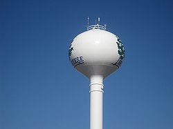
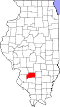
Breese is a city in Clinton County, Illinois, United States. Breese is the most populous city completely within Clinton County. As of the 2020 census, the population was 4,641, the majority of whom are of German ancestry. [4] Breese is part of the Metro-East region of the Greater St. Louis metropolitan area.

Contents

History

The town is named after Sidney Breese, a United States Senator and a contemporary of President Abraham Lincoln. [5] Breese was founded in 1855.

Even though the area around Breese, Illinois was first settled in 1816, it was not until 1835 that Germans came to the town to farm because of the flat fertile land there. Twenty years after the Germans' first immigration, the Mississippi and Ohio Railroad was completed. The early pioneers were enthralled by the thought of transportation by railroad. The Chicago-based company Sanger Kamp & Co. bought 80 acres of land near the railroad. Twenty-four acres were laid out with the railroad splitting the original town with some acres on the north side and south side creating Breese Township, February 3, 1855.[ citation needed ]

Late in 1855, forty Catholic immigrants, wanting to fulfill their religious needs, had the idea of constructing a church. Their desires were realized when two years later the Sanger Kamp & Co. gave half of one of its 80 acres (32 ha) to the Catholics’ project. By December 1869, St. Dominic's Catholic Church was completed. Breese was first recognized as a town on April 11, 1871, and later became a village on September 23, 1876. As a result, the construction of the village hall had begun. This project was completed in 1885. Seven years later a volunteer fire department was organized. The ever-growing population was then acknowledged as a city on January 19, 1905. The mayor of this new city was Henry Hummert.[ citation needed ]

Realizing that Breese would need some improvements, the mayor authorized the construction of an electric light plant that was completed in 1906. The streets of Breese were also topped with road oil in 1911. The next year improvements to the city's water works facility were also made.

However, things took a turn for the worse when, in 1914, a scarlet fever swept the community and its surrounding area and forced all the schools to close. Only four years later, still in the wake of the scarlet fever, the flu epidemic spread through the area.[ citation needed ]

1906 Coal mine disaster

On December 24, 1906, Six miners were killed and one injured when a mine cage collapsed and fell down the shaft in a mine owned and operated by The Breese and Trenton Coal Company. The miners killed included Henry Middeke, Herman Scheleper, Walter Schaffner, August Foppe, Frank Zehrer, and Hermann Holtmann. The only one injured was mine manager William Fritz. An investigation concluded that improper filling of an old air shaft caused a dirt slide leading to the collapse. The Breese and Trenton Coal Company was found guilty of negligence. [6]

Geography

According to the 2021 census gazetteer files, Breese has a total area of 2.69 square miles (6.97 km2), of which 2.67 square miles (6.92 km2) (or 99.07%) is land and 0.03 square miles (0.08 km2) (or 0.93%) is water. [7]

Breese is located on U.S. Route 50, 40 miles (64 km) east of St. Louis, Missouri.

Demographics

Historical population
CensusPop.Note
1870 489
1880 57417.4%
1890 80840.8%
1900 1,57194.4%
1910 2,12835.5%
1920 2,39912.7%
1930 1,957−18.4%
1940 2,20612.7%
1950 2,181−1.1%
1960 2,46112.8%
1970 2,88517.2%
1980 3,51621.9%
1990 3,5671.5%
2000 4,04813.5%
2010 4,4429.7%
2020 4,6414.5%
U.S. Decennial Census [8]

As of the 2020 census [9] there were 4,641 people, 1,861 households, and 1,116 families residing in the city. The population density was 1,722.72 inhabitants per square mile (665.15/km2). There were 2,038 housing units at an average density of 756.50 per square mile (292.09/km2). The racial makeup of the city was 93.30% White, 0.24% African American, 0.13% Native American, 0.32% Asian, 2.84% from other races, and 3.17% from two or more races. Hispanic or Latino of any race were 4.37% of the population.

There were 1,861 households, out of which 22.7% had children under the age of 18 living with them, 50.24% were married couples living together, 6.39% had a female householder with no husband present, and 40.03% were non-families. 33.91% of all households were made up of individuals, and 18.27% had someone living alone who was 65 years of age or older. The average household size was 2.84 and the average family size was 2.19.

The city's age distribution consisted of 21.0% under the age of 18, 6.9% from 18 to 24, 26.9% from 25 to 44, 26.6% from 45 to 64, and 18.6% who were 65 years of age or older. The median age was 39.9 years. For every 100 females, there were 88.9 males. For every 100 females age 18 and over, there were 77.4 males.

The median income for a household in the city was $70,411, and the median income for a family was $90,208. Males had a median income of $44,779 versus $26,833 for females. The per capita income for the city was $43,197. About 1.2% of families and 4.9% of the population were below the poverty line, including 0.0% of those under age 18 and 8.2% of those age 65 or over.

Schools

Public schools:

Private schools:

Notable people

Related Research Articles

<span class="mw-page-title-main">Clinton County, Illinois</span> County in Illinois, United States

Clinton County is located in the U.S. state of Illinois. At the 2020 census, the population was 36,899. Its county seat is Carlyle.

<span class="mw-page-title-main">Albers, Illinois</span> Village in Illinois, United States

Albers is a village in Clinton County, Illinois, United States. The population was 1,121 at the 2020 census.

<span class="mw-page-title-main">Aviston, Illinois</span> Village in Illinois, United States

Aviston is a village in Clinton County, Illinois, United States. The population was 2,340 at the 2020 census, up from 1,945 at the 2010 census.

<span class="mw-page-title-main">Bartelso, Illinois</span> Village in Illinois, United States

Bartelso is a village in Clinton County, Illinois, United States. The population was 635 at the 2020 census, up from 595 at the 2010 census.

<span class="mw-page-title-main">Beckemeyer, Illinois</span> Village in Illinois, United States

Beckemeyer is a village in Wade Township, Clinton County, Illinois, United States. The population was 923 as of the 2020 census.

<span class="mw-page-title-main">Carlyle, Illinois</span> City in Illinois, United States

Carlyle is a city in Clinton County, Illinois, United States. The population was 3,253 at the 2020 census. It is the county seat of Clinton County.

<span class="mw-page-title-main">Damiansville, Illinois</span> Village in Illinois, United States

Damiansville is a village in Clinton County, Illinois, United States. The population was 564 at the 2020 census, up from 491 at the 2010 census.

<span class="mw-page-title-main">Germantown, Illinois</span> Village in Illinois, United States

Germantown is a village in Clinton County, Illinois, United States. The population was 1,324 at the 2020 census.

<span class="mw-page-title-main">Clinton, Illinois</span> City in Illinois, United States

Clinton is the largest city in DeWitt County, Illinois, United States. The population was 7,004 at the 2020 census. It is the county seat of DeWitt County.

<span class="mw-page-title-main">Arcola, Illinois</span> City in Illinois, United States

Arcola is a city in Douglas County, Illinois, United States. The population was 2,927 at the 2020 census. The city was founded in 1855, when the Illinois Central Railroad was built through the county. The railroad itself was responsible for surveying, platting and founding the town.

<span class="mw-page-title-main">Gibson City, Illinois</span> City in Illinois, United States

Gibson City is a city in Ford County, Illinois, United States. The population was 3,407 at the 2010 census.

<span class="mw-page-title-main">Forsyth, Illinois</span> Village in Illinois, United States

Forsyth is a village in Macon County, Illinois, United States. Its population was 3,734 at the 2020 census, up from 3,490 in 2010. It is included in the Decatur, Illinois Metropolitan Statistical Area.

<span class="mw-page-title-main">Brookport, Illinois</span> City in Illinois, United States

Brookport is a city in Massac County, Illinois, United States. The population was 725 at the 2020 census, down from 984 in 2010. It is part of the Paducah, KY-IL Micropolitan Statistical Area.

<span class="mw-page-title-main">Mounds, Illinois</span> City in Illinois, United States

Mounds is a city in Pulaski County, Illinois, United States. The population was 810 in the 2010 census, a decline from 1,117 in 2000.

<span class="mw-page-title-main">Fulton, Illinois</span> Place in Illinois, United States

Fulton is a city in Whiteside County, Illinois, United States. The population was 3,481 at the 2010 census, down from 3,881 in 2000. Fulton is located across the Mississippi River from Clinton, Iowa.

<span class="mw-page-title-main">Crest Hill, Illinois</span> City in Illinois, United States

Crest Hill is a city in Lockport Township, Will County, Illinois, United States. The 2020 census put Crest Hill's population at 20,459.

<span class="mw-page-title-main">Creek Township, DeWitt County, Illinois</span> Township in Illinois, United States

Creek Township is one of thirteen townships in DeWitt County, Illinois, USA. As of the 2020 census, its population was 479 and it contained 203 housing units. The township contains the east half of Weldon Springs State Park.

<span class="mw-page-title-main">Breese Township, Clinton County, Illinois</span> Township in Illinois, United States

Breese Township is one of fifteen townships in Clinton County, Illinois, USA. As of the 2020 census, its population was 5,594 and it contained 2,410 housing units.

<span class="mw-page-title-main">Wheatfield Township, Clinton County, Illinois</span> Township in Illinois, United States

Wheatfield Township is one of fifteen townships in Clinton County, Illinois, USA. As of the 2020 census, its population was 438 and it contained 201 housing units.

Saint Rose is a village in Clinton County, Illinois, United States. Saint Rose is 5 miles (8.0 km) north-northwest of Breese. The population was 459 as of the 2020 census.

References

  1. 1 2 3 U.S. Geological Survey Geographic Names Information System: Breese, Illinois
  2. "2020 U.S. Gazetteer Files". United States Census Bureau. Retrieved March 15, 2022.
  3. "Breese IL ZIP Code". zipdatamaps.com. 2023. Retrieved May 12, 2023.
  4. "Explore Census Data". data.census.gov. Retrieved July 17, 2022.
  5. Allan H. Keith, Historical Stories: About Greenville and Bond County, IL. Consulted on August 15, 2007.
  6. "The 1906 Breese Mining Disaster, Clinton Co, IL".
  7. Bureau, US Census. "Gazetteer Files". Census.gov. Retrieved June 29, 2022.
  8. "Census of Population and Housing". Census.gov. Retrieved June 4, 2015.
  9. "Explore Census Data". data.census.gov. Retrieved June 28, 2022.
  10. "School / District / Community Profile" (PDF). Central Community High School. Archived from the original (PDF) on February 6, 2015. Retrieved April 5, 2020.