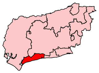
List of electoral wards in West Sussex

Last updated

This is a list of electoral divisions and wards in the ceremonial county of West Sussex in South East England. All changes since the re-organisation of local government following the passing of the Local Government Act 1972 are shown. The number of councillors elected for each electoral division or ward is shown in brackets.

Contents

County council

West Sussex

Electoral Divisions from 1 April 1974 (first election 12 April 1973) to 2 May 1985: [1] [2]

  1. Arundel (1)
  2. Bognor Regis No. 1 (Central) (1)
  3. Bognor Regis No. 2 (Felpham) (1)
  4. Bognor Regis No. 3 (South) (1)
  5. Bognor Regis No. 4 (West & Pagham) (2)
  6. Burgess Hill No. 1 (1)
  7. Burgess Hill No. 2 (Town) (1)
  8. Burgess Hill No. 3 (1)
  9. Chanctonbury No. 1 (Henfield) (1)
  10. Chanctonbury No. 2 (Pulborough) (1)
  11. Chanctonbury No. 3 (Steyning) (1)
  12. Chanctonbury No. 4 (1)
  13. Charlwood & Horley (3)
  14. Chichester (East) (1)
  15. Chichester (South) (1)
  16. Chichester (West) (1)
  17. Chichester Rural No. 1 (1)
  18. Chichester Rural No. 2 (1)
  19. Chichester Rural No. 3 (1)
  20. Chichester Rural No. 4 (1)
  21. Chichester Rural No. 5 (1)
  22. Chichester Rural No. 6 (1)
  23. Chichester Rural No. 7 (1)
  24. Crawley No. 1 (Pound Hill) (1)
  25. Crawley No. 2 (Gossops Green) (1)
  26. Crawley No. 3 (Ifield) (1)
  27. Crawley No. 4 (Langley Green) (1)
  28. Crawley No. 5 (Northgate & West Gre (1)
  29. Crawley No. 6 (Southgate) (1)
  30. Crawley No. 7 (Three Bridges) (1)
  31. Crawley No. 8 (Tilgate) (1)
  32. Cuckfield & Haywards Heath West (1)
  33. Cuckfield Rural No. 1 (1)
  34. Cuckfield Rural No. 2 (1)
  35. Cuckfield Rural No. 3 (1)
  36. Cuckfield Rural No. 4 (1)
  37. Cuckfield Rural No. 5 (1)
  38. East Grinstead (East) (1)
  39. East Grinstead (West) (1)
  40. Haywards Heath South (1)
  41. Horsham (North) (1)
  42. Horsham (South) (1)
  43. Horsham (West) (1)
  44. Horsham Rural No. 1 (1)
  45. Horsham Rural No. 2 (1)
  46. Horsham Rural No. 3 (1)
  47. Horsham Rural No. 4 (1)
  48. Lindfield & Haywards Heath East (1)
  49. Littlehampton No. 1 (Beach) (1)
  50. Littlehampton No. 2 (Wick) (1)
  51. Littlehampton No. 3 (1)
  52. Midhurst No. 1 (1)
  53. Midhurst No. 2 (1)
  54. Petworth No. 1 (1)
  55. Petworth No. 2 (1)
  56. Shoreham-by-Sea (East) (1)
  57. Shoreham-by-Sea (North) (1)
  58. Shoreham-by-Sea (South) (1)
  59. Southwick (North) (1)
  60. Southwick (South) (1)
  61. Worthing (Broadwater) (1)
  62. Worthing (Castle) (2)
  63. Worthing (Central) (1)
  64. Worthing (Durrington) (2)
  65. Worthing (Goring) (1)
  66. Worthing (Hearne) (1)
  67. Worthing (Marine) (1)
  68. Worthing (Offington) (2)
  69. Worthing (Selden) (1)
  70. Worthing (West Tarring) (1)
  71. Worthing Rural No. 1 (Rustington) (1)
  72. Worthing Rural No. 2 (Ferring) (1)
  73. Worthing Rural No. 3 (1)
  74. Worthing Rural No. 4 (1)
  75. Worthing Rural No. 5 (Sompting) (1)
  76. Worthing Rural No. 6 (2)

Electoral Divisions from 2 May 1985 to 5 May 2005: [3] [2]

  1. Arun East (1)
  2. Arundel & Angmering (1)
  3. Bersted (1)
  4. Bewbush (1)
  5. Billingshurst (1)
  6. Bognor Regis (1)
  7. Bourne (1)
  8. Broadfield (1)
  9. Broadwater (1)
  10. Burgess Hill Central (1)
  11. Burgess Hill East (1)
  12. Chichester East (1)
  13. Chichester North (1)
  14. Chichester South (1)
  15. Chichester West (1)
  16. Cissbury (1)
  17. Cuckfield Rural (1)
  18. Durrington (1)
  19. East Grinstead East (1)
  20. East Grinstead South (1)
  21. East Worthing (1)
  22. Felpham (1)
  23. Fernhurst (1)
  24. Fontwell (1)
  25. Furnace Green (1)
  26. Goring-by-Sea (1)
  27. Gossops Green (1)
  28. Hassocks & Burgess Hill W (1)
  29. Haywards Heath East (1)
  30. Haywards Heath West (1)
  31. Henfield (1)
  32. Holbrook (1)
  33. Hotham (1)
  34. Hurst (1)
  35. Ifield (1)
  36. Imberdown (1)
  37. Kingston Buci (1)
  38. Lancing (1)
  39. Langley Green (1)
  40. Lindfield (1)
  41. Littlehampton North (1)
  42. Littlehampton Town (1)
  43. Maybridge (1)
  44. Mid Sussex North (1)
  45. Mid Sussex South (1)
  46. Middleton (1)
  47. Midhurst (1)
  48. Northgate & Three Bridges (1)
  49. Nyetimber (1)
  50. Petworth (1)
  51. Pound Hill (1)
  52. Preston Manor (1)
  53. Pulborough (1)
  54. Richmond (1)
  55. Riverside (1)
  56. Roffey (1)
  57. Rustington West (1)
  58. Saltings (1)
  59. Salvington (1)
  60. Selsey & Sidlesham (1)
  61. Shoreham (1)
  62. Sompting (1)
  63. Southwater (1)
  64. Southwick (1)
  65. Steyning (1)
  66. Storrington (1)
  67. The Witterings (1)
  68. Tilgate (1)
  69. Warnham (1)
  70. West Parade (1)
  71. West Tarring (1)

Electoral Divisions from 5 May 2005 to 4 June 2009: [4]

  1. Angmering & Findon (1)
  2. Arundel & Wick (1)
  3. Bersted (1)
  4. Bewbush, Gossops Green & Southgate (2)
  5. Billingshurst (1)
  6. Bognor Regis East (1)
  7. Bognor Regis West & Aldwick (1)
  8. Bourne (1)
  9. Bramber Castle (1)
  10. Broadfield (1)
  11. Burgess Hill (2)
  12. Chichester East (1)
  13. Chichester North (1)
  14. Chichester South (1)
  15. Chichester West (1)
  16. Cuckfield & Lucastes (1)
  17. East Grinstead (2)
  18. East Preston & Ferring (1)
  19. Felpham (1)
  20. Fernhurst (1)
  21. Fontwell (1)
  22. Gaisford (2)
  23. Goring & Northbrook (2)
  24. Hassocks & Victoria (1)
  25. Haywards Heath East (1)
  26. Haywards Heath Town (1)
  27. Henfield (1)
  28. Holbrook (1)
  29. Horsham Carfax (1)
  30. Horsham Riverside (1)
  31. Hurstpierpoint & Bolney (1)
  32. Ifield, Langley Green & West Green (2)
  33. Imberdown (1)
  34. Kingston Buci (1)
  35. Lancing (1)
  36. Lindfield & High Weald (1)
  37. Littlehampton East (1)
  38. Littlehampton Town (1)
  39. Middleton (1)
  40. Midhurst (1)
  41. Northgate & Three Bridges (1)
  42. Nyetimber (1)
  43. Petworth (1)
  44. Pound Hill, Worth & Maidenbower (2)
  45. Pulborough (1)
  46. Roffey (1)
  47. Rustington (1)
  48. Saltings (1)
  49. Salvington (2)
  50. Selsey (1)
  51. Shoreham (1)
  52. Sompting (1)
  53. Southwater & Nuthurst (1)
  54. Southwick (1)
  55. Storrington (1)
  56. The Witterings (1)
  57. Tilgate & Furnace Green (1)
  58. Warnham & Rusper (1)
  59. Worth Forest (1)
  60. Worthing East (1)
  61. Worthing Pier (1)
  62. Worthing West (1)

Electoral Divisions from 4 June 2009 to present: [5]

West Sussex UK electoral division map (blank).svg
  1. Angmering & Findon (1)
  2. Arundel & Wick (1)
  3. Bersted (1)
  4. Bewbush & Ifield West (1)
  5. Billingshurst (1) †
  6. Bognor Regis East (1)
  7. Bognor Regis West & Aldwick (1)
  8. Bourne (1)
  9. Bramber Castle (1)
  10. Broadfield (1)
  11. Broadwater (1)
  12. Burgess Hill East (1)
  13. Burgess Hill Town (1)
  14. Chichester East (1)
  15. Chichester North (1)
  16. Chichester South (1)
  17. Chichester West (1)
  18. Cissbury (1)
  19. Cuckfield & Lucastes (1)
  20. Durrington & Salvington (1)
  21. East Grinstead Meridian (1)
  22. East Grinstead South & Ashurst Wood (1)
  23. East Preston & Ferring (1)
  24. Felpham (1)
  25. Fernhurst (1)
  26. Fontwell (1)
  27. Goring (1)
  28. Gossops Green & Ifield East (1)
  29. Hassocks & Victoria (1)
  30. Haywards Heath East (1)
  31. Haywards Heath Town (1)
  32. Henfield (1)
  33. Holbrook (1)
  34. Horsham Hurst (1)
  35. Horsham Riverside (1)
  36. Horsham Tanbridge & Broadbridge Heath (1)
  37. Hurstpierpoint & Bolney (1)
  38. Imberdown (1)
  39. Kingston Buci (1)
  40. Lancing (1)
  41. Langley Green & West Green (1)
  42. Lindfield & High Weald (1)
  43. Littlehampton East (1)
  44. Littlehampton Town (1)
  45. Maidenbower (1)
  46. Middleton (1)
  47. Midhurst (1)
  48. Northbrook (1)
  49. Northgate & Three Bridges (1)
  50. Nyetimber (1)
  51. Petworth (1)
  52. Pound Hill & Worth (1)
  53. Pulborough (1)
  54. Roffey (1)
  55. Rustington (1)
  56. Saltings (1)
  57. Selsey (1)
  58. Shoreham (1)
  59. Sompting & North Lancing (1)
  60. Southgate & Crawley Central (1)
  61. Southwater & Nuthurst (1) †
  62. Southwick (1)
  63. Storrington (1)
  64. Tarring (1)
  65. The Witterings (1)
  66. Tilgate & Furnace Green (1)
  67. Warnham & Rusper (1)
  68. Worth Forest (1)
  69. Worthing East (1)
  70. Worthing Pier (1)
  71. Worthing West (1)

† minor boundary changes in 2017 [6]

District councils

Adur

Wards from 1 April 1974 (first election 7 June 1973) to 3 May 1979: [7]

  1. Lancing: East (4)
  2. Lancing: North (4)
  3. Lancing: West (4)
  4. Marine (2)
  5. Shoreham: Buckingham (2)
  6. Shoreham: Kingston Buci (2)
  7. Shoreham: Kingston St. Julians (2)
  8. Shoreham: St. Marys (2)
  9. Shoreham: St. Nicholas (2)
  10. Sompting (5)
  11. Southwick: Central (2)
  12. Southwick: Fishersgate (2)
  13. Southwick: North (2)
  14. Southwick: South (1)
  15. Southwick: West (2)

Wards from 3 May 1979 to 10 June 2004: [8]

  1. Buckingham (3)
  2. Churchill (3)
  3. Cokeham (3)
  4. Eastbrook (3)
  5. Hillside (3)
  6. Manor (3)
  7. Marine (2)
  8. Mash Barn (3)
  9. Peverel (3)
  10. Southlands (3)
  11. Southwick Green (3)
  12. St. Marys (1)
  13. St. Nicholas (3)
  14. Widewater (3)

Wards from 10 June 2004 to present: [9]

Adur UK ward map 2010 (blank).svg
  1. Buckingham (2)
  2. Churchill (2)
  3. Cokeham (2)
  4. Eastbrook (2)
  5. Hillside (2)
  6. Manor (2)
  7. Marine (2)
  8. Mash Barn (2)
  9. Peverel (2)
  10. St Mary's (2)
  11. St Nicolas (2)
  12. Southlands (2)
  13. Southwick Green (2)
  14. Widewater (3)

Arun

Wards from 1 April 1974 (first election 7 June 1973) to 5 May 1983: [7]

  1. Aldingbourne (1)
  2. Angmering (3)
  3. Arundel (2)
  4. Bersted (2)
  5. Bognor Regis Central (3)
  6. Bognor Regis East (3)
  7. Bognor Regis Felpham (4)
  8. Bognor Regis North (3)
  9. Bognor Regis South (3)
  10. Bognor Regis West (3)
  11. Eastergate (2)
  12. East Preston and Kingston (3)
  13. Ferring (3)
  14. Findon (1)
  15. Littlehampton Beach (3)
  16. Littlehampton Central-Ham-River (3)
  17. Littlehampton Wick (4)
  18. Lyminster (1)
  19. Middleton-on-Sea (2)
  20. Pagham (3)
  21. Rustingtoná (5)
  22. Tortington (1)
  23. Walberton (1)
  24. Yapton (1)

Wards from 5 May 1983 to 1 May 2003: [10]

  1. Aldingbourne (1)
  2. Aldwick East (2)
  3. Aldwick West (3)
  4. Angmering (3)
  5. Arundel (2)
  6. Barnham (3)
  7. Bersted (3)
  8. East Preston with Kingston (3)
  9. Felpham East (2)
  10. Felpham West (2)
  11. Ferring (2)
  12. Findon (1)
  13. Hotham (2)
  14. Littlehampton Beach (2)
  15. Littlehampton Central (2)
  16. Littlehampton Ham (2)
  17. Littlehampton River (1)
  18. Littlehampton Wick (2)
  19. Marine (2)
  20. Middleton-on-Sea (2)
  21. Orchard (2)
  22. Pagham (3)
  23. Pevensey (2)
  24. Rustington East (2)
  25. Rustington North (2)
  26. Rustington South (2)
  27. Walberton (1)

Wards from 1 May 2003 to 7 May 2015: [11]

Arun UK ward map 2010 (blank).svg
  1. Aldwick East (2)
  2. Aldwick West (2)
  3. Angmering (3)
  4. Arundel (2)
  5. Barnham (3)
  6. Beach (2)
  7. Bersted (3)
  8. Brookfield (2)
  9. East Preston with Kingston (3)
  10. Felpham East (2)
  11. Felpham West (2)
  12. Ferring (2)
  13. Findon (1)
  14. Ham (2)
  15. Hotham (2)
  16. Marine (2)
  17. Middleton-on-Sea (2)
  18. Orchard (2)
  19. Pagham & Rose Green (3)
  20. Pevensey (2)
  21. River (2)
  22. Rustington East (2)
  23. Rustington West (3)
  24. Walberton (1)
  25. Wick with Toddington (2)
  26. Yapton (2)

Wards from 7 May 2015 to present: [12]

Arun UK ward map 2015 (blank).svg
  1. Aldwick East (2)
  2. Aldwick West (2)
  3. Angmering & Findon (3)
  4. Arundel & Walberton (3)
  5. Barnham (3)
  6. Beach (2)
  7. Bersted (3)
  8. Brookfield (2)
  9. Courtwick with Toddington (3)
  10. East Preston (3)
  11. Felpham East (2)
  12. Felpham West (2)
  13. Ferring (2)
  14. Hotham (2)
  15. Marine (2)
  16. Middleton-on-Sea (2)
  17. Orchard (2)
  18. Pagham (2)
  19. Pevensey (2)
  20. River (3)
  21. Rustington East (2)
  22. Rustington West (3)
  23. Yapton (2)

Chichester

Wards from 1 April 1974 (first election 7 June 1973) to 3 May 1979: [7]

Wards from 3 May 1979 to 1 May 2003: [13]

Wards from 1 May 2003 to present: [14]

Chichester UK ward map 2010 (blank).svg
  1. Bosham (2)
  2. Boxgrove (1)
  3. Bury (1)
  4. Chichester East (3)
  5. Chichester North (3)
  6. Chichester South (3)
  7. Chichester West (2)
  8. Donnington (1)
  9. Easebourne (1)
  10. East Wittering (2)
  11. Fernhurst (2)
  12. Fishbourne (1)
  13. Funtington (1)
  14. Harting (1)
  15. Lavant (1)
  16. Midhurst (2)
  17. North Mundham (1)
  18. Petworth (2)
  19. Plaistow (2)
  20. Rogate (1)
  21. Selsey North (3)
  22. Selsey South (2)
  23. Sidlesham (1)
  24. Southbourne (3)
  25. Stedham (1)
  26. Tangmere (1)
  27. Westbourne (1)
  28. West Wittering (2)
  29. Wisborough Green (1)

Crawley

Wards from 1 April 1974 (first election 7 June 1973) to 3 May 1979: [7]

  1. Charlwood (1) †
  2. Gossops Green (3)
  3. Horley (6) †
  4. Langley Green (3)
  5. Northgate (2)
  6. Pound Hill (3)
  7. Southgate (4)
  8. Three Bridges (3)
  9. Tilgate (3)
  10. West Green (2)

† Charlwood and Horley wards were moved to Surrey by the Charlwood and Horley Act 1974

Wards from 3 May 1979 to 5 May 1983: [15] [16]

  1. Broadfield (2)
  2. Furnace Green (2)
  3. Gossops Green (2)
  4. Ifield (2)
  5. Langley Green (3)
  6. Northgate (2)
  7. Pound Hill (3)
  8. Southgate (3)
  9. Three Bridges (2)
  10. Tilgate (3)
  11. West Green (2)

Wards from 5 May 1983 to 10 June 2004: [17]

Crawley UK ward map 1979.svg
  1. Bewbush (2)
  2. Broadfield (3)
  3. Furnace Green (2)
  4. Gossops Green (2)
  5. Ifield (3)
  6. Langley Green (3)
  7. Northgate (2)
  8. Pound Hill North (3)
  9. Pound Hill South (2)
  10. Southgate (3)
  11. Three Bridges (2)
  12. Tilgate (3)
  13. West Green (2)

Wards from 10 June 2004 to 2 May 2019: [18]

Crawley UK ward map (blank).svg
  1. Bewbush (3)
  2. Broadfield North (2)
  3. Broadfield South (2)
  4. Furnace Green (2)
  5. Gossops Green (2)
  6. Ifield (3)
  7. Langley Green (3)
  8. Maidenbower (3)
  9. Northgate (2)
  10. Pound Hill North (3)
  11. Pound Hill South & Worth (3)
  12. Southgate (3)
  13. Three Bridges (2)
  14. Tilgate (2)
  15. West Green (2)

Wards from 2 May 2019 to present: [19]

Crawley UK ward map 2019 (blank).svg
  1. Bewbush & North Broadfield (3)
  2. Broadfield (3)
  3. Furnace Green (2)
  4. Gossops Green & North East Broadfield (2)
  5. Ifield (3)
  6. Langley Green & Tushmore (3)
  7. Maidenbower (3)
  8. Northgate & West Green (3)
  9. Pound Hill North & Forge Wood (3)
  10. Pound Hill South & Worth (3)
  11. Southgate (3)
  12. Three Bridges (3)
  13. Tilgate (2)

Horsham

Wards from 1 April 1974 (first election 7 June 1973) to 3 May 1979: [7]

Wards from 3 May 1979 to 1 May 2003: [20]

Wards from 1 May 2003 to 2 May 2019: [21]

Horsham UK ward map 2010 (blank).svg
  1. Billingshurst & Shipley (3) †
  2. Bramber, Upper Beeding & Woodmancote (2)
  3. Broadbridge Heath (1)
  4. Chanctonbury (3)
  5. Chantry (3)
  6. Cowfold, Shermanbury & West Grinstead (2)
  7. Denne (2)
  8. Forest (1)
  9. Henfield (2)
  10. Holbrook East (2)
  11. Holbrook West (2)
  12. Horsham Park (3)
  13. Itchingfield, Slinfold & Warnham (2)
  14. Nuthurst (1)
  15. Pulborough & Coldwatham (2)
  16. Roffey North (2)
  17. Roffey South (2)
  18. Rudgwick (1)
  19. Rusper & Colgate (1)
  20. Southwater (3) †
  21. Steyning (2)
  22. Trafalgar (2)

† minor boundary changes in 2015 [6]

Wards from 2 May 2019 to present: [22]

  1. Billingshurst (3)
  2. Bramber, Upper Beeding & Woodmancote (2)
  3. Broadbridge Heath (2)
  4. Colgate & Rusper (2)
  5. Cowfold, Shermanbury & West Grinstead (2)
  6. Denne (3)
  7. Forest (3)
  8. Henfield (2)
  9. Holbrook East (2)
  10. Holbrook West (2)
  11. Itchingfield, Slinfold & Warnham (2)
  12. Nuthurst & Lower Beeding (1)
  13. Pulborough, Coldwaltham & Amberley (3)
  14. Roffey North (2)
  15. Roffey South (2)
  16. Rudgwick (1)
  17. Southwater North (2)
  18. Southwater South & Shipley (2)
  19. Steyning & Ashurst (2)
  20. Storrington & Washington (3)
  21. Trafalgar (2)
  22. West Chiltington, Thakeham & Ashington (3)

Mid Sussex

Wards from 1 April 1974 (first election 7 June 1973) to 5 May 1983: [7]

Wards from 5 May 1983 to 1 May 2003: [23]

Wards from 1 May 2003 to present: [24]

Mid Sussex UK ward map 2010 (blank).svg
  1. Ardingly & Balcombe (2)
  2. Ashurst Wood (1)
  3. Bolney (1)
  4. Burgess Hill Dunstall (2)
  5. Burgess Hill Franklands (2)
  6. Burgess Hill Leylands (2)
  7. Burgess Hill Meeds (2)
  8. Burgess Hill St Andrews (2)
  9. Burgess Hill Victoria (2)
  10. Copthorne & Worth (2)
  11. Crawley Down & Turners Hill (3)
  12. Cuckfield (2)
  13. East Grinstead Ashplats (2)
  14. East Grinstead Baldwins (2)
  15. East Grinstead Herontye (2)
  16. East Grinstead Imberhorne (2)
  17. East Grinstead Town (2)
  18. Hassocks (3)
  19. Haywards Heath Ashenground (2)
  20. Haywards Heath Bentswood (2)
  21. Haywards Heath Franklands (2)
  22. Haywards Heath Heath (2)
  23. Haywards Heath Lucastes (2)
  24. High Weald (2)
  25. Hurstpierpoint & Downs (3)
  26. Lindfield (3)

Worthing

Wards from 1 April 1974 (first election 7 June 1973) to 5 May 1983: [7]

Wards from 5 May 1983 to 10 June 2004: [25]

Wards from 10 June 2004 to present: [26]

Worthing UK ward map 2010 (blank).svg
  1. Broadwater (3)
  2. Castle (3)
  3. Central (3)
  4. Durrington (2)
  5. Gaisford (3)
  6. Goring (3)
  7. Heene (3)
  8. Marine (3)
  9. Northbrook (2)
  10. Offington (3)
  11. Salvington (3)
  12. Selden (3)
  13. Tarring (3)

Electoral wards by constituency

Arundel and South Downs

Angmering, Arundel, Barnham, Bramber, Upper Beeding and Woodmancote, Bury, Chanctonbury, Chantry, Cowfold, Shermanbury and West Grinstead, Findon, Hassocks, Henfield, Hurstpierpoint and Downs, Petworth, Pulborough and Coldwatham, Steyning, Walberton, Wisborough Green.

Bognor Regis and Littlehampton

Aldwick East, Aldwick West, Beach, Bersted, Brookfield, Felpham East, Felpham West, Ham, Hotham, Marine, Middleton-on-Sea, Orchard, Pagham and Rose Green, Pevensey, River, Wick with Toddington, Yapton.

Chichester

Bosham, Boxgrove, Chichester East, Chichester North, Chichester South, Chichester West, Donnington, Easebourne, East Wittering, Fernhurst, Fishbourne, Funtington, Harting, Lavant, Midhurst, North Mundham, Plaistow, Rogate, Selsey North, Selsey South, Sidlesham, Southbourne, Stedham, Tangmere, West Wittering, Westbourne.

Crawley

Bewbush, Broadfield North, Broadfield South, Furnace Green, Gossops Green, Ifield, Langley Green, Maidenbower, Northgate, Pound Hill North, Pound Hill South and Worth, Southgate, Three Bridges, Tilgate, West Green.

East Worthing and Shoreham

Broadwater, Buckingham, Churchill, Cokeham, Eastbrook, Gaisford, Hillside, Manor, Marine, Mash Barn, Peverel, Offington, Selden, St Mary's, St Nicolas, Southlands, Southwick Green, Widewater.

Horsham

Ardingly and Balcombe, Billingshurst and Shipley, Broadbridge Heath, Crawley Down and Turners Hill, Denne, Forest, Holbrook East, Holbrook West, Horsham Park, Itchingfield, Slinfold and Warnham, Nuthurst, Roffey North, Roffey South, Rudgwick, Rusper and Colgate, Southwater, Trafalgar.

Mid Sussex

Ashurst Wood, Bolney, Burgess Hill Dunstall, Burgess Hill Franklands, Burgess Hill Leylands, Burgess Hill Meeds, Burgess Hill St Andrews, Burgess Hill Victoria, Cuckfield, East Grinstead Ashplats, East Grinstead Baldwins, East Grinstead Herontye, East Grinstead Imberhorne, East Grinstead Town, Haywards Heath Ashenground, Haywards Heath Bentswood, Haywards Heath Franklands, Haywards Heath Heath, Haywards Heath Lucastes, High Weald, Lindfield.

Worthing West

Castle, Central, Durrington, East Preston with Kingston, Ferring, Goring, Heene, Marine, Northbrook, Rustington East, Rustington West, Salvington, Tarring.

See also

Related Research Articles

<span class="mw-page-title-main">West Sussex</span> County of England

West Sussex is a ceremonial county in South East England. It is bordered by Surrey to the north, East Sussex to the east, the English Channel to the south, and Hampshire to the west. The largest settlement is Crawley, and the county town is the city of Chichester.

<span class="mw-page-title-main">Burgess Hill</span> Human settlement in England

Burgess Hill is a town and civil parish in West Sussex, England, close to the border with East Sussex, on the edge of the South Downs National Park, 39 mi (63 km) south of London, 10 mi (16 km) north of Brighton and Hove, and 29 mi (47 km) northeast of the county town, Chichester. It had an area of 3.7 sq mi (9.6 km2) and a population of 30,635 at the 2011 Census, making it the fourth most populous parish in the county and the most populous in the Mid Sussex District. Other nearby towns include Haywards Heath to the northeast and Lewes, the county town of East Sussex, to the southeast.

<span class="mw-page-title-main">Mid Sussex District</span> Non-metropolitan district in England

Mid Sussex is a local government district in the English non-metropolitan county of West Sussex, within the historic county of Sussex. It contains the towns of East Grinstead, Haywards Heath and Burgess Hill.

<span class="mw-page-title-main">Arun District</span> Non-metropolitan district in England

Arun is a local government district in West Sussex, England. Its council is based in Littlehampton. The district's other towns are Arundel and Bognor Regis. The district is named after the River Arun, which runs through the centre of the district.

<span class="mw-page-title-main">Pease Pottage</span> Human settlement in England

Pease Pottage is a village in the Mid Sussex District of West Sussex, England. It lies on the southern edge of the Crawley built-up area, in the civil parish of Slaugham.

<span class="mw-page-title-main">Cuckfield</span> Human settlement in England

Cuckfield is a village and civil parish in the Mid Sussex District of West Sussex, England, on the southern slopes of the Weald. It lies 34 miles (55 km) south of London, 13 miles (21 km) north of Brighton, and 31 miles (50 km) east northeast of the county town of Chichester. Nearby towns include Haywards Heath to the southeast and Burgess Hill to the south. It is surrounded on the other sides by the parish of Ansty and Staplefield formerly known as Cuckfield Rural.

<span class="mw-page-title-main">Bognor Regis and Littlehampton (UK Parliament constituency)</span> UK Parliament constituency in England since 1997

Bognor Regis and Littlehampton is a constituency in West Sussex represented in the House of Commons of the UK Parliament since 1997 by Nick Gibb, a Conservative.

<span class="mw-page-title-main">Mid Sussex (UK Parliament constituency)</span> Parliamentary constituency in the United Kingdom

Mid Sussex is a constituency represented in the House of Commons of the UK Parliament from 2019 by Mims Davies, a Conservative. She is currently a minister in the Department for Work and Pensions.

The Sussex Senior Cup is an annual association football knock-out cup competition for men's football clubs in the English county of Sussex and is the county senior cup of the Sussex FA. Its official name is the Sussex Senior Challenge Cup. For sponsorship purposes, from 2012 to 2018 it is also known as the Parafix Sussex Senior Cup after a new three-year sponsorship deal was agreed in 2015.

Sussex 1 is an English level 9 Rugby Union League. It is made up of teams predominantly from Sussex. Teams play home and away matches from September through to April. The league champions are automatically promoted up to London 3 South East, while the second placed team plays a promotion playoff against the second placed team from Kent 1. Relegated teams drop to Sussex 2 although in recent season there has been no relegation. Only 1st XV sides can be promoted into London 3 South East.

<span class="mw-page-title-main">Sussex Rugby Football Union</span> Rugby team

The Sussex Rugby Football Union is the society responsible for rugby union in the county of Sussex, England and is one of the constituent bodies of the national Rugby Football Union.

The geology of West Sussex in southeast England comprises a succession of sedimentary rocks of Cretaceous age overlain in the south by sediments of Palaeogene age. The sequence of strata from both periods consists of a variety of sandstones, mudstones, siltstones and limestones. These sediments were deposited within the Hampshire and Weald basins. Erosion subsequent to large scale but gentle folding associated with the Alpine Orogeny has resulted in the present outcrop pattern across the county, dominated by the north facing chalk scarp of the South Downs. The bedrock is overlain by a suite of Quaternary deposits of varied origin. Parts of both the bedrock and these superficial deposits have been worked for a variety of minerals for use in construction, industry and agriculture.

The 2018–19 Southern Combination Football League season was the 94th in the history of the competition, which lies at levels 9 and 10 of the English football league system.

References

  1. The County of West Sussex (Electoral Divisions) Order 1973
  2. 1 2 Rallings, Colin; Thrasher, Michael. West Sussex County Council Election Results 1973-2009 (PDF). The Elections Centre. Retrieved 12 May 2016.
  3. The County of West Sussex (Electoral Arrangements) Order 1985
  4. legislation.gov.uk - The County of West Sussex (Electoral Changes) Order 2005. Retrieved on 3 November 2015.
  5. legislation.gov.uk - The County of West Sussex (Electoral Changes) Order 2009. Retrieved on 3 November 2015.
  6. 1 2 legislation.gov.uk - The Horsham (Electoral Changes) Order 2014. Retrieved on 3 November 2015.
  7. 1 2 3 4 5 6 7 The County of West Sussex (District Wards) Order 1973
  8. The District of Adur (Electoral Arrangements) Order 1978
  9. legislation.gov.uk - The District of Adur (Electoral Changes) Order 2002. Retrieved on 4 October 2015.
  10. The District of Arun (Electoral Arrangements) Order 1980
  11. legislation.gov.uk - The District of Arun (Electoral Changes) Order 2002. Retrieved on 4 October 2015.
  12. legislation.gov.uk - The Arun (Electoral Changes) Order 2013. Retrieved on 3 November 2015.
  13. The District of Chichester (Electoral Arrangements) Order 1977
  14. legislation.gov.uk - The District of Chichester (Electoral Changes) Order 2002. Retrieved on 4 October 2015.
  15. The Borough of Crawley (Electoral Arrangements) Order 1977
  16. "Local Government Boundary Commission For England Report No. 183" (PDF). Local Government Boundary Commission For England. 25 October 1976.
  17. "The Crawley, Horsham and Mid Sussex (Areas) Order 1982" (PDF). Local Government Commission for England. 18 November 1982.
  18. legislation.gov.uk - The Borough of Crawley (Electoral Changes) Order 2002. Retrieved on 4 October 2015.
  19. "The Borough of Crawley (Electoral Changes) Order 2019" (PDF). Retrieved 20 June 2019.
  20. legislation.gov.uk - The District of Horsham (Electoral Arrangements) Order 1978. Retrieved on 19 November 2015.
  21. legislation.gov.uk - The District of Horsham (Electoral Changes) Order 2002. Retrieved on 4 October 2015.
  22. "The Horsham (Electoral Changes) Order 2017" . Retrieved 29 June 2020.
  23. The District of Mid Sussex (Electoral Arrangements) Order 1980
  24. legislation.gov.uk - The District of Mid Sussex (Electoral Changes) Order 2002. Retrieved on 4 October 2015.
  25. The Borough of Worthing (Electoral Arrangements) Order 1979
  26. legislation.gov.uk - The Borough of Worthing (Electoral Changes) Order 2002. Retrieved on 4 October 2015.