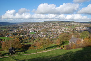
List of electoral wards in Derbyshire

Last updated

This is a list of electoral divisions and wards in the ceremonial county of Derbyshire in the East Midlands. All changes since the re-organisation of local government following the passing of the Local Government Act 1972 are shown. The number of councillors elected for each electoral division or ward is shown in brackets.

Contents

County council

Derbyshire

Electoral Divisions from 1 April 1974 (first election 12 April 1973) to 7 May 1981: [1] [2]

  1. Alfreton No. 1 (1)
  2. Alfreton No. 2 (1)
  3. Ashbourne & Hartington (1)
  4. Bakewell (1)
  5. Bakewell Rural No. 1 (1)
  6. Bakewell Rural No. 2 (1)
  7. Belper No. 1 (1)
  8. Belper No. 2 (1)
  9. Belper Rural No. 1 (1)
  10. Belper Rural No. 2 (1)
  11. Belper Rural No. 3 (1)
  12. Blackwell No. 1 (1)
  13. Blackwell No. 2 (1)
  14. Blackwell No. 3 (1)
  15. Blackwell No. 4 (1)
  16. Bolsover (1)
  17. Buxton North (1)
  18. Buxton South (1)
  19. Chapel-en-le-Frith No. 1 (1)
  20. Chapel-en-le-Frith No. 2 (1)
  21. Chesterfield No. 1 (1)
  22. Chesterfield No. 2 (2)
  23. Chesterfield No. 3 (1)
  24. Chesterfield No. 4 (2)
  25. Chesterfield No. 5 (1)
  26. Chesterfield No. 6 (1)
  27. Chesterfield Rural No. 1 (1)
  28. Chesterfield Rural No. 2 (1)
  29. Chesterfield Rural No. 3 (1)
  30. Chesterfield Rural No. 4 (1)
  31. Chesterfield Rural No. 5 (1)
  32. Chesterfield Rural No. 6 (1)
  33. Chesterfield Rural No. 7 (1)
  34. Clay Cross (1)
  35. Clowne (1)
  36. Derby Abbey (2)
  37. Derby Allestree (2)
  38. Derby Alvaston (1)
  39. Derby Arboretum (1)
  40. Derby Babington (2)
  41. Derby Breadsall (1)
  42. Derby Chaddesden (1)
  43. Derby Chellaston (2)
  44. Derby Darley (1)
  45. Derby Derwent (1)
  46. Derby Friar Gate (2)
  47. Derby Litchurch (1)
  48. Derby Littleover (1)
  49. Derby Mickleover (2)
  50. Derby Normanton (1)
  51. Derby Osmaston (1)
  52. Derby Pear Tree (1)
  53. Derby Spondon (1)
  54. Dronfield (2)
  55. Elmton & Whitwell (1)
  56. Glossop No. 1 (1)
  57. Glossop No. 2 (1)
  58. Heanor No. 1 (1)
  59. Heanor No. 2 (1)
  60. Heanor No. 3 (1)
  61. Ilkeston No. 1 (1)
  62. Ilkeston No. 2 (1)
  63. Ilkeston No. 3 (1)
  64. Ilkeston No. 4 (1)
  65. Long Eaton No. 1 (2)
  66. Long Eaton No. 2 (1)
  67. Long Eaton No. 3 (1)
  68. Matlock No. 1 (1)
  69. Matlock No. 2 (1)
  70. New Mills No. 1 (1)
  71. New Mills No. 2 (1)
  72. Repton No. 1 (1)
  73. Repton No. 2 (1)
  74. Repton No. 3 (1)
  75. Ripley No. 1 (1)
  76. Ripley No. 2 (1)
  77. South East Derbyshire No. 1 (1)
  78. South East Derbyshire No. 2 (1)
  79. South East Derbyshire No. 3 (1)
  80. South East Derbyshire No. 4 (1)
  81. Staveley East (1)
  82. Staveley West (1)
  83. Sudbury (1)
  84. Swadlincote No. 1 (1)
  85. Swadlincote No. 2 (1)
  86. Swadlincote No. 3 (1)
  87. Whaley Bridge (1)
  88. Wirksworth (1)

Electoral Divisions from 7 May 1981 to 5 May 2005: [2] [3]

  1. Abbey (1); electoral division abolished in 1997 [4]
  2. Alfreton (1)
  3. Allestree (1); electoral division abolished in 1997 [4]
  4. Alport (1)
  5. Alvaston (1); electoral division abolished in 1997 [4]
  6. Ashbourne (1)
  7. Babington (1); electoral division abolished in 1997 [4]
  8. Bakewell (1)
  9. Barlborough & Clowne (1)
  10. Belper (1)
  11. Blagreaves (1); electoral division abolished in 1997 [4]
  12. Bolsover (1)
  13. Boulton (1); electoral division abolished in 1997 [4]
  14. Brackenfield (1)
  15. Breadsall (1); electoral division abolished in 1997 [4]
  16. Brimington (1)
  17. Buxton North (1)
  18. Buxton South (1)
  19. Chaddesden (1); electoral division abolished in 1997 [4]
  20. Chapel (1)
  21. Chellaston (1); electoral division abolished in 1997 [4]
  22. Chesterfield North (1)
  23. Clay Cross (1)
  24. Cotmanhay (1)
  25. Darley (1); electoral division abolished in 1997 [4]
  26. Darley Dale (1)
  27. Derwent (1); electoral division abolished in 1997 [4]
  28. Draycott (1)
  29. Dronfield North (1)
  30. Dronfield South (1)
  31. Duffield (1)
  32. Eckington (1)
  33. Elmton (1)
  34. Etwall (1)
  35. Glossop East (1)
  36. Glossop South (1)
  37. Glossop West (1)
  38. Hasland & St Leonards (1)
  39. Heage (1)
  40. Heanor (1)
  41. Holmebrook & Rother (1)
  42. Holymoor & Wingerworth (1)
  43. Horsley (1)
  44. Ilkeston (1)
  45. Killamarsh (1)
  46. Kingsway (1); electoral division abolished in 1997 [4]
  47. Kirk Hallam (1)
  48. Linton (1)
  49. Litchurch (1); electoral division abolished in 1997 [4]
  50. Littleover (1); electoral division abolished in 1997 [4]
  51. Long Eaton (1)
  52. Loscoe (1)
  53. Mackworth (1); electoral division abolished in 1997 [4]
  54. Matlock (1)
  55. Melbourne (1)
  56. Mickleover (1); electoral division abolished in 1997 [4]
  57. Moor & St Helens (1)
  58. New Mills (1)
  59. Newbold & Brockwell (1)
  60. Newhall (1)
  61. Normanton (1); electoral division abolished in 1997 [4]
  62. North Wingfield (1)
  63. Osmaston (1); electoral division abolished in 1997 [4]
  64. Petersham (1)
  65. Repton (1)
  66. Ripley (1)
  67. Sandiacre (1)
  68. Sawley (1)
  69. Scarcliffe (1)
  70. Sheepbridge (1)
  71. Shirebrook (1)
  72. Sinfin (1); electoral division abolished in 1997 [4]
  73. Somercotes (1)
  74. South Normanton (1)
  75. Spondon (1); electoral division abolished in 1997 [4]
  76. Staveley (1)
  77. Sutton (1)
  78. Swadlincote (1)
  79. Tibshelf (1)
  80. Tideswell (1)
  81. Walton & West (1)
  82. West Hallam (1)
  83. Whaley Bridge (1)
  84. Wirksworth (1)

Electoral Divisions from 5 May 2005 to 2 May 2013: [5]

Derbyshire UK electoral division map (blank).svg
  1. Alfreton (1)
  2. Alport & Derwent (1)
  3. Ashbourne (1)
  4. Ashgate (1)
  5. Aston & Melbourne (1)
  6. Bakewell (1)
  7. Barlborough & Clowne (1)
  8. Belper (1)
  9. Birdholme (1)
  10. Bolsover North West, Elmton & Whitwell (1)
  11. Bolsover South West & Scarcliffe (1)
  12. Breadsall & West Hallam (1)
  13. Breaston (1)
  14. Brimington (1)
  15. Buxton North & East (1)
  16. Buxton West (1)
  17. Chapel & Hope Valley (1)
  18. Clay Cross (1)
  19. Cotmanhay (1)
  20. Derwent Valley (1)
  21. Dovedale (1)
  22. Dronfield North (1)
  23. Dronfield South (1)
  24. Duffield & Belper South (1)
  25. Eckington (1)
  26. Etherow (1)
  27. Glossop North & Rural (1)
  28. Glossop South (1)
  29. Greater Heanor (1)
  30. Hatton & Hilton (1)
  31. Heage (1)
  32. Heanor Central (1)
  33. Hipper (1)
  34. Holymoorside & Wingerworth (1)
  35. Horsley (1)
  36. Ilkeston (1)
  37. Killamarsh (1)
  38. Kirk Hallam (1)
  39. Linton & Church Gresley (1)
  40. Long Eaton (1)
  41. Matlock (1)
  42. Midway & Hartshorne (1)
  43. New Mills (1)
  44. Newbold (1)
  45. Newhall & Seales (1)
  46. North Wingfield & Tupton (1)
  47. Petersham (1)
  48. Pinxton & South Normanton West (1)
  49. Repton & Willington (1)
  50. Ripley (1)
  51. Sandiacre (1)
  52. Sawley (1)
  53. Shirebrook & Pleasley (1)
  54. Somercotes (1)
  55. South Normanton East & Tibshelf (1)
  56. Spire (1)
  57. St Mary's (1)
  58. Staveley North & Whittington (1)
  59. Staveley South (1)
  60. Stonebroom & Pilsley (1)
  61. Sutton (1)
  62. Swadlincote Central & Woodville (1)
  63. Whaley Bridge & Blackbrook (1)
  64. Wirksworth (1)

Electoral Divisions from 2 May 2013 to present: [6]

Derbyshire UK electoral division map 2013 (blank).svg
  1. Alfreton & Somercotes (2)
  2. Alport & Derwent (1)
  3. Ashbourne (1)
  4. Aston (1)
  5. Bakewell (1)
  6. Barlborough & Clowne (1)
  7. Belper (1)
  8. Birdholme (1)
  9. Bolsover North (1)
  10. Bolsover South (1)
  11. Boythorpe & Brampton South (1)
  12. Breadsall & West Hallam (1)
  13. Breaston (1)
  14. Brimington (1)
  15. Buxton North & East (1)
  16. Buxton West (1)
  17. Chapel & Hope Valley (1)
  18. Clay Cross North (1)
  19. Clay Cross South (1)
  20. Derwent Valley (1)
  21. Dovedale (1)
  22. Dronfield East (1)
  23. Dronfield West & Walton (1)
  24. Duffield & Belper South (1)
  25. Eckington & Killamarsh (2)
  26. Etherow (1)
  27. Etwall & Repton (1)
  28. Glossop & Charlesworth (2)
  29. Greater Heanor (1)
  30. Heanor Central (1)
  31. Hilton (1)
  32. Horsley (1)
  33. Ilkeston East (1)
  34. Ilkeston South (1)
  35. Ilkeston West (1)
  36. Linton (1)
  37. Long Eaton (1)
  38. Loundsley Green & Newbold (1)
  39. Matlock (1)
  40. Melbourne (1)
  41. New Mills (1)
  42. Petersham (1)
  43. Ripley East & Codnor (1)
  44. Ripley West & Heage (1)
  45. Sandiacre (1)
  46. Sawley (1)
  47. Shirebrook & Pleasley (1)
  48. South Normanton & Pinxton (1)
  49. Spire (1)
  50. St Mary’s (1)
  51. Staveley (1)
  52. Staveley North & Whittington (1)
  53. Sutton (1)
  54. Swadlincote Central (1)
  55. Swadlincote North (1)
  56. Swadlincote South (1)
  57. Tibshelf (1)
  58. Walton & West (1)
  59. Whaley Bridge (1)
  60. Wingerworth & Shirland (1)
  61. Wirksworth (1)

Unitary authority council

Derby

Wards from 1 April 1974 (first election 7 June 1973) to 3 May 1979: [7]

  1. Abbey (3)
  2. Allestree (3)
  3. Alvaston (3)
  4. Arboretum (3)
  5. Babington (3)
  6. Breadsall (3)
  7. Chaddesden (3)
  8. Chellaston (3)
  9. Darley (3)
  10. Derwent (3)
  11. Friar Gate (3)
  12. Litchurch (3)
  13. Littleover (3)
  14. Mickleover (3)
  15. Normanton (3)
  16. Osmaston (3)
  17. Pear Tree (3)
  18. Spondon (3)

Wards from 3 May 1979 to 2 May 2002: [8] [4]

Derby UK ward map 1979 (blank).svg
  1. Abbey (3)
  2. Allestree (2)
  3. Alvaston (2)
  4. Babington (3)
  5. Blagreaves (2)
  6. Boulton (2)
  7. Breadsall (2)
  8. Chaddesden (2)
  9. Chellaston (2)
  10. Darley (3)
  11. Derwent (2)
  12. Kingsway (2)
  13. Litchurch (2)
  14. Littleover (2)
  15. Mackworth (2)
  16. Mickleover (2)
  17. Normanton (2)
  18. Osmaston (2)
  19. Sinfin (2)
  20. Spondon (3)

Wards from 2 May 2002 to present: [9]

Derby UK ward map 2010 (blank).svg
  1. Abbey (3)
  2. Allestree (3)
  3. Alvaston (3)
  4. Arboretum (3)
  5. Blagreaves (3)
  6. Boulton (3)
  7. Chaddesden (3)
  8. Chellaston (3)
  9. Darley (3)
  10. Derwent (3)
  11. Littleover (3)
  12. Mackworth (3)
  13. Mickleover (3)
  14. Normanton (3)
  15. Oakwood (3)
  16. Sinfin (3)
  17. Spondon (3)

District councils

Amber Valley

Wards from 1 April 1974 (first election 7 June 1973) to 3 May 1979: [7]

  1. No. 1 (Alfreton) (4)
  2. No. 2 (Somercotes) (3)
  3. No. 3 (Swanwick) (2)
  4. No. 4 (Riddings & Ironville) (3)
  5. No. 5 (Belper: Central) (2)
  6. No. 6 (Belper: East) (3)
  7. No. 7 (Belper: Milford) (1)
  8. No. 8 (Belper: North) (2)
  9. No. 9 (Belper: South) (2)
  10. No. 10 (Heanor: North & West) (4)
  11. No. 11 (Heanor: Central Southwest & West Central (5)
  12. No. 12 (Heanor: East & South) (5)
  13. No. 13 (Ripley: West) (2)
  14. No. 14 (Ripley: Ambergate & Heage) (3)
  15. No. 15 (Ripley: Butterley & East) (2)
  16. No. 16 (Ripley: Marehay & Waingroves) (3)
  17. No. 17 (Crich) (2)
  18. No. 19 (Holbrook) (1)
  19. No. 21 (Denby) (1)
  20. No. 22 (Smalley) (1)
  21. No. 23 (South Wingfield) (1)
  22. No. 24 (Dethick Lea & Holloway) (1)
  23. No. 25 (Turnditch & Windley) (1)
  24. No. 26 (Quarndon) (1)
  25. No. 27 (Horsley Woodhouse) (1)
  26. No. 28 (Shipley) (1)
  27. Duffield (2)
  28. Kilburn (1)

Wards from 3 May 1979 to 4 May 2000: [10]

  1. Alfreton East (2)
  2. Alfreton West (2)
  3. Alport (1)
  4. Belper East (3)
  5. Belper North (2)
  6. Belper South (2)
  7. Codnor (1)
  8. Crich (1)
  9. Denby & Horsley Woodhouse (1)
  10. Duffield (2)
  11. Heage & Ambergate (2)
  12. Heanor & Loscoe (2)
  13. Heanor East (2)
  14. Heanor West (2)
  15. Holbrook & Horsley (1)
  16. Ironville & Riddings (2)
  17. Kilburn (1)
  18. Langley Mill & Aldercar (2)
  19. Ripley (3)
  20. Ripley & Marehay (2)
  21. Shipley Park (1)
  22. Somercotes (2)
  23. South West Parishes (1)
  24. Swanwick (2)
  25. Wingfield (1)

Wards from 4 May 2000 to present: [11]

Amber Valley UK ward map 2010 (blank).svg
  1. Alfreton (3)
  2. Alport (1)
  3. Belper Central (2)
  4. Belper East (2)
  5. Belper North (2)
  6. Belper South (2)
  7. Codnor & Waingroves (2)
  8. Crich (1)
  9. Duffield (2)
  10. Heage & Ambergate (2)
  11. Heanor East (2)
  12. Heanor West (2)
  13. Heanor & Loscoe (2)
  14. Ironville & Riddings (2)
  15. Kilburn, Denby & Holbrook (3)
  16. Langley Mill & Aldercar (2)
  17. Ripley (3)
  18. Ripley & Marehay (2)
  19. Shipley Park, Horsley & Horsley Woodhouse (2)
  20. Somercotes (2)
  21. South West Parishes (1)
  22. Swanwick (2)
  23. Wingfield (1)

Bolsover

Wards from 1 April 1974 (first election 7 June 1973) to 3 May 1979: [7]

  1. Ault Hucknall (1)
  2. Barlborough (1)
  3. Blackwell (2)
  4. Bolsover Central (2)
  5. Bolsover North (1)
  6. Bolsover South (2)
  7. Bolsover West (1)
  8. Clowne (3)
  9. Elmton & Creswell (3)
  10. Glapwell (1)
  11. Pinxton (2)
  12. Pleasely (1)
  13. Scarcliffe East (1)
  14. Scarcliffe North (1)
  15. Scarcliffe South (1)
  16. Shirebrook Central (1)
  17. Shirebrook East (1)
  18. Shirebrook South (1)
  19. Shirebrook West (2)
  20. South Normanton (3)
  21. Tibshelf (2)
  22. Whitwell (3)

Wards from 3 May 1979 to 1 May 2003: [12]

Wards from 1 May 2003 to 2 May 2019: [13]

Bolsover UK ward map 2010 (blank).svg
  1. Barlborough (2)
  2. Blackwell (2)
  3. Bolsover North West (2)
  4. Bolsover South (2)
  5. Bolsover West (2)
  6. Clowne North (2)
  7. Clowne South (2)
  8. Elmton-with-Creswell (3) †
  9. Pinxton (2)
  10. Pleasley (2)
  11. Scarcliffe (2)
  12. Shirebrook East (1)
  13. Shirebrook Langwith (1)
  14. Shirebrook North West (1)
  15. Shirebrook South East (1)
  16. Shirebrook South West (1)
  17. South Normanton East (2)
  18. South Normanton West (3)
  19. Tibshelf (2)
  20. Whitwell (2) †

† minor boundary changes in 2015 [14]

Wards from 2 May 2019 to present: [15]

  1. Ault Hucknall (3)
  2. Barlborough (2)
  3. Blackwell (2)
  4. Bolsover East (2)
  5. Bolsover North & Shuttlewood (2)
  6. Bolsover South (2)
  7. Clowne East (3)
  8. Clowne West (1)
  9. Elmton-with-Creswell (3)
  10. Langwith (2)
  11. Pinxton (2)
  12. Shirebrook North (2)
  13. Shirebrook South (2)
  14. South Normanton East (2)
  15. South Normanton West (3)
  16. Tibshelf (2)
  17. Whitwell (2)

Chesterfield

Wards from 1 April 1974 (first election 7 June 1973) to 3 May 1979: [7]

  1. Barrow Hill (1)
  2. Brimington Central (2)
  3. Brimington East (1)
  4. Brimington West (2)
  5. Central (3)
  6. Dunston (3)
  7. Hasland (3)
  8. Hollingwood (1)
  9. Holmebrook (3)
  10. Inkersall (2)
  11. Lowgates (2)
  12. Markham (2)
  13. Middlecroft (2)
  14. Moor (3)
  15. New Whittington (3)
  16. Newbold (4)
  17. Old Whittington (3)
  18. Rother (3)
  19. St Helens (3)
  20. St Leonards (3)
  21. West (3)
  22. Woodthorpe (2)

Wards from 3 May 1979 to 1 May 2003: [16]

Wards from 1 May 2003 to present: [17]

Chesterfield UK ward map 2010 (blank).svg
  1. Barrow Hill & New Whittington (3)
  2. Brimington North (2)
  3. Brimington South (3)
  4. Brockwell (3)
  5. Dunston (3)
  6. Hasland (3)
  7. Hollingwood & Inkersall (3)
  8. Holmebrook (2)
  9. Linacre (2)
  10. Lowgates & Woodthorpe (2)
  11. Loundsley Green (2)
  12. Middlecroft & Poolsbrook (2)
  13. Moor (2)
  14. Old Whittington (2)
  15. Rother (3)
  16. St Helen's (2)
  17. St Leonard's (3)
  18. Walton (3)
  19. West (3)

Derbyshire Dales

Wards from 1 April 1974 (first election 7 June 1973) to 3 May 1979: [7]

  1. No. 1 (Hartington) (1)
  2. No. 2 (Brassington) (1)
  3. No. 4 (Clifton) (1)
  4. No. 9 (Tideswell) (2)
  5. No. 10 (Bradwell) (1)
  6. No. 13 (Hathersage) (1)
  7. No. 14 (The Longstones) (1)
  8. No. 15 (Calver) (1)
  9. No. 16 (Winster) (2)
  10. No. 18 (Baslow & Bubnell) (1)
  11. No. 21 (Matlock) (6)
  12. No. 22 (North & South Darley) (4)
  13. Ashbourne (3)
  14. Bakewell (3)
  15. Brailsford (1)
  16. Doveridge (1)
  17. Eyam & Stoney Middleton (1)
  18. Hulland (1)
  19. Masson (2)
  20. Norbury (1)
  21. Taddington (1)
  22. Wirksworth (3)
  23. Youlgreave (1)

Wards from 3 May 1979 to 1 May 2003: [18]

Wards from 1 May 2003 to present: [19]

Derbyshire Dales UK ward map 2010 (blank).svg
  1. Ashbourne North (2)
  2. Ashbourne South (2)
  3. Bakewell (3)
  4. Bradwell (1)
  5. Brailsford (1)
  6. Calver (1)
  7. Carsington Water (1)
  8. Chatsworth (1)
  9. Clifton & Bradley (1)
  10. Darley Dale (3)
  11. Dovedale & Parwich (1)
  12. Doveridge & Sudbury (1)
  13. Hartington & Taddington (1)
  14. Hathersage & Eyam (2)
  15. Hulland (1)
  16. Lathkill & Bradford (1)
  17. Litton & Longstone (1)
  18. Masson (2)
  19. Matlock All Saints (3)
  20. Matlock St Giles (3)
  21. Norbury (1)
  22. Stanton (1)
  23. Tideswell (1)
  24. Winster & South Darley (1)
  25. Wirksworth (3)

Erewash

Wards from 1 April 1974 (first election 7 June 1973) to 3 May 1979: [7]

  1. No. 1 (Ilkeston: Granby) (2)
  2. No. 2 (Ilkeston: Market) (2)
  3. No. 3 (Ilkeston: North) (4)
  4. No. 5 (Ilkeston: South) (6)
  5. No. 6 (Ilkeston: Victoria) (2)
  6. No. 7 (Long Eaton: Derby Road) (6)
  7. No. 8 (Long Eaton: New Sawley) (6)
  8. No. 9 (Long Eaton: Nottingham Road & Sawley Road) (6)
  9. No. 12 (Dale Abbey) (2)
  10. No. 16 (Sandiacre) (4)
  11. Breadsall & Morley (1)
  12. Breaston (3)
  13. Draycott (1)
  14. Little Eaton (1)
  15. Ockbrook & Borrowash (4)
  16. Old Park (2)
  17. Stanley (1)
  18. West Hallam (1)

Wards from 3 May 1979 to 1 May 2003: [20]

Wards from 1 May 2003 to 7 May 2015: [21]

Erewash UK ward map 2010 (blank).svg
  1. Abbotsford (2)
  2. Breaston (2)
  3. Cotmanhay (2)
  4. Derby Road East (2)
  5. Derby Road West (3)
  6. Draycott (2)
  7. Hallam Fields (2)
  8. Ilkeston Central (2)
  9. Ilkeston North (2)
  10. Kirk Hallam (3)
  11. Little Eaton & Breadsall (2)
  12. Little Hallam (2)
  13. Long Eaton Central (3)
  14. Nottingham Road (3)
  15. Ockbrook & Borrowash (3)
  16. Old Park (2)
  17. Sandiacre North (2)
  18. Sandiacre South (2)
  19. Sawley (3)
  20. Stanley (1)
  21. West Hallam & Dale Abbey (3)
  22. Wilsthorpe (3)

Wards from 7 May 2015 to present: [22]

Erewash UK ward map 2015 (blank).svg
  1. Awsworth Road (2)
  2. Breaston (2)
  3. Cotmanhay (2)
  4. Derby Road East (2)
  5. Derby Road West (3)
  6. Draycott & Risley (2)
  7. Hallam Fields (2)
  8. Kirk Hallam & Stanton-by-Dale (3)
  9. Larklands (3)
  10. Little Eaton & Stanley (2)
  11. Little Hallam (2)
  12. Long Eaton Central (3)
  13. Nottingham Road (2)
  14. Ockbrook & Borrowash (3)
  15. Sandiacre (3)
  16. Sawley (3)
  17. Shipley View (2)
  18. West Hallam & Dale Abbey (3)
  19. Wilsthorpe (3)

High Peak

Wards from 1 April 1974 (first election 7 June 1973) to 3 May 1979: [7]

  1. No. 7 (Glossop: All Saints) (3)
  2. No. 8 (Glossop: St James) (4)
  3. No. 9 (Glossop: Hadfield) (6)
  4. No. 12 (Whaley Bridge: Fernilee) (1)
  5. No. 13 (Whaley Bridge: Furness Vale) (1)
  6. No. 14 (Whaley Bridge: Taxal) (1)
  7. No. 15 (Whaley Bridge: Yeardsley) (1)
  8. No. 16 (Charlesworth) (1)
  9. Barmoor (1)
  10. Barms (2)
  11. Blackbrook (2)
  12. Central (1)
  13. Chapel East (1)
  14. Chapel West (2)
  15. College (2)
  16. Corbar (2)
  17. Cote Heath (2)
  18. Hayfield (1)
  19. Ladybower (1)
  20. Limestone Peak (1)
  21. New Mills North (3)
  22. New Mills South (3)
  23. Peveril (1)
  24. Stone Bench (2)
  25. Tintwistle (1)

Wards from 3 May 1979 to 1 May 2003: [23]

Wards from 1 May 2003 to 7 May 2015: [24]

High Peak UK ward map 2010 (blank).svg
  1. Barms (1)
  2. Blackbrook (2)
  3. Burbage (1)
  4. Buxton Central (2)
  5. Chapel East (1)
  6. Chapel West (2)
  7. Corbar (2)
  8. Cote Heath (2)
  9. Dinting (1)
  10. Gamesley (1)
  11. Hadfield North (1)
  12. Hadfield South (2)
  13. Hayfield (1)
  14. Hope Valley (2)
  15. Howard Town (2)
  16. Limestone Peak (1)
  17. New Mills East (2)
  18. New Mills West (2)
  19. Old Glossop (2)
  20. Padfield (1)
  21. St John's (1)
  22. Sett (1)
  23. Simmondley (2)
  24. Stone Bench (2)
  25. Temple (1)
  26. Tintwistle (1)
  27. Whaley Bridge (3)
  28. Whitfield (1)

Wards from 7 May 2015 to present: [25]

High Peak UK ward map 2015 (blank).svg
  1. Barms (1)
  2. Blackbrook (2)
  3. Burbage (1)
  4. Buxton Central (2)
  5. Chapel East (1)
  6. Chapel West (2)
  7. Corbar (2)
  8. Cote Heath (2)
  9. Dinting (1)
  10. Gamesley (1)
  11. Hadfield North (1)
  12. Hadfield South (2)
  13. Hayfield (1)
  14. Hope Valley (2)
  15. Howard Town (2)
  16. Limestone Peak (1)
  17. New Mills East (2)
  18. New Mills West (2)
  19. Old Glossop (2)
  20. Padfield (1)
  21. Sett (1)
  22. Simmondley (2)
  23. St John’s (1)
  24. Stone Bench (2)
  25. Temple (1)
  26. Tintwistle (1)
  27. Whaley Bridge (3)
  28. Whitfield (1)

North East Derbyshire

Wards from 1 April 1974 (first election 7 June 1973) to 3 May 1979: [7]

  1. No. 1 (Clay Cross) (6)
  2. No. 2 (Dronfield: Central) (2)
  3. No. 4 (Dronfield: Dronfield) (3)
  4. No. 5 (Dronfield: North) (2)
  5. No. 6 (Dronfield: South) (2)
  6. No. 10 (Ashover) (2)
  7. No. 11 (Eckington) (3)
  8. No. 14 (Killamarsh) (3)
  9. No. 16 (Calow) (2)
  10. No. 17 (Heath) (1)
  11. No. 20 (North Wingfield) (4)
  12. No. 22 (Shirland & Higham) (3)
  13. No. 23 (Sutton-cum-Duckmanton) (1)
  14. Barlow & Holmesfield (1)
  15. Brampton & Walton (2)
  16. Coal Aston (2)
  17. Grassmoor (2)
  18. Pilsley (2)
  19. Renishaw (1)
  20. Ridgeway & Marsh Lane (1)
  21. Tupton (2)
  22. Unstone (1)
  23. Wingerworth (3)

Wards from 3 May 1979 to 1 May 2003: [26]

Wards from 1 May 2003 to 2 May 2019: [27]

North East Derbyshire UK ward map 2010 (blank).svg
  1. Ashover (1)
  2. Barlow & Holmesfield (1)
  3. Brampton & Walton (2)
  4. Clay Cross North (3)
  5. Clay Cross South (2)
  6. Coal Aston (2)
  7. Dronfield North (2)
  8. Dronfield South (3)
  9. Dronfield Woodhouse (2)
  10. Eckington North (2)
  11. Eckington South (2)
  12. Gosforth Valley (3)
  13. Grassmoor (2)
  14. Holmewood & Heath (2)
  15. Killamarsh East (2)
  16. Killamarsh West (3)
  17. North Wingfield Central (3)
  18. Pilsley & Morton (3)
  19. Renishaw (1)
  20. Ridgeway & Marsh Lane (1)
  21. Shirland (3)
  22. Sutton (2)
  23. Tupton (2)
  24. Unstone (1)
  25. Wingerworth (3)

Wards from 2 May 2019 to present: [28]

  1. Ashover (1)
  2. Barlow & Holmesfield (1)
  3. Brampton & Walton (2)
  4. Clay Cross North (3)
  5. Clay Cross South (2)
  6. Coal Aston (2)
  7. Dronfield North (2)
  8. Dronfield South (3)
  9. Dronfield Woodhouse (1)
  10. Eckington North (2)
  11. Eckington South & Renishaw (3)
  12. Gosforth Valley (3)
  13. Grassmoor (2)
  14. Holmewood & Heath (2)
  15. Killamarsh East (2)
  16. Killamarsh West (3)
  17. North Wingfield Central (3)
  18. Pilsley & Morton (3)
  19. Ridgeway & Marsh Lane (1)
  20. Shirland (3)
  21. Sutton (2)
  22. Tupton (3)
  23. Unstone (1)
  24. Wingerworth (3)

South Derbyshire

Wards from 1 April 1974 (first election 7 June 1973) to 3 May 1979: [7]

  1. No. 1 (Swadlincote: Church Gresley) (3)
  2. No. 2 (Swadlincote: Stanton & Newhall) (5)
  3. No. 3 (Swadlincote: Swadlincote) (4)
  4. No. 4 (Linton) (2)
  5. No. 5 (Overseal) (3)
  6. No. 6 (Hartshorne & Woodville) (4)
  7. No. 7 (Repton & Bretby) (2)
  8. No. 8 (Findern) (1)
  9. No. 9 (Etwall) (2)
  10. No. 11 (Hatton) (1)
  11. No. 12 (Hilton) (1)
  12. No. 13 (Burnaston) (1)
  13. No. 14 (Aston-on-Trent & Shardlow) (2)
  14. No. 15 (Melbourne) (3)
  15. Willington (1)

Wards from 3 May 1979 to 1 May 2003: [29]

Wards from 1 May 2003 to 5 May 2011: [30]

South Derbyshire UK ward map 2010 (blank).svg
  1. Aston (3)
  2. Church Gresley (2)
  3. Etwall (2)
  4. Hartshorne & Ticknall (2)
  5. Hatton (1)
  6. Hilton (2)
  7. Linton (2)
  8. Melbourne (2)
  9. Midway (3)
  10. Newhall & Stanton (3)
  11. North West (1)
  12. Repton (2)
  13. Seales (2)
  14. Stenson (2)
  15. Swadlincote (3)
  16. Willington & Findern (2)
  17. Woodville (2)

Wards from 5 May 2011 to present: [31]

South Derbyshire UK ward map 2011 (blank).svg
  1. Aston (3)
  2. Church Gresley (3)
  3. Etwall (2)
  4. Hatton (1)
  5. Hilton (3)
  6. Linton (2)
  7. Melbourne (2)
  8. Midway (3)
  9. Newhall & Stanton (3)
  10. Repton (2)
  11. Seales (2)
  12. Stenson (2)
  13. Swadlincote (3)
  14. Willington & Findern (2)
  15. Woodville (3)

Electoral wards by constituency

Amber Valley

Alfreton, Codnor and Waingroves, Heage and Ambergate, Heanor and Loscoe, Heanor East, Heanor West, Ironville and Riddings, Kilburn, Denby and Holbrook, Langley Mill and Aldercar, Ripley, Ripley and Marehay, Shipley Park, Horsley and Horsley Woodhouse, Somercotes, Swanwick, Wingfield.

Bolsover

Barlborough, Blackwell, Bolsover North West, Bolsover South, Bolsover West, Clowne North, Clowne South, Elmton-with-Creswell, Holmewood and Heath, Pilsley and Morton, Pinxton, Pleasley, Scarcliffe, Shirebrook East, Shirebrook Langwith, Shirebrook North West, Shirebrook South East, Shirebrook South West, Shirland, South Normanton East, South Normanton West, Sutton, Tibshelf, Whitwell.

Chesterfield

Brimington North, Brimington South, Brockwell, Dunston, Hasland, Hollingwood and Inkersall, Holmebrook, Linacre, Loundsley Green, Middlecroft and Poolsbrook, Moor, Old Whittington, Rother, St Helen's, St Leonard's, Walton, West.

Derby North

Abbey, Chaddesden, Darley, Derwent, Littleover, Mackworth, Mickleover.

Derby South

Alvaston, Arboretum, Blagreaves, Boulton, Chellaston, Normanton, Sinfin.

Derbyshire Dales

Alport, Ashbourne North, Ashbourne South, Bakewell, Bradwell, Brailsford, Calver, Carsington Water, Chatsworth, Clifton and Bradley, Crich, Darley Dale, Dovedale and Parwich, Doveridge and Sudbury, Hartington and Taddington, Hathersage and Eyam, Hulland, Lathkill and Bradford, Litton and Longstone, Masson, Matlock All Saints, Matlock St Giles, Norbury, South West Parishes, Stanton, Tideswell, Winster and South Darley, Wirksworth.

Erewash

Abbotsford, Breaston, Cotmanhay, Derby Road East, Derby Road West, Draycott, Hallam Fields, Ilkeston Central, Ilkeston North, Kirk Hallam, Little Hallam, Long Eaton Central, Nottingham Road, Old Park, Sandiacre North, Sandiacre South, Sawley, Wilsthorpe.

High Peak

Barms, Blackbrook, Burbage, Buxton Central, Chapel East, Chapel West, Corbar, Cote Heath, Dinting, Gamesley, Hadfield North, Hadfield South, Hayfield, Hope Valley, Howard Town, Limestone Peak, New Mills East, New Mills West, Old Glossop, Padfield, St John's, Sett, Simmondley, Stone Bench, Temple, Tintwistle, Whaley Bridge, Whitfield.

Mid Derbyshire

Allestree, Belper Central, Belper East, Belper North, Belper South, Duffield, Little Eaton and Breadsall, Oakwood, Ockbrook and Borrowash, Spondon, Stanley, West Hallam and Dale Abbey.

North East Derbyshire

Ashover, Barlow and Holmesfield, Barrow Hill and New Whittington, Brampton and Walton, Clay Cross North, Clay Cross South, Coal Aston, Dronfield North, Dronfield South, Dronfield Woodhouse, Eckington North, Eckington South, Gosforth Valley, Grassmoor, Killamarsh East, Killamarsh West, Lowgates and Woodthorpe, North Wingfield Central, Renishaw, Ridgeway and Marsh Lane, Tupton, Unstone, Wingerworth.

South Derbyshire

Aston, Church Gresley, Etwall, Hartshorne and Ticknall, Hatton, Hilton, Linton, Melbourne, Midway, Newhall and Stanton, North West, Repton, Seales, Stenson, Swadlincote, Willington and Findern, Woodville.

See also

Related Research Articles

<span class="mw-page-title-main">Derbyshire</span> Ceremonial county in East Midlands, England

Derbyshire is a ceremonial and non-metropolitan county in the East Midlands, England. The county is the westernmost in the East Midlands. It covers much of the Peak District National Park, the southern end of the Pennine range of hills and part of the National Forest. It is bordered by Greater Manchester to the north-west, West Yorkshire to the north, South Yorkshire to the north-east, Nottinghamshire to the east, Leicestershire to the south-east, Staffordshire to the west and south-west, and Cheshire to the west. The county’s largest settlement and only city, Derby, is now administered as a unitary authority. The rest of Derbyshire remains in the Derbyshire County Council local authority area.

<span class="mw-page-title-main">Bolsover District</span> Non-metropolitan district in England

Bolsover District is a local government district in Derbyshire, England. It is named after the town of Bolsover, which is near the geographic centre of the district, but the council is based in Clowne. At the 2011 Census, the district had a population of 75,866. The district is along with North East Derbyshire, Borough of Chesterfield and Bassetlaw District is a non-constituent member of the Sheffield City Region.

<span class="mw-page-title-main">Nottingham Urban Area</span> Area of land in and around Nottingham, England

The Nottingham Built-up Area (BUA), Nottingham Urban Area, or Greater Nottingham is an area of land defined by the Office for National Statistics as which is built upon, with nearby areas linked if within 200 metres - see the List of urban areas in the United Kingdom article for a broader definition. It consists of the city of Nottingham and the adjoining urban areas of Nottinghamshire and Derbyshire, in the East Midlands of England. It had a total population of 729,977 at the time of the 2011 census. This was an increase of almost 10% since the 2001 census recorded population of 666,358, due to population increases, reductions and several new sub-divisions.

<span class="mw-page-title-main">Ambergate railway station</span> Railway station in Derbyshire, England

Ambergate railway station is a railway station owned by Network Rail and managed by East Midlands Railway. It serves the village of Ambergate in Derbyshire, England. The station is located on the Derwent Valley Line from Derby to Matlock, which diverges from the Midland Main Line just south of the station at Ambergate Junction.

<span class="mw-page-title-main">North East Derbyshire (UK Parliament constituency)</span> Parliamentary constituency in the United Kingdom, 1885 onwards

North East Derbyshire is a constituency created in 1885 represented in the House of Commons of the UK Parliament since 2017 by Lee Rowley of the Conservative Party. This was the first time a Conservative candidate had been elected since 1935.

<span class="mw-page-title-main">Erewash (UK Parliament constituency)</span> UK Parliament constituency since 1983

Erewash is a county constituency represented in the House of Commons of the UK Parliament since 2015 by Maggie Throup, a Conservative.

The DE postcode area, also known as the Derby postcode area, is a group of 23 postcode districts in central England, within 11 post towns. These cover south and central Derbyshire, parts of east Staffordshire and north-west Leicestershire, and very small parts of Nottinghamshire.

The Derbyshire County FA Senior Cup is a local county football cup for teams based in the county of Derbyshire. Founded in 1883-1884, the first competition was won by Staveley, who beat Derby Midland 2-1 in the final. 1885-1886 saw Heeley from Yorkshire win the competition. It was not until 1892 that the county's top club Derby County first won the trophy. This delay was partially helped by a disagreement during Derby County's first season 1884-1885. After beating Derby St. Luke's and Wirksworth, Derby County were drawn at home to Long Eaton Rangers in the third round. The club applied for a week's delay in playing the fixture, however Long Eaton Rangers claimed the tie stating that they weren't aware of any change in date and had arrived on the set date to play. A correspondent of the 'Derby Daily Telegraph' wrote that the referee had arrived to take charge on the re-arranged date. The Derbyshire County FA awarded the tie to Long Eaton Rangers and the following season Derby County played in the Birmingham and District FA Senior Cup and set up their own Charity Cup. Players also boycotted playing for the County FA team in protest. It wasn't until 1887-1888 that Derby County next played in their own county's competition, where again in the third round they were drawn to play Long Eaton Rangers who won the tie 4-1.

<span class="mw-page-title-main">Shirebrook North railway station</span> Former railway station in Derbyshire, England

Shirebrook North railway station was a railway station serving the town of Shirebrook in Derbyshire, England. It was on the Lancashire, Derbyshire and East Coast Railway running from Chesterfield to Lincoln. The starion was also on the former Shirebrook North to Nottingham Victoria Line and the Sheffield District Railway. The station has since been demolished and housing now occupies parts of the site with some stub rails nearby serving a train scrapper.

Midlands 3 East (North) is a level 8 English Rugby Union league and level 3 of the Midlands League, made up of teams from the northern part of the East Midlands region including clubs from Derbyshire, Lincolnshire, Nottinghamshire and the occasional team from Leicestershire, with home and away matches played throughout the season. When this division began in 1992 it was known as Midlands East 2, until it was split into two regional divisions called Midlands 4 East (North) and Midlands 4 East (South) ahead of the 2000–01 season. Further restructuring of the Midlands leagues ahead of the 2009–10 season, led to the current name of Midlands 3 East (North).

George H. Widdows was an English architect who pioneered changes to school building design to enhance the health of school children. He was also responsible for the design of about 80 schools in Derbyshire, where he became Chief Architect.

The East Midlands Regional League was a football league in the East Midlands region of England between 1967 and 1985. The league was formed in 1967, taking all but four of the clubs from the Premier Division of the Central Alliance. In 1985 it merged with the Central Alliance to form the Midlands Regional Alliance.

The Hundreds of Derbyshire were the geographic divisions of the historic county of Derbyshire for administrative, military and judicial purposes. They were established in Derbyshire some time before the Norman conquest. In the Domesday Survey of 1086 AD the hundreds were called wapentakes. By 1273 the county was divided into 8 hundreds with some later combined, becoming 6 hundreds over the following centuries. The Local Government Act 1894 replaced hundreds with districts. Derbyshire is now divided into 8 administrative boroughs within the Derbyshire County Council area.

<span class="mw-page-title-main">Borough of Chesterfield</span> Borough and non-metropolitan local government district in north eastern Derbyshire, England

The Borough of Chesterfield is a non-metropolitan district with borough status in Derbyshire, England. It is named after its main settlement of Chesterfield.

There are a number of listed buildings in Derbyshire. The term "listed building", in the United Kingdom, refers to a building or structure designated as being of special architectural, historical, or cultural significance. Details of all the listed buildings are contained in the National Heritage List for England. They are categorised in three grades: Grade I consists of buildings of outstanding architectural or historical interest, Grade II* includes significant buildings of more than local interest and Grade II consists of buildings of special architectural or historical interest. Buildings in England are listed by the Secretary of State for Culture, Media and Sport on recommendations provided by English Heritage, which also determines the grading.

References

  1. The County of Derbyshire (Electoral Divisions) Order 1973
  2. 1 2 Rallings, Colin; Thrasher, Michael. Derbyshire County Council Election Results 1973-2009 (PDF). The Elections Centre. Retrieved 12 May 2016.
  3. The County of Derbyshire (Electoral Arrangements) Order 1980
  4. 1 2 3 4 5 6 7 8 9 10 11 12 13 14 15 16 17 18 19 20 21 legislation.gov.uk - The Derbyshire (City of Derby) (Structural Change) Order 1995. Retrieved on 6 November 2015.
  5. legislation.gov.uk - The County of Derbyshire (Electoral Changes) Order 2004. Retrieved on 3 November 2015.
  6. legislation.gov.uk - The Derbyshire (Electoral Changes) Order 2012. Retrieved on 3 November 2015.
  7. 1 2 3 4 5 6 7 8 9 The County of Derbyshire (District Wards) Order 1973
  8. The City of Derby (Electoral Arrangements) Order 1978
  9. legislation.gov.uk - The City of Derby (Electoral Changes) Order 2001. Retrieved on 4 October 2015.
  10. The District of Amber Valley (Electoral Arrangements) Order 1978
  11. legislation.gov.uk - The Borough of Amber Valley (Electoral Changes) Order 1999. Retrieved on 4 October 2015.
  12. The District of Bolsover (Electoral Arrangements) Order 1978
  13. legislation.gov.uk - The District of Bolsover (Electoral Changes) Order 1999. Retrieved on 4 October 2015.
  14. legislation.gov.uk - The Bolsover (Electoral Changes) Order 2014. Retrieved on 3 November 2015.
  15. "The Bolsover (Electoral Changes) Order 2017". gov.uk . 13 December 2017. Retrieved 5 April 2022.
  16. The Borough of Chesterfield (Electoral Arrangements) Order 1978
  17. legislation.gov.uk - The Borough of Chesterfield (Electoral Changes) Order 1999. Retrieved on 4 October 2015.
  18. The District of West Derbyshire (Electoral Arrangements) Order 1977
  19. legislation.gov.uk - The District of Derbyshire Dales (Electoral Changes) Order 1999. Retrieved on 4 October 2015.
  20. The Borough of Erewash (Electoral Arrangements) Order 1978
  21. legislation.gov.uk - The Borough of Erewash (Electoral Changes) Order 1999. Retrieved on 4 October 2015.
  22. legislation.gov.uk - The Erewash (Electoral Changes) Order 2015. Retrieved on 3 November 2015.
  23. The Borough of High Peak (Electoral Arrangements) Order 1977
  24. legislation.gov.uk - The Borough of High Peak (Electoral Changes) Order 1999. Retrieved on 4 October 2015.
  25. legislation.gov.uk - The High Peak (Electoral Changes) Order 2015. Retrieved on 3 November 2015.
  26. The District of North East Derbyshire (Electoral Arrangements) Order 1978
  27. legislation.gov.uk - The District of North East Derbyshire (Electoral Changes) Order 1999. Retrieved on 4 October 2015.
  28. "The North East Derbyshire (Electoral Changes) Order 2017". gov.uk . 13 December 2017. Retrieved 5 April 2022.
  29. The District of South Derbyshire (Electoral Arrangements) Order 1976
  30. legislation.gov.uk - The District of South Derbyshire (Electoral Changes) Order 1999. Retrieved on 4 October 2015.
  31. legislation.gov.uk - The South Derbyshire (Electoral Changes) Order 2011. Retrieved on 3 November 2015.