List of electoral wards in North Yorkshire

Last updated

This is a list of electoral divisions and wards in the ceremonial county of North Yorkshire in Yorkshire and the Humber. All changes since the re-organisation of local government following the passing of the Local Government Act 1972 are shown. The number of councillors elected for each electoral division or ward is shown in brackets.

Contents

Unitary authority councils

Middlesbrough

Wards from 1 April 1974 (first election 7 June 1973) to 3 May 1979: [1]

Wards from 3 May 1979 to 1 May 2003: [2] [3]

Wards from 1 May 2003 to 7 May 2015: [4]

Middlesbrough UK ward map 2010 (blank).svg
  1. Acklam (2)
  2. Ayresome (2)
  3. Beckfield (2)
  4. Beechwood (2)
  5. Brookfield (2)
  6. Clairville (2)
  7. Coulby Newham (3)
  8. Gresham (3)
  9. Hemlington (2)
  10. Kader (2)
  11. Ladgate (2)
  12. Linthorpe (3)
  13. Marton (2)
  14. Marton West (2)
  15. Middlehaven (2)
  16. North Ormesby & Brambles Farm (2)
  17. Nunthorpe (2)
  18. Pallister (2)
  19. Park (2)
  20. Park End (2)
  21. Stainton & Thornton (1)
  22. Thorntree (2)
  23. University (2)

Wards from 7 May 2015 to present: [5]

Middlesbrough UK ward map 2015 (blank).svg
  1. Acklam (2)
  2. Ayresome (2)
  3. Berwick Hills & Pallister (3)
  4. Brambles & Thorntree (3)
  5. Central (3)
  6. Coulby Newham (3)
  7. Hemlington (2)
  8. Kader (2)
  9. Ladgate (2)
  10. Linthorpe (2)
  11. Longlands & Beechwood (3)
  12. Marton East (2)
  13. Marton West (2)
  14. Newport (3)
  15. North Ormesby (1)
  16. Nunthorpe (2)
  17. Park (3)
  18. Park End & Beckfield (3)
  19. Stainton & Thornton (1)
  20. Trimdon (2)

North Yorkshire

Electoral Divisions from 1 April 2023 (first election 5 May 2022): [6]

  1. Aire Valley (1)
  2. Aiskew & Leeming (1)
  3. Amotherby & Ampleforth (1)
  4. Appleton Roebuck & Church Fenton (1)
  5. Barlby & Riccall (1)
  6. Bedale (1)
  7. Bentham & Ingleton (1)
  8. Bilton Grange & New Park (1)
  9. Bilton & Nidd Gorge (1)
  10. Boroughbridge & Claro (1)
  11. Brayton & Barlow (1)
  12. Camblesforth & Carlton (1)
  13. Castle (1)
  14. Catterick Village & Brompton-on-Swale (1)
  15. Cawoood & Escrick (1)
  16. Cayton (1)
  17. Cliffe & North Duffield (1)
  18. Coppice Valley & Duchy (1)
  19. Danby & Mulgrave (1)
  20. Derwent Valley & Moor (1)
  21. Easingwold (1)
  22. Eastfield (1)
  23. Esk Valley & Coast (1)
  24. Fairfax & Starbeck (1)
  25. Falsgrave & Stepney (1)
  26. Filey (1)
  27. Great Ayton (1)
  28. Glusburn, Cross Hills & Sutton-in-Craven (1)
  29. Harlow & St Georges (1)
  30. High Harrogate & Kingsley (1)
  31. Hipswell & Colburn (1)
  32. Helmsley & Sinnington (1)
  33. Hillside & Raskelf (1)
  34. Huby & Tollerton (1)
  35. Hunmanby & Sherburn (1)
  36. Hutton Rudby & Osmotherley (1)
  37. Killinghall, Hampsthwaite & Saltergate (1)
  38. Kirkbymoorside & Dales (1)
  39. Knaresborough East (1)
  40. Knaresborough West (1)
  41. Leyburn & Middleham (1)
  42. Malton (1)
  43. Masham & Fountains (1)
  44. Mid Craven (1)
  45. Monk Fryston & South Milford (1)
  46. Morton-on-Swale & Appleton Wiske (1)
  47. Newby (1)
  48. North Richmondshire (1)
  49. Northallerton North & Brompton (1)
  50. Northallerton South (1)
  51. Norton (1)
  52. Northstead (1)
  53. Oatlands & Pannal (1)
  54. Osgoldcross (1)
  55. Ouseburn (1)
  56. Pateley Bridge & Nidderdale (1)
  57. Pickering (1)
  58. Richmond (1)
  59. Ripon Minster & Moorside (1)
  60. Ripon Ure Bank & Spa (1)
  61. Romanby (1)
  62. Scalby & the Coast (1)
  63. Scotton & Lower Wensleydale (1)
  64. Seamer (1)
  65. Selby East (1)
  66. Selby West (2)
  67. Settle & Penyghent (1)
  68. Sherburn in Elmet (1)
  69. Sheriff Hutton & Derwent (1)
  70. Skipton East & South (1)
  71. Skipton North & Embsay-with-Eastby (1)
  72. Skipton West & West Craven (1)
  73. Sowerby & Topcliffe (1)
  74. Spofforth with Lower (1)
  75. Wharfedale & Tockwith (1)
  76. Stray, Woodlands & Hookstone (1)
  77. Stokesley (1)
  78. Tadcaster (1)
  79. Thirsk (1)
  80. Thorpe Willoughby & Hambleton (1)
  81. Upper Dales (1)
  82. Valley Gardens & Central Harrogate (1)
  83. Washburn & Birstwith (1)
  84. Wathvale & Bishop Monkton (1)
  85. Weaponness & Ramshill (1)
  86. Wharfedale (1)
  87. Whitby Streonshalh (1)
  88. Whitby West (1)
  89. Woodlands (1)

Redcar and Cleveland

Wards from 1 April 1974 (first election 7 June 1973) to 6 May 1976: [1]

Wards from 6 May 1976 to 2 May 1991: [7]

Wards from 2 May 1991 to 1 May 2003: [8] [3]

  1. Belmont (3)
  2. Brotton (2)
  3. Coatham (2)
  4. Dormanstown (3)
  5. Eston (3)
  6. Grangetown (3)
  7. Guisborough (3)
  8. Hutton (2)
  9. Kirkleatham (3)
  10. Lockwood & Skinningrove (2)
  11. Loftus (3)
  12. Longbeck (3)
  13. Newcomen (2)
  14. Normanby (3)
  15. Ormesby (3)
  16. Redcar (2)
  17. St Germain's (2)
  18. Saltburn (3)
  19. Skelton (3)
  20. South Bank (3)
  21. Teesville (3)
  22. West Dyke (3)

Wards from 1 May 2003 to 2 May 2019: [9]

Redcar and Cleveland UK ward map 2010 (blank).svg
  1. Brotton (3)
  2. Coatham (2)
  3. Dormanstown (3)
  4. Eston (3)
  5. Grangetown (2)
  6. Guisborough (3)
  7. Hutton (3)
  8. Kirkleatham (3)
  9. Lockwood (1)
  10. Loftus (3)
  11. Longbeck (3)
  12. Newcomen (2)
  13. Normanby (3)
  14. Ormesby (3)
  15. St Germain's (3)
  16. Saltburn (3)
  17. Skelton (3)
  18. South Bank (3)
  19. Teesville (3)
  20. West Dyke (3)
  21. Westworth (2)
  22. Zetland (2)

Wards from 2 May 2019 to present: [10]

  1. Belmont (2)
  2. Brotton (3)
  3. Coatham (2)
  4. Dormanstown (2)
  5. Eston (3)
  6. Grangetown (2)
  7. Guisborough (3)
  8. Hutton (3)
  9. Kirkleatham (3)
  10. Lockwood (1)
  11. Loftus (3)
  12. Longbeck (2)
  13. Newcomen (2)
  14. Normanby (3)
  15. Ormesby (3)
  16. Saltburn (3)
  17. Skelton East (2)
  18. Skelton West (2)
  19. South Bank (2)
  20. St Germain's (3)
  21. Teesville (3)
  22. West Dyke (3)
  23. Wheatlands (2)
  24. Zetland (2)

Stockton-on-Tees

See: List of electoral wards in County Durham#Stockton-on-Tees
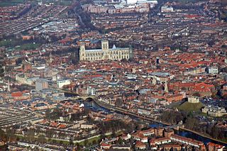
York

Wards from 1 April 1974 (first election 7 June 1973) to 3 May 1979: [11]

Wards from 3 May 1979 to 4 May 1995: [12]

Wards from 4 May 1995 to 1 May 2003: [13]

  1. Acomb (2)
  2. Beckfield (2)
  3. Bishophill (2)
  4. Bootham (2)
  5. Clifton (2)
  6. Clifton Without (1)
  7. Copmanthorpe (2)
  8. Dunnington & Kexby (1)
  9. Fishergate (2)
  10. Foxwood (3)
  11. Fulford (1)
  12. Guildhall (2)
  13. Haxby (3)
  14. Heslington (1)
  15. Heworth (2)
  16. Heworth Without (1)
  17. Holgate (2)
  18. Huntington & New Earswick (3)
  19. Knavesmire (2)
  20. Micklegate (2)
  21. Monk (2)
  22. Osbaldwick (1)
  23. Rawcliffe & Skelton (2)
  24. Strensall (2)
  25. Upper Poppleton (2)
  26. Walmgate (2)
  27. Westfield (2)
  28. Wheldrake (1)
  29. Wigginton (1)

Wards from 1 May 2003 to 7 May 2015: [14]

York UK ward map 2010 (blank).svg
  1. Acomb (2)
  2. Bishopthorpe (1)
  3. Clifton (3)
  4. Derwent (1)
  5. Dringhouses & Woodthorpe (3)
  6. Fishergate (2)
  7. Fulford (1)
  8. Guildhall (2)
  9. Haxby & Wigginton (3)
  10. Heslington (1)
  11. Heworth (3)
  12. Heworth Without (1)
  13. Holgate (3)
  14. Hull Road (2)
  15. Huntington & New Earswick (3)
  16. Micklegate (3)
  17. Osbaldwick (1)
  18. Rural West York (3)
  19. Skelton, Rawcliffe & Clifton Without (3)
  20. Strensall (2)
  21. Westfield (3)
  22. Wheldrake (1)

Wards from 7 May 2015 to present: [15]

York UK ward map 2015 (blank).svg
  1. Acomb (2)
  2. Bishopthorpe (1)
  3. Clifton (2)
  4. Copmanthorpe (1)
  5. Dringhouses & Woodthorpe (3)
  6. Fishergate (2)
  7. Fulford & Heslington (1)
  8. Guildhall (3)
  9. Haxby & Wigginton (3)
  10. Heworth (3)
  11. Heworth Without (1)
  12. Holgate (3)
  13. Hull Road (3)
  14. Huntington & New Earswick (3)
  15. Micklegate (3)
  16. Osbaldwick & Derwent (2)
  17. Rawcliffe & Clifton Without (3)
  18. Rural West York (2)
  19. Strensall (2)
  20. Westfield (3)
  21. Wheldrake (1)

Former county councils

Cleveland

Electoral Divisions from 1 April 1974 (first election 12 April 1973) to 2 May 1985: [16] [17]

  1. Acklam (3)
  2. Ayresome (2)
  3. Berwick Hills (3)
  4. Billingham East (3)
  5. Billingham West (3)
  6. Brinkburn (1)
  7. Brus (1)
  8. Coatham (2)
  9. Dyke House (1)
  10. Eston Grange (3)
  11. Fens (1)
  12. Grange (1)
  13. Grangefield (2)
  14. Gresham (2)
  15. Guisborough East (1)
  16. Guisborough West (1)
  17. Hart (1)
  18. Hartburn (3)
  19. Jackson (1)
  20. Kirkleatham (2)
  21. Linthorpe (3)
  22. Loftus (1)
  23. Marske (2)
  24. Marton & Nunthorpe (2)
  25. Mile House (3)
  26. North End (2)
  27. North Ormesby (2)
  28. Norton (2)
  29. Ormesby (3)
  30. Owton (1)
  31. Park (1)
  32. Redcar (2)
  33. Rift House (1)
  34. Rossmere (1)
  35. Saltburn (1)
  36. Seaton (1)
  37. Skelton & Brotton No. 1 (1)
  38. Skelton & Brotton No. 2 (1)
  39. South Bank (3)
  40. St Hilda (1)
  41. St Hildas (2)
  42. Stockton Rural No. 1 (1)
  43. Stockton Rural No. 2 (1)
  44. Stockton South (2)
  45. Stokesley (1)
  46. Stranton (1)
  47. Thornaby East (2)
  48. Thornaby West (2)
  49. Thorntree (2)
  50. Throston (1)
  51. Tollesby (3)

Electoral Divisions from 2 May 1985 to 1 April 1996 (county abolished): [17] [18]

  1. Ayresome (1)
  2. Belle Vue (1)
  3. Berwick Hills (1)
  4. Bishopsgarth (1)
  5. Blue Hall (1)
  6. Boundary (1)
  7. Brierton (1)
  8. Britannia (1)
  9. Brookfield (1)
  10. Brotton & Skinningthorpe (1)
  11. Brus (1)
  12. Burn (1)
  13. Cambridge Road (1)
  14. Cargo Fleet (1)
  15. Catcote (1)
  16. Charltons (1)
  17. College Road (1)
  18. Coulby Newham (1)
  19. Dormanstown (1)
  20. Dyke House (1)
  21. Egglescliffe (1)
  22. Eston (1)
  23. Fairfield (1)
  24. Foggy Furze (1)
  25. Glebe (1)
  26. Golden Flatts (1)
  27. Grangefield (1)
  28. Grangetown (1)
  29. Gresham (1)
  30. Guisborough (1)
  31. Hardwick (1)
  32. Hartburn (1)
  33. Ingleby Barwick (1)
  34. Jackson (1)
  35. Kader (1)
  36. Kirkleatham (1)
  37. Lingdale (1)
  38. Loftus (1)
  39. Longbeck (1)
  40. Low Grange (1)
  41. Mandale (1)
  42. Marsh House (1)
  43. Marton Grove (1)
  44. Middlesbrough Park (1)
  45. Mile House (1)
  46. Mill Hill (1)
  47. Mowbray (1)
  48. Netherby (1)
  49. Newcomen (1)
  50. Newham Grange (1)
  51. Newton under Roseberry (1)
  52. Normanby (1)
  53. Norton (1)
  54. Ormesby (1)
  55. Park End (1)
  56. Parkfield (1)
  57. Preston Whitton & Wolviston (1)
  58. Roworth (1)
  59. Rye Hill (1)
  60. Saltburn (1)
  61. Sandy Lane (1)
  62. Skelton (1)
  63. South Bank (1)
  64. St Anns (1)
  65. St Cuthberts (1)
  66. St Germains (1)
  67. St Hildas (1)
  68. Stadium (1)
  69. Stewart Park (1)
  70. Teesville (1)
  71. Throston (1)
  72. Tollesby (1)
  73. Victoria (1)
  74. Village (1)
  75. West Dyke (1)
  76. Yarm (1)
  77. Zetland Park (1)

North Yorkshire

Electoral Divisions from 1 April 1974 (first election 12 April 1973) to 2 May 1985: [19] [20]

  1. Acomb (1)
  2. Aysgarth (1)
  3. Beckfield (1)
  4. Bedale (1)
  5. Bootham (1)
  6. Brompton (1)
  7. Clifton (1)
  8. Derwent No. 1 (1)
  9. Derwent No. 2 (1)
  10. Easingwold (1)
  11. Filey (1)
  12. Fishergate (1)
  13. Flaxton No. 1 (1)
  14. Flaxton No. 2 (1)
  15. Flaxton No. 3 (1)
  16. Flaxton No. 4 (1)
  17. Guildhall (1)
  18. Harrogate (Bilton) (1)
  19. Harrogate (Duchy) (1)
  20. Harrogate (East Central) (1)
  21. Harrogate (Granby) (1)
  22. Harrogate (Harlow) (1)
  23. Harrogate (Pannal) (1)
  24. Harrogate (Starbeck) (1)
  25. Harrogate (Wedderburn) (1)
  26. Harrogate (West Central) (1)
  27. Hemsley (1)
  28. Heworth (1)
  29. Holgate (2)
  30. Kirkbymoorside (1)
  31. Knaresborough (2)
  32. Knavesmire (1)
  33. Leyburn (1)
  34. Malton (1)
  35. Micklegate (2)
  36. Monk (1)
  37. Nidderdale No. 1 (1)
  38. Nidderdale No. 2 (1)
  39. Nidderdale No. 3 (1)
  40. Northallerton (1)
  41. Norton (1)
  42. Norton Rural (1)
  43. Osgoldcross (1)
  44. Osmotherley (1)
  45. Pickering (1)
  46. Pickering Rural (1)
  47. Reeth (1)
  48. Richmond (1)
  49. Richmond Rural No. 1 (1)
  50. Richmond Rural No. 2 (1)
  51. Ripon & Pateley Bridge No. 1 (1)
  52. Ripon & Pateley Bridge No. 2 (1)
  53. Ripon East (1)
  54. Ripon West (1)
  55. Scalby (1)
  56. Scarborough (Castle) (1)
  57. Scarborough (Eastfield) (1)
  58. Scarborough (Falsgrave) (2)
  59. Scarborough (Northstead) (1)
  60. Scarborough (Weaponess) (1)
  61. Scarborough (Woodlands) (1)
  62. Scarborough Rural No. 1 (1)
  63. Scarborough Rural No. 2 (1)
  64. Selby No. 1 (1)
  65. Selby No. 2 (1)
  66. Selby Rural (1)
  67. Settle No. 1 (1)
  68. Settle No. 2 (1)
  69. Sheriff Hutton (1)
  70. Skipton No. 1 (1)
  71. Skipton No. 2 (1)
  72. Skipton Rural No. 1 (1)
  73. Skipton Rural No. 2 (1)
  74. Skipton Rural No. 3 (1)
  75. Stillington (1)
  76. Stokesley No. 1 (1)
  77. Stokesley No. 2 (1)
  78. Tadcaster No. 1 (1)
  79. Tadcaster No. 2 (1)
  80. Tadcaster No. 3 (1)
  81. Thirsk No. 1 (1)
  82. Thirsk No. 2 (1)
  83. Walmgate (1)
  84. Westfield (1)
  85. Wetherby (1)
  86. Whitby No. 1 (1)
  87. Whitby No. 2 (1)
  88. Whitby Rural No. 1 (1)
  89. Whitby Rural No. 2 (1)

Electoral Divisions from 2 May 1985 to 5 May 2005: [20] [21]

  1. Acomb (1); electoral division abolished in 1996 [13]
  2. Airedale (1)
  3. Appleton Wiske (1)
  4. Beckfield (1); electoral division abolished in 1996 [13]
  5. Bedale (1)
  6. Bilton (1)
  7. Bishophill (1); electoral division abolished in 1996 [13]
  8. Bishopthorpe/Copmanthorpe (1); electoral division abolished in 1996 [13]
  9. Bootham (1); electoral division abolished in 1996 [13]
  10. Boroughbridge (1)
  11. Brayton (1)
  12. Castle (1)
  13. Catterick (1)
  14. Cawood (1)
  15. Cayton (1)
  16. Claro (1)
  17. Clifton (1); electoral division abolished in 1996 [13]
  18. Danby (1)
  19. Derwent (1)
  20. Duchy (1)
  21. Dunnington (1); electoral division abolished in 1996 [13]
  22. Easingwold (1)
  23. East Central (1)
  24. Eastfield (1)
  25. Eskdale (1)
  26. Falsgrave (1)
  27. Filey (1)
  28. Fishergate (1); electoral division abolished in 1996 [13]
  29. Foxwood (1); electoral division abolished in 1996 [13]
  30. Fulford (1)
  31. Granby (1)
  32. Great Ayton (1)
  33. Guildhall (1); electoral division abolished in 1996 [13]
  34. Harlow (1)
  35. Haverah (1)
  36. Haxby/Strensall (1); electoral division abolished in 1996 [13]
  37. Haxby/Wigginton (1); electoral division abolished in 1996 [13]
  38. Heworth (1); electoral division abolished in 1996 [13]
  39. Holgate (1); electoral division abolished in 1996 [13]
  40. Hovingham/Sheriff Hutton (1)
  41. Huntington North (1)
  42. Huntington South (1); electoral division abolished in 1996 [13]
  43. Killinghall & New Park (1)
  44. Kirkbymoorside (1)
  45. Knaresborough East (1)
  46. Knaresborough West (1)
  47. Knavesmire (1); electoral division abolished in 1996 [13]
  48. Lindhead (1)
  49. Malton (1)
  50. Masham & Fountains (1)
  51. Mayfield (1)
  52. Micklegate (1); electoral division abolished in 1996 [13]
  53. Mid-Craven (1)
  54. Middle Dales (1)
  55. Monk (1); electoral division abolished in 1996 [13]
  56. North Craven (1)
  57. Northallerton East & Brompton (1)
  58. Northallerton West (1)
  59. Northstead (1)
  60. Norton (1)
  61. Osbaldwick/Heworth (1); electoral division abolished in 1996 [13]
  62. Osgoldcross (1)
  63. Pannal (1)
  64. Pateley Bridge (1)
  65. Pickering (1)
  66. Poppleton (1)
  67. Rawcliffe (1); electoral division abolished in 1996 [13]
  68. Ribblesdale (1)
  69. Richmond (1)
  70. Richmondshire North (1)
  71. Rillington (1)
  72. Ripon East (1)
  73. Ripon West (1)
  74. Scalby (1)
  75. Seamer (1)
  76. Selby North (1)
  77. Selby Rural (1)
  78. Sherburn (1)
  79. Skipton East (1)
  80. Skipton West (1)
  81. South Craven (1)
  82. Starbeck (1)
  83. Stillington (1)
  84. Stokesley (1)
  85. Streonshalh (1)
  86. Tadcaster East (1)
  87. Tadcaster West (1)
  88. Thirsk (1)
  89. Thornton (1)
  90. Upper Dales (1)
  91. Walmgate (1); electoral division abolished in 1996 [13]
  92. Weaponness (1)
  93. Wedderburn (1)
  94. West Central (1)
  95. Westfield (1); electoral division abolished in 1996 [13]
  96. Woodlands (1)

Electoral Divisions from 5 May 2005 to 5 May 2022: [22]

North Yorkshire UK electoral division map (blank).svg
  1. Ainsty (1)
  2. Airedale (1) †
  3. Bedale (1)
  4. Boroughbridge (1)
  5. Castle (1)
  6. Catterick Bridge (1)
  7. Cawood & Saxton (1)
  8. Central Richmondshire (1)
  9. Easingwold (1)
  10. Eastfield & Osgodby (1)
  11. Escrick (1)
  12. Esk Valley (1)
  13. Falsgrave & Stepney (1)
  14. Filey (1)
  15. Great Ayton (1)
  16. Harrogate Bilton & Nidd Gorge (2)
  17. Harrogate Central (2)
  18. Harrogate Harlow (1)
  19. Harrogate Oatlands (1)
  20. Harrogate Saltergate (1)
  21. Harrogate Starbeck (1)
  22. Hertford & Cayton (1)
  23. Hovingham & Sheriff Hutton (1)
  24. Kirkbymoorside (1)
  25. Knaresborough (2)
  26. Lower Nidderdale & Bishop Monkton (1)
  27. Malton (1)
  28. Masham & Fountains (1)
  29. Mid Craven (1) †
  30. Mid Selby (1)
  31. Middle Dales (1)
  32. Newby (1)
  33. North Craven (1)
  34. North Hambleton (1)
  35. Northallerton (1)
  36. Northstead (1)
  37. Norton (1)
  38. Osgoldcross (1)
  39. Pannal & Lower Wharfedale (1)
  40. Pateley Bridge (1)
  41. Pickering (1)
  42. Ribblesdale (1)
  43. Richmond (1)
  44. Richmondshire North (1)
  45. Ripon North (1)
  46. Ripon South (1)
  47. Romanby & Broomfield (1)
  48. Scalby & The Coast (1)
  49. Seamer & Derwent Valley (1)
  50. Selby Barlby (2)
  51. Selby Brayton (1)
  52. Sherburn in Elmet (1)
  53. Skipton East (1) †
  54. Skipton West (1) †
  55. South Craven (1) †
  56. South Selby (1)
  57. Sowerby (1)
  58. Stillington (1)
  59. Stokesley (1)
  60. Swale (1)
  61. Tadcaster (1)
  62. Thirsk (1)
  63. Thornton Dale & the Wolds (1)
  64. Upper Dales (1)
  65. Weaponness & Ramshill (1)
  66. Whitby/Mayfield cum Mulgrave (1)
  67. Whitby/Streonshalh (1)
  68. Woodlands (1)

† minor boundary changes in 2013 [23] [24]

Electoral Divisions from 6 May 2022 to 31 March 2023 (county abolished):

The electoral divisions for the election held on 5 May 2022 are those determined for the unitary North Yorkshire Council, and are in effect until the county council is abolished. [6]

Former district councils

Craven

Wards from 1 April 1974 (first election 7 June 1973) to 3 May 1979: [11]

Wards from 3 May 1979 to 2 May 2002: [25]

Wards from 2 May 2002 to 1 April 2023: [26] [27]

Craven UK ward map 2010 (blank).svg
Craven UK ward map 2016 (blank).svg
  1. Aire Valley with Lothersdale (2) †
  2. Barden Fell (1) †
  3. Bentham (2)
  4. Cowling (1) †
  5. Embsay-with-Eastby (1) †
  6. Gargrave & Malhamdale (2) †
  7. Glusburn (2) †
  8. Grassington (1) †
  9. Hellifield & Long Preston (1) †
  10. Ingleton & Clapham (2)
  11. Penyghent (1) †
  12. Settle & Ribblebanks (2) †
  13. Skipton East (2) †
  14. Skipton North (2) †
  15. Skipton South (2)
  16. Skipton West (2) †
  17. Sutton-in-Craven (2) †
  18. Upper Wharfedale (1)
  19. West Craven (1) †

† minor boundary changes in 2015 [23] [24]

Hambleton

Wards from 1 April 1974 (first election 7 June 1973) to 3 May 1979: [11]

Wards from 3 May 1979 to 1 May 2003: [28]

Wards from 1 May 2003 to 7 May 2015: [29]

Hambleton UK ward map 2010 (blank).svg
  1. Bedale (2)
  2. Brompton (1)
  3. Broughton & Greenhow (1)
  4. Cowtons (1)
  5. Crakehall (1)
  6. Easingwold (2)
  7. Great Ayton (3)
  8. Helperby (1)
  9. Huby & Sutton (1)
  10. Leeming (1)
  11. Leeming Bar (1)
  12. Morton-on-Swale (1)
  13. Northallerton Broomfield (2)
  14. Northallerton Central (2)
  15. Northallerton North (2)
  16. Osmotherley (1)
  17. Romanby (2)
  18. Rudby (2)
  19. Shipton (1)
  20. Sowerby (2)
  21. Stillington (1)
  22. Stokesley (3)
  23. Swainby (1)
  24. Tanfield (1)
  25. Thirsk (3)
  26. Thorntons (1)
  27. Tollerton (1)
  28. Topcliffe (1)
  29. White Horse (1)
  30. Whitestonecliffe (1)

Wards from 7 May 2015 to 1 April 2023: [30]

Hambleton UK ward map 2015 (blank).svg
  1. Appleton Wiske & Smeatons (1)
  2. Bagby & Thorntons (1)
  3. Bedale (3)
  4. Easingwold (3)
  5. Great Ayton (2)
  6. Huby (1)
  7. Hutton Rudby (1)
  8. Morton-on-Swale (1)
  9. Northallerton North & Brompton (2)
  10. Northallerton South (2)
  11. Osmotherley & Swainby (1)
  12. Raskelf & White Horse (1)
  13. Romanby (2)
  14. Sowerby & Topcliffe (2)
  15. Stokesley (2)
  16. Tanfield (1)
  17. Thirsk (2)

Harrogate

Wards from 1 April 1974 (first election 7 June 1973) to 5 May 1983: [11]

Wards from 5 May 1983 to 2 May 2002: [31]

Wards from 2 May 2002 to 3 May 2018: [32]

Harrogate UK ward map 2010 (blank).svg
  1. Bilton (2)
  2. Bishop Monkton (1)
  3. Boroughbridge (1)
  4. Claro (1)
  5. Granby (2)
  6. Harlow Moor (2)
  7. High Harrogate (2)
  8. Hookstone (2)
  9. Killinghall (1)
  10. Kirkby Malzeard (1)
  11. Knaresborough East (2)
  12. Knaresborough King James (2)
  13. Knaresborough Scriven Park (2)
  14. Lower Nidderdale (1)
  15. Low Harrogate (2)
  16. Marston Moor (1)
  17. Mashamshire (1)
  18. Newby (1)
  19. New Park (2)
  20. Nidd Valley (1)
  21. Ouseburn (1)
  22. Pannal (2)
  23. Pateley Bridge (1)
  24. Ribston (1)
  25. Ripon Minster (2)
  26. Ripon Moorside (2)
  27. Ripon Spa (2)
  28. Rossett (2)
  29. Saltergate (2)
  30. Spofforth with Lower Wharfedale (1)
  31. Starbeck (2)
  32. Stray (2)
  33. Washburn (1)
  34. Wathvale (1)
  35. Woodfield (2)

Wards from 3 May 2018 to 1 April 2023: [33]

  1. Bishop Monkton & Newby (1)
  2. Boroughbridge (1)
  3. Claro (1)
  4. Fountains & Ripley (1)
  5. Harrogate Bilton Grange (1)
  6. Harrogate Bilton Woodfield (1)
  7. Harrogate Central (1)
  8. Harrogate Coppice Valley (1)
  9. Harrogate Duchy (1)
  10. Harrogate Fairfax (1)
  11. Harrogate Harlow (1)
  12. Harrogate High Harrogate (1)
  13. Harrogate Hookstone (1)
  14. Harrogate Kingsley (1)
  15. Harrogate New Park (1)
  16. Harrogate Oaklands (1)
  17. Harrogate Old Bilton (1)
  18. Harrogate Pannal (1)
  19. Harrogate Saltergate (1)
  20. Harrogate St Georges (1)
  21. Harrogate Starbeck (1)
  22. Harrogate Stray (1)
  23. Harrogate Valley Gardens (1)
  24. Killinghall & Hampsthwaite (1)
  25. Knaresborough Aspin & Calcutt (1)
  26. Knaresborough Castke (1)
  27. Knaresborough Eastfield (1)
  28. Knaresborough Scriven Park (1)
  29. Marston Moor (1)
  30. Masham & Kirkby Malzeard (1)
  31. Nidd Valley (1)
  32. Ouseburn (1)
  33. Pateley Bridge & Nidderdale Moors (1)
  34. Ripon Minster (1)
  35. Ripon Moorside (1)
  36. Ripon Spa (1)
  37. Ripon Ure Bank (1)
  38. Spofforth with Lower Wharfedale (1)
  39. Washburn (1)
  40. Wathvale (1)

Richmondshire

Wards from 1 April 1974 (first election 7 June 1973) to 3 May 1979: [11]

Wards from 3 May 1979 to 1 May 2003: [34]

Wards from 1 May 2003 to 2 May 2019: [35]

Richmondshire UK ward map 2010 (blank).svg
  1. Addlebrough (1)
  2. Barton (1)
  3. Bolton Castle (1)
  4. Brompton-on-Swale & Scorton (2)
  5. Catterick (2)
  6. Colburn (3)
  7. Croft (1)
  8. Gilling West (1)
  9. Hawes & High Abbotside (1)
  10. Hipswell (2)
  11. Hornby Castle (1)
  12. Leyburn (2)
  13. Lower Wensleydale (1)
  14. Melsonby (1)
  15. Middleham (1)
  16. Middleton Tyas (1)
  17. Newsham with Eppleby (1)
  18. Penhill (1)
  19. Reeth & Arkengarthdale (1)
  20. Richmond Central (2)
  21. Richmond East (2)
  22. Richmond West (2)
  23. Scotton (2)
  24. Swaledale (1)

Wards from 2 May 2019 to 1 April 2023: [36]

  1. Catterick & Brompton-on-Swale (3)
  2. Colburn (2)
  3. Croft & Middleton Tyas (2)
  4. Gilling West (1)
  5. Hawes, High Abbotside & Upper Swaledale (1)
  6. Hipswell (2)
  7. Leyburn (2)
  8. Lower Swaledale & Arkengarthdale (1)
  9. Lower Wensleydale (1)
  10. Melsonby (1)
  11. Middleham (1)
  12. Richmond East (1)
  13. Richmond North (1)
  14. Richmond West (2)
  15. Scotton (2)
  16. Yoredale (1)

Ryedale

Wards from 1 April 1974 (first election 7 June 1973) to 5 May 1983: [11]

Wards from 5 May 1983 to 1 May 2003: [37]

Wards from 1 May 2003 to 1 April 2023: [38]

Ryedale UK ward map 2010 (blank).svg
  1. Amotherby (1)
  2. Ampleforth (1)
  3. Cropton (1)
  4. Dales (1)
  5. Derwent (2)
  6. Helmsley (2)
  7. Hovingham (1)
  8. Kirkbymoorside (2)
  9. Malton (3)
  10. Norton East (2)
  11. Norton West (2)
  12. Pickering East (2)
  13. Pickering West (2)
  14. Rillington (1)
  15. Ryedale South West (1)
  16. Sherburn (1)
  17. Sheriff Hutton (1)
  18. Sinnington (1)
  19. Thornton Dale (2)
  20. Wolds (1)

Scarborough

Wards from 1 April 1974 (first election 7 June 1973) to 3 May 1979: [11]

Wards from 3 May 1979 to 1 May 2003: [39]

Wards from 1 May 2003 to 2 May 2019: [40]

Scarborough UK ward map 2010 (blank).svg
  1. Castle (2)
  2. Cayton (2)
  3. Central (2)
  4. Danby (1)
  5. Derwent Valley (2)
  6. Eastfield (3)
  7. Esk Valley (2)
  8. Falsgrave Park (2)
  9. Filey (3)
  10. Fylingdales (1)
  11. Hertford (2)
  12. Lindhead (1)
  13. Mayfield (2)
  14. Mulgrave (2)
  15. Newby (3)
  16. North Bay (2)
  17. Northstead (2)
  18. Ramshill (2)
  19. Scalby, Hackness & Staintondale (2)
  20. Seamer (2)
  21. Stepney (2)
  22. Streonshalh (2)
  23. Weaponness (2)
  24. Whitby West Cliff (2)
  25. Woodlands (2)

Wards from 2 May 2019 to 1 April 2023: [41]

  1. Burniston & Cloughton (1)
  2. Castle (3)
  3. Cayton (2)
  4. Danby & Mulgrave (2)
  5. Derwent Valley & Moor (2)
  6. Eastfield (3)
  7. Esk Valley (2)
  8. Falsgrave & Stepney (3)
  9. Filey (3)
  10. Fylingdales & Ravenscar (1)
  11. Hunmanby (2)
  12. Mayfield (2)
  13. Newby (3)
  14. Northstead (3)
  15. Scalby (2)
  16. Seamer (2)
  17. Streonshalh (2)
  18. Weaponness & Ramshill (3)
  19. Whitby West Cliff (2)
  20. Woodlands (3)

Selby

Wards from 1 April 1974 (first election 7 June 1973) to 3 May 1979: [11]

Wards from 3 May 1979 to 1 May 2003: [42]

Wards from 1 May 2003 to 7 May 2015: [43]

Selby UK ward map 2010 (blank).svg
  1. Appleton Roebuck (1)
  2. Barlby (2)
  3. Brayton (3)
  4. Camblesforth (2)
  5. Cawood with Wistow (2)
  6. Eggborough (2)
  7. Fairburn with Brotherton (2)
  8. Hambleton (3)
  9. Hemingbrough (2)
  10. Monk Fryston & South Milford (2)
  11. North Duffield (1)
  12. Riccall with Escrick (2)
  13. Saxton & Ulleskelf (1)
  14. Selby North (3)
  15. Selby South (2)
  16. Selby West (2)
  17. Sherburn in Elmet (3)
  18. Tadcaster East (2)
  19. Tadcaster West (2)
  20. Whitley (2)

Wards from 7 May 2015 to 1 April 2023: [44]

Selby UK ward map 2015 (blank).svg
  1. Appleton Roebuck & Church Fenton (2)
  2. Barlby Village (1)
  3. Brayton (2)
  4. Byram & Brotherton (1)
  5. Camblesforth & Carlton (2)
  6. Cawood & Wistow (1)
  7. Derwent (2)
  8. Eggborough (1)
  9. Escrick (1)
  10. Hambleton (1)
  11. Monk Fryston (1)
  12. Riccall (1)
  13. Selby East (3)
  14. Selby West (3)
  15. Sherburn in Elmet (3)
  16. South Milford (1)
  17. Tadcaster (3)
  18. Thorpe Willoughby (1)
  19. Whitley (1)

Electoral wards by constituency

Harrogate and Knaresborough

Bilton, Boroughbridge, Claro, Granby, Harlow Moor, High Harrogate, Hookstone, Killinghall, Knaresborough East, Knaresborough King James, Knaresborough Scriven Park, Low Harrogate, New Park, Pannal, Rossett, Saltergate, Starbeck, Stray, Woodfield.

Middlesbrough

Acklam, Ayresome, Beckfield, Beechwood, Brookfield, Clairville, Gresham, Kader, Linthorpe, Middlehaven, North Ormesby and Brambles Farm, Pallister, Park, Thorntree, University.

Middlesbrough South and East Cleveland

Brotton, Coulby Newham, Guisborough, Hemlington, Hutton, Ladgate, Lockwood, Loftus, Marton, Marton West, Nunthorpe, Park End, Saltburn, Skelton, Stainton and Thornton, Westworth.

Redcar

Coatham, Dormanstown, Eston, Grangetown, Kirkleatham, Longbeck, Newcomen, Normanby, Ormesby, St Germain’s, South Bank, Teesville, West Dyke, Zetland.

Richmond

Addlebrough, Barton, Bedale, Bolton Castle, Brompton, Brompton-on-Swale and Scorton, Broughton and Greenhow, Catterick, Colburn, Cowtons, Crakehall, Croft, Great Ayton, Gilling West, Hawes and High Abbotside, Hipswell, Hornby Castle, Leeming, Leeming Bar, Leyburn, Lower Wensleydale, Melsonby, Middleham, Middleton Tyas, Morton-on-Swale, Newsham with Eppleby, Northallerton Broomfield, Northallerton Central, Northallerton North, Osmotherley, Penhill, Reeth and Arkengarthdale, Richmond Central, Richmond East, Richmond West, Romanby, Rudby, Scotton, Stokesley, Swaledale, Swainby, Tanfield.

Scarborough and Whitby

Castle, Cayton, Central, Danby, Derwent Valley, Eastfield, Esk Valley, Falsgrave Park, Fylingdales, Lindhead, Mayfield, Mulgrave, Newby, North Bay, Northstead, Ramshill, Scalby, Hackness and Staintondale, Seamer, Stepney, Streonshalh, Weaponness, Whitby West Cliff, Woodlands.

Selby and Ainsty

Appleton Roebuck, Barlby, Brayton, Camblesforth, Cawood with Wistow, Eggborough, Fairburn with Brotherton, Hambleton, Hemingbrough, Marston Moor, Monk Fryston and South Milford, North Duffield, Ouseburn, Ribston, Riccall with Escrick, Saxton and Ulleskelf, Selby North, Selby South, Selby West, Sherburn in Elmet, Spofforth with Lower Wharfedale, Tadcaster East, Tadcaster West, Whitley.

Skipton and Ripon

Aire Valley with Lothersdale, Barden Fell, Bentham, Bishop Monkton, Cowling, Embsay-with-Eastby, Gargrave and Malhamdale, Glusburn, Grassington, Hellifield and Long Preston, Ingleton and Clapham, Kirkby Malzeard, Lower Nidderdale, Mashamshire, Newby, Nidd Valley, Pateley Bridge, Penyghent, Ripon Minster, Ripon Moorside, Ripon Spa, Settle and Ribblebanks, Skipton East, Skipton North, Skipton South, Skipton West, Sutton-in-Craven, Upper Wharfedale, Washburn, Wathvale, West Craven.

Stockton South

Ingleby Barwick East, Ingleby Barwick West, Mandale and Victoria, Stainsby Hill, Village, Yarm.

Thirsk and Malton

Amotherby, Ampleforth, Cropton, Dales, Derwent, Easingwold, Filey, Helmsley, Helperby, Hertford, Hovingham, Huby and Sutton, Kirkbymoorside, Malton, Norton East, Norton West, Pickering East, Pickering West, Rillington, Ryedale South West, Sherburn, Sheriff Hutton, Shipton, Sinnington, Sowerby, Stillington, Thirsk, Thornton Dale, Thorntons, Tollerton, Topcliffe, White Horse, Whitestonecliffe, Wolds.

York Central

Acomb, Clifton, Fishergate, Guildhall, Heworth, Holgate, Hull Road, Micklegate, Westfield.

York Outer

Bishopthorpe, Derwent, Dringhouses and Woodthorpe, Fulford, Haxby and Wigginton, Heslington, Heworth Without, Huntington and New Earswick, Osbaldwick, Rural West York, Skelton, Rawcliffe and Clifton Without, Strensall, Wheldrake.

See also

Related Research Articles

<span class="mw-page-title-main">North Yorkshire</span> County of England

North Yorkshire is a ceremonial county in the Yorkshire and the Humber and North East regions of England. It borders County Durham to the north, the North Sea to the east, the East Riding of Yorkshire to the south-east, South Yorkshire to the south, West Yorkshire to the south-west, and Cumbria and Lancashire to the west. Northallerton is the county town.

<span class="mw-page-title-main">Ripon</span> City in North Yorkshire, England

Ripon is a cathedral city and civil parish in North Yorkshire, England. The city is located at the confluence of two tributaries of the River Ure, the Laver and Skell. Within the boundaries of the historic West Riding of Yorkshire, the city is noted for its main feature, Ripon Cathedral, which is architecturally significant, as well as the Ripon Racecourse and other features such as its market.

<span class="mw-page-title-main">Selby District</span> Former local government district in England

Selby District was a local government district of North Yorkshire, England, from 1974 to 2023. Its council was based in the town of Selby. The district had a population of 83,449 at the 2011 Census. The southernmost district of North Yorkshire, it bordered the City of York unitary authority, the Borough of Harrogate in North Yorkshire, the City of Leeds and City of Wakefield districts in West Yorkshire, the City of Doncaster in South Yorkshire, and the ceremonial county of the East Riding of Yorkshire.

<span class="mw-page-title-main">Borough of Harrogate</span> Former local government district in England

The Borough of Harrogate was a local government district with borough status in North Yorkshire, England, from 1974 to 2023. Its council was based in the town of Harrogate, but it also included surrounding settlements, including the cathedral city of Ripon, and almost all of the Nidderdale Area of Outstanding Natural Beauty. At the 2011 Census, the borough had a population of 157,869.

<span class="mw-page-title-main">Harrogate line</span> Passenger rail line in England

The Harrogate line is a passenger rail line through parts of North Yorkshire and the West Yorkshire area of northern England connecting Leeds to York by way of Harrogate and Knaresborough. Service on the line is operated by Northern, with a few additional workings by London North Eastern Railway starting and terminating at Harrogate. West Yorkshire Metro's bus and rail MetroCard ticket is available for journeys between Leeds and Harrogate.

<span class="mw-page-title-main">Selby (UK Parliament constituency)</span> Parliamentary constituency in the United Kingdom, 1983–2010

Selby was a parliamentary constituency in North Yorkshire, represented in the House of Commons of the Parliament of the United Kingdom. It elected one Member of Parliament (MP) by the first past the post system of election. The constituency existed from 1983 to 2010.

<span class="mw-page-title-main">Vale of York (UK Parliament constituency)</span> Parliamentary constituency in the United Kingdom, 1997–2010

Vale of York was a county constituency represented in the House of Commons of the Parliament of the United Kingdom. It elected one Member of Parliament (MP) by the first past the post system of election.

<span class="mw-page-title-main">Skipton and Ripon (UK Parliament constituency)</span> Parliamentary constituency in the United Kingdom, 1983 onwards

Skipton and Ripon is a constituency in North Yorkshire represented in the House of Commons of the UK Parliament since 2010 by Julian Smith, a Conservative.

<span class="mw-page-title-main">Harrogate and Knaresborough (UK Parliament constituency)</span> Parliamentary constituency in the United Kingdom

Harrogate and Knaresborough is a parliamentary constituency in North Yorkshire which has been represented in the House of Commons of the UK Parliament since 2010 by Andrew Jones, an MP from the Conservative Party. The constituency was formed in the 1997 boundary changes, before which it was named Harrogate.

Bilton is a suburb of Harrogate, North Yorkshire, England, situated to the north-east of the town centre.

<span class="mw-page-title-main">North Yorkshire Council</span> Unitary authority in England

North Yorkshire Council is the unitary authority which governs the non-metropolitan county of North Yorkshire, within the larger ceremonial county of North Yorkshire, in England. North Yorkshire was a two-tier non-metropolitan county from 1974 to 2023, when North Yorkshire Council was a county council called North Yorkshire County Council. On 1 April 2023 the seven lower-tier districts of the county were abolished and their functions taken over by the new unitary authority.

<span class="mw-page-title-main">City of York</span> Unitary authority area in North Yorkshire, England

The City of York, officially simply "York", is a unitary authority area with city status in the ceremonial county of North Yorkshire, England.

<span class="mw-page-title-main">2009 North Yorkshire County Council election</span>

Elections to North Yorkshire County Council took place on 4 June 2009, having been delayed from 7 May, in order to coincide with elections to the European Parliament.

<span class="mw-page-title-main">2014 Harrogate Borough Council election</span>

Elections to Harrogate Borough Council were held on 22 May 2014. A third of the council was up for election, with voting only in the urban wards of Harrogate, Knaresborough and Ripon. The elections were held on the same day as the British local elections and the European Parliament elections. Each ward up for election returned a councillor for a four-year term of office.

<span class="mw-page-title-main">North Yorkshire (district)</span> Unitary authority area in England

North Yorkshire is a non-metropolitan county and unitary authority area, in the ceremonial county of North Yorkshire, England. It covers seven former districts: Craven, Hambleton, Harrogate, Scarborough, Richmondshire, Ryedale and Selby.

Wetherby and Easingwold is a proposed constituency of the House of Commons in the UK Parliament, partly in North Yorkshire and partly in West Yorkshire. Further to the completion of the 2023 Periodic Review of Westminster constituencies, it will first be contested at the next general election.

References

  1. 1 2 The County of Cleveland (District Wards) Order 1973
  2. The Borough of Middlesbrough (Electoral Arrangements) Order 1976
  3. 1 2 legislation.gov.uk - The Cleveland (Structural Change) Order 1995. Retrieved on 6 November 2015.
  4. legislation.gov.uk - The Borough of Middlesbrough (Electoral Changes) Order 2003. Retrieved on 3 November 2015.
  5. legislation.gov.uk - The Middlesbrough (Electoral Changes) Order 2014. Retrieved on 3 November 2015.
  6. 1 2 "The North Yorkshire (Structural Changes) Order 2022". gov.uk . 17 March 2022. Retrieved 22 April 2022.
  7. legislation.gov.uk - The Borough of Langbaurgh (Electoral Arrangements) Order 1975. Retrieved on 4 November 2015.
  8. legislation.gov.uk - The Borough of Langbaurgh (Electoral Arrangements) Order 1991. Retrieved on 4 November 2015.
  9. legislation.gov.uk - The Borough of Redcar and Cleveland (Electoral Changes) Order 2003. Retrieved on 3 November 2015.
  10. "The Redcar and Cleveland (Electoral Changes) Order 2018". gov.uk . 13 November 2018. Retrieved 5 April 2022.
  11. 1 2 3 4 5 6 7 8 The County of North Yorkshire (District Wards) Order 1973
  12. The City of York (Electoral Arrangements) Order 1976
  13. 1 2 3 4 5 6 7 8 9 10 11 12 13 14 15 16 17 18 19 20 21 22 23 legislation.gov.uk - The North Yorkshire (District of York) (Structural and Boundary Changes) Order 1995. Retrieved on 6 November 2015.
  14. legislation.gov.uk - The City of York (Electoral Changes) Order 2001. Retrieved on 4 October 2015.
  15. legislation.gov.uk - The York (Electoral Changes) Order 2014. Retrieved on 3 November 2015.
  16. The County of Cleveland (Electoral Divisions) Order 1973
  17. 1 2 Rallings, Colin; Thrasher, Michael. Cleveland County Council Election Results 1973-1993 (PDF). The Elections Centre. Retrieved 12 May 2016.
  18. The County of Cleveland (Electoral Arrangements) Order 1985
  19. The County of North Yorkshire (Electoral Divisions) Order 1973
  20. 1 2 Rallings, Colin; Thrasher, Michael. North Yorkshire County Council Election Results 1973-2009 (PDF). The Elections Centre. Retrieved 12 May 2016.
  21. legislation.gov.uk - The County of North Yorkshire (Electoral Arrangements) Order 1985. Retrieved on 5 November 2015.
  22. legislation.gov.uk - The County of North Yorkshire (Electoral Changes) Order 2005. Retrieved on 3 November 2015.
  23. 1 2 legislation.gov.uk - The District of Craven (Electoral Changes) Order 2012. Retrieved on 3 November 2015.
  24. 1 2 legislation.gov.uk - The District of Craven (Electoral Changes) (Amendment) Order 2013. Retrieved on 3 November 2015.
  25. The District of Craven (Electoral Arrangements) Order 1977
  26. legislation.gov.uk - The District of Craven (Electoral Changes) Order 2000. Retrieved on 4 October 2015.
  27. legislation.gov.uk - The District of Craven (Electoral Changes) (Amendment) Order 2005. Retrieved on 3 November 2015.
  28. The District of Hambleton (Electoral Arrangements) Order 1978
  29. legislation.gov.uk - The District of Hambleton (Electoral Changes) Order 2000. Retrieved on 4 October 2015.
  30. legislation.gov.uk - The Hambleton (Electoral Changes) Order 2014. Retrieved on 3 November 2015.
  31. The Borough of Harrogate (Electoral Arrangements) Order 1979
  32. legislation.gov.uk - The Borough of Harrogate (Electoral Changes) Order 2000. Retrieved on 4 October 2015.
  33. "The Harrogate (Electoral Changes) Order 2017". gov.uk . 27 March 2017. Retrieved 22 April 2022.
  34. The District of Richmondshire (Electoral Arrangements) Order 1977
  35. legislation.gov.uk - The District of Richmondshire (Electoral Changes) Order 2000. Retrieved on 4 October 2015.
  36. "The Richmondshire (Electoral Changes) Order 2018". gov.uk . 17 July 2018. Retrieved 22 April 2022.
  37. legislation.gov.uk - The District of Ryedale (Electoral Arrangements) Order 1979. Retrieved on 19 November 2015.
  38. legislation.gov.uk - The District of Ryedale (Electoral Changes) Order 2000. Retrieved on 4 October 2015.
  39. The Borough of Scarborough (Electoral Arrangements) Order 1977
  40. legislation.gov.uk - The Borough of Scarborough (Electoral Changes) Order 2000. Retrieved on 4 October 2015.
  41. "The Scarborough (Electoral Changes) Order 2018". gov.uk . 17 July 2018. Retrieved 22 April 2022.
  42. The District of Selby (Electoral Arrangements) Order 1978
  43. legislation.gov.uk - The District of Selby (Electoral Changes) Order 2000. Retrieved on 4 October 2015.
  44. legislation.gov.uk - The Selby (Electoral Changes) Order 2014. Retrieved on 3 November 2015.