List of electoral wards in Somerset

Last updated

This is a list of electoral divisions and wards in the ceremonial county of Somerset in South West England. All changes since the re-organisation of local government following the passing of the Local Government Act 1972 are shown. The number of councillors elected for each electoral division or ward is shown in brackets.

Contents

Unitary authority councils

Bath and North East Somerset

Wards from 1 April 1996 (first election 4 May 1995) to 6 May 1999: [1]

Bath and North East Somerset UK ward map 1995 (blank).svg
  1. Abbey (2)
  2. Bathavon North (3)
  3. Bathavon South (2)
  4. Bathwick (2)
  5. Bloomfield (2)
  6. Cameley (1)
  7. Chew Valley North & Clutton (2)
  8. Chew Valley South (1)
  9. Chew Valley West (1)
  10. Combe Down (2)
  11. Farmborough & High Littleton (1)
  12. Keynsham East (2)
  13. Keynsham North (1)
  14. Keynsham South (2)
  15. Keynsham West (1)
  16. Kingsmead (2)
  17. Lambridge (2)
  18. Lansdown (2)
  19. Lyncombe (2)
  20. Midsomer Norton North (2)
  21. Midsomer Norton Redfield (2)
  22. Newbridge (2)
  23. Newton St Loe (1)
  24. Oldfield (2)
  25. Paulton (2)
  26. Peasedown (2)
  27. Radstock (2)
  28. Saltford (2)
  29. Southdown (2)
  30. Timsbury (1)
  31. Twerton (2)
  32. Walcot (2)
  33. Westfield (2)
  34. Westmoreland (2)
  35. Weston (2)
  36. Widcombe (2)

Wards from 6 May 1999 to 2 May 2019: [2]

Bath and North East Somerset UK ward map 2010 (blank).svg
  1. Abbey (2)
  2. Bathavon North (3)
  3. Bathavon South (1)
  4. Bathavon West (1)
  5. Bathwick (2)
  6. Chew Valley North (1)
  7. Chew Valley South (1)
  8. Clutton (1)
  9. Combe Down (2)
  10. Farmborough (1)
  11. High Littleton (1)
  12. Keynsham East (2)
  13. Keynsham North (2)
  14. Keynsham South (2)
  15. Kingsmead (2)
  16. Lambridge (2)
  17. Lansdown (2)
  18. Lyncombe (2)
  19. Mendip (1)
  20. Midsomer Norton North (2)
  21. Midsomer Norton Redfield (2)
  22. Newbridge (2)
  23. Odd Down (2)
  24. Oldfield (2)
  25. Paulton (2)
  26. Peasedown (2)
  27. Publow & Whitchurch (1)
  28. Radstock (2)
  29. Saltford (2)
  30. Southdown (2)
  31. Timsbury (1)
  32. Twerton (2)
  33. Walcot (2)
  34. Westfield (2)
  35. Westmoreland (2)
  36. Weston (2)
  37. Widcombe (2)

Wards from 2 May 2019 to 1 April 2023: [3]

Bath and North East Somerset UK ward map 2019 (blank).svg
  1. Bathavon North (2)
  2. Bathavon South (2)
  3. Bathwick (2)
  4. Chew Valley (2)
  5. Clutton & Farmborough (1)
  6. Combe Down (2)
  7. High Littleton (1)
  8. Keynsham East (2)
  9. Keynsham North (2)
  10. Keynsham South (2)
  11. Kingsmead (2)
  12. Lambridge (2)
  13. Lansdown (2)
  14. Mendip (1)
  15. Midsomer Norton North (2)
  16. Midsomer Norton Redfield (2)
  17. Moorlands (1)
  18. Newbridge (2)
  19. Odd Down (2)
  20. Oldfield Park (1)
  21. Paulton (2)
  22. Peasedown (2)
  23. Publow & Whitchurch (1)
  24. Radstock (2)
  25. Saltford (2)
  26. Southdown (2)
  27. Timsbury (1)
  28. Twerton (2)
  29. Walcot (2)
  30. Westfield (2)
  31. Westmoreland (2)
  32. Weston (2)
  33. Widcombe & Lyncombe (2)

North Somerset

Wards from 1 April 1996 (first election 4 May 1995) to 6 May 1999: [1]

  1. Backwell (2)
  2. Banwell (2)
  3. Blagdon (1)
  4. Churchill (1)
  5. Clevedon Central (1)
  6. Clevedon East (1)
  7. Clevedon North (1)
  8. Clevedon South (1)
  9. Clevedon Walton (1)
  10. Clevedon West (1)
  11. Congresbury (1)
  12. Easton in Gordano (2)
  13. Gordano (1)
  14. Hutton (1)
  15. Locking (1)
  16. Long Ashton (2)
  17. Nailsea East (2)
  18. Nailsea North & West (3)
  19. North Weston (1)
  20. Portishead Central (1)
  21. Portishead Coast (1)
  22. Portishead South (1)
  23. Portishead West (1)
  24. Weston-super-Mare Ashcombe (3)
  25. Weston-super-Mare East (3)
  26. Weston-super-Mare Ellenborough (3)
  27. Weston-super-Mare North (3)
  28. Weston-super-Mare South (3)
  29. Weston-super-Mare Uphill (3)
  30. Weston-super-Mare West (3)
  31. Winford (1)
  32. Winscombe (2)
  33. Wraxall (1)
  34. Wrington (1)
  35. Yatton (3)

Wards from 6 May 1999 to 7 May 2015: [4]

North Somerset UK ward map 2010 (blank).svg
  1. Backwell (2) †
  2. Banwell & Winscombe (3) †
  3. Blagdon & Churchill (1)
  4. Clevedon Central (1)
  5. Clevedon East (1)
  6. Clevedon North (1)
  7. Clevedon South (1)
  8. Clevedon Walton (1)
  9. Clevedon West (1)
  10. Clevedon Yeo (1)
  11. Congresbury (1)
  12. Easton in Gordano (1)
  13. Gordano (1)
  14. Hutton & Locking (2) †
  15. Kewstoke (1) †
  16. Nailsea East (2)
  17. Nailsea North & West (3)
  18. Pill (1)
  19. Portishead Central (1)
  20. Portishead Coast (1)
  21. Portishead East (1)
  22. Portishead Redcliffe Bay (1)
  23. Portishead South & North Weston (1)
  24. Portishead West (1)
  25. Weston-super-Mare Central (2)
  26. Weston-super-Mare Clarence & Uphill (3) †
  27. Weston-super-Mare East (3) †
  28. Weston-super-Mare Milton & Old Worle (3)
  29. Weston-super-Mare North Worle (3) †
  30. Weston-super-Mare South (3)
  31. Weston-super-Mare South Worle (3)
  32. Weston-super-Mare West (3)
  33. Winford (1) †
  34. Wraxall & Long Ashton (2)
  35. Wrington (1) †
  36. Yatton (3)

† minor boundary changes in 2011 [5]

Wards from 7 May 2015 to 1 April 2023: [6]

North Somerset UK ward map 2015 (blank).svg
  1. Backwell (1)
  2. Banwell & Winscombe (2)
  3. Blagdon & Churchill (1)
  4. Clevedon East (1)
  5. Clevedon South (1)
  6. Clevedon Walton (1)
  7. Clevedon West (1)
  8. Clevedon Yeo (1)
  9. Congresbury & Puxton (1)
  10. Gordano Valley (1)
  11. Hutton & Locking (2)
  12. Long Ashton (2)
  13. Nailsea Golden Valley (1)
  14. Nailsea West End (1)
  15. Nailsea Yeo (1)
  16. Nailsea Youngwood (1)
  17. Pill (1)
  18. Portishead East (2)
  19. Portishead North (1)
  20. Portishead South (1)
  21. Portishead West (2)
  22. Weston-super-Mare Bournville (2)
  23. Weston-super-Mare Central (2)
  24. Weston-super-Mare Hillside (2)
  25. Weston-super-Mare Kewstoke (2)
  26. Weston-super-Mare Mid Worle (1)
  27. Weston-super-Mare Milton (2)
  28. Weston-super-Mare North Worle (2)
  29. Weston-super-Mare South Worle (2)
  30. Weston-super-Mare Uphill (2)
  31. Weston-super-Mare Winterstoke (2)
  32. Wick St Lawrence & St Georges (1)
  33. Winford (1)
  34. Wrington (1)
  35. Yatton (2)

Somerset

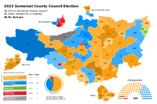
Electoral divisions from 1 April 2023 (first election 5 May 2022): [7]

  1. Bishop's Hull & Taunton West (2)
  2. Blackdown & Neroche (2)
  3. Blackmoor Vale (2)
  4. Brent (2)
  5. Bridgwater East & Bawdrip (2)
  6. Bridgwater North & Central (2)
  7. Bridgwater South (2)
  8. Bridgwater West (2)
  9. Brympton (2)
  10. Burnham on Sea North (2)
  11. Cannington (2)
  12. Castle Cary (2)
  13. Chard North (2)
  14. Chard South (2)
  15. Cheddar (2)
  16. Coker (2)
  17. Comeytrowe & Trull (2)
  18. Crewkerne (2)
  19. Curry Rivel & Langport (2)
  20. Dulverton & Exmoor (2)
  21. Dunster (2)
  22. Frome East (2)
  23. Frome North (2)
  24. Frome West (2)
  25. Glastonbury (2)
  26. Highbridge & Burnham South (2)
  27. Huntspill (2)
  28. Ilminster (2)
  29. King Alfred (2)
  30. Lydeard (2)
  31. Martock (2)
  32. Mendip Central & East (2)
  33. Mendip Hills (2)
  34. Mendip South (2)
  35. Mendip West (2)
  36. Minehead (2)
  37. Monkton & North Curry (2)
  38. North Petherton (2)
  39. Rowbarton & Staplegrove (2)
  40. Shepton Mallet (2)
  41. Somerton (2)
  42. South Petherton & Islemoor (2)
  43. Street (2)
  44. Taunton East (2)
  45. Taunton North (2)
  46. Taunton South (2)
  47. Upper Tone (2)
  48. Watchet & Stogursey (2)
  49. Wellington (2)
  50. Wells (2)
  51. Wincanton & Bruton (2)
  52. Yeovil Central (2)
  53. Yeovil East (2)
  54. Yeovil South (2)
  55. Yeovil West (2)
Former county councils

Avon

Electoral Divisions from 1 April 1974 (first election 12 April 1973) to 7 May 1981: [8] [9]

  1. Axbridge No. 1 (1)
  2. Axbridge No. 2 (1)
  3. Bath No. 1 (1)
  4. Bath No. 2 (1)
  5. Bath No. 3 (1)
  6. Bath No. 4 (1)
  7. Bath No. 5 (1)
  8. Bath No. 6 (1)
  9. Bath No. 7 (1)
  10. Bathavon No. 1 (1)
  11. Bathavon No. 2 (1)
  12. Bitton (1)
  13. Bristol Avon (1)
  14. Bristol Bedminster (1)
  15. Bristol Bishopston (1)
  16. Bristol Bishopsworth (1)
  17. Bristol Brislington (1)
  18. Bristol Cabot (1)
  19. Bristol Clifton (1)
  20. Bristol District (1)
  21. Bristol Durdham (1)
  22. Bristol Easton (1)
  23. Bristol Eastville (1)
  24. Bristol Henbury (2)
  25. Bristol Hengrove (2)
  26. Bristol Hillfields (1)
  27. Bristol Horfield (1)
  28. Bristol Knowle (1)
  29. Bristol Redland (1)
  30. Bristol Somerset (1)
  31. Bristol Southmead (1)
  32. Bristol Southville (1)
  33. Bristol Ss Philip & Jacob (1)
  34. Bristol St George East (1)
  35. Bristol St George West (1)
  36. Bristol St Paul (1)
  37. Bristol Stapleton (2)
  38. Bristol Stockwood (2)
  39. Bristol Westbury-on-Trym (2)
  40. Bristol Windmill Hill (1)
  41. Clevedon (1)
  42. Clutton No. 1 (1)
  43. Clutton No. 2 (1)
  44. Keynsham East (1)
  45. Keynsham West (1)
  46. Kingswood No. 1 (1)
  47. Kingswood No. 2 (1)
  48. Long Ashton No. 1 (1)
  49. Long Ashton No. 2 (1)
  50. Long Ashton No. 3 (1)
  51. Mangotsfield No. 1 (1)
  52. Mangotsfield No. 2 (1)
  53. Norton/Radstock (1)
  54. Portishead (1)
  55. Siston (1)
  56. Sodbury No. 1 (1)
  57. Sodbury No. 2 (1)
  58. Sodbury No. 3 (1)
  59. Sodbury No. 4 (1)
  60. Sodbury No. 5 (1)
  61. Thornbury No. 1 (1)
  62. Thornbury No. 2 (1)
  63. Thornbury No. 3 (1)
  64. Weston-super-Mare No. 1 (1)
  65. Weston-super-Mare No. 2 (1)
  66. Weston-super-Mare No. 3 (1)
  67. Weston-super-Mare No. 4 (1)

Electoral Divisions from 7 May 1981 to 1 April 1996 (county abolished): [9] [10]

  1. Ashley (1)
  2. Avonmouth (1)
  3. Bath Central (1)
  4. Bath North East (1)
  5. Bath North West (1)
  6. Bath South (1)
  7. Bath South East (1)
  8. Bath South West (1)
  9. Bath West (1)
  10. Bathavon (1)
  11. Bedminster (1)
  12. Bishopston (1)
  13. Bishopsworth (1)
  14. Bitton (1)
  15. Brislington East (1)
  16. Brislington West (1)
  17. Cabot (1)
  18. Chew Valley (1)
  19. Clevedon (1)
  20. Clifton (1)
  21. Cotham (1)
  22. Downend (1)
  23. Easton (1)
  24. Eastville (1)
  25. Filton (1)
  26. Filwood (1)
  27. Frome Vale (1)
  28. Gordano Valley (1)
  29. Hartcliffe (1)
  30. Henbury (1)
  31. Hengrove (1)
  32. Henleaze (1)
  33. Hillfields (1)
  34. Horfield (1)
  35. Keynsham East (1)
  36. Keynsham West (1)
  37. Kings Chase (1)
  38. Kingsweston (1)
  39. Knowle (1)
  40. Ladden Brook (1)
  41. Lawrence Hill (1)
  42. Lockleaze (1)
  43. Longwell Green (1)
  44. Midsomer Norton (1)
  45. Mount Hill (1)
  46. Nailsea (1)
  47. Patchway (1)
  48. Portishead (1)
  49. Priory (1)
  50. Radstock (1)
  51. Redland (1)
  52. Rodway (1)
  53. Severn Vale (1)
  54. Siston (1)
  55. Sodbury (1)
  56. Southmead (1)
  57. Southville (1)
  58. St George East (1)
  59. St George West (1)
  60. Stockwood (1)
  61. Stoke Bishop (1)
  62. The Combe (1)
  63. Thornbury (1)
  64. Westbury-on-Trym (1)
  65. Weston East (1)
  66. Weston North (1)
  67. Weston South (1)
  68. Weston West (1)
  69. Whitchurch Park (1)
  70. Wick (1)
  71. Windmill Hill (1)
  72. Winscombe & Wrington Vale (1)
  73. Winterbourne (1)
  74. Worle (1)
  75. Yate (1)
  76. Yatton & Yeo Moor (1)

Somerset

Electoral Divisions from 1 April 1974 (first election 12 April 1973) to 7 May 1981: [11] [12]

  1. Axbridge No. 1 (1)
  2. Axbridge No. 2 (1)
  3. Bridgwater (Central) (1)
  4. Bridgwater (Eastover) (1)
  5. Bridgwater (Westover) (1)
  6. Bridgwater Rural No. 1 (1)
  7. Bridgwater Rural No. 2 (Cannington) (1)
  8. Bridgwater Rural No. 3 (North Petherton) (1)
  9. Burnham-on-Sea No. 1 (1)
  10. Burnham-on-Sea No. 2 (1)
  11. Castle Cary (1)
  12. Chard (1)
  13. Coker (1)
  14. Crewkerne (1)
  15. Curry Rivel (1)
  16. Dowlish Wake (1)
  17. Dulverton (1)
  18. Dunster (1)
  19. Frome (North) (1)
  20. Frome (South) (1)
  21. Glastonbury (1)
  22. Ilchester (2)
  23. Ilminster (1)
  24. Kilmersdon (1)
  25. Langport (1)
  26. Martock (1)
  27. Milborne Port (1)
  28. Milverton (1)
  29. Minehead (1)
  30. Nunney (1)
  31. Shepton Mallet (1)
  32. Shepton Mallet Rural No. 1 (1)
  33. Shepton Mallet Rural No. 2 (Evercre (1)
  34. Somerton (1)
  35. Stogursey (1)
  36. Street (1)
  37. Taunton (East) (1)
  38. Taunton (North) (1)
  39. Taunton (Trinity) (1)
  40. Taunton (West) (1)
  41. Taunton (Wilton) (1)
  42. Taunton Rural No. 1 (1)
  43. Taunton Rural No. 2 (1)
  44. Taunton Rural No. 3 (1)
  45. Taunton Rural No. 4 (1)
  46. Wellington (1)
  47. Wells (1)
  48. Wells Rural No. 1 (1)
  49. Wells Rural No. 2 (Meare) (1)
  50. Williton (1)
  51. Wincanton (1)
  52. Wiveliscombe (1)
  53. Yeovil (North & East) (1)
  54. Yeovil (South & Central) (1)
  55. Yeovil (West & Preston) (1)

Electoral Divisions from 7 May 1981 to 7 June 2001: [12] [13]

  1. Blackmoor Vale (1)
  2. Brent (1)
  3. Bridgwater East (1)
  4. Bridgwater North (1)
  5. Bridgwater South (1)
  6. Bridgwater West (1)
  7. Burnham-on-Sea (1)
  8. Cannington (1)
  9. Castle Cary (1)
  10. Chard Town (1)
  11. Cheddar (1)
  12. Coker (1)
  13. Crewkerne (1)
  14. Curry Rivel (1)
  15. Dowlish Wake (1)
  16. Dulverton (1)
  17. Dunster (1)
  18. East Mendip (1)
  19. East Shepton (1)
  20. Frome North (1)
  21. Frome South (1)
  22. Glastonbury (1)
  23. Highbridge (1)
  24. Houndstone (1)
  25. Huntspill (1)
  26. Ilchester (1)
  27. Ilminster (1)
  28. Langport (1)
  29. Lydeard (1)
  30. Martock (1)
  31. Mendip South West (1)
  32. Mendip West (1)
  33. Mid Tone (1)
  34. Minehead (1)
  35. North Curry (1)
  36. North Mendip (1)
  37. North Petherton (1)
  38. Pitminster (1)
  39. Poldens (1)
  40. Quantock (1)
  41. Shepton Mallet (1)
  42. Somerton (1)
  43. Staplegrove (1)
  44. Street (1)
  45. Taunton East (1)
  46. Taunton Fairwater (1)
  47. Taunton North (1)
  48. Taunton South (1)
  49. Taunton West (1)
  50. Upper Tone (1)
  51. Wellington (1)
  52. Wells (1)
  53. Williton (1)
  54. Wincanton & Bruton (1)
  55. Yeovil North & East (1)
  56. Yeovil South & Central (1)
  57. Yeovil West & Preston (1)

Electoral Divisions from 7 June 2001 to 2 May 2013: [14]

Somerset UK electoral division map (blank).svg
  1. Blackdown & Wellington East (1)
  2. Blackmoor Vale (1)
  3. Brent (1)
  4. Bridgwater East & Bawdrip (1)
  5. Bridgwater North & Central (1)
  6. Bridgwater South (1)
  7. Bridgwater West (1)
  8. Burnham-on-Sea North (1)
  9. Cannington (1)
  10. Castle Cary (1)
  11. Chard North (1)
  12. Chard South (1)
  13. Cheddar (1)
  14. Coker (1)
  15. Crewkerne (1)
  16. Curry Rivel (1)
  17. Dulverton & Exmoor (1)
  18. Dunster (1)
  19. Frome North (1)
  20. Frome Selwood (1)
  21. Frome South (1)
  22. Glastonbury (1)
  23. Highbridge & Burnham-on-Sea South (1)
  24. Huntspill (1)
  25. Ilchester (1)
  26. Ilminster (1)
  27. King Alfred (1)
  28. Langport (1)
  29. Lydeard (1)
  30. Martock (1)
  31. Mendip Central & East (1)
  32. Mendip North East (1)
  33. Mendip North West (1)
  34. Mendip South (1)
  35. Mendip West (1)
  36. Minehead (1)
  37. North Curry (1)
  38. North Petherton (1)
  39. Shepton Mallet (1)
  40. Somerton (1)
  41. South Petherton (1)
  42. Staplegrove (1)
  43. Street (1)
  44. Taunton & Trull (1)
  45. Taunton East (1)
  46. Taunton Fairwater (1)
  47. Taunton North (1)
  48. Taunton South (1)
  49. Taunton West (1)
  50. Upper Tone (1)
  51. Watchet & Quantocks (1)
  52. Wellington (1)
  53. Wells (1)
  54. Wincanton & Bruton (1)
  55. Yeovil East (1)
  56. Yeovil North & Central (1)
  57. Yeovil South (1)
  58. Yeovil West (1)

Electoral Divisions from 2 May 2013 to 1 April 2023: [15]

Somerset UK electoral division map 2013 (blank).svg
  1. Bishop’s Hull & Taunton West (1)
  2. Blackdown & Neroche (1)
  3. Blackmoor Vale (1)
  4. Brent (1)
  5. Bridgwater East & Bawdrip (1)
  6. Bridgwater North & Central (1)
  7. Bridgwater South (1)
  8. Bridgwater West (1)
  9. Brympton (1)
  10. Burnham North (1)
  11. Cannington (1)
  12. Castle Cary (1)
  13. Chard North (1)
  14. Chard South (1)
  15. Cheddar (1)
  16. Coker (1)
  17. Comeytrowe & Trull (1)
  18. Crewkerne (1)
  19. Curry Rivel & Langport (1)
  20. Dulverton & Exmoor (1)
  21. Dunster (1)
  22. Frome East (1)
  23. Frome North (1)
  24. Frome West (1)
  25. Glastonbury & Street (2)
  26. Highbridge & Burnham South (1)
  27. Huntspill (1)
  28. Ilminster (1)
  29. King Alfred (1)
  30. Lydeard (1)
  31. Martock (1)
  32. Mendip Central & East (1)
  33. Mendip Hills (1)
  34. Mendip South (1)
  35. Mendip West (1)
  36. Minehead (1)
  37. Monkton & North Curry (1)
  38. North Petherton (1)
  39. Rowbarton & Staplegrove (1)
  40. Shepton Mallet (1)
  41. Somerton (1)
  42. South Petherton & Islemoor (1)
  43. Taunton East (1)
  44. Taunton North (1)
  45. Taunton South (1)
  46. Upper Tone (1)
  47. Watchet & Stogursey (1)
  48. Wellington (1)
  49. Wells (1)
  50. Wincanton & Bruton (1)
  51. Yeovil Central (1)
  52. Yeovil East (1)
  53. Yeovil South (1)
  54. Yeovil West (1)

Former district councils

Bath

Wards from 1 April 1974 (first election 7 June 1973) to 6 May 1976: [16]

  1. Abbey (3)
  2. Bathwick (3)
  3. Bloomfield (3)
  4. Combe Down (3)
  5. Kingsmead (3)
  6. Lambridge (3)
  7. Lansdown (3)
  8. Lyncombe (3)
  9. Newbridge (3)
  10. Oldfield (3)
  11. Twerton East (3)
  12. Twerton West (3)
  13. Walcot (3)
  14. Westmoreland (3)
  15. Widcombe (3)

Wards from 6 May 1976 to 1 April 1996 (district abolished): [17]

Bath UK ward map 1975 (blank).svg
  1. Abbey (3)
  2. Bathwick (3)
  3. Bloomfield (3)
  4. Combe Down (3)
  5. Kingsmead (3)
  6. Lambridge (3)
  7. Lansdown (3)
  8. Lyncombe (3)
  9. Newbridge (3)
  10. Oldfield (3)
  11. Southdown (3)
  12. Twerton (3)
  13. Walcot (3)
  14. Westmoreland (3)
  15. Weston (3)
  16. Widcombe (3)

Mendip

Wards from 1 April 1974 (first election 7 June 1973) to 3 May 1979: [18]

Wards from 3 May 1979 to 6 May 1999: [19]

Wards from 6 May 1999 to 3 May 2007: [20]

  1. Ashwick & Ston Easton (1)
  2. Avalon (1)
  3. Beacon (1)
  4. Beckington & Rode (1)
  5. Chilcompton (1)
  6. Coleford (1)
  7. Creech (1)
  8. Frome Berkley Down (2)
  9. Frome Fromefield (2)
  10. Frome Keyford (2)
  11. Frome Park (2)
  12. Frome Welshmill (2)
  13. Glastonbury St Benedict's (1)
  14. Glastonbury St Edmund's (1)
  15. Glastonbury St John's (1)
  16. Glastonbury St Mary's (1)
  17. Knowle (1)
  18. Mells (1)
  19. Moor (1)
  20. Nedge (1)
  21. Nordinton (1)
  22. Postlebury (1)
  23. Pylcombe (1)
  24. Rodney & Priddy (1)
  25. St Cuthbert (Out) North & West (1)
  26. Shepton East (2)
  27. Shepton West (2)
  28. Stratton (1)
  29. Street North (2)
  30. Street South (2)
  31. Street West (1)
  32. Vale (1)
  33. Wells Central (1)
  34. Wells St Cuthbert's (2)
  35. Wells St Thomas' (2)

Wards from 3 May 2007 to 1 April 2023: [21]

Mendip UK ward map 2010 (blank).svg
  1. Ammerdown (1)
  2. Ashwick, Chilcompton & Stratton (2)
  3. Beckington & Selwood (1)
  4. Butleigh & Baltonsborough (1)
  5. Chewton Mendip & Ston Easton (1)
  6. Coleford & Holcombe (2)
  7. Cranmore, Doulting & Nunney (1)
  8. Creech (1)
  9. Croscombe & Pilton (1)
  10. Frome Berkley Down (2)
  11. Frome College (2)
  12. Frome Keyford (2)
  13. Frome Market (2)
  14. Frome Oakfield (1)
  15. Frome Park (2)
  16. Glastonbury St Benedict’s (1)
  17. Glastonbury St Edmund’s (1)
  18. Glastonbury St John’s (1)
  19. Glastonbury St Mary’s (1)
  20. Moor (1)
  21. Postlebury (1)
  22. Rode & Norton St Philip (1)
  23. Rodney & Westbury (1)
  24. Shepton East (2)
  25. Shepton West (2)
  26. St Cuthbert Out North (1)
  27. Street North (2)
  28. Street South (2)
  29. Street West (1)
  30. The Pennards & Ditcheat (1)
  31. Wells Central (1)
  32. Wells St Cuthbert’s (2)
  33. Wells St Thomas’ (2)
  34. Wookey & St Cuthbert Out West (1)

Sedgemoor

Wards from 1 April 1974 (first election 7 June 1973) to 3 May 1979: [18]

Wards from 3 May 1979 to 6 May 1999: [22]

Wards from 6 May 1999 to 5 May 2011: [23]

Sedgemoor UK ward map 2010 (blank).svg
  1. Axbridge (1)
  2. Axe Vale (1)
  3. Berrow (1)
  4. Brent North (1)
  5. Bridgwater Bower (3)
  6. Bridgwater Eastover (2)
  7. Bridgwater Hamp (3)
  8. Bridgwater Quantock (3)
  9. Bridgwater Sydenham (3)
  10. Bridgwater Victoria (2)
  11. Burnham North (3)
  12. Burnham South (3)
  13. Cannington & Quantocks (3)
  14. Cheddar & Shipham (3)
  15. East Poldens (1)
  16. Highbridge (3)
  17. Huntspill & Pawlett (2)
  18. King’s Isle (2)
  19. Knoll (1)
  20. North Petherton (3)
  21. Puriton (1)
  22. Sandford (1)
  23. Wedmore & Mark (2)
  24. West Poldens (1)
  25. Woolavington (1)

Wards from 5 May 2011 to 1 April 2023: [24]

Sedgemoor UK ward map 2011 (blank).svg
  1. Axevale (2)
  2. Berrow (1)
  3. Bridgwater Dunwear (2)
  4. Bridgwater Eastover (2)
  5. Bridgwater Fairfax (3)
  6. Bridgwater Hamp (2)
  7. Bridgwater Victoria (2)
  8. Bridgwater Westover (2)
  9. Bridgwater Wyndham (2)
  10. Burnham Central (3)
  11. Burnham North (3)
  12. Cannington & Wembdon (2)
  13. Cheddar & Shipham (3)
  14. East Polden (1)
  15. Highbridge & Burnham Marine (3)
  16. Huntspill & Pawlett (1)
  17. King’s Isle (2)
  18. Knoll (2)
  19. North Petherton (3)
  20. Puriton & Woolavington (2)
  21. Quantocks (2)
  22. Wedmore & Mark (2)
  23. West Polden (1)

Somerset West and Taunton

Wards from 2 May 2019 to 1 April 2023: [25] [26]

Somerset West and Taunton UK electoral ward map 2019 (blank).svg
  1. Alcombe (1)
  2. Blackbrook & Holway (2)
  3. Comeytrowe & Bishop's Hull (3)
  4. Cotford St Luke & Oake (1)
  5. Creech St Michael (2)
  6. Dulverton & District (1)
  7. Exmoor (1)
  8. Halcon & Lane (2)
  9. Hatch & Blackdown (1)
  10. Manor & Tangier (1)
  11. Milverton & District (1)
  12. Minehead Central (2)
  13. Minehead North (1)
  14. Monument (1)
  15. North Curry & Ruishton (2)
  16. North Town (1)
  17. Norton Fitzwarren & Stapelgrove (3)
  18. Old Cleeve & District (2)
  19. Periton & Woodcombe (1)
  20. Porlock & District (1)
  21. Priorswood (3)
  22. Quantock Vale (1)
  23. Rockwell Green (1)
  24. South Quantock (2)
  25. Trull, Pitminster & Corfe (2)
  26. Victoria (2)
  27. Vivary (2)
  28. Watchet & Williton (3)
  29. Wellington East (2)
  30. Wellington North (2)
  31. Wellington South (1)
  32. Wellsprings & Rowbarton (2)
  33. West Monkton & Cheddon Fitzpaine (3)
  34. Wilton & Sherford (1)
  35. Wiveliscombe & District (2)

South Somerset

Wards from 1 April 1974 (first election 7 June 1973) to 6 May 1976: [18]

Wards from 6 May 1976 to 2 May 1991: [27]

Wards from 2 May 1991 to 6 May 1999: [28]

  1. Blackdown (1)
  2. Blackmoor Vale (2)
  3. Brue (2)
  4. Burrow Hill (1)
  5. Camelot (1)
  6. Cary (2)
  7. Chard Avishayes (1)
  8. Chard Combe (1)
  9. Chard Crimchard (1)
  10. Chard Holyrood (1)
  11. Chard Jocelyn (1)
  12. Coker (2)
  13. Crewkerne (3)
  14. Curry Rivel (1)
  15. Eggwood (1)
  16. Hamdon (1)
  17. Houndstone (1)
  18. Ilminster (2)
  19. Islemoor (1)
  20. Ivelchester (1)
  21. Langport & Huish (1)
  22. Martock (2)
  23. Milborne Port (1)
  24. Mudford (1)
  25. Neroche (1)
  26. Northstone (1)
  27. Parrett (1)
  28. St Michael's (1)
  29. South Petherton (2)
  30. Tatworth & Forton (1)
  31. Turn Hill (1)
  32. Wessex (2)
  33. Wincanton (2)
  34. Windwhistle (1)
  35. Yeovil Central (3)
  36. Yeovil East (3)
  37. Yeovil Preston (2)
  38. Yeovil South (2)
  39. Yeovil West (2)
  40. Yeovil Without (3)

Wards from 6 May 1999 to 2 May 2019: [29]

South Somerset UK ward map 2010 (blank).svg
  1. Blackdown (1)
  2. Blackmoor Vale (2)
  3. Bruton (1)
  4. Brympton (2)
  5. Burrow Hill (1)
  6. Camelot (1)
  7. Cary (2)
  8. Chard Avishayes (1)
  9. Chard Combe (1)
  10. Chard Crimchard (1)
  11. Chard Holyrood (1)
  12. Chard Jocelyn (1)
  13. Coker (2)
  14. Crewkerne (3)
  15. Curry Rivel (1)
  16. Eggwood (1)
  17. Hamdon (1)
  18. Ilminster (2)
  19. Islemoor (1)
  20. Ivelchester (1)
  21. Langport & Huish (1)
  22. Martock (2)
  23. Milborne Port (1)
  24. Neroche (1)
  25. Northstone (1)
  26. Parrett (1)
  27. St Michael's (1)
  28. South Petherton (2)
  29. Tatworth & Forton (1)
  30. Tower (1)
  31. Turn Hill (1)
  32. Wessex (2)
  33. Wincanton (2)
  34. Windwhistle (1)
  35. Yeovil Central (3)
  36. Yeovil East (3)
  37. Yeovil South (3)
  38. Yeovil West (3)
  39. Yeovil Without (3)

Wards from 2 May 2019 to 1 April 2023: [30]

South Somerset UK ward map 2019 (blank).svg
  1. Blackdown & Tatworth (2)
  2. Blackmoor Vale (2)
  3. Bruton (1)
  4. Brympton (3)
  5. Burrow Hill (1)
  6. Camelot (1)
  7. Cary (2)
  8. Chard Avishayes (1)
  9. Chard Combe (1)
  10. Chard Crimchard (1)
  11. Chard Holyrood (1)
  12. Chard Jocelyn (1)
  13. Coker (2)
  14. Crewkerne (3)
  15. Curry Rivel, Huish & Langport (2)
  16. Eggwood (1)
  17. Hamdon (1)
  18. Ilminster (2)
  19. Islemoor (1)
  20. Martock (2)
  21. Milborne Port (1)
  22. Northstone, Ivelchester & St Michael's (3)
  23. Parrett (1)
  24. South Petherton (2)
  25. Tower (1)
  26. Turn Hill (1)
  27. Wessex (2)
  28. Wincanton (2)
  29. Windwhistle (1)
  30. Yeovil College (3)
  31. Yeovil Lyde (2)
  32. Yeovil Summerlands (3)
  33. Yeovil Westland (3)
  34. Yeovil Without (3)

Taunton Deane

Wards from 1 April 1974 (first election 7 June 1973) to 3 May 1979: [18]

Wards from 3 May 1979 to 6 May 1999: [31] [32]

Wards from 6 May 1999 to 3 May 2007: [33] [34]

  1. Bishop's Hull (2)
  2. Bishops Lydeard (2)
  3. Blackdown (1)
  4. Bradford on Tone (1)
  5. Comeytrowe (3)
  6. Milverton & North Deane (2)
  7. Monument (1)
  8. Neroche (1)
  9. North Curry (1)
  10. Norton Fitzwarren (1)
  11. Ruishton & Creech (2)
  12. Staplegrove (2)
  13. Stoke St Gregory (1)
  14. Taunton Blackbrook & Holway (3)
  15. Taunton Eastgate (2)
  16. Taunton Fairwater (3)
  17. Taunton Halcon (3)
  18. Taunton Killams & Mountfield (2)
  19. Taunton Lyngford (3)
  20. Taunton Manor & Wilton (3)
  21. Taunton Pyrland & Rowbarton (3)
  22. Trull (1)
  23. Wellington East (2)
  24. Wellington North (2)
  25. Wellington Rockwell Green & West (3)
  26. West Monkton (2)
  27. Wiveliscombe & West Deane (2)

Wards from 3 May 2007 to 2 May 2019 (district abolished): [35]

Taunton Deane UK ward map 2010 (blank).svg
  1. Bishop’s Hull (2)
  2. Bishop’s Lydeard (3)
  3. Blackdown (1)
  4. Bradford-on-Tone (1)
  5. Comeytrowe (3)
  6. Milverton & North Deane (1)
  7. Monument (1)
  8. Neroche (1)
  9. North Curry & Stoke St Gregory (2)
  10. Norton Fitzwarren (2)
  11. Ruishton & Creech (2)
  12. Staplegrove (2)
  13. Taunton Blackbrook & Holway (3)
  14. Taunton Eastgate (2)
  15. Taunton Fairwater (3)
  16. Taunton Halcon (3)
  17. Taunton Killams & Mountfield (2)
  18. Taunton Lyngford (3)
  19. Taunton Manor & Wilton (3)
  20. Taunton Pyrland & Rowbarton (3)
  21. Trull (1)
  22. Wellington East (2)
  23. Wellington North (2)
  24. Wellington Rockwell Green & West (3)
  25. West Monkton (3)
  26. Wiveliscombe & West Deane (2)

Wansdyke

Wards from 1 April 1974 (first election 7 June 1973) to 6 May 1976: [16]

  1. Bathampton (1)
  2. Batheaston (2)
  3. Bathford (1)
  4. Cameley (1)
  5. Camerton (1)
  6. Charlcombe (1)
  7. Chew Magna (1)
  8. Chew Stoke (1)
  9. Clutton (1)
  10. Compton Dando (1)
  11. Farmborough (1)
  12. Freshford (1)
  13. High Littleton (1)
  14. Hinton Charterhouse (1)
  15. Keynsham Central (2)
  16. Keynsham East (2)
  17. Keynsham North (2)
  18. Keynsham South (3)
  19. Keynsham West (3)
  20. Midsomer Norton (3)
  21. Newton St Loe (1)
  22. Paulton (2)
  23. Peasedown St John (2)
  24. Publow (1)
  25. Radstock (3)
  26. Stowey Sutton (1)
  27. The Hartprees (1)
  28. Timsbury (1)
  29. Westfield (3)

Wards from 6 May 1976 to 1 April 1996 (district abolished): [36]

Wansdyke UK ward map 1975 (blank).svg
  1. Bathampton (1)
  2. Batheaston (2)
  3. Bathford (1)
  4. Cameley (1)
  5. Camerton (1)
  6. Charlcombe (1)
  7. Chew Magna (1)
  8. Chew Stoke (1)
  9. Clutton (1)
  10. Compton Dando (1)
  11. Farmborough (1)
  12. Freshford (1)
  13. Hartprees (1)
  14. High Littleton (1)
  15. Hinton Charterhouse (1)
  16. Keynsham East (3)
  17. Keynsham North (2)
  18. Keynsham South (3)
  19. Keynsham West (3)
  20. Midsomer Norton North (2)
  21. Midsomer Norton Redfield (2)
  22. Newton St Loe (1)
  23. Paulton (3)
  24. Peasedown St John (2)
  25. Publow (1)
  26. Radstock (3)
  27. Saltford (2)
  28. Stowey Sutton (1)
  29. Timsbury (1)
  30. Westfield (3)

West Somerset

Wards from 1 April 1974 (first election 7 June 1973) to 3 May 1979: [18]

Wards from 3 May 1979 to 6 May 1999: [37]

Wards from 6 May 1999 to 5 May 2011: [38]

West Somerset UK ward map 2010 (blank).svg
  1. Alcombe East (2)
  2. Alcombe West (2)
  3. Aville Vale (1)
  4. Brompton Ralph & Haddon (1)
  5. Carhampton & Withycombe (1)
  6. Crowcombe & Stogumber (1)
  7. Dulverton & Brushford (2)
  8. Dunster (1)
  9. Exmoor (1)
  10. Minehead North (3)
  11. Minehead South (3)
  12. Old Cleeve (2)
  13. Porlock & District (2)
  14. Quantock Vale (2)
  15. Quarme (1)
  16. Watchet (3)
  17. West Quantock (1)
  18. Williton (2)

Wards from 5 May 2011 to 2 May 2019 (district abolished): [39]

West Somerset UK ward map 2011 (blank).svg
  1. Alcombe (2)
  2. Brendon Hills (1)
  3. Carhampton & Withycombe (1)
  4. Crowcombe & Stogumber (1)
  5. Dulverton & District (2)
  6. Dunster & Timberscombe (1)
  7. Greater Exmoor (1)
  8. Minehead Central (3)
  9. Minehead North (2)
  10. Minehead South (2)
  11. Old Cleeve (2)
  12. Porlock & District (2)
  13. Quantock Vale (2)
  14. Watchet (3)
  15. West Quantock (1)
  16. Williton (2)

Woodspring

Wards from 1 April 1974 (first election 7 June 1973) to 3 May 1979: [16]

Wards from 3 May 1979 to 1 April 1996 (district abolished): [40] [1]

Electoral wards by constituency

Bath

Bathwick, Combe Down, Kingsmead, Lambridge, Lansdown, Moorlands, Newbridge, Odd Down, Oldfield Park, Southdown, Twerton, Walcot, Westmoreland, Weston, Widcombe & Lyncombe.

Bridgwater and West Somerset

Alcombe East, Alcombe West, Aville Vale, Bridgwater Bower, Bridgwater Eastover, Bridgwater Hamp, Bridgwater Quantock, Bridgwater Sydenham, Bridgwater Victoria, Brompton Ralph and Haddon, Cannington and Quantocks, Carhampton and Withycombe, Crowcombe and Stogumber, Dulverton and Brushford, Dunster, East Poldens, Exmoor, Huntspill and Pawlett, King's Isle, Minehead North, Minehead South, North Petherton, Old Cleeve, Porlock and District, Puriton, Quantock Vale, Quarme, Sandford, Watchet, West Poldens, West Quantock, Williton, Woolavington.

North East Somerset

Bathavon North, Bathavon South, Chew Valley, Clutton and Farmborough, High Littleton, Keynsham East, Keynsham North, Keynsham South, Mendip, Midsomer Norton North, Midsomer Norton Redfield, Paulton, Peasedown, Publow and Whitchurch, Radstock, Saltford, Timsbury, Westfield.

North Somerset

Backwell, Clevedon Central, Clevedon East, Clevedon North, Clevedon South, Clevedon Walton, Clevedon West, Clevedon Yeo, Easton-in-Gordano, Gordano, Nailsea East, Nailsea North and West, Pill, Portishead Central, Portishead Coast, Portishead East, Portishead Redcliffe Bay, Portishead South and North Weston, Portishead West, Winford, Wraxall and Long Ashton, Wrington, Yatton.

Somerton and Frome

Beacon, Beckington and Rode, Blackmoor Vale, Bruton, Burrow Hill, Camelot, Cary, Coleford, Creech, Curry Rivel, Frome Berkley Down, Frome Fromefield, Frome Keyford, Frome Park, Frome Welshmill, Islemoor, Langport and Huish, Martock, Mells, Milborne Port, Nordinton, Northstone, Postlebury, Stratton, Tower, Turn Hill, Vale, Wessex, Wincanton.

Taunton Deane

Bishop's Hull, Bishop's Lydeard, Blackdown, Bradford-on-Tone, Comeytrowe, Milverton and North Deane, Monument, Neroche, North Curry, Norton Fitzwarren, Ruishton and Creech, Staplegrove, Stoke St. Gregory, Taunton Blackbrook and Holway, Taunton Eastgate, Taunton Fairwater, Taunton Halcon, Taunton Killams and Mountfield, Taunton Lyngford, Taunton Manor and Wilton, Taunton Pyrland and Rowbarton, Trull, Wellington East, Wellington North, Wellington Rockwell Green and West, West Monkton, Wiveliscombe and West Deane.

Wells

Ashwick and Ston Easton, Avalon, Axbridge, Axe Vale, Berrow, Brent North, Burnham North, Burnham South, Cheddar and Shipham, Chilcompton, Glastonbury St Benedict's, Glastonbury St Edmund's, Glastonbury St John's, Glastonbury St Mary's, Highbridge, Knoll, Knowle, Moor, Nedge, Pylcombe, Rodney and Priddy, St Cuthbert (Out) North and West, Shepton East, Shepton West, Street North, Street South, Street West, Wedmore and Mark, Wells Central, Wells St Cuthbert's, Wells St Thomas’.

Weston-Super-Mare

Banwell and Winscombe, Blagdon and Churchill, Congresbury, Hutton and Locking, Kewstoke, Weston-Super-Mare Central, Weston-Super-Mare Clarence and Uphill, Weston-Super-Mare East, Weston-Super-Mare Milton and Old Worle, Weston-Super-Mare North Worle, Weston-Super-Mare South, Weston-Super-Mare South Worle, Weston-Super-Mare West.

Yeovil

Blackdown, Brympton, Chard Avishayes, Chard Combe, Chard Crimchard, Chard Holyrood, Chard Jocelyn, Coker, Crewkerne, Eggwood, Hamdon, Ilminster, Ivelchester, Neroche, Parrett, St Michael's, South Petherton, Tatworth and Forton, Windwhistle, Yeovil Central, Yeovil East, Yeovil South, Yeovil West, Yeovil Without.

See also

Related Research Articles

<span class="mw-page-title-main">Somerset</span> County in South West England

Somerset is a ceremonial county in South West England which borders Gloucestershire and Bristol to the north, Wiltshire to the east, Dorset to the south-east and Devon to the south-west. It is bounded to the north and west by the Severn Estuary and the Bristol Channel, its coastline facing southeastern Wales. Its traditional border with Gloucestershire is the River Avon.

<span class="mw-page-title-main">History of Somerset</span> Aspect of history

Somerset is a historic county in the south west of England. There is evidence of human occupation since prehistoric times with hand axes and flint points from the Palaeolithic and Mesolithic eras, and a range of burial mounds, hill forts and other artefacts dating from the Neolithic, Bronze and Iron Ages. The oldest dated human road work in Great Britain is the Sweet Track, constructed across the Somerset Levels with wooden planks in the 39th century BCE.

<span class="mw-page-title-main">Geology of Somerset</span>

Somerset is a rural county in the southwest of England, covering 4,171 square kilometres (1,610 sq mi). It is bounded on the north-west by the Bristol Channel, on the north by Bristol and Gloucestershire, on the north-east by Wiltshire, on the south-east by Dorset, and on the south west and west by Devon. It has broad central plains with several ranges of low hills. The landscape divides into four main geological sections from the Silurian through the Devonian and Carboniferous to the Permian which influence the landscape, together with water-related features.

<span class="mw-page-title-main">Somerset County League</span> Faootball competition based in England

The Somerset County League is a football competition based in England. The Premier Division sits at step 7 of the National League System. It is a feeder to the Western League Division One and has promoted a club in seven of the last ten seasons – Hengrove Athletic, Portishead, Radstock Town, Oldland Abbotonians, Wells City, Cheddar, Ashton & Backwell United and Nailsea & Tickenham.

<span class="mw-page-title-main">Bristol and Exeter Railway</span> Former English railway company

The Bristol and Exeter Railway (B&ER) was an English railway company formed to connect Bristol and Exeter. It was built on the broad gauge and its engineer was Isambard Kingdom Brunel. It opened in stages between 1841 and 1844. It was allied with the Great Western Railway (GWR), which built its main line between London and Bristol, and in time formed part of a through route between London and Cornwall.

<span class="mw-page-title-main">Economy of Somerset</span> Regional economy

Somerset is a county in the south west of England. It is a rural county and transport infrastructure has been significant in industrial development. There is some heavy industry particularly related to the defence technologies and the county has several centres for stone quarrying, although the coalfield is now closed.

<span class="mw-page-title-main">Transport in Somerset</span> Overview of transport in Somerset

The earliest known infrastructure for transport in Somerset is a series of wooden trackways laid across the Somerset Levels, an area of low-lying marshy ground. To the west of this district lies the Bristol Channel, while the other boundaries of the county of Somerset are along chains of hills that were once exploited for their mineral deposits. These natural features have all influenced the evolution of the transport network. Roads and railways either followed the hills, or needed causeways to cross the Levels. Harbours were developed, rivers improved, and linked to sources of traffic by canals. Railways were constructed throughout the area, influenced by the needs of the city of Bristol, which lies just to the north of Somerset, and to link the ports of the far south-west with the rest of England.

<span class="mw-page-title-main">Geography of Somerset</span>

The county of Somerset is in South West England, bordered by the Bristol Channel and the counties of Bristol and Gloucestershire to the north, and Wiltshire to the east, Dorset to the south, and Devon to the west. The climate, influenced by its proximity to the Atlantic Ocean and the prevailing westerly winds, tends to be mild, damp and windy.

<span class="mw-page-title-main">Bristol–Exeter line</span> Railway line in England

The Bristol to Exeter line is a major branch of the Great Western Main Line in the West of England and runs from Bristol, to Exeter, from where it continues as the Exeter to Plymouth line. It was one of the principal routes of the pre-1948 Great Western Railway which were subsequently taken over by the Western Region of British Railways and are now part of the Network Rail system.

<span class="mw-page-title-main">Somerset Rugby Football Union</span> Rugby union governing body in England

The Somerset County Rugby Football Union (SCRFU) is the governing body for the sport of rugby union in the county of Somerset in England. The union is the constituent body of the Rugby Football Union (RFU) for Somerset. The SCRFU administers and organises rugby union clubs and competitions in the Somerset including the county rugby representative teams.

<span class="mw-page-title-main">2017 Somerset County Council election</span>

The 2017 Somerset County Council election took place on 4 May 2017 as part of the 2017 local elections in the United Kingdom. All 55 councillors were elected from 54 electoral divisions which each returned either one or two county councillors by first-past-the-post voting for a four-year term of office.

The Somerset Senior Cup is an annual rugby union knock-out club competition organised by the Somerset Rugby Football Union. First contested between 1906-07 and 1913-14, it was reintroduced during the 1970–71 season, with the winners being Bath. It is the most important rugby union cup competition in Somerset, ahead of the Somerset Vase.

<span class="mw-page-title-main">2022 Somerset Council election</span> 2022 local election in Somerset

The 2022 Somerset Council election took place on 5 May 2022. It was the inaugural election of the new unitary authority, Somerset Council, which replaced Somerset County Council on 1 April 2023. All 110 councillors were elected, representing the same divisions as the old county council, but with twice as many councillors representing each. The councillors elected first sat as members of the existing county council until its replacement by the new authority. The same councillors are now members of Somerset Council.

References

  1. 1 2 3 legislation.gov.uk - The Avon (Structural Change) Order 1995. Retrieved on 6 November 2015.
  2. legislation.gov.uk - The District of Bath and North East Somerset (Electoral Changes) Order 1998. Retrieved on 4 October 2015.
  3. legislation.gov.uk - The Bath and North East Somerset (Electoral Changes) Order 2018. Retrieved on 7 August 2019.
  4. legislation.gov.uk - The District of North Somerset (Electoral Changes) Order 1998. Retrieved on 4 October 2015.
  5. legislation.gov.uk - The North Somerset (Electoral Changes) Order 2010. Retrieved on 3 November 2015.
  6. legislation.gov.uk - The North Somerset (Electoral Changes) Order 2014. Retrieved on 3 November 2015.
  7. "The Somerset (Structural Changes) Order 2022". gov.uk . 17 March 2022. Retrieved 23 April 2022.
  8. The County of Avon (Electoral Divisions) Order 1973
  9. 1 2 Rallings, Colin; Thrasher, Michael. Avon County Council Election Results 1973-1993 (PDF). The Elections Centre. Retrieved 12 May 2016.
  10. The County of Avon (Electoral Arrangements) Order 1981
  11. The County of Somerset (Electoral Divisions) Order 1973
  12. 1 2 Rallings, Colin; Thrasher, Michael. Somerset County Council Election Results 1973-2009 (PDF). The Elections Centre. Retrieved 12 May 2016.
  13. The County of Somerset (Electoral Arrangements) Order 1980
  14. legislation.gov.uk - The County of Somerset (Electoral Changes) Order 2000. Retrieved on 4 October 2015.
  15. legislation.gov.uk - The Somerset (Electoral Changes) Order 2012. Retrieved on 3 November 2015.
  16. 1 2 3 The County of Avon (District Wards) Order 1973
  17. The City of Bath (Electoral Arrangements) Order 1975
  18. 1 2 3 4 5 The County of Somerset (District Wards) Order 1973
  19. The District of Mendip (Electoral Arrangements) Order 1976
  20. legislation.gov.uk - The District of Mendip (Electoral Changes) Order 1998. Retrieved on 4 October 2015.
  21. legislation.gov.uk - The District of Mendip (Electoral Changes) Order 2007. Retrieved on 3 November 2015.
  22. The District of Sedgemoor (Electoral Arrangements) Order 1977
  23. legislation.gov.uk - The District of Sedgemoor (Electoral Changes) Order 1998. Retrieved on 4 October 2015.
  24. legislation.gov.uk - The Sedgemoor (Electoral Changes) Order 2011. Retrieved on 3 November 2015.
  25. legislation.gov.uk - The Somerset West and Taunton (Electoral Changes) Order 2018. Retrieved on 29 April 2020.
  26. legislation.gov.uk - The Somerset West and Taunton (Local Government Changes) Order 2018. Retrieved on 29 April 2020.
  27. The District of Yeovil (Electoral Arrangements) Order 1975
  28. legislation.gov.uk - The District of South Somerset (Electoral Arrangements) Order 1988. Retrieved on 4 November 2015.
  29. legislation.gov.uk - The District of South Somerset (Electoral Changes) Order 1998. Retrieved on 4 October 2015.
  30. legislation.gov.uk - The South Somerset (Electoral Changes) Order 2018. Retrieved on 29 April 2020.
  31. The Borough of Taunton Deane (Electoral Arrangements) Order 1976
  32. The Borough of Taunton Deane (Electoral Arrangements) Order 1986
  33. legislation.gov.uk - The Borough of Taunton Deane (Electoral Changes) Order 1998. Retrieved on 4 October 2015.
  34. legislation.gov.uk - The Borough of Taunton Deane (Electoral Changes) (Amendment) Order 2000. Retrieved on 4 October 2015.
  35. legislation.gov.uk - The Borough of Taunton Deane (Electoral Changes) Order 2007. Retrieved on 3 November 2015.
  36. legislation.gov.uk - The District of Wansdyke (Electoral Arrangements) Order 1975. Retrieved on 19 November 2015.
  37. The District of West Somerset (Electoral Arrangements) Order 1976
  38. legislation.gov.uk - The District of West Somerset (Electoral Changes) Order 1998. Retrieved on 4 October 2015.
  39. legislation.gov.uk - The West Somerset (Electoral Changes) Order 2011. Retrieved on 3 November 2015.
  40. The District of Woodspring (Electoral Arrangements) Order 1977