List
| Mountain | Image | Province-level division | Elevation | Notes | |
|---|---|---|---|---|---|
| Amne Machin |  | Qinghai | 6,282 metres (20,610 ft) | ||
| Badaling |  | Beijing | 1,015 metres (3,330 ft) | ||
| Paektu Mountain |  | Jilin | 2,744 metres (9,003 ft) | The highest peak in both Northeast China and the Korean Peninsula | |
| Baishi Mountain |  | Hebei | 2,096 metres (6,877 ft) | AAAAA-level tourist attraction | |
| Baiyun Mountain |  | Guangdong | 382 metres (1,253 ft) | ||
| Mount Beiwudang | Shanxi | ||||
| Bijia Mountain |  | Liaoning | 78 metres (256 ft) | ||
| Bogda Peak |  | Xinjiang | 5,445 metres (17,864 ft) | ||
| Broad Peak |  | Xinjiang | 8,051 metres (26,414 ft) | ||
| Bukadaban Feng |  | Qinghai/Xinjiang | 6,860 metres (22,507 ft) | ||
| Mount Cangyan |  | Hebei | 1,000 metres (3,281 ft) | ||
| Chakragil | Xinjiang | 6,760 metres (22,178 ft) | |||
| Changla | Tibet | 6,721 metres (22,051 ft) | |||
| Changzheng Ri |  | Tibet | 6,916 metres (22,690 ft) | ||
| Mount Chishi | Guangdong | 380 metres (1,247 ft) | |||
| Chomo Lonzo | Tibet | 7,804 metres (25,604 ft) | Subsidiary peak of Makalu (5th highest in the world) | ||
| Chongtar Kangri | Xinjiang | 7,315 metres (23,999 ft) | |||
| Dahei Mountain |  | Liaoning | 663 metres (2,175 ft) | ||
| Mount Danxia | | Guangdong | |||
| Daxue Mountain | Yunnan | 3,500 metres (11,483 ft) | Ultra prominent peak of Southeast Asia | ||
| Dinghu Mountain | Guangdong | ||||
| Mount Dingjun | Shaanxi | ||||
| Mount Du | Henan | 368 metres (1,207 ft) | |||
| Dunheger | Xinjiang | 3,325 metres (10,909 ft) | |||
| Dunhong | Xinjiang | ||||
| Mount Emei |  | Sichuan | 3,099 metres (10,167 ft) | ||
| Mount Erlang | Sichuan | ||||
| Mount Everest |  | Tibet | 8,848 metres (29,029 ft) [4] | The highest peak in the world. Located in Nepal and China. [1] [2] | |
| Geladaindong Peak |  | Qinghai | 6,621 metres (21,722 ft) | ||
| Mount Genyen | Sichuan | 6,204 metres (20,354 ft) | |||
| Kharta Changri | Tibet | 7,056 metres (23,150 ft) | |||
| Mount Gongga |  | Sichuan | 7,556 metres (24,790 ft) | The highest peak in Sichuan and the easternmost 7,000 m (23,000 ft)+ peak worldwide | |
| Gora Alagordy | Xinjiang | 4,622 metres (15,164 ft) | |||
| Haba Xueshan |  | Yunnan | 5,396 metres (17,703 ft) | ||
| Mount Heng (Hunan) |  | Hunan | 1,300 metres (4,265 ft) | ||
| Mount Heng (Shanxi) |  | Shanxi | 2,017 metres (6,617 ft) | ||
| Mount Hua |  | Shaanxi | 2,160 metres (7,087 ft) | ||
| Mount Huangbo | Fujian | ||||
| Huangyajian Peak | Zhejiang | 1,921 metres (6,302 ft) | |||
| Khüiten Peak |  | Xinjiang | 4,374 metres (14,350 ft) | ||
| Hunhua Shan | Yunnan | 3,420 metres (11,220 ft) | Ultra prominent peak of Southeast Asia | ||
| Jade Dragon Snow Mountain |  | Yunnan | 5,596 metres (18,360 ft) | ||
| Jengish Chokusu |  | Xinjiang | 7,439 metres (24,406 ft) | ||
| Jiangjun Mountain | Jiangsu | ||||
| Mount Jianglang | Zhejiang | 817 metres (2,680 ft) | |||
| Mount Jiuhua |  | Anhui | |||
| Mount Jizu |  | Yunnan | 3,240 metres (10,630 ft) | ||
| Jongsong Peak | Tibet | 7,462 metres (24,482 ft) | |||
| K2 |  | Xinjiang | 8,611 metres (28,251 ft) | The highest peak in Xinjiang and Pakistan, and the second-highest globally | |
| Mount Kailash |  | Tibet | 6,638 metres (21,778 ft) | ||
| Kalamely Mountain | Xinjiang | ||||
| Kangpenqing |  | Tibet | 7,281 metres (23,888 ft) | ||
| Kangphu Kang | Tibet | 7,204 metres (23,635 ft) | On Tibet/Bhutan border | ||
| Kangto |  | Tibet/India | 7,060 metres (23,163 ft) | Located in both India | |
| Kangze Gyai | Qinghai | 5,808 metres (19,055 ft) | |||
| Karjiang | Tibet | 7,221 metres (23,691 ft) | |||
| Kawagarbo |  | Yunnan | 6,740 metres (22,113 ft) | ||
| Kezhen Peak | Xinjiang | 7,038 metres (23,091 ft) | |||
| Khartaphu | Tibet | 7,213 metres (23,665 ft) | |||
| Khumbutse | 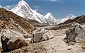 | Tibet | 6,636 metres (21,772 ft) | ||
| Kitten Mountain | Guangxi | 2,142 metres (7,028 ft) | The highest peak in the Guangxi Zhuang Autonomous Region | ||
| Cat Mountain |  | Fujian | 516 metres (1,693 ft) | ||
| Kongur Tagh |  | Xinjiang | 7,649 metres (25,095 ft) | ||
| Kubi Gangri |  | Tibet | 6,859 metres (22,503 ft) | ||
| Labuche Kang |  | Tibet | 7,367 metres (24,170 ft) | ||
| Langtang Ri |  | Tibet | 7,205 metres (23,638 ft) | ||
| Laojun Mountain | Yunnan | 4,513 metres (14,806 ft) | |||
| Mount Langya | Anhui | ||||
| Mount Lao |  | Shandong | 1,138 metres (3,734 ft) | ||
| Lhotse |  | Tibet | 8,516 metres (27,940 ft) | ||
| Mount Liang | Shandong | 198 metres (650 ft) | |||
| Lingtren |  | Tibet | 6,749 metres (22,142 ft) | ||
| Mount Lingyan |  | Jiangsu | |||
| Mount Li | Shaanxi | 1,302 metres (4,272 ft) | |||
| Liushi Shan | Tibet/Xinjiang | 7,167 metres (23,514 ft) | |||
| Loenpo Gang |  | Tibet | 6,979 metres (22,897 ft) | ||
| Mount Longhu |  | Jiangxi | |||
| Lunpo Gangri |  | Tibet | 7,095 metres (23,278 ft) | ||
| Mount Luofu |  | Guangdong | |||
| Huangshan |  | Anhui | 1,864 metres (6,115 ft) | ||
| Makalu |  | Tibet | 8,481 metres (27,825 ft) | ||
| Mazong Mountain | Gansu | 2,584 metres (8,478 ft) | |||
| Mianzimu |  | Yunnan | 6,054 metres (19,862 ft) | ||
| Mount Jinfo |  | Chongqing | 2,238 metres (7,343 ft) | ||
| Mount Longmen (Shanxi) | Shanxi | 1,087 metres (3,566 ft) | |||
| Mount Mian |  | Shanxi | 2,440 metres (8,005 ft) | An important Taoist center, associated with the origin of the Cold Food Festival. Also formerly known as Mt Jie. | |
| Mount Mogan |  | Zhejiang | |||
| Moon Hill |  | Guangxi | |||
| Muztagh Ata |  | Xinjiang | 7,546 metres (24,757 ft) | ||
| Nairamdal Peak | Xinjiang | 4,180 metres (13,714 ft) | |||
| Nyegyi Kansang |  | Tibet | 7,060 metres (23,163 ft) | Located in both India | |
| Mount Pan |  | Tianjin | 858 metres (2,815 ft) | ||
| Phu Si Lung | Yunnan | 3,076 metres (10,092 ft) | |||
| Mount Pomiu | Sichuan | 5,413 metres (17,759 ft) | |||
| Porong Ri | Tibet | 7,292 metres (23,924 ft) | |||
| Pumori |  | Tibet | 7,161 metres (23,494 ft) | ||
| Purple Mountain |  | Jiangsu | 447 metres (1,467 ft) | ||
| Mount Putuo |  | Zhejiang | |||
| Qianling Mountain |  | Guizhou | 1,500 metres (4,921 ft) | ||
| Mount Qingcheng |  | Sichuan | |||
| Qionglong Mountain |  | Suzhou | 341.7 metres (1,121 ft) | ||
| Qixia Mountain | Jiangsu | 286 metres (938 ft) | |||
| Mount Qiyun |  | Anhui | 585 metres (1,919 ft) | ||
| Ratna Chuli | Tibet | 7,035 metres (23,081 ft) | |||
| Mount Sanqing |  | Jiangxi | 1,817 metres (5,961 ft) | ||
| Sauyr Zhotasy | Xinjiang | 3,840 metres (12,598 ft) | |||
| Shenguang Mountain | Guangdong | ||||
| Shennong Mountain | Henan | 1,028 metres (3,373 ft) | |||
| Shiceng Dashan | Yunnan | 1,830 metres (6,004 ft) | Tripoint | ||
| Shiren Mountain | Henan | 2,153 metres (7,064 ft) | |||
| Siguang Ri | Tibet | 7,308 metres (23,976 ft) | |||
| Shishapangma |  | Tibet | 8,013 metres (26,289 ft) | The lowest Eight-thousander | |
| Simian Mountain |  | Chongqing | |||
| Skyang Kangri |  | Xinjiang | 7,545 metres (24,754 ft) | ||
| Mount Song |  | Henan | 1,500 metres (4,921 ft) | ||
| Mount Taibai |  | Shaanxi | 3,767 metres (12,359 ft) | ||
| Mount Tai |  | Shandong | 1,533 metres (5,030 ft) | ||
| Mount Tangjia | Sichuan | ||||
| Tavan Bogd | | Xinjiang | 4,374 metres (14,350 ft) | The highest peak in Mongolia | |
| Teram Kangri | Xinjiang | 7,462 metres (24,482 ft) | |||
| The Crown (mountain) |  | Xinjiang | 7,295 metres (23,934 ft) | ||
| Mount Tiandang | Shaanxi | ||||
| Tianmen Mountain |  | Hunan | |||
| Tianmu Mountain |  | Zhejiang | 1,506 metres (4,941 ft) | ||
| Mount Tiantai |  | Zhejiang | 1,138 metres (3,734 ft) | ||
| Tiantangzhai | Anhui/Hubei | 1,729 metres (5,673 ft) | |||
| Tianzhong Mountain | Henan | ||||
| Mount Tianzhu |  | Anhui | 1,760 metres (5,774 ft) | ||
| Tianzi Mountain |  | Hunan | |||
| Tomort | Xinjiang | 4,886 metres (16,030 ft) | |||
| Tuoshan | | Sichuan | |||
| Mount Wangwu |  | Henan | |||
| Wugai Mountain |  | Hunan | 1,600 metres (5,249 ft) | ||
| Wunü Mountain |  | Liaoning | 821 metres (2,694 ft) | ||
| Wushao Ling Mountain | Gansu | ||||
| Mount Wutai |  | Shanxi | 3,058 metres (10,033 ft) | Highest peak in north China | |
| Wutong Mountain |  | Guangdong | 944 metres (3,097 ft) | ||
| Wuzhi Mountain |  | Hainan | 1,840 metres (6,037 ft) | ||
| Xiao Mountain | Henan | 1,903 metres (6,243 ft) | |||
| Mount Xiqiao |  | Guangdong | 346 metres (1,135 ft) | ||
| Mount Siguniang |  | Sichuan | 6,250 metres (20,505 ft) | ||
| Mount Xuebaoding |  | Sichuan | 5,588 metres (18,333 ft) | ||
| Xuelian Feng |  | Xinjiang | 6,627 metres (21,742 ft) | ||
| Xueshan |  | Taiwan | 3,886 metres (12,749 ft) | Controlled by the | |
| Yangmolong | Sichuan | 6,060 metres (19,882 ft) | |||
| Yiwulü Mountain |  | Liaoning | 867 metres (2,844 ft) | ||
| Yu Shan |  | Taiwan | 3,952 metres (12,966 ft) | Controlled by the | |
| Yuelu Mountain |  | Hunan | 300 metres (984 ft) | ||
| Yun Mountain | Hunan | 1,372 metres (4,501 ft) | |||
| Yunlong Mountain |  | Jiangsu | |||
| Yuntai Mountain (Henan) |  | Henan | 1,308 metres (4,291 ft) | ||
| Yuzhu Peak |  | Qinghai | 6,224 metres (20,420 ft) | ||
| Zhaobao Mountain | Zhejiang | ||||
| Zimao Mountain | Fujian | 518 metres (1,699 ft) | |||
| Kunyu Mountain |  | Shandong | 900 metres (2,953 ft) | ||
| Changbai Mountains | Heilongjiang | 2,000 metres (6,562 ft) | |||
| Mount Tian |  | Xinjiang | 7,439 metres (24,406 ft) | ||
| Mountain Lu |  | Jiangxi | 1,474 metres (4,836 ft) |