Longs Peak is a high and prominent mountain in the northern Front Range of the Rocky Mountains of North America. The 14,259-foot (4346 m) fourteener is located in the Rocky Mountain National Park Wilderness, 9.6 miles (15.5 km) southwest by south of the Town of Estes Park, Colorado, United States. Longs Peak is the northernmost fourteener in the Rocky Mountains of Colorado and the highest point in Boulder County and Rocky Mountain National Park. The mountain was named in honor of explorer Stephen Harriman Long and is featured on the Colorado state quarter.

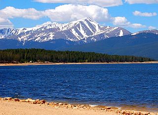
The summit of Mount Elbert at 14,440 feet (4401.2 m) elevation is the highest summit of the Rocky Mountains of North America, the highest point in the U.S. State of Colorado, and the second-highest summit in the contiguous United States after Mount Whitney. The ultra-prominent fourteener is the highest peak in the Sawatch Range, as well as the highest point in the entire Mississippi River drainage basin. Mount Elbert is located in San Isabel National Forest, 12.1 miles (19.4 km) southwest of the City of Leadville in Lake County, Colorado.

The American Discovery Trail is a system of recreational trails and roads that collectively form a coast-to-coast hiking and biking trail across the mid-tier of the United States. Horses can also be ridden on most of this trail. The coastal trailheads are the Delmarva Peninsula on the Atlantic Ocean and the northern California coast on the Pacific Ocean. The trail has northern and southern alternates for part of its distance, passing through Chicago and St. Louis respectively. The total length of the trail, including both the north and south routes, is 6,800 miles (10,900 km). The northern route covers 4,834 miles (7,780 km) with the southern route covering 5,057 miles (8,138 km). It is the only non-motorized coast-to-coast trail.

Grays Peak is the tenth-highest summit of the Rocky Mountains of North America and the U.S. state of Colorado. The prominent 14,278-foot (4352 m) fourteener is the highest summit of the Front Range and the highest point on the Continental Divide and the Continental Divide Trail in North America. Grays Peak is located in Arapahoe National Forest, 3.9 miles (6.2 km) southeast by east of Loveland Pass on the Continental Divide between Clear Creek and Summit counties. The peak is the highest point in both counties.

Torreys Peak is a mountain in the Front Range region of the Rocky Mountains in Colorado. It is one of 58 fourteeners in Colorado. Its nearest major city is Denver. Torreys Peak is located along the Continental Divide, as well as the division between Clear Creek County and Summit County.

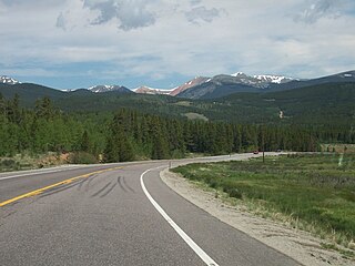
Kenosha Pass, elevation 10,000 ft (3,000 m), is a high mountain pass located in the Rocky Mountains of central Colorado in the United States.

The Mosquito Range is a high mountain range in the Rocky Mountains of central Colorado in the United States. The peaks of the range form a ridge running north–south for roughly 40 mi (64 km) from southern Summit County on the north end, then along the boundary between Lake and Park Counties. The ranges forms a high barrier separating the headwaters of the Arkansas River near Leadville from South Park and the headwaters of the South Platte River near Fairplay. The highest peak in the range is Mount Lincoln at an elevation of 14,286 ft. Other fourteeners in the range are Quandary Peak (14,272 ft), Mount Bross (14,172 ft), Mount Democrat (14,148 ft), and Mount Sherman (14,036 ft).

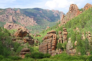
The Lost Creek Wilderness is a 119,790-acre (485 km2) wilderness area located in central Colorado in Jefferson and Park counties, south of the town of Bailey. The area is situated entirely within the boundaries of the Pike National Forest.

The Weminuche Wilderness is a wilderness area in southwest Colorado managed by the United States Forest Service as part of the San Juan National Forest on the west side of the Continental Divide and the Rio Grande National Forest on the east side of the divide. The Weminuche Wilderness was designated by Congress in 1975, and expanded by the Colorado Wilderness Acts of 1980 and 1993. It is located 4 miles (6.4 km) southeast of the town of Silverton, 17 miles (27 km) northeast of Durango, and 8 miles (13 km) west of South Fork. At 499,771 acres (2,022.50 km2), it is the largest wilderness area in the state of Colorado. Elevation in the wilderness ranges from 7,700 feet (2,300 m) along the Animas River to 14,093 feet (4,296 m) at the summit of Windom Peak.

Crystal Peak is a high mountain summit in the Tenmile Range of the Rocky Mountains of North America. The 13,859-foot (4,224 m) thirteener is in White River National Forest, 5.9 miles (9.5 km) southwest of the Town of Breckenridge in Summit County, Colorado, United States.

The geography of the U.S. State of Colorado is diverse, encompassing both rugged mountainous terrain, vast plains, desert lands, desert canyons, and mesas. Colorado is a landlocked U.S. state. In 1861, the United States Congress defined the boundaries of the new Territory of Colorado exclusively by lines of latitude and longitude, stretching from 37°N to 41°N latitude, and from 102°02'48"W to 109°02'48"W longitude. Starting in 1868, official surveys demarcated the boundaries, deviating from the parallels and meridians in several places. Later surveys attempted to correct some of these mistakes but in 1925 the U.S. Supreme Court affirmed that the earlier demarcation was the official boundary. The borders of Colorado are now officially defined by 697 boundary markers connected by straight boundary lines. Colorado, Wyoming, and Utah are the only states that have their borders defined solely by straight boundary lines with no natural features. The southwest corner of Colorado is the Four Corners Monument at 36°59'56"N, 109°2'43"W. This is the only place in the United States where four states meet: Colorado, New Mexico, Arizona, and Utah.

Split Mountain is a fourteener in the Sierra Nevada of the U.S. state of California, near the southeast end of the Palisades group of peaks. It is the only fourteener in the watershed of the South Fork Kings River, and rises to 14,064 ft (4,287 m), making it the eighth-highest peak in the state.

The Great Craggy Mountains, commonly called the Craggies, are a mountain range in western North Carolina, United States. They are a subrange of the Blue Ridge Mountains and encompass an area of approx. 194 sq mi (503 km²). They are situated in Buncombe County, North Carolina, 14 miles northeast of Asheville. The Black Mountains lie to the northeast, across the upper Cane River valley.

Devils Head is a mountain summit in the Rampart Range of the Rocky Mountains of Colorado. The 9,749-foot (2,971 m) peak is located in Pike National Forest, 14.2 miles (22.9 km) southwest by south of the community of Sedalia in Douglas County, Colorado, United States.

Pikes Peak is the highest summit of the southern Front Range of the Rocky Mountains in North America. The ultra-prominent 14,115-foot (4,302.31 m) fourteener is located in Pike National Forest, 12 miles (19 km) west of downtown Colorado Springs, Colorado. The town of Manitou Springs lies at its base.

Mount Rosa is a mountain summit of the Pikes Peak Massif in the southern Front Range of the Rocky Mountains of North America. The 11,504-foot (3,506 m) peak is located in Pike National Forest, 12.8 miles (20.6 km) southwest by west of downtown Colorado Springs in Teller County, Colorado, United States.

The Anthracite Range is a mountain range in the West Elk Mountains, a sub-range of the Rocky Mountains of North America. The range is located in Gunnison County of western Colorado and lies within the West Elk Wilderness of the Gunnison National Forest. The Anthracite Range is one of several prominent laccoliths found in the West Elk Mountains.

Mount Sheridan is a 13,748-foot (4,190 m) mountain summit on the boundary shared by Lake County and Park County, in Colorado, United States.


