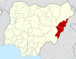
Yola, meaning 'Great Plain' or 'Vast Plain Land', is a large city, capital city and administrative centre of Adamawa State, Nigeria. It is located on the Benue River, and it has a population of over 336,648 (2010). Yola is split into two parts. The old town of Yola where the Lamido resides is the traditional city and the new city of Jimeta is the administrative and commercial centre. They are generally referred to as Yola.
Song is a town and Local Government Area in Adamawa State, Nigeria is a town and also a local government area in the state with the area council consisting districts of Song, Dumme, Dirma, Kilange, Funa, Gudu, Mboi, Kilange, Hirna, Gari, Waje, Suktu, Zumo, Waltandi and Ditera.

Gboko is a Local Government Area in Benue state, North-central Nigeria. It is headquartered in the town of Gboko.
Emure is a town in the Ekiti State of Nigeria. It is also called Emure Ekiti. It became much better known in the US after the king of Emure's grandson Adewale Ogunleye made it into the NFL for the Chicago Bears.

Madagali or Madagli is a town and local government area in Adamawa State, Nigeria, adjacent to the border with Cameroon.
Demsa is a Local Government Area of Adamawa State, Nigeria with headquarters located in Demsa. Demsa lies on the Benue River.
Fufore is a town and local government area in Adamawa State, Nigeria.

Ganye is a town and Local Government Area of Adamawa State, Nigeria. Jada and Toungo Local Governments were carved out from Ganye local government area of Adamawa state Nigeria. Ganye is bordered by Jada Local Government Area to the North and East, Toungo Local Government Area to the South and Taraba State to the West. It is the headquarter of the Sama (Chamba) people worldwide.
Gombi is the Local Government Headquarter of Gombi Local Government Area of Adamawa State, Nigeria.

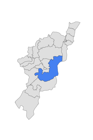
Girei is a town and local government area of Adamawa State, Nigeria. It lies on the Benue River. The dominant tribe in the area are the Fulɓe or Fulani; however, a substantial number of Bwatiye also dwell in villages such as Greng, Notable, and Labondo within the Girei local government area. The primary occupation of the people in the area is farming and cattle rearing. Girei is also a home to Radio Gotel.
Hong is a town and a Local Government Area in Adamawa State, Nigeria. Hong is the capital city of the Kilba.

Jada is a town and Local Government Area of Adamawa State, Nigeria.
Lamurde is a town and Local Government Area of Adamawa State, Nigeria inhabited predominantly by the Bwatiye (Bachama) people.

Mubi North is a Local Government Area of Adamawa State, Nigeria. The town is the location of the Adamawa State University and the Federal Polytechnic, Mubi.

Mubi South is a Local Government Area of Adamawa State, Nigeria.
Numan, also known as Nomweh, is a town and a Local Government Area in Adamawa State, Nigeria. It is a port town that lies on the confluence of Benue River and Gongola River.
Shelleng is a Local Government Area (LGA) of Adamawa State, North-east Nigeria.
Toungo is a town and Local Government Area of Adamawa State, Nigeria.
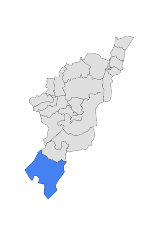
Mayo-Belwa, is a Local Government Area in Adamawa State, Nigeria. It had an estimated population of about 204,200 people as of 2016. It shares boundary with Taraba State to the west.

Keffi Local Government Area and also is a traditional or commercial town in Nasarawa north central Nigeria Its headquarters are in the town of Keffi. Keffi is 50 kilometers from Abuja. Nasarawa State university is located in Keffi sitting along Keffi-Akwanga express way.