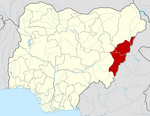
Uyo is the capital city of Akwa Ibom in South South Nigeria. Ibibio is the language spoken in Uyo.
Ihiala is a city in Nigeria, located in the southern part of Anambra State and within the region known as Igboland. It has long served as the local administrative capital of Ihiala Local Government Area. The Local Government Area has a population of about 87,796.

Ningi is a town, a local government area, and an emirate in Bauchi State, Nigeria. The Ningi emirate comprises two local government areas, Ningi and Warji, with a combined area of 5,250 km2 and a population of 501,912 according to the 2006 Census. The Ningi local government area covers an area of 4,625 km2 with a population of 387,192 at the 2006 Census. The area is inhabited mostly by hausa people, Duwa, Ningawa.Yunusa Muhammadu Danyaya is the current Emir of Ningi.

Gboko is a Local Governments Area is in Benue state, North-central Nigeria. Its headquarters in the town of Gboko.
Ikere-Ekiti, also known as Ikere or Ikerre, is a city in Ekiti State of Nigeria.In Ikere Local Government. It is an agricultural and mine centre. According to the 1963 and 1991 census, the population was 114,780 and 60,257 respectively, but the 2006 census recorded it to be 147,355.
Charanchi is a town and Local Government Area (LGA) in Katsina State, northern Nigeria. The town, on the A9 highway, is the headquarters of the LGA. The chairman of the LGA is Dr.Badamasi Lawal Charanchi, the population is approximately 79,000 (2003), and the area is 471 km2. The local government was created from the former Rimi local government in 1996. Currently there are 11 councillors representing their wards in the administration of the local government council. These councillors have the right to impeach the Local Government Chairman in case of any misconduct or misappropriation of the government's fund.
Demsa is a Local Government Area of Adamawa State, Nigeria with headquarters located in Demsa. Demsa lies on the Benue River.
Numan, also known as Nomweh, is a town and a Local Government Area in Adamawa State, Nigeria. It is a port town that lies on the confluence of Benue River and Gongola River.
Itas/Gadau is a Local Government Area of Bauchi State, Nigeria. Its headquarters are in the town of Itas Itesiwaju. The town of Gadau is in the east of the area at 11°50′08″N10°10′02″E.
Kirfi is a Local Government Area of Bauchi State, Nigeria, bordering Gombe State in the east. Its headquarters are in the town of Kirfi. The northeasterly line of equal latitude and longitude passes through the Local Government Area.
Ise/Orun is a Local Government Area of Ekiti State, Nigeria. Its headquarters are in the town of Ise Ekiti.
Akko is a local government area of Gombe, Gombe State, Nigeria. Its headquarters is in Kumo town on the A345 highway south of the state capital Gombe, about 40 km away. Kumo (headquarter) is a cosmopolitan communities of more than 30 differents tribes, ranging from the dominant Fulani tribe to Tangale, Tera, Hausa and other minorities.
Nafada is one of the eleven Local Government Areas (LGA) of Gombe State, Nigeria. Its headquarter is in the town of Nafada in the east of the area at 11°05′44″N11°19′58″E,on the Gongola River which traverses the area. According to the 2006 census, the LGA covers 1,586 square kilometers and has a population of 138,185 people. Nafada has ten wards namely: Nafada East, Nafada Central, Nafada West, Jigawa, Birnin Fulani East, Birnin Bolewa, Birnin Fulani West, Gudukku, Barwo/Nasarawo and Barwo Winde.
Guri is a Local Government Area of Jigawa State, Nigeria. Its headquarters are in the town of Guri. [The big town of guri local government is] KADIRA.
Kalgo is a Local Government Area (LGA) in Kebbi State, Nigeria. It was created in 1996 out of the Bunza LGA. Its headquarters are in the town of Kalgo. Kalgo LGA shares a west border with Bunza LGA.
Kauru is a Local Government Area in southern Kaduna State, Nigeria. The area is 3,186 km2. Its headquarters are in the town of Kauru. The postal code of the area is 811.
Anka is a Local Government Area in Zamfara State, Nigeria. Its headquarters is in the town of Anka at 12°06′30″N5°56′00″E.
Birnin Magaji/Kiyaw is a Local Government Area in Zamfara State, Nigeria. Its headquarters are in the town of Birnin Magaji in the north of the LGA at12°33′00″N6°49′00″E. The LGA is also named from the town of Kiyaw to the south.
Jakusko is a Local Government Area in Yobe State, Nigeria. Its headquarters are in the town of Jakusko in the west of the area at 12°22′09″N10°46′23″E.
Lau is a Local Government Area in Taraba State, Nigeria. Its headquarters is in the town of Lau and the area is dominated by Hausa Fulani people. Lau Local government has a border with Ardo Kola, Jalingo, Yorro and Zing local governments of Taraba state. It also shares a border with Numan, Adamawa State.