Related Research Articles

Parksville is a city on Vancouver Island in British Columbia, Canada. As of the 2016 Census, Parksville's population was 12,514, representing a 4.5% increase over the 2011 Census.

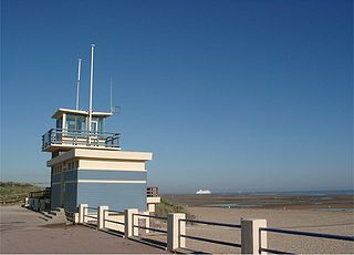
Merville-Franceville-Plage is a commune in the Calvados department in the Normandy region in northwestern France.

Madeira Park is an unincorporated community in the area of Pender Harbour on the Sunshine Coast of southwestern British Columbia, Canada.

Sallenelles is a commune in the Calvados department in the Normandy region in northwestern France.

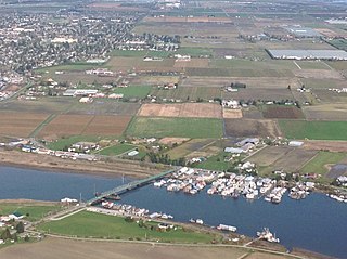
Laidlaw is an unincorporated settlement in the Upper Fraser Valley region of British Columbia, Canada, located just west of the westernmost boundary of Hope, British Columbia on the south side of the Fraser River and along the Trans-Canada Highway.
Halfmoon Bay is a small community of about 2,800 people, many of whom are only summer residents. It is a large scalloped bay protected from the open sea by South Thormanby Island and Vancouver Island. It encompasses a small village of permanent homes, summer cottages and five regional parks on the Sunshine Coast of British Columbia. It belongs to Electoral Area B in the Sunshine Coast Regional District.

Lasqueti Island is an island off the east coast of Vancouver Island in the Strait of Georgia, qathet Regional District, British Columbia, Canada and has a population of 399 people. A passenger-only ferry connects the island to the community of French Creek, near Parksville. The ferry makes two to three runs per day, five days per week, weather permitting.

Lulu Island is the name of the largest island in the estuary of the Fraser River, located south of Vancouver, British Columbia, and the second-most populous island in British Columbia, after Vancouver Island. The city of Richmond occupies most of the island, while a small section at the eastern tip, known as Queensborough, is part of the city of New Westminster.

Westham Island is an island located near Ladner, British Columbia, Canada within the City of Delta, which in turn is part of Greater Vancouver, Canada. The George C. Reifel Migratory Bird Sanctuary for migratory birds is located at the northern end of the island. The Alaksen National Wildlife Area is also located on the island. The island is accessible via the Westham Island Bridge.
Honeymoon Bay is an unincorporated community in the Canadian province of British Columbia. It is located on Cowichan Lake in the southeastern part of Vancouver Island — approximately 75 kilometres (47 mi) northwest of Victoria — at 48°49′N124°10′W. In 2011, its population was listed at 580.
Menzies Bay is a large bay adjoining Seymour Narrows and Quadra Island north of Campbell River on Vancouver Island. It was once considered in 1872 as a crossing point to Vancouver Island for the Canadian Pacific Railway from Sonora Island and Bute Inlet in that project's quest for a transcontinental line. The bay was the site of a Bloedel, Stewart and Welch railroad logging camp in the 1930s, and adjacent to Ripple Rock.

The Côte Fleurie stretches for approximately 40 km (25 mi) between Merville-Franceville-Plage, at the mouth of the Orne river, opposite Ouistreham to the west and Honfleur on the Seine estuary in the east. It forms part of the eastern Basse-Normandie coast on the English Channel to the north of the Pays d'Auge in the Calvados department. The coast between the towns of Trouville and Honfleur, although part of the Côte Fleurie, is named Côte de Grace. Dives-sur-Mer is on the Côte Fleurie but possesses no beach or seafront. The Côte de Nacre continues west from the Touques estuary.

Passage Island is a small island near West Vancouver, British Columbia, and across from Bowen Island in Canada. The island is mostly woodland and cliffs. It marks the entrance to Howe Sound, and the ferry between Horseshoe Bay to Nanaimo regularly passes it. The island borrows a postal code, V7W 1V7, from the wealthiest community in Canada, West Vancouver. However, Passage Island is actually overseen by the Islands Trust and is part of the Metro Vancouver Regional District. It is isolated from West Vancouver by approximately two km (1.2 mi) of ocean.

Mansons Landing is an unincorporated community near the southern tip of Cortes Island, British Columbia, Canada.
Norrish Creek is a tributary of the Fraser River. It is located in the Douglas Ranges, the southernmost subrange of the Pacific Ranges of the Coast Mountains of British Columbia, Canada to the north of Nicomen Island. Local residents refer to it as "Suicide Creek." It was named after William Henry Norrish a pioneer Scottish Canadian farmer.

Heriot Bay is the principal settlement on Quadra Island in British Columbia, Canada.
Franceville is a place-name that may refer to:
Burke Channel is a channel in the Central Coast region of the Canadian province of British Columbia, separating the south and east coasts of King Island from the mainland. It was first charted in 1792 by James Johnstone, one of George Vancouver's officers during his 1791-1795 expedition. Vancouver named it "Burke's Channel" after Edmund Burke.
Fisher Channel is a channel in the Central Coast region of the Canadian province of British Columbia. To its west are Hunter and Denny Islands, to its east King Island. It was first charted in 1793 by George Vancouver during his 1791-95 expedition. He named it "Fisher’s Channel" after "a much-respected friend" Reverend John Fisher.

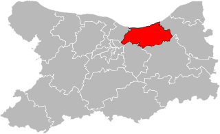
The canton of Cabourg is an administrative division of the Calvados department, northwestern France. Its borders were modified at the French canton reorganisation which came into effect in March 2015. Its seat is in Cabourg.
References
- ↑ Akrigg, G.P.V.; Akrigg, Helen B. (1986), British Columbia Place Names (3rd, 1997 ed.), Vancouver: UBC Press, ISBN 0-7748-0636-2
Coordinates: 49°47′N125°04′W / 49.783°N 125.067°W