Oak Bay, British Columbia

Last updated

Oak Bay
The Corporation of the District of Oak Bay [1]
Oak Bay.jpg
OakBayCoatofArms.gif
24 Capital Regional District British Columbia.svg
Western Canada Map Assets City.svg
Oak Bay
Location of Oak Bay within the Capital Regional District
Canada British Columbia location map 2.svg
Red pog.svg
Location of Oak Bay in British Columbia
Coordinates: 48°25′34.284″N123°19′0.84″W / 48.42619000°N 123.3169000°W / 48.42619000; -123.3169000
CountryCanada
Province British Columbia
Regional district Capital
Incorporated 1906
Government
  MayorKevin Murdoch
   Governing Body Oak Bay Municipal Council
   MP Laurel Collins (NDP)
   MLA Murray Rankin (BC NDP)
Area
[2]
  Total10.53 km2 (4.07 sq mi)
Elevation
34 m (112 ft)
Population
 (2016) [2]
  Total18,094
  Density1,717.7/km2 (4,449/sq mi)
Time zone UTC−8 (Pacific Time Zone)
  Summer (DST) UTC−7 (Pacific Daylight Time)
Area code(s) 250, 778
Website Official website
Oak Bay Oak Bay Boats.jpg
Oak Bay

Oak Bay is a municipality incorporated in 1906 that is located on the southern tip of Vancouver Island, in the Canadian province of British Columbia. It is one of thirteen member municipalities of the Capital Regional District, and is bordered to the west by the city of Victoria and to the north by the district of Saanich. It is an eastern residential suburb of Victoria.

Contents

History

Cattle Point, Oak Bay, British Columbia, Canada Cattle-Point,-Oak-Bay.jpg
Cattle Point, Oak Bay, British Columbia, Canada

Oak Bay is part of the traditional territories of the Coast Salish people of the Songhees First Nation. The people that came and went in the millennia before are unknown. Evidence of their ancient settlements has been found along local shores, including Willows Beach, where an ancient Lkwungen seaport known as Sitchanalth was centred around the mouth of the river commonly known as Bowker Creek. [3] Sitchanalth is hypothesized to have been destroyed by the great Tsunami of 930 AD. [4] Much of this neighbourhood is built upon an Indigenous burial ground. [5]

Oak Bay takes its name from the Garry oak tree, which is found throughout the region, and also the name of the large bay on the eastern shore of the municipality, fronting onto Willows Beach.

John Tod, in 1850, built on a 109-acre (44 ha) farm that is today the oldest continuously-occupied home in Western Canada. Tod was the Chief Fur Trader for the Hudson's Bay Company for Kamloops, one of the original appointed members of BC's Legislative Council. [6] [7] [8]

Originally developed as a middle class streetcar suburb of Victoria, Oak Bay was incorporated as a municipality in 1906. Its first Council included Francis Rattenbury, the architect who designed the Legislative Buildings and Empress Hotel located on the inner harbour in Victoria. Rattenbury's own home on Beach Drive is now used as the junior campus for Glenlyon Norfolk School. In 1912, the former farm lands of the Hudson's Bay Company were subdivided to create the Uplands area, but development was hampered by the outbreak of World War I. After the war, development of expensive homes in the Uplands was accompanied by the construction of many more single-family dwellings in the Estevan, Willows and South Oak Bay neighbourhoods.

The Victoria Golf Club is located in South Oak Bay. It was founded in 1893, and is the second oldest golf course west of the Great Lakes. It is a 6,120 yard links course on the ocean side, and claims to be the oldest golf course in Canada still on its original site. The course is reported to be haunted. [7]

The Royal Victoria Yacht Club was formed on June 8, 1892, and moved in 1912 to its current location, at the location of the old Hudson's Bay Company cattle wharf.

In 1925, the Victoria Cougars won the Stanley Cup at the Patrick Arena in Oak Bay, defeating the Montreal Canadiens in four games. [9] The arena was soon after destroyed by fire in 1929. Nowadays, the Victoria Cougars are the Detroit Red Wings of the National Hockey League.

The Oak Bay Marina, built in 1962, was officially opened in April 1964. It replaced the Oak Bay Boat House built in 1893. The breakwater was built in 1959 and funded by the federal government.

There have reportedly been sightings of a sea monster known as the Cadborosaurus off Oak Bay, with both reports dating back to before European settlement in the area. [10]

Demographics

In the 2021 Census of Population conducted by Statistics Canada, Oak Bay had a population of 17,990 living in 7,807 of its 8,168 total private dwellings, a change of

Ethnicity

Panethnic groups in the District of Oak Bay (1996−2021)
Panethnic
group
2021 [12] 2016 [13] 2011 [14] 2006 [15] 2001 [16] 1996 [17]
Pop. %Pop.%Pop.%Pop.%Pop.%Pop.%
European [lower-alpha 1] 15,04015,35515,51516,20016,03016,240
East Asian [lower-alpha 2] 1,1101,0808106451,000845
South Asian 370285325180120205
Indigenous 34525519026012090
Southeast Asian [lower-alpha 3] 2501901551857510
Latin American 1209545654535
Middle Eastern [lower-alpha 4] 11511585801080
African 1005560257085
Other/Multiracial [lower-alpha 5] 1804575352010
Total responses17,64017,47517,38517,68517,48517,595
Total population17,99018,09418,01517,90817,79817,865
Note: Totals greater than 100% due to multiple origin responses

Religion

According to the 2021 census, religious groups in Oak Bay included: [12]

Film studio

During the 1930s, Oak Bay, British Columbia was the original "Hollywood North" where fourteen films were produced in Greater Victoria between 1933 and 1938. [18] In 1932 Kenneth James Bishop leased an off-season exhibition building on the Willows Fairgrounds that was converted to a film sound stage to produce films for the British film quota system under the Cinematograph Films Act 1927 [19] and films were produced with Hollywood stars such as Lillian Gish, Paul Muni, Sir Cedric Hardwicke, Edith Fellows, Charles Starrett and Rin Tin Tin Jr. Film production was curtailed when the Cinematograph Films Act 1938 specified only British made films would be included in the quota.

The Willows Park Studio films include:
1933

1935

1936

1937

1938

1942

Climate

Climate data for Gonzales Avenue, Victoria, British Columbia, Canada (1971-2000)
MonthJanFebMarAprMayJunJulAugSepOctNovDecYear
Record high humidex 13.816.018.322.429.133.836.135.032.324.719.715.136.1
Record high °C (°F)14.4
(57.9)
17.4
(63.3)
20.6
(69.1)
27.0
(80.6)
29.5
(85.1)
35.0
(95.0)
35.0
(95.0)
32.8
(91.0)
31.7
(89.1)
25.0
(77.0)
18.9
(66.0)
15.0
(59.0)
35.0
(95.0)
Mean daily maximum °C (°F)7.0
(44.6)
8.6
(47.5)
10.6
(51.1)
13.1
(55.6)
15.9
(60.6)
17.9
(64.2)
19.8
(67.6)
20.1
(68.2)
18.5
(65.3)
13.8
(56.8)
9.4
(48.9)
7.1
(44.8)
13.5
(56.3)
Daily mean °C (°F)5.0
(41.0)
6.2
(43.2)
7.6
(45.7)
9.6
(49.3)
12.1
(53.8)
14.0
(57.2)
15.6
(60.1)
15.9
(60.6)
14.6
(58.3)
10.9
(51.6)
7.2
(45.0)
5.2
(41.4)
10.3
(50.6)
Mean daily minimum °C (°F)3.0
(37.4)
3.7
(38.7)
4.5
(40.1)
6.0
(42.8)
8.2
(46.8)
10.0
(50.0)
11.3
(52.3)
11.7
(53.1)
10.7
(51.3)
7.9
(46.2)
5.0
(41.0)
3.2
(37.8)
7.1
(44.8)
Record low °C (°F)−14.4
(6.1)
−12.8
(9.0)
−7.2
(19.0)
−2.2
(28.0)
1.1
(34.0)
3.9
(39.0)
6.1
(43.0)
4.4
(39.9)
1.7
(35.1)
−2.8
(27.0)
−11.1
(12.0)
−15.6
(3.9)
−15.6
(3.9)
Record low wind chill −22.0−19.0−14.0−5.0−2.03.04.07.01.0−9.0−21.0−27.0−27.0
Average precipitation mm (inches)94.3
(3.71)
71.7
(2.82)
46.5
(1.83)
28.5
(1.12)
25.8
(1.02)
20.7
(0.81)
14.0
(0.55)
19.7
(0.78)
27.4
(1.08)
51.2
(2.02)
98.9
(3.89)
108.9
(4.29)
607.6
(23.92)
Average rainfall mm (inches)85.2
(3.35)
68.1
(2.68)
45.3
(1.78)
28.5
(1.12)
25.8
(1.02)
20.7
(0.81)
14.0
(0.55)
19.7
(0.78)
27.4
(1.08)
51.1
(2.01)
95.5
(3.76)
101.9
(4.01)
583.2
(22.95)
Average snowfall cm (inches)9.7
(3.8)
3.5
(1.4)
1.1
(0.4)
0
(0)
0
(0)
0
(0)
0
(0)
0
(0)
0
(0)
0.1
(0.0)
4.1
(1.6)
7.8
(3.1)
26.3
(10.3)
Average precipitation days (≥ 0.2 mm)17.015.414.510.89.67.95.15.28.013.517.417.5141.9
Average rainy days (≥ 0.2 mm)14.614.312.910.59.07.14.94.87.911.915.316.1129.3
Average snowy days (≥ 0.2 cm)2.61.70.670000000.120.821.97.81
Mean monthly sunshine hours 74.193.7149.5201.5266.6273.8327.8297.3204.1153.483.168.72,193.6
Source: Environment Canada [26]

Education

Oak Bay is the home of the University of Victoria, a public research institution in the Capital Region District. While much of the University of Victoria campus is located within the District of Oak Bay, parts of it are also located in the adjacent municipality of Saanich.

Oak Bay also hosts a number of academically focused public and private secondary schools which are part of School District 61. There is one public elementary school, Willows Elementary, one public middle school, Monterey Middle School, and one public high school, Oak Bay High School, with the largest student population in the Greater Victoria School District. [27] Residents in the South Oak Bay area may also register their children at the nearby Margaret Jenkins Elementary (in Victoria). In addition to public schools, there are two private schools located in Oak Bay, Glenlyon Norfolk School and St. Michael's University School.

Neighbourhoods

Parks and recreation centres

Parks

Public safety

See also

Notes

  1. Statistic includes all persons that did not make up part of a visible minority or an indigenous identity.
  2. Statistic includes total responses of "Chinese", "Korean", and "Japanese" under visible minority section on census.
  3. Statistic includes total responses of "Filipino" and "Southeast Asian" under visible minority section on census.
  4. Statistic includes total responses of "West Asian" and "Arab" under visible minority section on census.
  5. Statistic includes total responses of "Visible minority, n.i.e." and "Multiple visible minorities" under visible minority section on census.

Related Research Articles

<span class="mw-page-title-main">Saanich, British Columbia</span> Municipality in British Columbia, Canada

Saanich is a district municipality on Vancouver Island in British Columbia, within the Greater Victoria area. The population was 117,735 at the 2021 census, making it the most populous municipality in the Capital Regional District and Vancouver Island, and the eighth-most populous in the province. The district adopted its name after the Saanich First Nation, meaning "emerging land" or "emerging people". The district acts as a bedroom community immediately to the north of Victoria, British Columbia.

<span class="mw-page-title-main">Esquimalt</span> Township in British Columbia, Canada

The Township of Esquimalt is a municipality at the southern tip of Vancouver Island, in British Columbia, Canada. It is bordered to the east by the provincial capital, Victoria, to the south by the Strait of Juan de Fuca, to the west by Esquimalt Harbour and Royal Roads, to the northwest by the New Songhees 1A Indian reserve and the town of View Royal, and to the north by a narrow inlet of water called the Gorge, across which is the district municipality of Saanich. It is almost tangential to Esquimalt 1 Indian Reserve near Admirals Road. It is one of the 13 municipalities of Greater Victoria and part of the Capital Regional District.

<span class="mw-page-title-main">Ladysmith, British Columbia</span> Town in British Columbia, Canada

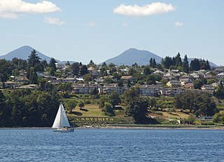
Ladysmith, originally Oyster Harbour, is a town located on the 49th parallel north on the east coast of Vancouver Island, British Columbia, Canada. The local economy is based on forestry, tourism, and agriculture. A hillside location adjacent to a sheltered harbour forms the natural geography of the community.

<span class="mw-page-title-main">Capital Regional District</span> Regional district in British Columbia, Canada

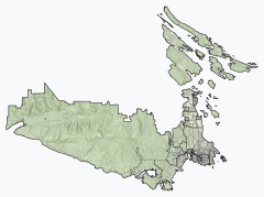
The Capital Regional District (CRD) is a local government administrative district encompassing the southern tip of Vancouver Island and the southern Gulf Islands in the Canadian province of British Columbia. The CRD is one of several regional districts in British Columbia and had an official population of 415,451 as of the Canada 2021 Census.

<span class="mw-page-title-main">Victoria (British Columbia federal electoral district)</span> Federal electoral district in British Columbia, Canada

Victoria is a federal electoral district in British Columbia, Canada, that has been represented in the House of Commons of Canada from 1872 to 1904 and since 1925.

<span class="mw-page-title-main">View Royal</span> Town in British Columbia, Canada

View Royal is a town in Greater Victoria and a member municipality of the Capital Regional District of British Columbia, Canada. View Royal has a population of 11,575 residents. With over 700 hectares of parkland, View Royal includes Thetis, McKenzie, Pike, and Prior Lakes and portions of Esquimalt Harbour and Portage Inlet.

<span class="mw-page-title-main">Duncan, British Columbia</span> City in British Columbia, Canada

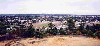
Duncan is a city on southern Vancouver Island in British Columbia, Canada. It is the smallest city by area in Canada. It was incorporated in 1912.

<span class="mw-page-title-main">Sunshine Coast Regional District</span> Regional district in British Columbia, Canada

The Sunshine Coast Regional District is a regional district in British Columbia, Canada. It is located on the southern mainland coast, across Georgia Strait from Vancouver Island. It borders on the qathet Regional District to the north, the Squamish-Lillooet Regional District to the east, and, across Howe Sound, the Metro Vancouver District to the south. The regional district offices are located in the District Municipality of Sechelt.

<span class="mw-page-title-main">North Cowichan</span> District municipality in British Columbia, Canada

North Cowichan is a district municipality established in 1873 on Vancouver Island, in British Columbia, Canada. The municipality is part of the Cowichan Valley Regional District. North Cowichan is noted for a landscape including forests, beaches, rivers, and lakes. The municipality encompasses the communities of Chemainus; Westholme; Crofton; Maple Bay; and "the South End". The latter is an informal name for a built-up area which is essentially a suburb of the City of Duncan, a separate municipality.

Lantzville is a coastal community on the east side of Vancouver Island, British Columbia, Canada, along the western shore of the Strait of Georgia and immediately north of Nanaimo.

<span class="mw-page-title-main">Central Saanich</span> District municipality in British Columbia, Canada

Central Saanich is a district municipality in Greater Victoria, British Columbia, Canada, and a member municipality of the Capital Regional District. It is located on the Saanich Peninsula, in the far south-east of Vancouver Island. It is the traditional territory of the W̱SÁNEĆ people. The district began as a farming community, and many hobby farms, along working farms and vineyards, still exist. In recent decades, the area has seen increasing residential, commercial, and industrial development, especially around the neighbourhoods of Brentwood Bay and Saanichton, which are occasionally referred to as separate communities.

<span class="mw-page-title-main">Langford, British Columbia</span> City in British Columbia, Canada

Langford is a city on southern Vancouver Island in the province of British Columbia, Canada. Langford is one of the 13 component municipalities of Greater Victoria and is within the Capital Regional District. Langford was incorporated in 1992 and has a population of over 40,000 people. Its municipal neighbours are Colwood to the southeast, Highlands to the north, Metchosin to the southwest, and View Royal to the northeast.

The District of Metchosin is a municipality and community in Greater Victoria on the southern tip of Vancouver Island in British Columbia, Canada. It is a coastal community adjacent to the Strait of Juan de Fuca. Metchosin is part of the Western Communities and one of the 13 regional municipalities.

<span class="mw-page-title-main">Cowichan Valley Regional District</span> Regional district in British Columbia, Canada

The Cowichan Valley Regional District is a regional district in the Canadian province of British Columbia is on the southern part of Vancouver Island, bordered by the Nanaimo and Alberni-Clayoquot Regional Districts to the north and northwest, and by the Capital Regional District to the south and east. As of the 2021 Census, the Regional District had a population of 89,013. The regional district offices are in Duncan.

<span class="mw-page-title-main">Colwood, British Columbia</span> City in British Columbia, Canada

Colwood is a city located on Vancouver Island to the southwest of Victoria, capital of British Columbia, Canada. Colwood was incorporated in 1985 and has a population of approximately 19,000 people. Colwood lies within the boundaries of the Greater Victoria area or Capital Regional District, in a region called the Western Communities, or the West Shore. It is one of the 13 component municipalities of Greater Victoria.

Cumberland is an incorporated village municipality east of Perseverance Creek, near the east coast of central Vancouver Island, British Columbia. The Comox Valley community is west of BC Highway 19 and is by road about 105 kilometres (65 mi) northwest of Nanaimo and 10 kilometres (6 mi) southwest of Courtenay.

The District of North Saanich is located on the Saanich Peninsula of British Columbia, approximately 25 km (16 mi) north of Victoria on southern Vancouver Island. It is one of the 13 Greater Victoria municipalities. The district is surrounded on three sides by 20 km (12 mi) of ocean shoreline, and consists of rural/residential areas and a large agricultural base. It is home to the Victoria International Airport and the Swartz Bay Ferry Terminal.

The demographics of Metro Vancouver indicate a multicultural and multiracial region. Metro Vancouver is a metropolitan area, with its major urban centre being Vancouver, British Columbia, Canada. The Vancouver census metropolitan area, as defined by Statistics Canada, encompasses roughly the same territory as the Metro Vancouver Regional District, a regional district in British Columbia. The regional district includes 23 local authorities. Figures provided here are for the Vancouver census metropolitan area and not for the City of Vancouver.

<span class="mw-page-title-main">Coldstream, British Columbia</span> District municipality in British Columbia, Canada

Coldstream is a district municipality in British Columbia, Canada, located at the northern end of Kalamalka Lake in the Okanagan Valley. Incorporated on December 21, 1906, Coldstream celebrated its centennial in 2006. The municipality is directly southeast of Vernon and is considered part of Greater Vernon. It is a member municipality of, and also the location of the head offices, of the Regional District of North Okanagan.

Spallumcheen is a district municipality in the Canadian province of British Columbia. Located in the Okanagan region between Vernon and Enderby, the township had a population of 5,055 and land area of 255.77 square kilometres (98.75 sq mi) in the Canada 2011 Census. The district, whose official name is the Township of Spallumcheen and which is the oldest rural municipality in the British Columbia Interior, consists primarily of agricultural land surrounding the separately incorporated City of Armstrong. Both Spallumcheen and Armstrong are member municipalities of the Regional District of North Okanagan.

References

  1. "British Columbia Regional Districts, Municipalities, Corporate Name, Date of Incorporation and Postal Address" (XLS). British Columbia Ministry of Communities, Sport and Cultural Development. Archived from the original on July 13, 2014. Retrieved November 2, 2014.
  2. 1 2 "Oak Bay, District municipality [Census subdivision], British Columbia and Capital, Regional district [Census division], British Columbia". Statistics Canada. January 23, 2017. Retrieved February 8, 2017.
  3. "Capital Regional District Victoria BC". CRD. 30 October 2013. Retrieved 26 January 2017.
  4. Doughton, Sandi. "Ancient quake and tsunami in Puget Sound shake researchers". The Seattle Times. Retrieved 29 January 2016.
  5. "When Victorians Used to Dig Up Indigenous Bones for Fun". The Capital. Retrieved 2020-08-16.
  6. "Tod House".
  7. 1 2 Belyk, Robert C. (2011-07-06). Ghosts: True Tales of Eerie Encounters. ISBN   9781926971186.
  8. Green, Valerie (2001). If These Walls Could Talk: Victoria's Houses from the Past. ISBN   9780920663783.
  9. Fame, Hockey Hall of. "HHOF | Silverware Trophy Tour". Hockey Hall of Fame. Retrieved 2023-03-09.
  10. Woodley, M.; Naish, D.; Shanahan, H. (2008). "How many extant pinniped species remain to be described?". Historical Biology. 20 (4): 225–235. doi:10.1080/08912960902830210. ISSN   0891-2963. S2CID   14824564.
  11. "Population and dwelling counts: Canada, provinces and territories, and census subdivisions (municipalities), British Columbia". Statistics Canada. February 9, 2022. Retrieved February 20, 2022.
  12. 1 2 Government of Canada, Statistics Canada (2022-10-26). "Census Profile, 2021 Census of Population". www12.statcan.gc.ca. Retrieved 2022-11-09.
  13. Government of Canada, Statistics Canada (2021-10-27). "Census Profile, 2016 Census". www12.statcan.gc.ca. Retrieved 2023-03-03.
  14. Government of Canada, Statistics Canada (2015-11-27). "NHS Profile". www12.statcan.gc.ca. Retrieved 2023-03-03.
  15. Government of Canada, Statistics Canada (2019-08-20). "2006 Community Profiles". www12.statcan.gc.ca. Retrieved 2023-03-03.
  16. Government of Canada, Statistics Canada (2019-07-02). "2001 Community Profiles". www12.statcan.gc.ca. Retrieved 2023-03-03.
  17. Government of Canada, Statistics Canada (2019-07-02). "Profile of Census Divisions and Subdivisions, 1996 Census". www12.statcan.gc.ca. Retrieved 2023-03-03.
  18. "The Oak Bay Encyclopedia". Archived from the original on 2004-11-21.
  19. p. 30 Gasher, Mike Hollywood North: The Feature Film Industry in British Columbia UBC Press, 2002
  20. "The Crimson Paradise". IMDb . 14 December 1933.
  21. 1 2 Reksten, Terry (December 2009). The Dunsmuir Saga. ISBN   9781926706061.
  22. "Willows Park Studio, Victoria, British Columbia".
  23. "Secrets of Chinatown - RBCM Archives".
  24. Archived at Ghostarchive and the Wayback Machine : "Secrets of Chinatown = The Black Robe (1935)". YouTube .
  25. "Secrets of Chinatown (1931)".
  26. "Canadian Climate Normals - Climate - Environment and Climate Change Canada". 31 October 2011.
  27. "School Enrolment Numbers - the Greater Victoria School District No. 61".
  28. "Oak Bay - the Victoria Real Estate Board". www.vreb.org. Retrieved 2020-11-21.
  29. "Fire Department".
  30. Van Reeuwyk, Christine (2021-05-29). "Oak Bay cop targets police history, aims to share". www.oakbaynews.com. Retrieved 2023-03-07.
  31. "History of OBSR Society / CCGA(P) Unit #33". Oak Bay Sea Rescue Society. Retrieved 2012-12-29.

Oak Bay, British Columbia: in Photographs 1906-2006 (book)

Only in Oak Bay Oak Bay Municipality: 1906-1981 (book)