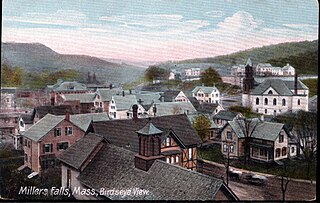
Millers Falls is a census-designated place (CDP) in the town of Montague in Franklin County, Massachusetts, United States. The population was 1,139 at the 2010 census. It is part of the Springfield, Massachusetts metropolitan statistical area.

Columbia is a town in Herkimer County, New York, United States. As of the 2010 census, the town population was 1,580. The town is at the southern border of the county and is southeast of Utica.
Gerrit Smith Miller Jr. was an American zoologist and botanist.

Engle is an unincorporated community in Jefferson County, West Virginia, United States, originally known by the names of Millers Mill, Striders Crossing, Keller, and Engles Switch before its post office's name changed to Engle in 1910.
Miller and Millar are surnames of English language, Irish or Scottish origin.

Tarbell Brook is a 10.1-mile-long (16.3 km) stream located in southwestern New Hampshire and northern Massachusetts in the United States. It is a tributary of the Millers River, itself a tributary of the Connecticut River, which flows to Long Island Sound.

Cunninghamhead is a hamlet on the Annick Water in the Parish of Dreghorn, North Ayrshire, Scotland. The area was part of the old Cunninghamhead estate, and once contained several watermills.
The Mill River is a river in the U.S. states of Massachusetts and Rhode Island. It flows approximately 17.1 miles (27.5 km).
Abbott Run is a de facto river in the U.S. state of Massachusetts and Rhode Island. It flows approximately 10 miles (16 km).

The governor of Maine is the head of government of the Maine. Before Maine was admitted to the Union in 1820, Maine was part of Massachusetts and the Governor of Massachusetts was chief executive.

Millhurst is an unincorporated community located within Manalapan Township in Monmouth County, New Jersey, United States. Route 33 and County Route 527 pass through the center of Millhurst. Much of the area consists of businesses along the aforementioned arterial roads with the Millhurst Mill at the CR 527 crossing of Manalapan Brook. The mill is a former grist mill built in the 1700s, rebuilt in the 1800s as a more efficient mill, and turned into a family business by Bernard Hochberg in 1925.

Rockefellows Mills is an unincorporated community located within Raritan Township in Hunterdon County, New Jersey, United States. The settlement is located along the South Branch Raritan River near Three Bridges. The river is spanned in the area by the historic Rockafellows Mill Bridge built in 1900 and part of the Raritan–Readington South Branch Historic District. Most of the area within the Raritan Township side of the river is forested however on the north side of the river in Readington Township, some farmland dots the area.

Spring Mill is an unincorporated community located within Upper Freehold Township in Monmouth County, New Jersey, United States. The settlement is located along County Route 524 between Hamilton Township and Allentown on a commercialized segment of the road originally built as New Jersey Route 37. A vestige of the state construction remains along the road through a wide right-of-way and a bridge crossing Doctor's Creek stating that it was constructed by the state in 1940 for State Highway Route 37.

Browns Mills Junction is an unincorporated community located within Pemberton Township in Burlington County, New Jersey, United States. The site, located about 1.6 miles (2.6 km) southwest of downtown Browns Mills, is located at the crossing of Junction Road and the Philadelphia and Long Branch Railway, later a part of the Pennsylvania Railroad. It was the site of a train station named Browns Mills in-the-Pines where a short branch connected the main line to Browns Mills. The settlement features a few houses along Junction Road and Mount Misery Road but is otherwise very forested as a part of the New Jersey Pine Barrens.

Dunns Mill or Dunns Mills is an unincorporated community located within Bordentown Township in Burlington County, New Jersey, United States. The site is named for a gristmill established in 1708 that is located near the settlement along Blacks Creek. Martin Luther Dunn purchased the mill in 1875 but burned down in 1901. The site is presently located near the crossing of the New Jersey Turnpike over County Route 545. A mix of housing developments and preserved open space are located around Dunns Mill today.
Avoca is an unincorporated community in Hamilton County, Florida, United States.

The Canajoharie Creek is a river that flows into the Mohawk River in the Village of Canajoharie in the U.S. State of New York. The name "Canajoharie" is a Mohawk language term meaning "the pot that washes itself", referring to the "Canajoharie Boiling Pot", a 20-foot (6.1 m) wide and 10-foot (3.0 m) deep pothole in the Canajoharie Creek, just south of the village of Canajoharie. Bowmans Creek is one main tributary that enters the creek east of the Hamlet of Sprout Brook. The other main tributary is Brimstone Creek which enters the creek north-northwest of the Village of Ames.
Millers Mills is a hamlet located in the Town of Columbia in Herkimer County, New York, United States.

Rome was a short-lived postbellum frontier settlement in Ellis County, Kansas, United States.


