
Hudson Strait in Nunavut links the Atlantic Ocean and the Labrador Sea to Hudson Bay in Canada. This strait lies between Baffin Island and Nunavik, with its eastern entrance marked by Cape Chidley in Newfoundland and Labrador and Nunavut and Resolution Island, off Baffin Island. The strait is about 750 km (470 mi) long with an average width of 125 km (78 mi), varying from 70 km (43 mi) at the eastern entrance to 240 km (150 mi) at Deception Bay.
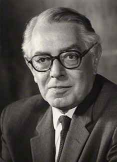
Edward Arthur Alexander Shackleton, Baron Shackleton, was a British geographer, Royal Air Force officer and Labour Party politician.

Gilbert Elliot-Murray-Kynynmound, 1st Earl of Minto,, known as Sir Gilbert Elliott, 4th Baronet until 1797, and the Lord Minto from 1797 to 1813, was a British diplomat and politician who sat in the House of Commons between 1776 and 1795. He was viceroy of the short-lived Anglo-Corsican Kingdom from 1794 to 1796 and went on to become Governor-General of India between July 1807 and 1813.
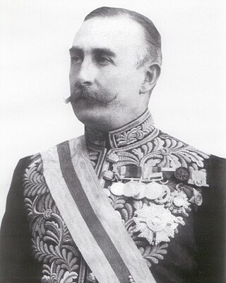
Gilbert John Elliot-Murray-Kynynmound, 4th Earl of Minto,, known as Viscount Melgund by courtesy from 1859 to 1891, was a British peer and politician who served as Governor General of Canada from 1898 to 1904, and Viceroy of India from 1905 to 1910.
Earl of Minto, in the County of Roxburgh, is a title in the Peerage of the United Kingdom. It was created in 1813 for Gilbert Elliot-Murray-Kynynmound, 1st Baron Minto. The current earl is Gilbert Timothy George Lariston Elliot-Murray-Kynynmound, 7th Earl of Minto.

Koettlitz Glacier is a large Antarctic glacier lying west of Mount Morning and Mount Discovery in the Royal Society Range, flowing from the vicinity of Mount Cocks northeastward between Brown Peninsula and the mainland into the ice shelf of McMurdo Sound.

HMS Terror was a specialised warship and a newly developed bomb vessel constructed for the Royal Navy in 1813. She participated in several battles of the War of 1812, including the Battle of Baltimore with the bombardment of Fort McHenry. She was converted into a polar exploration ship two decades later, and participated in George Back's Arctic expedition of 1836–1837, the successful Ross expedition to the Antarctic of 1839 to 1843, and Sir John Franklin's ill-fated attempt to force the Northwest Passage in 1845, during which she was lost with all hands along with HMS Erebus.

Mount Maxwell Provincial Park is a provincial park in the Gulf Islands of British Columbia, Canada. It is located on Burgoyne Bay and the Sansum Narrows on the western shores of Saltspring Island.
K'iyán Mountain is a mountain in the Atlin Country of far northwestern British Columbia, Canada. It is located 43 km (27 mi) north of the town of Atlin. It lies on the western side of the northeast arm of Atlin Lake.

John Minto IV was an American pioneer born in Wylam, England. He was a prominent sheep farmer in the U.S. state of Oregon and a four-time Republican representative in the state legislature. Minto also volunteered for the militia during the Cayuse War and years later helped locate Minto and Santiam passes through the Cascade Mountains east of Salem, Oregon.
The Rural Municipality of Minto is a former rural municipality (RM) in the Canadian province of Manitoba. It was originally incorporated as a rural municipality on November 15, 1902. It ceased on January 1, 2015 as a result of its provincially mandated amalgamation with the RM of Odanah to form the Rural Municipality of Minto-Odanah.

Captain George Comer was considered the most famous American whaling captain of Hudson Bay, and the world's foremost authority on Hudson Bay Inuit in the early 20th century.
The Minto Islands are a Canadian Arctic island group in the Nunavut Territory. The islands lie in the western portion of Queen Maud Gulf, between Kent Peninsula on Nunavut's mainland, and Melbourne Island. Back Point, Victoria Island is approximately 47.9 km (29.8 mi) to the north.

The Bell Peninsula is located on southeastern Southampton Island, in the Kivalliq Region, Nunavut, Canada. It is close to the small Inuit community of Coral Harbour. The southern shores make up the northern boundary of Hudson Bay. Foxe Basin is to the east. There are several large bays surrounding the peninsula. Bowhead whale frequent the area. The Bell Peninsula's irregular coastline is marked by five distinct points, some of which have notable archaeological sites. Mount Minto, in the north, is the highest peak. The Back Peninsula is on the eastern end of the Bell Peninsula.
Walker Bay is a Canadian Arctic waterway in the Northwest Territories. It is an eastern arm of Amundsen Gulf. The bay is located on western Victoria Island, between Jago Bay, in the north, and Minto Inlet, in the south. It is at the south entrance of Prince of Wales Strait. Fort Collinson is on the bay's northern shore.
In Canada, a number of sites and structures are named for royal individuals, whether a member of the past French royal family, British royal family, or present Canadian royal family thus reflecting the country's status as a constitutional monarchy under the Canadian Crown. Those who married into the royal family are indicated by an asterisk (*). Charles Edward Stuart was a pretender to the British throne.
The Baillie Islands are located off the north coast of Cape Bathurst in the Northwest Territories, Canada. The islands formed part of the area used by the Avvaqmiut who are a branch of the Inuvialuit.
In Canada, a number of sites and structures are named for Governors General of the country, the Canadian monarch's representative in the country.
Edward Nicholas Kendall, R.N. was an English hydrographer, an officer in the Royal Navy, and polar explorer. During one of his Arctic expeditions, Kendall became the first known European to sight Wollaston Land.
Blue Glacier is a large glacier which flows into Bowers Piedmont Glacier about 10 nautical miles south of New Harbour, in Victoria Land, Antarctica. It was discovered by the British National Antarctic Expedition (BrNAE) under Robert Falcon Scott, 1901–04, who gave it this name because of its clear blue ice at the time of discovery.
