
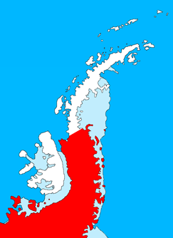
Victoria Island is a large island in the Arctic Archipelago that straddles the boundary between Nunavut and the Northwest Territories of Canada. It is the eighth-largest island in the world, and at 217,291 km2 (83,897 sq mi)1 in area, it is Canada's second-largest island. It is nearly double the size of Newfoundland (111,390 km2 [43,010 sq mi]), and is slightly larger than the island of Great Britain (209,331 km2 [80,823 sq mi]) but smaller than Honshu (225,800 km2 [87,200 sq mi]). The western third of the island lies in the Inuvik Region of the Northwest Territories; the remainder is part of Nunavut's Kitikmeot Region. The population of 2,168 is divided between two settlements, the larger of which is Cambridge Bay (Nunavut) and the other Ulukhaktok.

The Arctic Archipelago, also known as the Canadian Arctic Archipelago, is an archipelago lying to the north of the Canadian continental mainland, excluding Greenland and Iceland.

The Shackleton Range is a mountain range in Antarctica that rises to 1,875 metres (6,152 ft) and extends in an east–west direction for about 100 miles (160 km) between the Slessor and Recovery Glaciers.

The Recovery Glacier is a glacier, at least 60 nautical miles long and 40 nautical miles wide at its mouth, flowing west along the southern side of the Shackleton Range in Antarctica.
Palmer Land is the portion of the Antarctic Peninsula, Antarctica that lies south of a line joining Cape Jeremy and Cape Agassiz. This application of Palmer Land is consistent with the 1964 agreement between the Advisory Committee on Antarctic Names and the UK Antarctic Place-Names Committee, in which the name Antarctic Peninsula was approved for the major peninsula of Antarctica, and the names Graham Land and Palmer Land for the northern and southern portions, respectively. The line dividing them is roughly 69° S.
The Support Force Glacier is a major glacier in the Pensacola Mountains, draining northward between the Forrestal Range and Argentina Range to the Filchner-Ronne Ice Shelf.
The Deep Freeze Range is a rugged mountain range, over 80 nautical miles long and about 10 nautical miles wide, rising between Priestley and Campbell Glaciers in Victoria Land, Antarctica, and extending from the edge of the polar plateau to Terra Nova Bay. It is southwest of the Southern Cross Mountains, south of the Mesa Range and northeast of the Eisenhower Range of the Prince Albert Mountains.
The Victory Mountains are a major group of mountains in Victoria Land, Antarctica, about 100 nautical miles long and 50 nautical miles wide, which is bounded primarily by Mariner and Tucker glaciers and the Ross Sea. They are north of the Mountaineer Range, east of the Freyberg Mountains and south of the Concord Mountains and the Admiralty Mountains. The division between the Victory Mountains and the Concord Mountains is not precise but apparently lies in the vicinity of Thomson Peak.
The Victoria Cross Ranges are a set of mountain ranges in the Canadian Rockies, located to the northwest of Jasper. Of the 19 peaks contained within this range, five are named after Canadian recipients of the Victoria Cross. The area of the ranges is 678 square kilometres (262 sq mi).
The Aviator Glacier is a major valley glacier in Antarctica that is over 60 nautical miles long and 5 nautical miles wide, descending generally southward from the plateau of Victoria Land along the west side of Mountaineer Range, and entering Lady Newnes Bay between Cape Sibbald and Hayes Head where it forms a floating tongue.
The Flood Range is a range of large snow-covered mountains extending in an east–west direction for about 60 nautical miles and forming a right angle with the southern end of the Ames Range in Marie Byrd Land, Antarctica.

The Outback Nunataks are a series of bare rock nunataks and mountains which are distributed over an area about 40 nautical miles long by 20 nautical miles wide. The group lies south of Emlen Peaks of the Usarp Mountains and west of Monument Nunataks and upper Rennick Glacier, adjacent to the featureless interior plateau.

The Treuter Mountains, formerly known as the Truter Mountains and the Trenter Mountains, are a small mountain range on eastern Devon Island, Nunavut, Canada. The Treuter Mountains are part of the Devon Ice Cap which forms part of the Arctic Cordillera mountain range.
The Nass Ranges are a mountain range north of the Skeena River, west of Hazelton, and northeast of Terrace, British Columbia, Canada. It is a subrange of the Hazelton Mountains, which in turn form part of the Interior Mountains.
Mount Helena is a mountain located at the Queen Reach arm of Jervis Inlet and behind Princess Louisa Inlet. Mount Helena is part of the Pacific Ranges of the Coast Mountains in British Columbia Canada. The mountain was named during the 1860 survey by HMS Plumper who charted all of the known area and named the mountain after Princess Helena Augusta Victoria "Lenchen" who was the fifth child of Queen Victoria and Prince Albert of England.
The Oweegee Range is a small subrange of the Skeena Mountains of the Interior Mountains, located on the east side of Bell-Irving River in northern British Columbia, Canada.
The Freyberg Mountains are a group of mountains in Victoria Land, Antarctica, bounded by the Rennick Glacier, Bowers Mountains, Black Glacier, and Evans Névé. They are west of the Victory Mountains and south of the Bowers Mountains.
The Guettard Range is a mountain range, 40 nautical miles long and 10 nautical miles wide, located northwest of Bowman Peninsula and between Johnston Glacier and Irvine Glacier, in the southeastern extremity of Palmer Land, Antarctica.

The Haskard Highlands are a range of peaks and ridges between Blaiklock Glacier and Stratton Glacier in the northwest of the Shackleton Range, Antarctica, rising to 1,210 metres (3,970 ft) at Mount Weston and including features between Mount Provender and Pointer Nunatak. The highlands were first mapped in 1957 by the Commonwealth Trans-Antarctic Expedition, and photographed from the air by the U.S. Navy in 1967. They were surveyed by the British Antarctic Survey between 1968 and 1971, and named by the UK Antarctic Place-Names Committee in 1971 after Sir Cosmo Haskard, Governor of the Falkland Islands 1964–70.
The Hutton Mountains are a group of mountains in southeast Palmer Land, Antarctica, bounded on the southwest by Johnston Glacier, on the northwest by Squires Glacier, on the north by Swann Glacier, and on the east by Keller Inlet.