Related Research Articles

Baffin Island, in the Canadian territory of Nunavut, is the largest island in Canada and the fifth-largest island in the world. Its area is 507,451 km2 (195,928 sq mi)—slightly larger than Spain, its population was 13,039 as of the 2021 Canadian census, and is located at 68°N70°W. It also contains the city of Iqaluit, the capital of Nunavut.

In geography and geology, a cliff is an area of rock which has a general angle defined by the vertical, or nearly vertical. Cliffs are formed by the processes of weathering and erosion, with the effect of gravity. Cliffs are common on coasts, in mountainous areas, escarpments and along rivers. Cliffs are usually composed of rock that is resistant to weathering and erosion. The sedimentary rocks that are most likely to form cliffs include sandstone, limestone, chalk, and dolomite. Igneous rocks such as granite and basalt also often form cliffs.

Bylot Island lies off the northern end of Baffin Island in Nunavut Territory, Canada. Eclipse Sound to the southeast and Navy Board Inlet to the southwest separate it from Baffin Island. Parry Channel lies to its northwest. At 11,067 km2 (4,273 sq mi) it is ranked 71st largest island in the world and Canada's 17th largest island. The island measures 180 km (110 mi) east to west and 110 km (68 mi) north to south and is one of the largest uninhabited islands in the world. While there are no permanent settlements on this Canadian Arctic island, Inuit from Pond Inlet and elsewhere regularly travel to Bylot Island. An Inuit seasonal hunting camp is located southwest of Cape Graham Moore.

Auyuittuq National Park is a national park located on Baffin Island's Cumberland Peninsula, in the Qikiqtaaluk Region of Nunavut, the largest political subdivision of Canada. The park was initially known as Baffin Island National Park when it was established in 1972, but the name was changed in 1976 to its current name to better reflect the region and its history. It features many terrains of Arctic wilderness, such as fjords, glaciers, and ice fields. Although Auyuittuq was established in 1972 as a national park reserve, it was upgraded to a full national park in 2000.

Sirmilik National Park is a national park located in Qikiqtaaluk, Nunavut, Canada, established in 1999. Situated within the Arctic Cordillera, the park is composed of three areas: most of Bylot Island with the exception for a few areas that are Inuit-owned lands, Oliver Sound, and Baffin Island's Borden Peninsula. Much of the park is bordered by water.

Mount Asgard is a twin peaked mountain with two flat-topped, cylindrical, rock towers, separated by a saddle. It is located in Auyuittuq National Park, on the Cumberland Peninsula of Baffin Island, Nunavut, Canada. The peak is named after Asgard, the realm of the Æsir (gods) in Norse mythology. Mount Asgard is perhaps the most famous of the Baffin Mountains.

Mount Thor, officially gazetted as Thor Peak, is a mountain with an elevation of 1,675 metres (5,495 ft) located in Auyuittuq National Park, on Baffin Island, Nunavut, Canada. The mountain is located 46 km (29 mi) northeast of Pangnirtung and features Earth's greatest vertical drop of 1,250 m (4,101 ft), with the cliff overhanging at an average angle of 15 degrees from vertical. Despite its remoteness, this feature makes the mountain a popular rock climbing site. Camping is allowed, with several designated campsites located throughout the length of Akshayuk Pass. For climbers looking to scale Mount Thor, there is an established campsite a few kilometres north of its base, complete with windbreaks and emergency shelters.

The Arctic Cordillera is a terrestrial ecozone in northern Canada characterized by a vast, deeply dissected chain of mountain ranges extending along the northeastern flank of the Canadian Arctic Archipelago from Ellesmere Island to the northeasternmost part of the Labrador Peninsula in northern Labrador and northern Quebec, Canada. It spans most of the eastern coast of Nunavut with high glaciated peaks rising through ice fields and some of Canada's largest ice caps, including the Penny Ice Cap on Baffin Island. It is bounded to the east by Baffin Bay, Davis Strait and the Labrador Sea while its northern portion is bounded by the Arctic Ocean.

The Baffin Mountains are a mountain range running along the northeastern coast of Baffin Island and Bylot Island, Nunavut, Canada. The ice-capped mountains are part of the Arctic Cordillera and have some of the highest peaks of eastern North America, reaching a height of 1,525–2,146 metres (5,003–7,041 ft) above sea level. While they are separated by bodies of water to make Baffin Island, they are closely related to the other mountain ranges that make the much larger Arctic Cordillera mountain range.

Mount Odin is a mountain in Qikiqtaaluk, Nunavut, Canada. It is located in Auyuittuq National Park along the Akshayuk Pass, 46 km (29 mi) north of Pangnirtung and south of Mount Asgard. Mount Odin is the highest mountain on Baffin Island.

The Byam Martin Mountains are a rugged mountain range extending the length of Bylot Island, Nunavut, Canada. It is one of the most northern ranges in the world and is an extension of the Baffin Mountains which in turn form part of the Arctic Cordillera mountain system. The highest mountain in the range is Angilaaq Mountain, 1,951 m (6,401 ft), located near the island's center. Sharp peaks and ridges, divided by deep glacier-filled valleys are typical features in the range and has been extensively modified by glacial erosion. The Byam Martin Mountains have not been conducive to habitation. While there are no permanent settlements in the Byam Martin Mountains, Inuit from Pond Inlet and elsewhere regularly travel to the range.
The Bruce Mountains are a small mountain range on the northeast coast of Baffin Island, Nunavut, Canada. It is a subrange of the Baffin Mountains which in turn form part of the Arctic Cordillera mountain range.
The Precipitous Mountains are a mountain range on northern Baffin Island, Nunavut, Canada. It lies in, or near, Sirmilik National Park and is a subrange of the Arctic Cordillera.

The Everett Mountains are a mountain range located at Frobisher Bay on southern Baffin Island, Nunavut, Canada. Nunavut's capital city Iqaluit is protected by the Everett Mountains. The mountain range is a subrange of the Arctic Cordillera.
The Krag Mountains are a mountain range on northern Baffin Island, Nunavut, Canada. It is part of a much larger mountain range called the Baffin Mountains which in turn form part of the Arctic Cordillera mountain system.
Oliver Glacier is a glacier located on the northeast coast of the Baffin Mountains on Baffin Island, Nunavut, Canada. It is just outside Sirmilik National Park.
Akshayuk Pass formerly Pangnirtung Pass is a mountain pass in the Baffin Mountains of Nunavut, Canada. It is found within Auyuittuq National Park. To the southwest is Mount Thor, about 17 km (11 mi), and Pangnirtung, about 64 km (40 mi) and to the northeast is Qikiqtarjuaq, about 109 km (68 mi).

Midnight Sun Peak is a mountain in the Baffin Mountains, Baffin Island, Nunavut, Canada. It is part of the Auyuittuq National Park area with an elevation of 1,967 m (6,453 ft).
Pugh Island is an inhabited private Baffin Island offshore island located in the Arctic Archipelago in the territory of Nunavut. The island lies in Frobisher Bay, less than 1 km (0.62 mi) from Baffin Island's Everett Mountains range. Islands in the immediate vicinity include Pike and Fletcher Islands to the east.
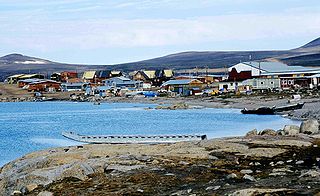
Broughton Island is a 127.6 km2 (49.3 sq mi) island in the Arctic Archipelago.
References
| | This Qikiqtaaluk Region, Nunavut location article is a stub. You can help Wikipedia by expanding it. |