Related Research Articles

Jasper National Park is a national park in Alberta, Canada. It is the largest national park within Alberta's Rocky Mountains spanning 11,000 km2 (4,200 sq mi). Its location is north of Banff National Park and west of Edmonton. The park contains the glaciers of the Columbia Icefield, springs, lakes, waterfalls and mountains.

The white-crowned sparrow is a species of passerine bird native to North America. A medium-sized member of the New World sparrow family, this species is marked by a grey face and black and white streaking on the upper head. It breeds in brushy areas in the taiga and tundra of the northernmost parts of the continent and in the Rocky Mountains and Pacific coast. While southerly populations in the Rocky Mountains and coast are largely resident, the breeding populations of the northerly part of its range are migratory and can be found as wintering or passage visitors through most of North America south to central Mexico.

The mountain bluebird is a small migratory thrush that is found in mountainous districts of western North America. It has a light underbelly and black eyes. Adult males have thin bills and are bright turquoise-blue and somewhat lighter underneath. Adult females have duller blue wings and tail, grey breast, grey crown, throat and back. In fresh fall plumage, the female's throat and breast are tinged with red-orange, brownish near the flank contrasting with white tail underparts. Their call is a thin 'few'; while their song is warbled high 'chur chur'. It is the state bird of Idaho and Nevada. It is an omnivore and it can live 6 to 10 years in the wild. It eats spiders, grasshoppers, flies and other insects, and small fruits. The mountain bluebird is a relative of the eastern and western bluebirds.

The gray-crowned rosy finch, or gray-crowned rosy-finch, is a species of passerine bird in the family Fringillidae native to Alaska, western Canada, and the north-western United States. Due to its remote and rocky alpine habitat it is rarely seen. There are currently six recognized subspecies. It is one of four species of rosy finches.

The flag of British Columbia is based upon the shield of the provincial arms of British Columbia. At the top of the flag is a rendition of the Royal Union Flag, defaced in the centre by a crown, and with a setting sun below, representing the location of the province of British Columbia at the western end of Canada.

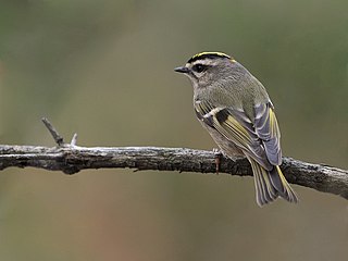
The golden-crowned kinglet is a very small songbird in the family Regulidae that lives throughout much of North America.

Kootenay National Park is a national park of Canada located in southeastern British Columbia. The park consists of 1,406 km2 (543 sq mi) of the Canadian Rockies, including parts of the Kootenay and Park mountain ranges, the Kootenay River and the entirety of the Vermilion River. While the Vermilion River is completely contained within the park, the Kootenay River has its headwaters just outside the park boundary, flowing through the park into the Rocky Mountain Trench and eventually joining the Columbia River. The park ranges in elevation from 918 m (3,012 ft) at the southwestern park entrance to 3,424 m (11,234 ft) at Deltaform Mountain.

The coat of arms of Alberta, the heraldic symbol representing the Canadian province of Alberta, contains symbols reflecting Alberta's British heritage along with local symbols. The upper part of the shield features the red cross of Saint George. The lower portion of the shield depicts the Rocky Mountains, grass prairies, and wheat fields - representing Alberta's landscape.
Laval—Two Mountains was a federal electoral district in the province of Quebec, Canada that was represented in the House of Commons of Canada from 1917 to 1949.

Strathcona Provincial Park is the oldest provincial park in British Columbia, Canada, and the largest on Vancouver Island. Founded in 1911, the park was named for Donald Alexander Smith, 1st Baron Strathcona and Mount Royal, a wealthy philanthropist and railway pioneer. It lies within the Strathcona Regional District. The Clayoquot Sound Biosphere Reserve, established in 2000, includes three watersheds in the western area of the park.

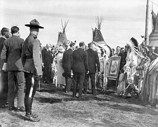
The Nakoda are an Indigenous people in Western Canada and, originally, the United States.
Treaty 2 was entered in to on 21 August 1871 at Manitoba House, Rupertsland, with representatives of the Queen of Great Britain and Ireland. The original Anishinaabe, who were present, constitute Treaty 2 today. It is known that many of the chiefs and leaders within the territory were at the early gathering and after the treaty was agreed to. Those who were not present were represented through Mekis until they indicated where they wished their farming reserves to be established. The treaty reaffirmed the inherent rights that the Anishinaabe had prior to European contact, located where southwestern Manitoba is today and a small part of southeastern Saskatchewan.

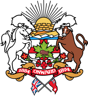
The coat of arms of Calgary, Alberta, was adopted in 1902. The arms existed only in black and white until 1984, when an alderman asked the City to develop it in full colour.

The Sandilands Provincial Forest is located within the southeastern area of Manitoba, Canada and consists of thousands of acres of sand hills, forest, wetlands, and mostly unpopulated crown lands. Sandilands Provincial Forest covers close to 3,000 km2. The area has been logged for decades, and it is popular for hiking, hunting, and camping. The large sand eskers and hills were left behind by the last ice age as the glaciers retreated and deposited large rocks, boulders, and vast amounts of sand. These sand ridges sometimes called the Bedford Hills or Cyprus Hills, are the second highest point in Manitoba, behind Baldy Mountain.
Crown Mountain may refer to:

Crown Mountain is a mountain located north of North Vancouver, British Columbia, in the North Shore Mountains and is visible from most of Vancouver and the vicinity. A rock formation known as The Camel sits just east of the main summit, and the mountain has west and north peaks. The mountain lies on the fringes of Lynn Headwaters Regional Park.

The White Goat Wilderness Area is a provincially designated wilderness area in the Canadian Rockies of Alberta. It was established in 1961 and it, as one of the three wilderness areas of Alberta, has the strictest form of government protection available in Canada. All development is forbidden and only travel by foot is permitted. Hunting and fishing are not allowed. The other two wilderness areas are Ghost River Wilderness Area and Siffleur Wilderness Area and together the three areas total 249,548.80 acres (100,988.82 ha).

The Siffleur Wilderness Area is a provincially designated wilderness area in the Canadian Rockies of Alberta. It was established in 1961 and it, as one of the three wilderness areas of Alberta, has the strictest form of government protection available in Canada. All development is forbidden and only travel by foot is permitted. Hunting and fishing are not allowed. The other two wilderness areas are White Goat Wilderness Area and Ghost River Wilderness Area and together the three areas total 249,548.80 acres (100,988.82 ha).

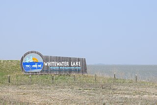
Whitewater Lake is a lake in the Canadian province of Manitoba located between Boissevain and Deloraine. It is an endorheic basin and more marsh than lake. Whitewater Lake was previously called White Lake due to the color of the salt flats exposed during dry periods. Whitewater Lake covers approximately 22,000 acres on average and only reaches depths of about 2 metres (6.6 ft). The lake is fed by several small streams which flow into it from the Turtle Mountains but has no natural outflow.
References
- ↑ White Crown Mountain in the Canadian Mountain Encyclopedia.